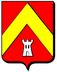
Terville
| Terville | ||
|---|---|---|

|
|
|
| region | Grand Est | |
| Department | Moselle | |
| Arrondissement | Thionville | |
| Canton | Thionville | |
| Community association | Portes de France-Thionville | |
| Coordinates | 49 ° 21 ' N , 6 ° 8' E | |
| height | 155-188 m | |
| surface | 3.83 km 2 | |
| Residents | 7,025 (January 1, 2017) | |
| Population density | 1,834 inhabitants / km 2 | |
| Post Code | 57180 | |
| INSEE code | 57666 | |
 Saint-Sébastien church |
||
Terville (German Terwen , Lorraine Tierwen ) is a French commune with 7025 inhabitants (as of January 1, 2017) in the Moselle department in the Grand Est region ( Lorraine until 2015 ). It belongs to the Arrondissement of Thionville .
geography
Terville is located immediately south of Thionville at an altitude between 155 and 188 m above sea level, the mean height is 160 m. The municipal area covers 3.7 km².
history
Other spellings were: Terven (1282), Terffen (1524), Tervern (1544), Therville (1793).
Terville came to the German Empire in 1871 and was assigned to the realm of Alsace-Lorraine , with the village being named Terwen . In 1918 the German Reich had to cede Terwen and the rest of the Reichsland Alsace-Lorraine to France as a result of the defeat in the First World War ; Terwen was renamed Terville. In the early 1940s, Terville was occupied by soldiers from the Nazi Reich and renamed Terwen again. In the mid-1940s, Terwen was liberated by American troops and since then Terwen has belonged to France again and is called Terville.
Population development
| year | 1962 | 1968 | 1975 | 1982 | 1990 | 1999 | 2007 | 2015 |
| Residents | 35,429 | 5,771 | 5,747 | 5,224 | 6,281 | 6,469 | 6,479 | 6,804 |
Web links
Individual evidence
- ^ Franz Xaver Kraus - Art and Antiquity in Alsace-Lorraine (1886)
