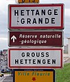
Hettange-Grande
| Hettange-Grande | ||
|---|---|---|

|
|
|
| region | Grand Est | |
| Department | Moselle | |
| Arrondissement | Thionville | |
| Canton | Yutz | |
| Community association | Cattenom et Environs | |
| Coordinates | 49 ° 24 ' N , 6 ° 9' E | |
| height | 155-247 m | |
| surface | 16.27 km 2 | |
| Residents | 7,653 (January 1, 2017) | |
| Population density | 470 inhabitants / km 2 | |
| Post Code | 57330 | |
| INSEE code | 57323 | |
| Website | Hettange-Grande | |
 City center with Saint Etienne church |
||

Hettange-Grande (German Großhettingen , Lorraine Grouss-Hetténgen ) is a French commune with 7,653 inhabitants (as of January 1, 2017) in the Moselle department in the Grand Est region (until 2015 Lorraine ).
geography
The municipality of Hettange-Grande is about six kilometers north of Thionville and eight kilometers south of the border with Luxembourg .
history
Nestled in the area of the triangle ( Luxembourg , Germany , France ), the municipality of Hettange-Grande has enjoyed a worldwide reputation in scientific circles for more than a century. In 1864 a geologist from Switzerland suggested that the “Gries” quarry, which was located in the community's ban mile , be recorded as an internationally valid model for a geological layer that was formed between 204 and 201 million years ago. This is how the original hettangium stratotype came about . The affected area has been a nature reserve since 1985 , the only geological reserve in Lorraine and one of ten in France.
Archaeological excavations have also produced evidence of an important Gallo-Roman road connection, a mandatory passage on the Roman road from Metz to Trier . Most of the unearthed pieces are kept in the Thionville Museum. An annual exhibition on site takes stock of the current excavation and research work.
The village had an eventful history throughout the Middle Ages. The only evidence from this period is the Sœtrich chapel , which today still has numerous elements from the 15th century and survived the Thirty Years War.
From 1809 the quarries were cultivated. The population explosion began with the mining industry: the "Charles-Ferdinand" mine was opened in 1904 and brought Hettange-Grande to prosperous economic activity for 75 years.
During this time, the place was also shaped by the war. Seven defense systems, which were built between the two world wars along the Maginot Line , are located on the territory of the municipality: the large fortress of Soetrich, the well-preserved Immerho intermediate works, the shelters of Stressling, Hettange-Grande and the Route von Luxembourg, as well as two observation towers.
Population development
| year | 1962 | 1968 | 1975 | 1982 | 1990 | 1999 | 2007 | 2015 |
| Residents | 4,502 | 5,037 | 5,621 | 5,786 | 5,734 | 6,356 | 7,422 | 7,618 |
economy
From the beginning of the 20th century to the end of the 1970s, iron ore mining shaped the economic life of Hettange-Grande.
Twin cities
The twin towns of the municipality are Pederobba in Italian Veneto and Sinzig in Germany . Residents of Pederobba used to work as guest workers in the mines of Hettange-Grande.

Rastenne Castle

Robert Schuman Square

Town Hall (Mairie)

The Rastenne bridge