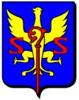
Kédange-sur-Canner
| Kédange-sur-Canner | ||
|---|---|---|

|
|
|
| region | Grand Est | |
| Department | Moselle | |
| Arrondissement | Thionville | |
| Canton | Metzervisse | |
| Community association | Arc Mosellan | |
| Coordinates | 49 ° 18 ′ N , 6 ° 20 ′ E | |
| height | 177-298 m | |
| surface | 3.91 km 2 | |
| Residents | 1,087 (January 1, 2017) | |
| Population density | 278 inhabitants / km 2 | |
| Post Code | 57920 | |
| INSEE code | 57358 | |
 Town hall (mairie) |
||
Kédange-sur-Canner ( German Kedingen ) is a French commune in the Moselle department in the Grand Est region (until 2015 Lorraine ).
geography
The municipality of Kédange-sur-Canner is located on the Moselle tributary of the Canner, about 14 kilometers southeast of Thionville on the highway to Saarlouis . The municipality covers 3.91 km².
Kédange-sur-Canner has 1087 inhabitants (as of January 1, 2017).
history
Until 1947 the place name was simply Kédange .
Kédange has belonged to France since 1697 and was part of the municipality of Hombourg-sur-Kaner from 1811 to 1902 .
On September 4, 1945 occurred in the railway station a serious of Kédange railway accident , who had a large fire. 39 people died and 34 were also injured.
Population development
| year | 1962 | 1968 | 1975 | 1982 | 1990 | 1999 | 2007 |
| Residents | 815 | 797 | 912 | 1124 | 1078 | 1036 | 1112 |
Web links
Commons : Kédange-sur-Canner - Collection of images, videos and audio files

