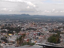
Municipio Comitán de Domínguez
| Comitán de Domínguez | ||
|---|---|---|

|
||
| Symbols | ||
|
||
| Basic data | ||
| Country | Mexico | |
| State | Chiapas | |
| Seat | Comitán de Domínguez | |
| surface | 981.2 km² | |
| Residents | 141,013 (2010) | |
| density | 143.7 inhabitants per km² | |
| founding | 1915 | |
| Website | comitan.gob.mx | |
| INEGI no. | 07019 | |
| politics | ||
| Presidente municipal | Emmanuel Cordero Sánchez | |
| Comitán de Domínguez | ||
Coordinates: 16 ° 15 ′ N , 92 ° 7 ′ W
Comitán de Domínguez is a municipality in the center of the Mexican state Chiapas . The municipality is located in the Sierra Madre de Chiapas . The municipality, founded in 1915, has around 141,000 inhabitants today and covers 981.2 km². The administrative seat and largest city in the municipality is the Pueblo Mágico Comitán de Domínguez of the same name .
The name Comitán comes from Nahuatl and means “place of the ceramists”, the part of the name Domínguez honors Belisario Domínguez Palencia , a Mexican liberal politician.
The Maya site of Tenam Puente is located in the municipality .
geography
The Municipio Comitán de Domínguez is centrally located in the Mexican state of Chiapas at an altitude of between 600 m and 2700 m . It belongs entirely to the physiographic province of the Sierra Madre de Chiapas and is entirely in the hydrological region of Grijalva - Usumacinta . The geology of the municipality is determined to 84% by limestone with 9% silty sandstone ; The predominant soil types are Leptosol (62%), Luvisol and Vertisol (each approx. 12%). About 51% of the community area is forested, 40% is used for agriculture.
The Municipio Comitán de Domínguez borders on the Municipios Amatenango del Valle , Chanal , Las Margaritas , La Independencia , La Trinitaria , Tzimol , Socoltenango and Las Rosas .
population
In the 2010 census, 141,013 people in 34,139 residential units were counted in the municipality. Of these, 5,569 people were registered as speakers of an indigenous language , including 2,545 speakers from Tojolabal and 1,872 speakers from Tzeltal . A good 13 percent of the population was illiterate. 5,161 inhabitants were registered as economically active, of which approx. 86% were men and 2.3% were unemployed. Over 16% of the population lived in extreme poverty.
places
The Municipio Comitán de Domínguez comprises 268 inhabited localidades , of which only the main town is classified as urban by the INEGI . In the 2010 census, eleven towns had a population of over 1000, 188 towns had fewer than 100 inhabitants. The biggest places are:
| place | Residents |
| Comitán de Domínguez | 97,537 |
| Villahermosa Yalumá | 2,368 |
| San Jose Yocnajab | 1,809 |
| La Floresta | 1,743 |
| Los Riegos | 1,740 |
| Francisco Sarabia | 1,673 |
| Cash | 1,429 |
| Señor del Pozo | 1,353 |
| Zaragoza la Montaña | 1,263 |
| Efraín A. Gutiérrez | 1,153 |
| Chacaljocom | 1,056 |
Web links
- Enciclopedia de los Municipios y Delegaciones de México: Municipio Comitán de Domínguez (Spanish)
- INEGI : Datos Geográficos: Municipio Comitán de Domínguez (Spanish; PDF)


