Municipio Las Margaritas
| Las margaritas | |
|---|---|

|
|
| Basic data | |
| Country | Mexico |
| State | Chiapas |
| Seat | Las margaritas |
| surface | 3,025.7 km² |
| Residents | 111,484 (2010) |
| density | 36.8 inhabitants per km² |
| INEGI no. | 07052 |
| politics | |
| Presidente municipal | Jorge Luis Escandón Hernández |
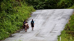
| Country road scene in the municipality of Las Margaritas | |
Coordinates: 16 ° 20 ′ N , 91 ° 55 ′ W
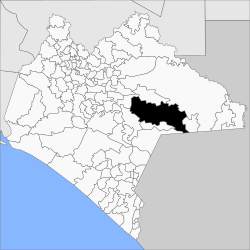
Las Margaritas is a municipality in the east of the Mexican state Chiapas . The municipality is located in the Sierra Madre de Chiapas . The municipality has over 110,000 inhabitants and an area of 3,025.7 km². The administrative seat and largest town of the municipality is Las Margaritas of the same name .
geography
The municipality of Las Margaritas is located in the east of the Mexican state Chiapas at heights between 100 m and 2600 m . It belongs entirely to the physiographic province of the Sierra Madre de Chiapas and is entirely in the hydrological region of Grijalva - Usumacinta . The geology of the municipality is determined by 77% limestone with 18% sandstone - lutite ; The predominant soil types are Luvisol (42%), Leptosol (35%) and Phaeozem (14%). About 67% of the community area is forested, 18% is used for pasture, 14% is used for arable farming.
The municipality of Las Margaritas borders the municipalities of La Trinitaria , La Independencia , Comitán de Domínguez , Chanal , Altamirano , Ocosingo and Maravilla Tenejapa as well as the Republic of Guatemala .
population
In the 2010 census, 111,484 people in 20,288 residential units were counted in the municipality. Of these, 49,571 people were registered as speakers of an indigenous language , including 40,631 speakers from Tojolabal , 2,717 speakers from Tzotzil , 2,035 speakers from Kanjobal and 1,276 speakers from Tzeltal . Almost 26 percent of the population were illiterate. 34,264 inhabitants were registered as economically active, of which 86% were men and 1.2% were unemployed. Over 60% of the population lived in extreme poverty.
places
The Municipio Las Margaritas comprises 393 inhabited localidades , of which the main town and Plan de Ayala are classified as urban by INEGI . In the 2010 census, 17 towns had a population of over 1000, and 209 towns had fewer than 100 inhabitants. The biggest places are:
| place | Residents |
| Las margaritas | 20,786 |
| Plan de Ayala | 3.164 |
| Veinte de Noviembre | 2,207 |
| Jalisco | 1.915 |
| Yasha | 1,862 |
| Chiapas | 1,808 |
| Nuevo San Juan Chamula ( El Pacayal ) | 1,684 |
| Bajucú | 1,665 |
| Francisco I. Madero | 1,626 |
| Justo Sierra ( San Francisco ) | 1,386 |
| El Edén | 1,283 |
| Saltillo | 1,222 |
| El Vergel | 1,177 |
| Rafael Ramírez | 1,075 |
| Veracruz | 1,062 |
| Lomantan | 1,034 |
| El Progreso | 1.007 |
| San Pedro Yutniotic | 996 |
| San Antonio los Montes | 980 |
Web links
- Enciclopedia de los Municipios y Delegaciones de México: Municipio Las Margaritas (Spanish)
- INEGI : Datos Geográficos: Municipio Las Margaritas (Spanish; PDF)

