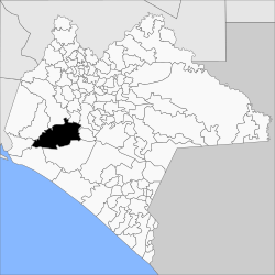
Municipio Villaflores
| Villaflores | |
|---|---|

|
|
| Basic data | |
| Country | Mexico |
| State | Chiapas |
| Seat | Villaflores |
| surface | 1,907.9 km² |
| Residents | 98,618 (2010) |
| density | 51.7 inhabitants per km² |
| founding | 1915 |
| INEGI no. | 07108 |
| politics | |
| Presidente municipal | Mariano Guadalupe Rosales Zuarth |
| View from the main town Villaflores to Cerro Yambiyugua | |
Coordinates: 16 ° 15 ′ N , 93 ° 20 ′ W
Villa Comaltitlán is a municipality in the Mexican state of Chiapas . The municipality has about 100,000 inhabitants and is about 1900 km² in size. The administrative seat and largest place of the municipality is the eponymous Villaflores .
There are several nature reserves in the municipality, including parts of the La Sepultura biosphere reserve .
geography
The municipality of Villaflores is located in the west of the Mexican state of Chiapas at heights between 200 m and 2300 m . 76% of it belongs to the physiographic province of the Cordillera Centroamericana , the rest to the Sierra Madre de Chiapas , and 99% of it is in the hydrological region of Grijalva - Usumacinta and 1% in the Costa de Chiapas region . The geology of the municipality is 60% granite with 22% alluvion and 16% limestone ; The predominant soil types are Leptosol (37%), Regosol (34%) and Luvisol (12%). 48% of the community area is forested, 32% is used for agriculture, 13% is used as pasture land.
The municipality borders on the municipalities Ocozocoautla de Espinosa , Suchiapa , Chiapa de Corzo , El Parral , Villa Corzo , Tonalá , Arriaga and Jiquipilas .
population
In the 2010 census, 98,618 people were counted in 24,206 residential units in the municipality. Of these, 2,160 people were registered as speakers of an indigenous language , including 1,465 speakers from Tzotzil and 315 speakers from Tzeltal . A good 15 percent of the population was illiterate. 37,178 inhabitants were registered as economically active, of which over 77% were men or 2% were unemployed. 28% of the population lived in extreme poverty.
places
The Municipio Villaflores comprises 1058 inhabited localidades , of which, in addition to the main town, Jesús María Garza, Cristóbal Obregón, Guadalupe Victoria, Benito Juárez, Cuauhtémoc, Nuevo México, Doctor Domingo Chanona and Villa Hidalgo are classified as urban by the INEGI . In the 2010 census, 17 towns had a population of over 1000, while 1005 towns had fewer than 100 inhabitants. The biggest places are:
| place | Residents |
| Villaflores | 37,237 |
| Jesús María Garza | 6,724 |
| Cristóbal Obregón | 4,664 |
| Guadalupe Victoria ( Lázaro Cárdenas ) | 3,583 |
| Benito Juarez | 3,567 |
| Cuauhtémoc | 3,084 |
| Nuevo México | 3,014 |
| Doctor Domingo Chanona | 2,962 |
| Villa Hidalgo | 2,502 |
| Roblada Grande | 1,729 |
| Joaquín Miguel Gutiérrez | 1,663 |
| Francisco Villa | 1,360 |
| Libertad Melchor Ocampo | 1,324 |
| Agrónomos Mexicanos | 1,202 |
| Dieciséis de Septiembre | 1,177 |
| Ignacio Zaragoza | 1,055 |
| Calzada Larga | 1,049 |
Web links
- Enciclopedia de los Municipios y Delegaciones de México: Municipio Villaflores (Spanish)
- INEGI : Datos Geográficos: Municipio Villaflores (Spanish; PDF)

