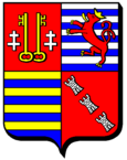
Talange
| Talange | ||
|---|---|---|

|
|
|
| region | Grand Est | |
| Department | Moselle | |
| Arrondissement | Metz | |
| Canton | Le Sillon mosellan | |
| Community association | Rives de Moselle | |
| Coordinates | 49 ° 14 ' N , 6 ° 10' E | |
| height | 154-184 m | |
| surface | 3.70 km 2 | |
| Residents | 7,707 (January 1, 2017) | |
| Population density | 2,083 inhabitants / km 2 | |
| Post Code | 57525 | |
| INSEE code | 57663 | |
| Website | www.talange.com | |
 Town Hall ( Hôtel de ville ) |
||
Talange (German Talingen , Lorraine Taléngen ) is a French commune with 7707 inhabitants (as of January 1, 2017) in the Moselle department in the Grand Est region (until 2015 Lorraine ). It belongs to the arrondissement of Metz .
geography
Talange is located a few kilometers north of Metz on the Moselle at an altitude between 154 and 184 m above sea level, the mean height is 159 m. The municipal area covers 3.7 km².
history
The place was first mentioned in 960 as Tatolinga .
Talange was on the German side of the former Franco-German language border . The Lorraine dialect is hardly spoken anymore due to demographic changes.
Population development
| year | 1910 | 1962 | 1968 | 1975 | 1982 | 1990 | 1999 | 2007 | 2017 |
| Residents | 454 | 5246 | 6985 | 8176 | 8325 | 7755 | 7782 | 7549 | 7707 |
Attractions
Personalities
- Francis Piasecki (1951-2018), football player
Web links
Commons : Talange - collection of images, videos and audio files
Individual evidence
- ↑ Walter De Gruyter - On the oldest contacts between Romans and Teutons (1970)

