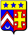
Charleville-sous-Bois
| Charleville-sous-Bois | ||
|---|---|---|

|
|
|
| region | Grand Est | |
| Department | Moselle | |
| Arrondissement | Metz | |
| Canton | Le Pays messin | |
| Community association | Haut Chemin-Pays de Pange | |
| Coordinates | 49 ° 11 ′ N , 6 ° 25 ′ E | |
| height | 215-347 m | |
| surface | 12.82 km 2 | |
| Residents | 320 (January 1, 2017) | |
| Population density | 25 inhabitants / km 2 | |
| Post Code | 57220 | |
| INSEE code | 57128 | |
 Château Charleville-sous-Bois |
||
Charleville-sous-Bois (until 1945 Charleville ) is a French commune with 320 inhabitants (as of January 1, 2017) in the Moselle department in the Grand Est region (until 2015 Lorraine ).
geography
The municipality of Charleville-sous-Bois is located about 22 kilometers northeast of Metz near Boulay .
history
The place was founded in 1618 by the then abbot of the Cistercian monastery Villers-Bettnach .
1915–1918 he carried the German name Karlheim and 1940–1944 Karlsheim am Wald .
The place is known for its eponymous health clinic, which is housed in a former castle. The castle was built in 1912–1913 and was initially called Rexroth Castle, and it opened as the Maison de Convalescence Charleville health clinic in 1925.
Population development
| year | 1962 | 1968 | 1975 | 1982 | 1990 | 1999 | 2007 |
| Residents | 186 | 190 | 167 | 178 | 199 | 222 | 271 |
Web links
Commons : Charleville-sous-Bois - Collection of images, videos and audio files


