Chailly-lès-Ennery
| Chailly-lès-Ennery | ||
|---|---|---|

|
|
|
| region | Grand Est | |
| Department | Moselle | |
| Arrondissement | Metz | |
| Canton | Le Pays messin | |
| Community association | Rives de Moselle | |
| Coordinates | 49 ° 12 ' N , 6 ° 14' E | |
| height | 169-244 m | |
| surface | 7.29 km 2 | |
| Residents | 381 (January 1, 2017) | |
| Population density | 52 inhabitants / km 2 | |
| Post Code | 57365 | |
| INSEE code | 57125 | |
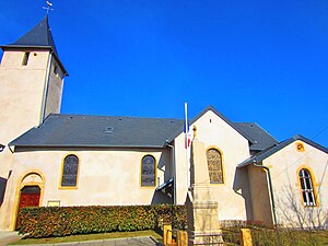
 Saint-Jean-Baptiste church |
||
Chailly-lès-Ennery is a French commune with 381 inhabitants (as of January 1, 2017) in the Moselle department in the Grand Est region (until 2015 Lorraine ). It belongs to the arrondissement of Metz .
geography
Chailly-lès-Ennery is located about twelve kilometers north of Metz near Ennery at an altitude between 169 and 244 m above sea level. The municipal area covers 7.29 km².
Place name
The French village was mentioned in German sources in 1544 as Kettenchen and in 1698 as Ketenchen . 1915–1918 Kettenchen was also the official German name. 1940–1944 the German civil administration then used the invented name Kettingen .
Population development
| year | 1962 | 1968 | 1975 | 1982 | 1990 | 1999 | 2007 |
| Residents | 171 | 197 | 211 | 230 | 254 | 272 | 345 |
Culture and sights
- Saint-Jean-Baptiste church
- Remains of a Templar castle that was burned down in 1386 by the Duke of Jülich's troops
Individual evidence
- ↑ Monika Buchmüller-Pfaff: settlement names between late antiquity and the early Middle Ages. The -iacum name of the Roman province of Belgica Prima. 1990, page 140.
Web links
Commons : Chailly-lès-Ennery - collection of images, videos and audio files
