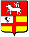
Sanry-sur-Nied
| Sanry-sur-Nied | ||
|---|---|---|

|
|
|
| region | Grand Est | |
| Department | Moselle | |
| Arrondissement | Metz | |
| Canton | Le Pays messin | |
| Community association | Haut Chemin-Pays de Pange | |
| Coordinates | 49 ° 3 ' N , 6 ° 21' E | |
| height | 215-300 m | |
| surface | 4.81 km 2 | |
| Residents | 291 (January 1, 2017) | |
| Population density | 60 inhabitants / km 2 | |
| Post Code | 57530 | |
| INSEE code | 57627 | |
 Saint-Urbain church |
||
Sanry-sur-Nied is a French commune in the district Metz , in the Moselle department and the region Grand Est (2015 Lorraine ) ..
geography
Sanry-sur-Nied is located on the French Nied , 15 kilometers southeast of Metz at an altitude of between 215 and 300 m above sea level. The mean height is 220 m. The municipality covers 4.81 km².
history
The oldest surviving mention of the village comes from 1235.
In the years 1915 to 1918 Sanry-sur-Nied carried the Germanized name Sanringen an der Nied and 1940 to 1944 Senn an der Nied .
On August 24, 1951 drove the train station of Sanry-sur-Nied an express train on one where unscheduled holding second fast train on. 21 people died.
The community has 291 inhabitants (as of January 1, 2017).
- Population development
| year | 1962 | 1968 | 1975 | 1982 | 1990 | 1999 | 2007 |
| Residents | 161 | 164 | 162 | 221 | 310 | 343 | 331 |
Web links
Commons : Sanry-sur-Nied - Collection of images, videos and audio files
