
Brussels

the business district (northern district)
floral art at the Great Market • View from Kunstberg
arcades and Arc de Triomphe in Cinquantenaire
Manneken Pis • Cathedral • Congress Column
Royal Palace
Brussels ( French Bruxelles [ bryˈsɛl ], Dutch Brussel [ brɵsəɫ ]) means either the municipality of the City of Brussels ( French Ville de Bruxelles , Dutch Stad Brussel ) or the Brussels Capital Region ( French Région de Bruxelles-Capitale , Dutch Brussels Hoofdstedelijk Gewest ) from 18 other municipalities or the entire urban agglomeration, which also includes suburbs.
The bilingual Brussels-Capital region is one of three regions in the Belgian federal structure , along with Flanders and the Walloon Region . The Brussels-Capital Region is a contiguous urban area with around 1.21 million inhabitants (as of January 1, 2019). With around 7441 inhabitants per km², it has a higher population density than any major German city. It is therefore not comparable with the metropolitan regions that extend far into the surrounding area and that have been defined around many major European cities. The Brussels metropolitan area is once again much larger than the Brussels-Capital Region.
The city of Brussels is the capital and residence of the Kingdom of Belgium. It forms the center of the Brussels-Capital Region, is one of its 19 municipalities and has around 180,000 inhabitants. Several federal institutions are based there: The city of Brussels is the administrative seat of the Brussels-Capital Region. The administrative headquarters of the French Community of Belgium are also located here , while the Walloon Region has its headquarters in Namur . The bodies of the Flemish Region and the Flemish (Dutch-speaking) Community have merged and are also based in the city of Brussels. In addition, the city is the headquarters of the European Union and the headquarters of NATO , as well as the permanent secretariat of the Benelux countries and EUROCONTROL .
Mentioned for the first time in 996 and became the capital of the Duchy of Brabant in the Middle Ages , Brussels became its capital with the independence of Belgium in 1830. Together with its surrounding communities, Brussels is now an industrial and commercial city with two universities, several colleges, academies, libraries, museums and theaters, an important economic, scientific and cultural center as well as an important transport hub in the center of the country.
The article Brussels-Capital Region mainly deals with the topics of politics, administration and the language situation. Further and overarching topics are dealt with below.
geography

The city of Brussels is located quite centrally within the Belgian national territory, embedded in the Brussels Basin between the Flanders Lowlands and the Brabant Plateau at an altitude between 15 and 100 meters above sea level. The Senne runs through the city from southwest to northeast, where it can no longer be made out due to its extensive vaulting from the 19th and 20th centuries. In addition, a shipping canal , starting from Anderlecht and the western city limits with Molenbeek-Saint-Jean / Sint-Jans-Molenbeek , crosses the northern urban area of Brussels and thus connects the city with Charleroi and Antwerp .
The Brussels-Capital Region is one of the three regions and one of the 43 administrative districts of Belgium. It covers the bilingual area of the capital Brussels and is divided into 19 independent municipalities. The city of Brussels, which includes the center of Brussels, is one of these 19 municipalities.
Administrative division


The city of Brussels (red area on the map on the left) originally consisted only of the city center of Brussels, also called the Pentagon because of its pentagonal shape. In 1921 the previously independent municipalities of Haren, Laken and Neder-Over-Heembeek were incorporated. Nowadays, the city of Brussels can be divided into six parts: the Pentagon, Laken, Neder-Over-Heembeek, Haren, the southern axis Louise / Louiza-Roosevelt, which divides the capital region municipality Ixelles / Elsene , and the European quarter.
The Brussels-Capital Region is divided into 19 independent municipalities (see map on the right), which, however, form a coherent urban area. The communities have retained a high degree of political independence to this day. In terms of quality of life and residential character, the municipalities in the capital differ greatly from one another. The south-eastern and eastern municipalities of the Brussels-Capital Region are generally preferred residential areas due to their proximity to the Sonian Forest recreation area, among other things . In particular, municipalities close to the center such as Molenbeek, Anderlecht, Schaarbeek, Sint-Joost-ten-Node and Sint-Gillis, on the other hand, tend to be inhabited by the poor and sometimes give a shabby impression.
The difference between the City of Brussels and the Brussels-Capital Region is reminiscent of that between the City of London and Greater London - but not in terms of size. The city of Brussels has a comparatively high share of space of around 20 percent in the Brussels region, while the City of London's share of the area of Greater London is less than 0.2 percent.
Expansion and agglomeration

The municipal area of the city of Brussels covers 32 km², while the capital region covers 161 km². 1,175,000 people live on the area of this regional authority (as of January 1, 2016), that is 7298 inhabitants per square kilometer, more than in any major German city ( Munich has the highest density with 4668 inhabitants per square kilometer). The settlement area of the Brussels agglomeration in the geographical sense extends across regional borders in municipalities in the surrounding Flanders region . The metropolitan region (see below), which has not yet been defined by the Belgian authorities, is much larger and extends into the Wallonia region .
The Brussels metropolitan area can be understood in different ways. First, there is the operationalized agglomeration ( geoperationaliseerde agglomeratie ) with 1,451,047 inhabitants. Together with the banlieue (literally “bannmeile”, “suburbs”) there are 1,831,496 inhabitants and with the commuter catchment area ( forensenwoonzone ) there is a population of 2,676,701 inhabitants and more.
The division of the urban settlement area into 19 communities is due to the fact that the rapid population growth that began in the middle third of the 19th century was handled differently than in German cities. The role of the capital and industrialization promoted immigration and thus the urbanization of the previously rural surrounding communities. A large part of the immigrants came from Wallonia and northern France, which also changed the language structure of the previously Flemish places. In contrast to Berlin in 1920 , only a few of the villages that had grown into cities were incorporated into the capital. The few exceptions came about by royal decree and primarily concerned palace parks, administrative areas and other areas for representative capital city buildings. The municipality of Brussels today consists of the “pentagon” given by the lines of the outer city fortifications built in 1356 and 1383 and several branches, some of which are narrow and long and extend to the edge of the capital region. The 18 remaining neighboring communities retained their communal independence, but, like Brussels itself, surrendered competencies to the agglomeration institutionalized in 1971. In 1989, the capital region of Brussels emerged from the agglomeration and took over a large part of the municipal tasks and powers.
The European statistical authority Eurostat puts the capital region as a “city” on a level with the large urban communities and thus regards Brussels as a metropolis of millions. For the Brussels metropolitan area, which has not actually been defined by the Belgian authorities, Eurostat calculated an area of 3823 square kilometers and a population of 2,922,678 inhabitants for 2012, i.e. 759 inhabitants per square kilometer. For comparison: The capital region has an area of 161.38 square kilometers with 1,175,000 inhabitants (as of January 2016), i.e. 7,298 inhabitants per square kilometer.
population
The demographic conditions in the Brussels-Capital Region are extremely heterogeneous. In particular, the proportion of the population with a migration background varies depending on the municipality. With 98%, Saint-Josse-ten-Noode has the highest proportion of allochtones , followed by Saint-Gilles (81%), Schaerbeek and Molenbeek-Saint-Jean (both 74% each). The two outer communities of Ganshoren and Watermaal-Bosvoorde have the lowest proportion of allochtonen with 24% each. Overall, Brussels has with 57% (according to NPDATA) a very high proportion of the allochton population by European standards.
The Dutch-speaking minority lives mainly in the northern and western municipalities of the Brussels-Capital Region, where they make up around 15% of the local population; in the southern districts their share drops to less than 10%.
| Population development of Brussels-Capital | ||||||
|---|---|---|---|---|---|---|
| 1990 | 1995 | 2000 | 2005 | 2010 | 2015 | 2019 |
| 964,385 | 951,546 | 959.318 | 1,006,749 | 1,089,538 | 1,175,173 | 1,208,542 |
climate
With its full humidity, Brussels is located in the cool, temperate climate zone with a maritime climate .
Due to the location of Brussels relatively close to the coast, the city is under the influence of sea air masses, which is weakening towards the inland, and which causes lower temperature fluctuations over the course of the year. In Brussels, July and August are the warmest months with an average temperature of 17.2 and 17.0 ° C, respectively, and the average minimum temperature in January is 3.2 ° C. The annual average temperature is 10.3 ° C. The average duration of sunshine is around 1585 hours a year. The average maximum temperatures in July are 22.4 ° C, the mean minimum is 13.6 ° C. In January, the mean maximum is 5.6 ° C, the average minimum temperature is 0.7 ° C.
The amount of precipitation in the Brussels area results in a humid course of the year, with most precipitation falling in November and December at around 79 mm. The annual rainfall in Brussels is 820 mm. The number of rainy days is around 200 days. The number of winter frost days is around 60 days. Snow is rather rare in winter.
| Brussels | ||||||||||||||||||||||||||||||||||||||||||||||||
|---|---|---|---|---|---|---|---|---|---|---|---|---|---|---|---|---|---|---|---|---|---|---|---|---|---|---|---|---|---|---|---|---|---|---|---|---|---|---|---|---|---|---|---|---|---|---|---|---|
| Climate diagram | ||||||||||||||||||||||||||||||||||||||||||||||||
| ||||||||||||||||||||||||||||||||||||||||||||||||
|
Average monthly temperatures and rainfall for Brussels
Source: geo.de - hours of sunshine: wetterkontor.de
|
|||||||||||||||||||||||||||||||||||||||||||||||||||||||||||||||||||||||||||||||||||||||||||||||||||||||||||||||||||||||||||||||||||||||||||||||||||||||||||||||||||||
history
Beginnings
The name Brussels is made up of the word components bruk and sel [la] , as can be seen from the French form of the name Bruxelles . The first part of the name is explained with Old Dutch bruoc or nine Dutch broek ("swamp", " break "), while the second part is derived from the Old Dutch sella ("seat", "place of residence"). The name therefore means "place of residence in the swamp", as also applies to the German city of Bruchsal and the northern French municipality of Broxeele (Dutch: Broksele). An older explanation, according to which the name is composed of brug ("bridge") and a corruption of the river name Senne , has not been accepted in recent times.

According to legend, a chapel dedicated to St. Michael was founded in the 7th century by St. Goorik on the site of today's collegiate church. A manuscript from the year 695 reports that Bishop Vindicianus (620-712) of Cambrai was sick in Brosella. The place Bruocsella is mentioned in a document from Otto the Great from 966. From 977 to 979, Karl von Niederlothringen built a castle on an island in the river Senne and the St. Gudula chapel on the Treurenberg. The castle is believed to be on the site of today's Sankt-Goriks-Platz and became the seat of the county of Brussels, at that time one of the four counties of the Gaues Brabant. The castle and chapel were the starting points for the development of a larger settlement. Archaeological traces from this time have not yet been found.
Rise to the capital of Brabant
With the foundation of the cathedral chapter in 1047, Saint Gudula became a collegiate church. Brussels experienced a decisive boom in the High Middle Ages. During the reign of Duke Henry I (1190–1235) of Brabant , work began in 1225 to replace the old Romanesque collegiate church with today's Gothic basilica. In 1229 he granted the town town charter, after which the first 4 km long wall ring was built, which, in addition to the craftsmen's settlement around the Grote Markt, also enclosed the basilica and the ducal castle on the Koudenberg . Several towers and sections of wall were exposed again in the 20th century after centuries of renovation. The cities of Brabant enjoyed great privileges and were involved in all political decisions of the duchy through a state parliament.
After Johann III. von Brabant had left three daughters but no son at his death in 1356, Count Ludwig II of Flanders claimed the city in the Brabant War of Succession . Duchess Johanna could not hold her capital and had to hand it over to a Flemish garrison. Everard t'Serclaes , a citizen of Brussels, drove out the Flemish troops in a jab. The old wall ring had proven too weak in the War of Succession and had also become too narrow. As a result, between 1356 and 1383, under the rule of Joan and her second husband Wenceslaus of Luxembourg, an 8 km long new city fortification was built. Its course can largely be seen in the boulevards of the small ring, some of which form the border of the city of Brussels within the capital region. The outstanding structure of this fortification is the Hallepoort ( Porte de Hal , "Hallesches Tor") in the very south.

Burgundians and Habsburgs
From 1420 the town hall and the first guild houses were built on the Great Market . In 1430 Philip the Good , Duke of Burgundy , inherited the Duchy of Brabant . He made Brussels the capital of his Burgundy empire. The city flourished economically during this period. Sculptors, carpet makers and goldsmiths found their livelihood. Artists like Rogier van der Weyden (and in the 16th century Pieter Brueghel the Elder ) settled in the city. The granddaughter of Philip the Good, Maria of Burgundy , married Maximilian von Habsburg , Holy Roman Emperor of the German Nation , in 1477 . As a result, Brabant came under the rule of the Habsburg Empire. After a brief interruption by Margaret of Austria , who moved the residence to Mechelen , Brussels became the capital of Burgundy again after 1531.
The Reformation found supporters in Antwerp and Brussels early on in the Augustinian order . But already in 1522 the Habsburg regent had the first evangelicals arrested, in 1523 the two Augustinian monks Johannes van Esschen and Hendrik Vos from Antwerp were burned here after being condemned by the Inquisition . That was the beginning of the first persecution of Protestants in the southern Netherlands. As a result, around 40,000 people fled to Amsterdam and Emden . Between 1544 and 1648, around 60,000 Evangelical Walloons who lived in the southern province of the Netherlands followed to the northern province. From 1680 a further 100,000 Flemings fled to the northern Netherlands in order to freely practice their new faith.
After the death of Charles V, the greater part of what is now Belgium, including Brussels, became part of the Spanish Netherlands under his son Philip II . Under Philip II there were uprisings against Spanish rule, including the uprisings of Counts Hoorn and Egmont . With the execution of the two nobles on the Great Market Square, these uprisings were brutally suppressed in 1568. As a result of this failed uprising, the Union of Utrecht was founded in 1578–1579, the nucleus of what would later become the independent northern Netherlands. Under the governor of Spain, the Duke of Alba , the Protestants were persecuted mercilessly. This repression resulted in the exodus of the economic and intellectual elite, mainly to Amsterdam in Holland, and the economic decline of the city of Brussels.
After the Eighty Years War
As a result of the Eighty Years War and the Peace of Westphalia of 1648, the northern Netherlands became independent, while the southern Netherlands, and thus Brussels, remained under Spanish rule. In the second half of the 17th century, France fought for supremacy in Europe under Louis XIV . The troops of Louis XIV conquered West Flanders and Hainaut .
Brussels' Great Market was bombarded with cannons for three days in 1695 and almost completely destroyed. In the Treaty of Rijswijk in 1697, France had to cede the Belgian territories again. As a result of the Spanish War of Succession 1701–1714, the Austrian Habsburgs received rule over the southern Netherlands and thus over Brussels.
Time of revolutions


Out of displeasure over the liberal reforms of Joseph II , the Brabant Revolution broke out in October 1789 and in December of that year culminated in the independence of the United Belgian States from Austria, which lasted just under a year . His rule over Brussels then only lasted until 1794, when the troops of the revolutionary French republic conquered the country. The French rule ended in 1815 with the defeat of Napoleon on the battlefield of Waterloo , which is located immediately south of today's Brussels-Capital region. In the Congress of Vienna from 1814 to 1815, the southern Netherlands were united with the northern Netherlands under William I of Orange . But as a result of the divergent political and cultural developments over the course of history, conflicts between the two parts of the country were in the bud.
The partly French-speaking and mainly Catholic south felt at a disadvantage compared to the Protestant, "Dutch" north in terms of politics, education and economy. The Belgian Revolution soon led to the secession from the United Kingdom of the Netherlands and the establishment of the Belgian state. Since the great powers England, Prussia, Austria and Russia had an interest in settling the conflict peacefully in order to counteract any possible influence and thus a resurgence of France, they confirmed the independence of the new kingdom at the London Conference . Brussels became the capital of the new state and Leopold I of Saxe-Coburg became the first king of a new constitutional monarchy.
Modern Brussels since the 19th century

Brussels experienced a significant boom through its new role as the capital of an independent state, as well as through the industrialization of Belgium in the 19th century and other factors. The population grew noticeably, also as a result of the strong immigration from Wallonia and France. Formerly rural communities around the historic city center merged into an urban agglomeration; large new neighborhoods were added in the late 19th and early 20th centuries. During this time, large buildings such as the Palace of Justice (1866–1883), the Stock Exchange (1873), the Triumphal Arch (completed in 1905) and the city's Art Nouveau buildings, such as those by the architect Victor Horta, were built .
The world exhibition in 1897 also contributed to the promotion of the infrastructure. Among other things, the Colonial Palace (today's Royal Central Africa Museum ) in the suburb of Tervuren was connected to the capital through the construction of an eleven-kilometer long avenue.
Belgium was a victim of the German offensive strategy in both world wars as an advance area. In 1914, German troops marched through Belgium in an effort to achieve a quick victory over France . King Albert I left Brussels on August 14, 1914 and Brussels became an open city .
During the Second World War, the German Wehrmacht's campaign in the west turned into a blitzkrieg : it began on May 10, 1940, the Dyle position was breached on May 16, and one day later the Wehrmacht occupied Brussels without a fight. Belgium capitulated on May 28 (and France on June 22, 1940 ). During the occupation, on the evening of September 3, 1942 , the German Wehrmacht carried out a targeted pogrom against Jews in the densely populated poor inner city quarter of Marolles and searched numerous houses; 718 Jews were captured.

During the four years of occupation, Brussels emerged as the “epicenter of the Belgian resistance”. For example, the 19 communities that made up Brussels at that time refused to introduce the Jewish star in 1942 . Mayor Jules Coelst replied to the German occupiers that he and his colleagues could not make up their minds to “take part in an order that so openly violates human dignity.” The Brussels mayors and the police also refused to participate in the raids to participate in the German security services against Jews.
"Few cities in occupied Europe resisted Nazi rule so courageously and consistently."
In September 1944 the Allied troops advanced very quickly . The Wehrmacht vacated their positions, in some cases hastily; in many places there was only rearguard fighting. Brussels was liberated from the Second Army under Miles Dempsey on September 3, 1944 , and Dolle Dinsdag was celebrated two days later .
The architecture and streets of the Wilhelminian era shaped the cityscape until the 1960s (and in some cases still today) . The major project to link the Gare du Nord and Gare du Midi stations by rail put a strain on the center of Brussels from the 1930s onwards; numerous buildings there were demolished.

The linguistic and cultural conflict between the Flemish, Dutch-speaking population in the north of Belgium and the Walloon, French-speaking population in the south ( Flemish-Walloon conflict ) remains a point of contention . Small-town Brussels in the early 19th century was north of the Flemish-French language border, which is still otherwise stable today. The small town of Brussels, which was influenced by the Netherlands, was "Frenchized" because of its capital city function and the greater economic and cultural weight of Wallonia, which was then industrially more developed in the late 19th century. The Nazi regime tried to use this conflict for its own purposes. Right-wing extremist groups in Belgium, which tried to make political profit from it, especially in the 1930s, were denied success by compromises made again and again between Flemings and Walloons.

Today Brussels is officially bilingual, even if French is dominant. Since then, street names, city districts and train stations have been signposted consistently in two languages, unless the names are the same in both national languages. In 1988 the Belgian Parliament passed a law that made Belgium a federal state , with the autonomous regions of Flanders and Wallonia and the Brussels region with special status.
After the Second World War , Brussels also established itself as an international center: in 1958 it became the seat of the European Economic Community (EEC), the forerunner of today's European Union . In the same year, the second Brussels World's Fair, Expo 58, took place, which left one of its most famous buildings, the Atomium . The seat of NATO was moved from Paris to Brussels in 1967 . In terms of town planning and urban development, this period turned out to be rather problematic for Brussels: A law of 1953 that state reimbursement for the municipalities for the purchase and demolition costs of redevelopment areas (minus the estimated land value), had the effect in the Belgian capital that the municipalities to Demolition speculators became who, like the private builders, were interested in the most profitable exploitation of the building site and thus in a high-rise building. Belief in progress and the desire for a car-friendly city also led to changes in the cityscape , which have sometimes been characterized as " Brusselsization ".
On May 22, 1967, a fire broke out in the À l'innovation department store during a well-attended special exhibition, in which over 300 people died.
The strong contrast between affluent and poor neighborhoods, which are often right next to each other, as well as the threatened ghettoization of relatively centrally located city quarters through the settlement of poor and poorly integrated immigrants (especially Molenbeek-Saint-Jean , Anderlecht , Saint-Josse-ten-Noode ) became clear a characteristic of modern Brussels.
The not always clearly delimited responsibilities of the authorities in the 19 municipalities and the capital region are problematic, for example in urban and transport planning , police work or the fair distribution of tax revenues.
Languages and Communities
Language relations


The Brussels region is a multilingual area with two official languages, French and Dutch .
It has always been a Dutch-speaking area, but it was only since French rule and especially from 1830 that the French language, initially the only official language in Belgium, became increasingly important. As the capital, Brussels was home to a variety of authorities and every civil servant was supposed to speak French. As a result, more and more residents swapped their Dutch mother tongue for the French language. According to the results of the census, the relationship between Dutch and French speakers in what is now the Brussels region developed as follows:
- 1846: 68% Dutch and 32% French speakers
- 1910: 49% Dutch and 51% French speakers
- 1930: 35% Dutch and 65% French speakers
- 1947: 26% Dutch and 74% French speakers
Because the last census would have had consequences for the administrative language of the municipalities and therefore the censuses in some municipalities were influenced, and because Dutch had a bad reputation as the administrative language of Brussels during World War II, the Flemings fought the results as unreliable and pleaded for the final determination the language barriers. In 1962 the language borders and thus also the borders of the bilingual region (then administrative district) of Brussels were established. At the same time it was decided not to ask for language affiliation in the census.
Although there have been no official surveys on language relationships since 1947, various studies have been carried out on this subject. A study by the Free University of Brussels (VUB) in 2001 showed the following linguistic situation:
- 50% monolingual French
- 10% monolingual Dutch
- 10% bilingual Dutch and French, mostly of Flemish origin
- 10% bilingual with French and another language or with Dutch and another language
- 20% speak another language with neither French nor Dutch as their mother tongue
Today's population in the region no longer consists of just two language groups, but of people of very different origins: native Brussels dialect-speaking, native French-speaking bourgeois, Walloons, Flemings, officials and employees of the European institutions, immigrants from the former Belgian colony of the Congo , former Guest workers from Morocco and Turkey , refugees, etc. It is estimated that a majority of the inhabitants are of foreign origin.
In the political field, however, there are only French and Flemish parties. Because the majority of the autochthonous Brussels as well as the vast majority of immigrants and even many bilinguals vote for the French parties, they always win the vast majority of the votes (a good 85% against almost 15% for the Flemish parties).

Linguistic communities
The policy fields of culture , language , education and parts of the social sector in Belgium are not the responsibility of the regions, but that of the communities .
The French-speaking residents of the Brussels-Capital Region belong to the French Community of Belgium and are represented by the COCOF ( Commission communautaire française ; German French Community Commission), the Dutch- speaking residents belong to the Flemish Community and are represented by the VGC ( Vlaamse Gemeenschapscommissie , German Flemish Community Commission ) represented. Both commissions (COCOF and VGC) are part of the GGC (Gemeenschappelijke Gemeenschapscommissie) / COCOM ( Commission communautaire commune ), the united assembly of both community commissions. In Brussels, therefore, many educational and cultural institutions exist twice, one in French and one in Dutch, under the responsibility of the respective community. Brussels is also home to a representation of the German-speaking Community (DG), a branch of the Ministry of the DG .
A separate regional Brussels identity, as it exists in the Flemish regions and, to a lesser extent, in Wallonia, has developed reactively and, to a certain extent, also in Brussels.
politics
The Brussels-Capital Region has its own government and regional parliament . The government consists of a prime minister and four ministers, two from each language community. The Brussels regional parliament has 89 seats - 72 for French speakers and 17 seats for Dutch speakers. Both language groups have a right of veto over linguistic and institutional matters (as in the Belgian parliament).
International organizations
A large number of international organizations have their headquarters in Brussels.
European Union

The most important institutions of the European Union are based in the Europaviertel Leopold in Brussels. In addition to the European Commission as the central administrative body of the EU, the European Parliament and the Council of the European Union are also represented here. In addition, the EU summits of the heads of state and government and the EU Commission President are held here as part of the European Council.
The European Defense Agency EDA, which is responsible for the coordination of military procurement policy in the EU, is also based in Brussels. In addition, are Executive Agency for Education, Audiovisual and Culture , the executive agency of the European Research Council , the Executive Agency for Small and Medium Enterprises , executive agency for research and the Trans-European Transport Network Executive Agency represented here.
The European Free Trade Association (EFTA) maintains a secretariat and a monitoring authority; these institutions are located here due to the proximity to the EU Commission in order to conduct joint agreements and negotiations.
Other organizations
In addition to the institutions and bodies of the European Union, other important international organizations have their headquarters in Brussels. The most important non-European actor here is NATO, whose headquarters are in Brussels. The General Secretariat of the Benelux Union is also based in Brussels.
economy
In comparison with the gross domestic product of the European Union expressed in purchasing power standards , the Brussels-Capital Region achieved an index of 233.3 (EU-27 = 100) in 2006, the third highest value in the European Union . In 2017 the unemployment rate was 14.8%. The Brussels-Capital Region had a higher unemployment rate than any of the Belgian provinces.
The European institutions and the seat of the NATO headquarters are the reason why many large international companies as well as interest groups and lobbyists' offices have settled in Brussels. Country offices, cultural institutes and embassies from all over the world also bring great purchasing power to Brussels. The global press is well represented.
traffic
Street
Brussels is the center of the well-developed Belgian motorway network . The highways ![]() ,
, ![]() ,
, ![]() ,
, ![]() ,
, ![]() ,
, ![]() (counterclockwise) run radially to Brussels. Brussels has mainly two road rings:
(counterclockwise) run radially to Brussels. Brussels has mainly two road rings:
- The first is the outer ring of the motorway Ring
 , which runs generously around the urban area of Brussels and is almost exclusively developed as a motorway and is partially tunneled under;
- as well as the inner road ring Het kleine Ring - Le petit ceinture (Eng .: the small belt) , which runs around the city center on the former course of the city wall, also known as the pentagon due to its shape. In order to get ahead faster on the inner ring, it is tunneled under the wide road as an expressway and provided with access roads at all crossings above ground.
From ![]() the sun highway run
the sun highway run ![]() , the airport highway
, the airport highway ![]() and the Arden highway
and the Arden highway ![]() well into the city. Important national roads are the N1, N2, N21, N3, N4, N5, N6, N7, N8 and N9, all of which connect the center with the rest of Belgium. The main roads were often tunneled under at large intersections due to the high volume of traffic. Another example of the numerous tunnels is the Reyers tunnel from the motorway in the east of the city to the EU quarter.
well into the city. Important national roads are the N1, N2, N21, N3, N4, N5, N6, N7, N8 and N9, all of which connect the center with the rest of Belgium. The main roads were often tunneled under at large intersections due to the high volume of traffic. Another example of the numerous tunnels is the Reyers tunnel from the motorway in the east of the city to the EU quarter.
![]()
![]()
rail

In Brussels, there is next to a large number of smaller stations, the three major railway stations Brussels-North train station , Brussels Central Station and Brussels South Station , which together by a north-south tunnel section are connected. Train travelers from abroad usually arrive at Südbahnhof, where there are connections from Paris, Amsterdam, Cologne, Frankfurt (with the Thalys , TGV or ICE ) and London ( Eurostar ). The Bruxelles Luxembourg train station, off the main north-south tunnel route, was originally a train station to connect the EU institutions, which is now increasingly accepted by the general population after the renovation.
Within the Brussels-Capital Region there are a total of the following train stations, which are collectively referred to as "Zone Bruxelles Agglo" on tickets:
- Berchem-Ste-Agathe, Bockstael, Boitsfort, Boondael, Bordet, Bruxelles-Central, Bruxelles-Chapelle, Bruxelles-Congrès, Bruxelles-Midi, Bruxelles-Nord, Bruxelles-Luxembourg, Bruxelles-Schuman, Delta, Etterbeek, Evere, Forest- Est, Forest-Midi, Haren, Haren-Sud, Jette, Meiser, Mérode, Moensberg, Saint-Job, Schaerbeek, Uccle-Calevoet, Uccle-Stalle, Vivier d'oie / Diesdelle and Watermael.
Local public transport

The public transport serve four metro , three Premetro - 18 Tram - 50 bus and 17 night bus lines (as of April 2009). All stops have a name in French and Dutch, provided they have different names in the two languages. The operator of the local transport network is the Society for Inter-Community Transport to Brussels (STIB / MIVB).
The Brussels Metro (U-Bahn) consists of the four lines 1, 2, 5 and 6, which have been in operation on this route since April 2009. The removed in the course of this project Western Railway Station (Gare de l'Ouest / West Station) now serves as a transfer station for all four lines and in the S-Bahn S 10 of the S-Bahn Brussels . There are also so-called Prémetro routes (numbers 3, 4 and 7) - tram lines, some of which are run underground. The most important of these routes is the north-south axis between the north and south stations.
There are also other tram and bus routes that open up the greater area. A night transport network only exists in Brussels - apart from the N71 night bus line - only on weekends. 17 so-called “Noctis” night bus routes operate here throughout the city (no more night surcharge). Taxis are relatively expensive.
The area around the Brussels-Capital Region, which also includes the airport in Zaventem , is currently being developed by the state railway SNCB / NMBS through the Brussels S-Bahn . In order to meet the increasing demand and to cope with the traffic jams on the streets of Brussels, this network was put into operation on December 13, 2015. Before that, only outdated suburban trains operated.
air
ship
The port of Brussels is one of the largest in Belgium with 7.5 million tons of handling. It is connected to the Scheldt and thus to the port of Antwerp and the North Sea via the Brussels-Scheldt Sea Canal. It is connected to Wallonia via the Charleroi-Brussels Canal .
Municipalities of the Brussels-Capital Region
Although the 19 municipalities in Brussels are administratively independent of one another, they form a coherent urban area, which is why they can be compared with districts (see also list with map ).
Brussels city

The most famous and important municipality in the region is the city of Brussels. Here you will find the most famous sights. In the Pentagon, the city center, there is the Quartier Royale with many museums and the Royal Palace as well as the Quartier du Center with the Grand Place, many galleries, restaurants and bars, the Fressgassen, the stock exchange, Manneken Pis. There are many small restaurants, hotels and the Gothic church Notre Dame du Sablon in the Quartier des Sablons. Weekly and antique markets are held at regular intervals in the Quartier des Marolles.
There is also the Palace of Justice and the Place Polaert, which offers an overview of the lower city of Brussels. The luxury district around Louisenallee, part of the Brussels city area, which invites you to stroll and shop, divides the municipality of Ixelles / Elsene into two parts.


Important buildings in the EU quarter are the Berlaymont building , in which the European Commission has its headquarters, the Justus Lipsius building , the seat of the Council of the European Union and the European Parliament . The statue of Europe named Unity in Peace is a sculpture in Brussels' EU quarter. Many embassies and interest groups are also based in this district.
The city of Brussels also includes the districts of Laeken / Laken , in which the Atomium and the royal castle are located, and Neder-Over-Heembeek in the north-west and Haren in the north, as well as the Bois de la Cambre / Ter Kamerenbos and the avenue connecting it Urban forest and downtown, Avenue Louise, which divides Ixelles into two areas.
Anderlecht
Anderlecht is located in the south-west of Brussels and is particularly well-known abroad for the RSC Anderlecht football club . The Constant Vanden Stock Stadium is located on the municipality's territory. The Sint-Guido Church is also worth mentioning. Otherwise the community is characterized by residential areas.
Auderghem / Oudergem

Auderghem has a share in the large Brussels city forest, the Forêt de Soignes / Zoniënwoud. At the edge of the forest is the former Red Monastery Abbey, another former abbey is the Herzoginnental in the park of the same name. In the 1950s, the Treaty of Rome was largely drawn up in the former Val Duchesse / Hertoginnental abbey .
Berchem-Sainte-Agathe / Sint-Agatha-Berchem
The municipality is located on the western edge of Brussels. The community area begins immediately behind the National Basilica of the Sacred Heart on the Koekelberg, which is the most important point of reference, but does not belong to the community itself. The center of the community is Albert-Schweitzer-Platz on Chaussée de Gand / Gentse Steenweg, an arterial road to the northwest.
Etterbeek

Etterbeek is located to the east of Brussels city center. The boulevards (including the avenue de Tervuren / Tervurenlaan), the triumphal arch in the Jubelpark, and the Art Nouveau residential area are well worth seeing. Etterbeek borders on the neighboring European quarter. Etterbeek is home to a large number of representations and Commission services, not least because of its close proximity to the European Quarter. However, there are few large administrative office buildings in Etterbeek. The original structure and the charm of the community could thus be preserved. On the Jourdanplatz (Place Jourdan) there are numerous cafes, one of the most famous chips stalls in the region and restaurants as well as a prestigious market. There are numerous shopping opportunities, especially in the Avenue de la Chasse / Jachtlaan area.
Evere
The important arterial road Chaussée de Louvain / Leuvensesteenweg and the airport slip road Boulevard Léopold III / Leopold III-laan, on which the NATO headquarters are located, run through Evere. Evere also has the largest cemetery in the entire city.
The last open-air swimming pool in Brussels was also located in Evere, which opened as the "Solarium d'Evère" in 1934 and was the last open-air swimming pool in Brussels to close two years later, despite a record number of visits.
Forest / Vorst
In Forest / Vorst there are two large parks, the Parque de Forest / Park van Vorst and the Parque de Duden / Dudenpark, the St. Dionys Abbey and an Audi factory.
Ganshoren
Ganshoren is located in the northwest of the region. The small municipal area is almost completely built on, larger green areas are the Rivieren Castle Park and the King Baldwin Park in the far north of the municipality. The castle of Rivieren and the swamps of Ganshoren are worth seeing.
Ixelles / Elsene

The municipality is located in the south-east of the city of Brussels. The municipality is divided into two parts because the boulevard Louisenallee (Avenue Louise or Louizalaan) running through the middle of Ixelles / Elsene belongs to the city of Brussels. The name Elsene comes from a name of the village Elsele and means something like Erlenheim (Else for alder). The African-looking Matongé district around the Namener Stadttor is known for its multicultural charm, which originated in the Maison Africaine, the former student residence for Congolese students. The African nightlife unfolds especially in the Rue de la Longe Vie / Lang Levenstraat.
In the early 2000s, Matongé temporarily fell into disrepute due to riots and crime as a problem area. The Boondaelviertel, located between the two university campuses of the ULB and VUB, is a trendy student area and is just as lively as the multicultural Flagey district. The redevelopment of its central square, Eugène Flagey, has given the quarter a boost.
In the rather bourgeois Kastanienviertel on the Place du Chatelain / Kasteleinsplein you will find an above-average number of upscale restaurants, organic grocery stores, libraries and art shops. The Leopoldsviertel and the Brussels-Luxembourg train station partly belong to Ixelles / Elsene, as do some of the European Parliament buildings right behind the train station . Due to its proximity to the European institutions, Ixelles / Elsene has become a popular residential area for young employees and interns from institutions and associations.
Jette
Although the municipal area is mainly built up with urban development, there are some forests and large parks (Poelbos, Laarbeekbos, Dielegem, König-Balduin -Park). The large Sacred Heart Monastery is located at the King Baldwin Park. Jette is also home to the University Clinic of the Free University of Brussels, UZ Brussel , one of the largest hospitals in the city.
Koekelberg
The Basilique Nationale du Sacré-Cœur , one of the largest churches in the world , is known nationwide on the hill of the same name . It was built at the beginning of the 20th century and stands at the end of a monumental street axis. In front of the basilica is the Elisabethpark.
Molenbeek-Saint-Jean / Sint-Jans-Molenbeek
The municipality is located immediately west of Brussels' old town (Porte de Flandre / Vlaamsepoort), separated from it by the Charleroi Canal. The main street of the municipality is the Chaussée de Gand / Gentse Steenweg, which begins at the Flemish Gate (Porte de Flandre / Vlaamsepoort). Rathausplatz is a pedestrian zone and the center of the community, which looks more like an inner city district than an independent municipality.
The population of Sint-Jans-Molenbeek has a high percentage of mainly Moroccan immigrants . The FC Molenbeek Brussels Strombeek football club plays its home games in Division 1B in the Edmond-Machtensstadion . The association emerged from the merger of the clubs KFC Strombeek and RWD Molenbeek.
Saint-Gilles / Sint-Gillis

The Brussels South Station (Gare de Bruxelles-Midi / Brussel-Zuidstation), the most important train station in the city, is located in Saint-Gilles / Sint-Gillis. The Chaussée de Waterloo / Waterloose Steenweg, the main shopping street of Saint-Gilles / Sint-Gillis, which leads to the world-famous suburb in the south of Brussels, begins at the former city gate to Halle (Porte de Hal / Hallepoort), which is still preserved today, but is largely alienated from a classicist-romantic perspective leads. The church that gave the community its name is also located here. Also worth seeing are the town hall and the Art Nouveau residential area.
Saint-Josse-ten-Noode / Sint-Joost-ten-Node
In Saint-Josse-ten-Noode / Sint-Joost-ten-Node, the Brussels North Station, surrounded by high-rise buildings (including a World Trade Center), and the botanical garden (Le Botanique / Kruidtuin) are located at Schaarbeeker Tor, which also has a cultural center heard. The community has a share in the representative Königstrasse, which runs from the royal city palace to Schaerbeek / Schaarbeek .
St. Joost-tN is the poorest municipality in Belgium based on the average income of the local population. In addition, no other municipality in Belgium has such a high proportion of allochtonen as St. Joost-tN. Mayor Jean Demannez said in 2003 that only 20% of the population still has a Belgian grandfather. However, the official proportion of foreigners is 33% (January 2008), as most of the allochtonen have taken Belgian citizenship. Based on election results, NPData estimates the actual proportion of allochtons to be 98% (2006).
Sights are the neo-baroque St. Joost Church from 1865, the Charlier Museum, the former train station on the Chaussée de Louvain / Leuvensesteenweg from 1885, which is a listed building and now houses a meeting place for jazz musicians called Jazz Station . The so-called Rogierzentrum, designed by the architect Jacques Cuisenier, stood in the community between 1960 and 2001. The gigantic complex was once a symbol of post-war modernism, but was demolished after its neglect. Between 2002 and 2006, the headquarters of Dexia Bank was built on the same site . This building shines in different colors at night. In some cases, passers-by can send greetings to the building wall via SMS.
Schaerbeek / Schaarbeek


The birth town of Jacques Brel is known for its exceptionally well-preserved Art Nouveau residential area with outstanding buildings such as the Maison Autrique (Chaussée de Haecht / Haachtsesteenweg) built by Victor Horta in 1893 . The Josaphatpark, an English garden with a stadium, playing fields, a small zoo, archery, mini golf and many artistic sculptures from different eras is well worth seeing. From the park you can enjoy a good view of Brussels. Architecturally interesting buildings are also the Les Halles cultural center , the Dailly barracks and the Romanesque-Byzantine St. Mary's Church. The RTBF television tower in Schaarbeek is the tallest building in Belgium at around 300 meters.
Schaerbeek / Schaarbeek is the city with the highest percentage of Turkish residents in the entire EU, ahead of Gelsenkirchen and Duisburg . Schaarbeek also has - compared to the 18 other Brussels municipalities - a high proportion of the Flemish minority.
Uccle / Ukkel
The community has a share in the southern urban forest, the Forêt de Soignes / Zoniënwoud, the residential areas adjacent to it are among the most prestigious in the Belgian capital. Many wealthy personalities own their villas here on huge, partly park-like properties. Well-known facilities in Uccle / Ukkel include the Royal Observatory ( Observatoire royal de Belgique ), the Royal Meteorological Institute and facilities of the University of Liège .
Watermael-Boitsfort / Watermaal-Bosvoorde
The municipality is a popular residential area and is located on the Forêt de Soignies / Zoniënwoud, the urban forest in the south of Brussels.
Woluwe-Saint-Lambert / Sint-Lambrechts-Woluwe
Woluwe-Saint-Lambert / Sint-Lambrechts-Woluwe is predominantly a residential community with a high proportion of foreigners, especially from EU countries. In the east of the municipality is the medical faculty and the Saint-Luc University Hospital of the Université catholique de Louvain . Many high-tech companies, radio and TV stations (e.g. RTL) have settled in the community. Opened in 2006, Wolubillis is the community's new cultural center, with a theater that seats almost 500 people. Shops can be found on Avenue Georges Henri / Georges Henrilaan and in the Woluwe Shopping Center.
Some of the main axes of the municipality are named after famous Belgian statesmen, such as B. Broqueville and Hymans . The Linkedemühle (Lindekemale) on Woluwebach, first mentioned in 1129, is a special attraction of the community, as is the neoclassical Malouschloss 1776 and the Spatzenhof Hof ter Musschen near the brook. The Romanesque St. Lamberti's church with tower from the 12th century and the parish hall built in the Art Deco style of the 1930s are further architectural features.
Woluwe-Saint-Pierre / Sint-Pieters-Woluwe
With Woluwepark, the municipality has one of the largest green spaces in all of Brussels. On avenue de Tervueren / Tervurenlaan is the Brussels Museum of Urban Transport, a collection of old trams. For the German-speaking population of the Brussels region, there are two churches, a Protestant and a Roman Catholic , in this place, which is thus the cultural center of the Germans in Brussels.
Culture


Buildings / sights


.jpg)
One of the main attractions of the city of Brussels are
- Grand-Place , which has been on the UNESCO World Heritage List since 1988, with the Gothic town hall and the estate houses in the old center (see panoramic view above)
- Saint Michel Cathedral
- Atomium in Laeken / Laken , the landmark of the 1958 World's Fair
- Mini-Europa , park directly below the Atomium, in which models of famous European landmarks are exhibited in 1:25 scale
- Royal Gallery Saint Hubert , one of the oldest covered shopping arcades in Europe
- Manneken Pis , a 60 centimeter high bronze figure in the old town
- Triumphal arch in the Jubelpark (see panorama view above)
- Royal Palace
- Laeken Castle (Palais Royal) with park and large greenhouses
- Stock exchange and stock exchange
- Kunstberg
- Palace of Justice
- EU building in the Europaviertel , originally Leopold quarter
The Art Deco Sacré-Cœur basilica is located on the territory of the Brussels municipality of Koekelberg .
The King Baudouin Stadium , formerly the Heysel Stadium , is a concert and competition venue with 50,000 seats. It was here that the Heysel disaster occurred in 1985 with 39 deaths and over 400, some seriously injured: English hooligans attacked Italian football fans and triggered a mass panic.
Cultural offers
The great cultural offerings of Brussels include many theaters as well as the La Monnaie opera house and museums of all kinds - from the Royal Art Museums to the Arms Museum to the Comics Museum and the Jewish Museum of Belgium . Brussels also has a wide range of music from music bars to concert halls and techno clubs.

The main houses of the painting and sculpture collections of the Royal Museums of Fine Arts are located on the Kunstberg , including the Museum of Ancient Art, the Museum of Modern Art, the Fin-de-Siècle Museum and the Magritte Museum, dedicated to the Belgian surrealism painter René Magritte . The collections include over 20,000 paintings, drawings and sculptures from the 15th to the 21st century, among others. a. by Flemish artists such as Pieter Bruegel , Peter Paul Rubens or Jacob Jordaens . The collection of the Musical Instrument Museum includes around 8,000 instruments. The BELvue Museum deals with the present and the past of Belgium, while the City Museum is dedicated to the development of Brussels from its inception to the present day. The Horta Museum shows the life and work of the Belgian Art Nouveau architect Victor Horta as well as numerous objects from his time. The Museum of Natural Sciences houses u. a. an extensive collection of dinosaurs. In the Jubelpark you will find the Musée Royal de l'Armée , the Musée Art et Histoire of the Royal Museums for Art and History as well as Autoworld with an exhibition on the development of the Belgian automotive industry and an extensive collection of classic cars. In 2016, the MIMA opened a new museum for contemporary art . The House of European History in Leopoldpark opened its doors in 2017 .
The BOZAR shows changing exhibitions, readings, theater and dance performances .
art

The cityscape in the center is characterized by Flemish town houses. Art Nouveau is particularly noticeable in the streetscape , for example in the buildings by the Brussels architect Victor Horta . In the heyday of Art Nouveau, new suburbs sprang up in Brussels. The architecture of the Schaerbeek , Etterbeek , Elsene and Saint-Gilles districts is particularly worth seeing. Another example of Brussels Art Nouveau is the Palais Stoclet at 281 avenue de Tervueren by the Viennese architect Josef Hoffmann . The modern buildings in Quartier Leopold or Espace Nord complete the picture.
There has always been a large artistic scene in the city. The famous Belgian surrealist René Magritte spent most of his life here. Today you can visit the house in which he painted around half of his pictures ( René Magritte Museum ) and immerse yourself completely in the surrealistic world of the painter.
But Brussels is also considered the capital of comics: the best known in Germany are Lucky Luke , Tintin , Cubitus , Gaston and Marsupilami . As part of the BD course , gray house walls across the city were painted with giant pictures of Belgian comic heroes. In addition, metro stations were designed by artists. In the Center Belge de la Bande Dessinée two artistic leitmotifs of Brussels are combined, because this national comic museum is housed in the former Art Nouveau department store Waucquez , built in 1906 and also designed by Victor Horta .
The Museum of original figurines also deals with European and American comic heroes.
gastronomy

The gastronomic offer includes around 1800 restaurants with a large number of high-class restaurants. In addition to the classic restaurants, there is an unmanageable number of cafés, bistros and the usual range of international fast food chains. The cafés are more like pubs with a beer and a small selection of dishes, coffee houses in the German understanding are the Salons de Thé . The brasseries are also widespread and usually offer a large number of beers and typical national dishes.
Both French fries and waffles are sold at street stalls in Brussels. The well-known Belgian beers such as Hoegaarden , Jupiler , Stella Artois , the Brussels specialty Geuze and the Kirsch beer Kriek are available all over the city.

Belgian cuisine is characterized by the combination of French cuisine with the more hearty Flemish cuisine. Culinary specialties of Brussels are especially Belgian waffles (Gaufres) and mussels (usually served as “ moules fries ” with french fries). The "Brussels cake" was named after the capital - an elaborate cake with two different bases, a sponge roll edge and creamy berry cream in the middle. The city is a stronghold of chocolate and praline manufacturers with traditional companies such as Leonidas , Godiva and Neuhaus .
Web links
|
Further content in the sister projects of Wikipedia:
|
||
|
|
Commons | - multimedia content |
|
|
Wiktionary | - Dictionary entries |
|
|
Wikisource | - Sources and full texts |
|
|
Wikivoyage | - Travel Guide |
- Website of the city of Brussels
- Brussels Capital Region website
- Interactive city map of Brussels
- Brussels, Easter Holidays 2013 - A short trip test Travel tips with a comic book reference
Individual evidence
- ^ Population - Evolution annuelle. (XLSX; 59.5 KB) Institut Bruxellois de Statistique et d'Analyse, July 10, 2019, accessed on November 22, 2019 (French).
- ↑ Aménagement du territoire et Immobilier - Occupation du sol. (XLSX; 122 KB) Institut Bruxellois de Statistique et d'Analyse, April 10, 2019, accessed on November 22, 2019 (French).
- ↑ The list of German municipalities, arranged according to population density, provides an overview of the comparative figures
-
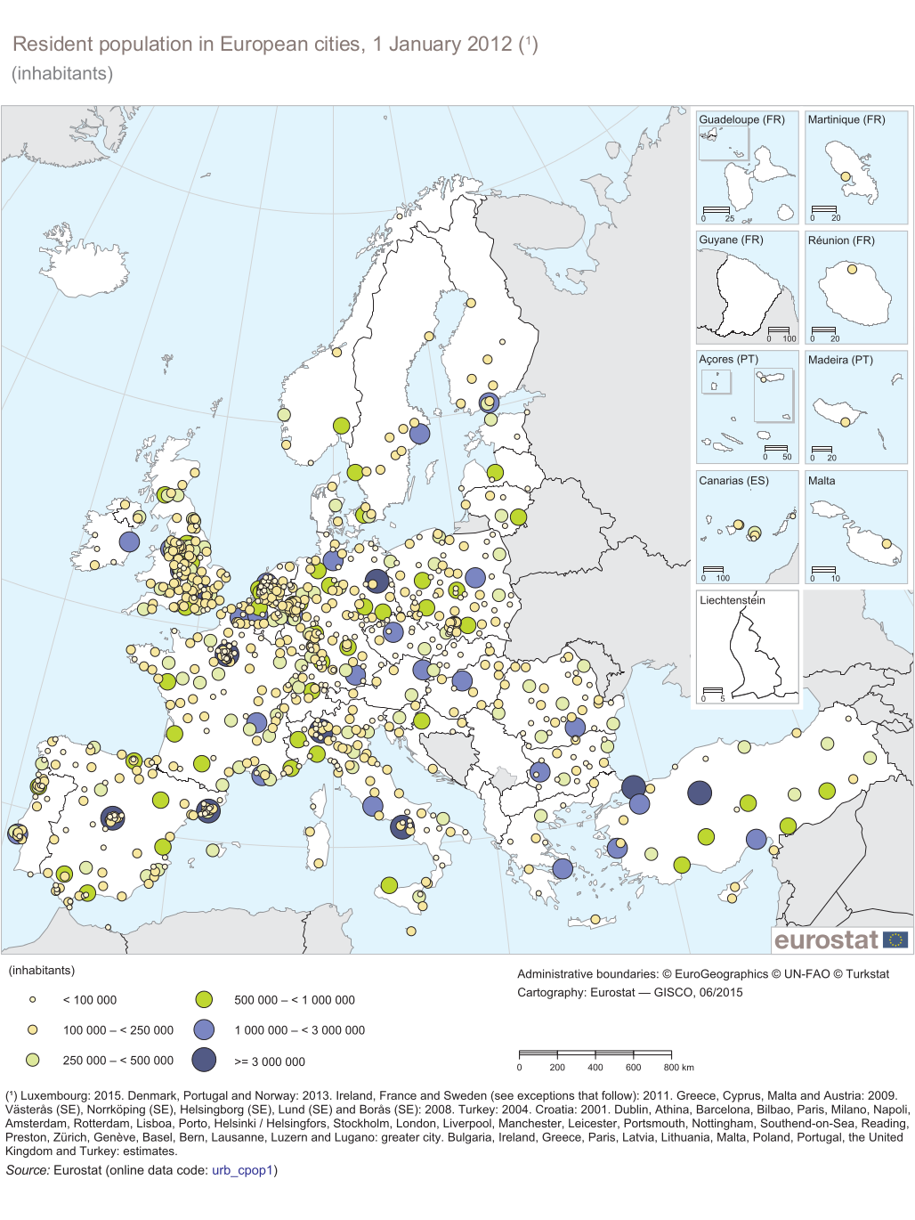
↑ Resident population in European cities, January 1, 2012. Eurostat - GISCO, June 2015. On EC.Europa.eu, accessed on January 5, 2019.
Map of Europe: Brussels (light blue point = 1–3 million inhabitants), strong of smaller neighboring signatures superimposed south of Antwerp (green point = 0.5–1 million inhabitants). -
^ Belgium - capital: Brussels. Overview. Status: November 2018. On Auswaertiges-Amt.de, accessed on January 5, 2019.
1.2 million inhabitants within the 19 municipalities that make up the Brussels-Capital Region, almost 3 million inhabitants in the greater Brussels area (as of 2018). -
↑ Metropolitan Regions Database. Eurostat. At EC.Europa.eu, accessed on January 5, 2019.
A selection of tables to click on. - ^ Population - Evolution annuelle. (XLSX; 59.5 KB) Institut Bruxellois de Statistique et d'Analyses, July 10, 2020, accessed on May 3, 2020 (French).
- ↑ Eberhard Gresch: The Huguenots. History, Belief and Impact. 4th, revised edition. Evangelische Verlagsanstalt, Leipzig 2009, ISBN 978-3-374-02260-1 , pp. 197 to 200
- ↑ John Horne , Alan Kramer: Deutsche Kriegsgreuel 1914: The controversial truth , p. 59.
- ^ War diary , pp. 1164/65.
- ↑ Jean-Marie Binst: Grote pogrom in Marolles herdacht. August 29, 2017. From Bruzz.be (Dutch), accessed January 5, 2019.
- ↑ a b Christoph Driessen: History of Belgium. The divided nation. Regensburg 2018, p. 180
- ^ Christoph Driessen: History of Belgium. The divided nation. Regensburg 2018, p. 177
- ↑ Quotation n .: Christoph Driessen: History of Belgium. The divided nation. Regensburg 2018, p. 177f.
- ^ Christoph Driessen: History of Belgium. The divided nation. Regensburg 2018, p. 178
- ↑ Martin Blumenson: Chapter XXXII: Towards the Heart of Germany. In: United States Army in World War II. European Theater of Operations - Breakout and Pursuit, p. 686. At ibiblio.org, accessed January 5, 2019.
- ↑ Eurostat press release 23/2009: Regional GDP per inhabitant in the EU27 (PDF; 360 kB).
- ↑ Unemployment rate, by NUTS 2 regions. Retrieved November 5, 2018 .
- ↑ Brussels public transport lines
- ↑ Planning of the MIVB / STIB 2009 (French)
- ↑ Ken Lambeets: Handen aan de schop Brussel deze week, edition 1470 of April 16, 2015, pages 25
- ↑ Jean Demannez, interview of November 24, 2003 ( Memento of December 5, 2012 in the web archive archive.today )
- ↑ Non-Profit Data. Retrieved December 28, 2017 .
- ↑ Saint-Josse-ten-Noode: Center international Rogier, Place Charles Rogier 10-15. In: Région de Bruxelles-Capitale: Inventaire du Patrimoine Architectural. From IrisMonument.be (French), accessed November 21, 2019.
- ↑ Bart Sibiel: That time we… Took a closer look at the local legacy of architect Jacques Cuisinier. In: Neighborhood live. January 28, 2016. From TheWordMagazine.com, accessed November 21, 2019.
- ↑ Museums. The Royal Museums of Fine Arts of Belgium, accessed on May 3, 2020 .
- ↑ About. MIMA Museum, accessed May 3, 2020 .
- ^ Brussels as painted in: Die Welt, June 20, 2009
Brussels (Belgium) | Sofia (Bulgaria) | Copenhagen (Denmark) | Berlin (Germany) | Tallinn (Estonia) | Helsinki (Finland) | Paris (France) | Athens (Greece) | Dublin (Ireland) | Rome (Italy) | Zagreb (Croatia) | Riga (Latvia) | Vilnius (Lithuania) | Luxembourg (Luxembourg) | Valletta (Malta) | Amsterdam (Netherlands) | Vienna (Austria) | Warsaw (Poland) | Lisbon (Portugal) | Bucharest (Romania) | Stockholm (Sweden) | Bratislava (Slovakia) | Ljubljana (Slovenia) | Madrid (Spain) | Prague (Czech Republic) | Budapest (Hungary) | Nicosia (Cyprus)
Communities: German-speaking Community | Flemish Community | French community
Regions: Brussels-Capital | Flanders | Wallonia
Flanders: Aalst | Antwerp | Bruges | Dendermonde | Diksmuide | Eeklo | Ghent | Halle-Vilvoorde | Hasselt | Kortrijk | Lions | Maaseik | Mechelen | Ostend | Oudenaarde | Roeselare | Sint-Niklaas | Tielt | Turnhout | Tongeren | Veurne | Ypres
Wallonia: Arlon | Ath | Bastogne | Charleroi | Dinant | Huy | La Louvière | Liege | Marche-en-Famenne | Mons | Namur | Neufchâteau | Nivelles | Philippeville | Soignies | Thuin | Tournai-Mouscron | Verviers | Virton | Waremme
Brussels-Capital Region: Brussels-Capital
Coordinates: 50 ° 51 ' N , 4 ° 22' E