
Motorway 7 (Belgium)
| Motorway / Autoroute / Autosnelweg A7 in Belgium | |||||||||||||||||||||||||||||||||||||||||||||||||||||||||||||||||||||||||||||||||||||

|
|||||||||||||||||||||||||||||||||||||||||||||||||||||||||||||||||||||||||||||||||||||
| |
|||||||||||||||||||||||||||||||||||||||||||||||||||||||||||||||||||||||||||||||||||||
| map | |||||||||||||||||||||||||||||||||||||||||||||||||||||||||||||||||||||||||||||||||||||
.svg) |
|||||||||||||||||||||||||||||||||||||||||||||||||||||||||||||||||||||||||||||||||||||
| Basic data | |||||||||||||||||||||||||||||||||||||||||||||||||||||||||||||||||||||||||||||||||||||
| Operator: | |||||||||||||||||||||||||||||||||||||||||||||||||||||||||||||||||||||||||||||||||||||
| Overall length: | 61 km | ||||||||||||||||||||||||||||||||||||||||||||||||||||||||||||||||||||||||||||||||||||
| Development condition: | 2 × 2 lanes + emergency lanes | ||||||||||||||||||||||||||||||||||||||||||||||||||||||||||||||||||||||||||||||||||||
|
Course of the road
|
|||||||||||||||||||||||||||||||||||||||||||||||||||||||||||||||||||||||||||||||||||||
The Belgian Autobahn 7 , also on French. Autoroute 7 or Dutch Called Autosnelweg 7 , it connects Brussels past Mons with the French border at Hensies . Its total length is around 60 km. It is part of the Europastraße 19 .
course

The motorway rises at the southern end of the Brussels ring road ( R0 ) at the Échangeur de Haut-Ittre . The motorway runs past Nivelles , Le Roeulx , Jemappes and Saint-Ghislain through the Belgian provinces of Walloon Brabant and Hainaut . It ends at the Mons border crossing , where it merges into the French A2 motorway. It continues to Combles .
In the entire area from Haut-Ittre to the border, the A7 runs identically to European route 19 . The E19 then continues identically to the R0 and A1 , or in France with the A2 and A1 in the direction of Paris .
photos

Beginning / end of the A7 at Brussels Ring

A7 or E19 towards Brussels
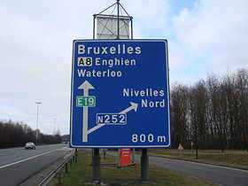
Signs for the E19

Houdeng-Goegnies motorway junction : junction of the A7 and the A15


