
Scheldt
| Scheldt / Escaut | ||
.png) |
||
| Data | ||
| Water code | FR : E1000600 , FR : E1280600 , FR : E --- 004- | |
| location | France , Belgium , the Netherlands | |
| River system | Scheldt | |
| source | near Gouy 49 ° 59 ′ 11 " N , 3 ° 15 ′ 59" E |
|
| Source height | 97 m | |
| muzzle |
North Sea (estuary of the Scheldt: Westerschelde ) Coordinates: 51 ° 25 ′ 22 " N , 3 ° 32 ′ 42" E 51 ° 25 ′ 22 " N , 3 ° 32 ′ 42" E |
|
| Mouth height | 0 m | |
| Height difference | 97 m | |
| Bottom slope | 0.27 ‰ | |
| length | 360 km | |
| Catchment area | 21,863 km² | |
| Discharge at the Schaar van Ouden Doel gauge |
NNQ (Aug 1973) MQ 1958–1990 HHQ (Dec 1966) |
18 m³ / s 127 m³ / s 719 m³ / s |
| Big cities | Antwerp , Ghent | |
| Medium-sized cities | Cambrai , Tournai , Valenciennes | |
| Residents in the catchment area | about 11 million | |
| Ports | Antwerp , Vlissingen , Terneuzen , Gent | |
| Navigable | Yes | |
The Scheldt (fr. Escaut , lat. Scaldis ) is a river in France , Belgium and the Netherlands .
Course, characteristics and mouth

The Scheldt rises in Gouy in northern France 16 km north of Saint-Quentin and after 104 km crosses the border to Belgium . After a further 26.5 km it reaches Flanders . For West Flanders , it only forms the southeast border and then flows through East Flanders and the province of Antwerp . The city of Antwerp in the estuary has a large deep water port , i. H. it can also be used by very large container ships. From 2009 to 2014 it was roughly level with the port of Hamburg and was the second largest container port in Europe (based on the container TEU handled ).
The border between the inland water and the estuary (estuary, an inner coastal water ), the 56 km long Westerschelde , is usually the Belgian-Dutch border. Because of the low gradient of the river, the tidal influence extends 100 km further upstream.
At the beginning of the Westerschelde estuary, the Scheldt has an average discharge of 127 m³ / s. The up to five kilometers wide estuary (Westerschelde) is considered a habitat of exceptional ecological wealth.
The estuary in the Dutch province of Zeeland has a complicated history: until 8,000 years ago, the lower reaches of what is now the Gent-Terneuzen Canal . Silting up then shifted the estuary far east. About 5000 years ago a sea inrush tapped that eastern course and the Oosterschelde was formed . In the 10th century AD, a new sea invasion widened the hitherto insignificant marsh waters of Honte inland until it reached the Scheldt and became the Westerschelde. Until the 17th century the double estuary consisted of the Westerschelde and the Oosterschelde. Since the latter also received a tributary from the Meuse until the 20th century , the estuaries of the Scheldt, Meuse and Rhine are also considered together as the Rhine-Maas-Scheldt Delta , although the Scheldt does not belong to the Rhine river system . However, the Oosterschelde silted up near the fork in the Westerschelde in the 17th and 18th centuries. In the 20th century, the Oosterschelde was also cut off from the Maas inflow as part of the delta plan and is now a sea bay that has been protected from storm surges by the Oosterschelde barrage since 1986 .
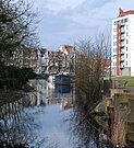
photos

Valenciennes lock

Pont des Trous and Cathedral in Tournai

Scheldt near Oudenaarde
Scheldearm Franse Vaart in Ghent

Scheldt near Schellebelle

Installation ship Innovation in Antwerp


Cultural and historical aspects
In ancient times the river was called Scaldis . Presumably it also corresponds to the river Tabuda or Tabula mentioned by Ptolemy .
The Scheldt has played an important role in the economic and political development of Flanders , Brabant and Hainaut since the Middle Ages . For a long time it was the border between the Kingdom of France and the Holy Roman Empire . Funnel mouths were easy to defend against attackers from the sea since the artillery could shoot far and with some precision. It was also useful that ports in funnel mouths offer ships better protection from storms than ports directly on the coast, the same framework that makes cities such as Hamburg ( Elbe ), Emden ( Ems ) and London ( Thames ) important ports .
Vauban used the Scheldt to defend the fortresses of Valenciennes , Bouchain , Condé-sur-l'Escaut and Cambrai . Since the Spanish conquest of Antwerp in 1585 , the Scheldt was blocked by the Dutch fleet until the 19th century.
From May 10, 1940, Wehrmacht troops occupied the Benelux countries (and northern France in June during the western campaign ). In August 1944, Allied troops advanced rapidly; the port of Antwerp was occupied by the British 2nd Army at the beginning of September . Since Antwerp is located in the hinterland of the Scheldt estuary, about 80 kilometers from the coast, it was only possible to use it if it was possible to eliminate the strong German artillery positions on the offshore Walcheren peninsula . This happened in the long and bloody battle of the Scheldt estuary .
shipping
The Scheldt is navigable by ships almost on its entire course, in the upper reaches it is developed as Canal de Saint-Quentin , which it supplies with water, from Cambrai as an independent canalised river. The confluence of the large shipping route Dunkirk-Schelde (French: Liaison à grand gabarit Dunkerque-Escaut ) has made it an important shipping route in northern France and Belgium.
Tributaries of the Scheldt
- Waters of less than 25 km in particular are included if they are to be regarded as part of a longer watercourse.
| The Scheldt, its tributaries and tributaries from 25 km in length (order upstream) | ||||||||||
Representation:
|
||||||||||
| Inflow in the direction of flow seen from |
Surname | Location of the mouth |
Water code number : BE: various FR: SANDRE |
Length [km] |
Catchment area [km²] |
mean discharge [m³ / s] |
||||
| Westerschelde (as an estuary ) | Vlissingen | approx. 56 | ||||||||
| ↑ Scheldt | Zandvliet | BV10 ← E --- 004- ← E1280600 ← E1000600 |
380 | 21 863 | 127 | |||||
| right | Rupel from: | Niel | 12 | |||||||
| ↑ right | Nete | Rumst , NW of Mechelen | 15th | |||||||
| ↑ right | Little nete | Lier | 44 | |||||||
| ↑ left | Grote Nete | 44 | ||||||||
| ↑ left | Dijle / Dyle | Rumst , NW of Mechelen | VL05-77, -78 | 86 | 25th | |||||
| Left | Zenne / Senne | Heffen , NW of Mechelen | 103 | 1 164 | 5.5 | |||||
| right | Zinnet / Senette | Tubeke - Klabbeek | 35 | |||||||
| Left | Laan / Lasne | Sint-Joris-Weert | VL05_84 | 26th | 109 | |||||
| right | Demer | Rotselaar | 85 | |||||||
| Left | Velp | This | 35 | |||||||
| Left | Gete / Gette = Gète from: | Halen (together with Herk) | VB: 4,001 | 12.7 | ||||||
| ↑ right | Grote Gete = Tiense Gete | Zoutleeuw -Budingen | VB: 4,002 | 51 | ||||||
| ↑ left | Little Gete | VB: 4,003 | 36 | |||||||
| Left | Herk | Halen (together with Gete) | 43 | |||||||
| Left | Durme (without the former upper reaches west of Ghent) | 3 km above v. Temse | 24.6 / 47.1 | |||||||
| ↑ Moervaart (from the branch off the Gent – Terneuzen canal ) | Lokeren | 22.5 | ||||||||
| right | Dender | Dendermonde | BV18 = 0518 | 65 | 40 | 10 | ||||
| right | Mark / Marcq | Lessines - Deux-Acres | 05215 | 28 | ||||||
| Left | Leie / Lys | Ghent | BV 51; VL05_48, -49, -50 | 114.7 | 202 | 22nd | ||||
| Left | Almond (partially cased) | Oeselgem (no longer Deinze ) | VL05_50, -51 | 39.5 | ||||||
| right | Deûle / Deûle (over half canalized) | Deûlemont | E3-021- , E3010770 | 58.8 | 1 071 | 8th | ||||
| right | Marque | Marquette-lez-Lille | E3340600 | 31.6 | 215 | |||||
| Left | Scarpe |
Mortagne-du-Nord , near south of the F / B border |
E2--0110 , E2010600 | 102 | 1 322 | 2.6 | ||||
| right | Haine (Flemish Hene ) | Condé-sur-l'Escaut | E1820402 | 72 | 179 | |||||
| Left | Hogneau = Honniau = Grande Honnelle | Thivencelle | E1820700 | 37.6 | 240 | 1.95 | ||||
| Left | Aunelle | Crespin | E1820800 | 27.3 | ||||||
| right | Écaillon | Prouvy | E1760750 | 33.2 | 173 | 1.2 | ||||
| right | Selle | E1720600 | 45.9 | 252 | 2.4 | |||||
| right | Erclin = Erclain | Iwuy | E1310600 | 34.1 | 160 | |||||
| Left | Sensée | south Bouchain | E1560600 | 47 | ||||||
Cities on the Scheldt
| Surname | Inhabitants: F: Municipality B: Core city |
Residents: F: Aire urbaine B, NL: municipality |
Altitude [m] |
annotation |
|---|---|---|---|---|
| France: | ||||
| Cambrai | 32 897 | 58 330 | 41-101 | |
| Valenciennes | 43 787 | 367 992 | 17-56 | Northern French-Belgian industrial area |
| Belgium | ||||
| Tournai | 35 004 | 69 751 | 15-50 | Northern French-Belgian industrial area |
| Oudenaarde | 5 338 | 30 318 | 10-30 | |
| Ghent | 249 008 | 249 008 | 4-15 | |
| Dendermonde | 9 207 | 44 546 | 2-10 | |
| Antwerp | 204 742 | 506 922 | ||
| Netherlands | ||||
| ( Bergen op Zoom ) | 66 283 | Oosterschelde | ||
| Terneuzen | 54 713 | Ghent – Terneuzen Canal | ||
| Vlissingen | 44 980 |
Others
The story of the romantic opera Lohengrin by Richard Wagner takes place on the banks of the Scheldt . The asteroid (30773) Scheldt is named after the river.
Lode van der Linden (1888–1960) painted numerous Scheldt motifs.
The Doel nuclear power plant is located on the left bank of the Scheldt estuary, 15 km north of Antwerp . Its four large cooling towers and their steam plumes are landmarks that can be seen from afar. The NPP has four pressurized water reactors: two with 433 MW net electrical output each and two with around 1000 MW. The Doel-3 nuclear reactor (construction started in 1975), like the Tihange-2 nuclear reactor, has thousands of cracks in the reactor pressure vessel .
In the early 1930s, a pedestrian tunnel was built under the river bed on the banks of the city of Antwerp. The tunnel was named Sint-Anna tunnel . There is also a tunnel for road traffic, the Waasland tunnel .
See also
- Escaut department
- Regional nature park Scarpe-Schelde
- Battle of Fontenoy (May 11, 1745)
- Albert Canal (Scheldt-Maas Canal)
- Scheldt-Rhine Canal
Web links
Individual evidence
- ↑ Data from the Rijkswaterstaat
- ↑ Statistics
- ↑ Ptol. 2.9.3. Cf. Alfred Stückelberger, Gerd Graßhoff (eds.): Klaudios Ptolemaios. Handbook of Geography. Vol. 1. Schwabe, Basel 2006, p. 209
- ↑ http://geo.vlaamsbrabant.be/waterlopen/
- ↑ http://www.zoutleeuw.be/website/1856-www/.../WATERLOPEN.pdf ( page no longer available , search in web archives )
- ↑ a b http://atlaswaterlopen.oost-vlaanderen.be/
- ↑ GPS track Marcq Mark
- ↑ Google "leie almond waterlopen number" → www.integraalwaterbeleid.be/nl/stroomgebiedbeheerplannen/.../Leiebekken.pdf Bekkenspecifiek deel Leiebekken - Integraal Waterbeleid
- ↑ Length measurement with the measurement function of the Vlaamse Hydrographic Atlas using the positions: VHA-waterloop + VHA-waterloop, names + waterloopsegmenten class waterlichaam + VHA-waterloopsegmenten volgens categorie
- ↑ a b c d http://www.ngi.be/topomapviewer/public?lang=nl&