Langer See (Dahme)
| Long lake | ||
|---|---|---|

|
||
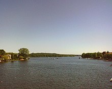
| View over the Long Lake to Wendenschloß | ||
| Geographical location | Berlin , Treptow-Koepenick district | |
| Tributaries | Dahme , Gosen Canal | |
| Drain | Dahme | |
| Places on the shore | Grünau , Köpenick , Schmöckwitz | |
| Data | ||
| Coordinates | 52 ° 24 ' N , 13 ° 38' E | |
|
|
||
| surface | 2.43 km² | |
| length | 11 km | |
| width | 221 m | |
| Maximum depth | 8.5 m | |
| Middle deep | 4.1 m | |
A body of water about eleven kilometers long in the Berlin district of Treptow-Köpenick is called Langer See . It is a typical Rinnensee through which the Dahme flows and covers an area of 2.43 square kilometers. This results in an average width of 221 meters.

The lake, which is more of a chain of lakes, begins at the Seenkreuz near Schmöckwitz and, after running northwest, ends at the Köpenick old town island, where the Dahme flows into the Spree . The approximately two kilometer long area between the confluences of the Teltow Canal (Grünau) and Müggelspree (Köpenick) is again referred to as Dahme and no longer as Langer See.
The long lake between Seenkreuz and Teltow Canal is part of the federal waterway Spree-Oder waterway of waterway class Va; The Berlin Waterways and Shipping Office is responsible .
There are three islands in the Long Lake:
Two other islands in the southeast on the border to the neighboring Seddinsee are Werderchen and Weidenwall. They are included in the latter lake. The Berlin-Grünau regatta course , the Grünau lido and the Wendenschloss seaside resort are located on Langen See . In addition, many boathouses and excursion restaurants such as the " butterfly nest " have settled there.
The BVG ferry F12 runs all year round between Grünau (water sports avenue) and Wendenschloß (Müggelbergallee), and between Müggelheim / Krampenburg and Schmöckwitz (Zum Seeblick) the ferry line F21 crosses Langen See in the summer. The Schmöckwitz – Grünauer Uferbahn runs between Grünau and the Richtershorn peninsula along to the southern shore of the lake.
Web links
Individual evidence
- ↑ Senate Department Environment: Our city's waterways .
- ^ Directory of the federal inland waterways serving general traffic. Federal Waterways and Shipping Administration, accessed on February 10, 2020 .
- ↑ BVG ferry line F12.
- ↑ BVG ferry line F21.
