
Wildspitze
| Wildspitze | ||
|---|---|---|
 North-east side with the south summit (left) and the firnigen north summit |
||
| height | 3768 m above sea level A. | |
| location | Tyrol , Austria | |
| Mountains | Ötztal Alps , Eastern Alps | |
| Dominance | 48.5 km → Ortler | |
| Notch height | 2261 m ↓ Reschenpass | |
| Coordinates | 46 ° 53 '7 " N , 10 ° 52' 2" E | |
|
||
| First ascent | 1848 by Leander Klotz | |
| Normal way | High tour over Mitterkarjoch - west flank - southwest ridge | |
 Panorama from the Hinterer Brunnenkogel ( 3440 m ) to the Wildspitze |
||

The Wildspitze with 3768 meters the highest mountain in North Tyrol and the Oetztal Alps . It is the second highest mountain in Austria after the Großglockner ( 3798 m ) .
location
It is located approx. 12 km northeast of the main Alpine ridge in the Weißkamm , the part of the Ötztal Alps that stretches from the Weißkugel to the northeast towards Sölden . Its south and east side rises above the Venter Valley , an orographically left side valley of the Ötztal ; its western and northern flanks form the end of the Pitztal valley . It has two peaks , the rocky south peak ( 3768 m , according to other sources 3770 m ) with a summit cross and the firnigen and thus potentially melting north peak (approx. 3765 m , location ). Even in the 1990s, its height was often given as 3774 m. To the north the Taschachferner flows off into the Pitztal, to the southwest and east the Mitterkar and Rofenkarferner into the Venter valley.
With a notch height of 2,266 meters, the Wildspitze is fourth in the Alps: this difference is only exceeded by Mont Blanc (4,697 m), the Großglockner (2,424 m) and the Finsteraarhorn (2,280 m). The dominance is around 48.5 kilometers, with the Ortler reference mountain for both values .
The view from the Wildspitze is only limited by the haze and the curvature of the earth and extends from the Valais Alps in the west-southwest ( Täschhorn approx. 248 km, Weismies ), the Bernese Alps in the west ( Aletschhorn approx. 225 km, Finsteraarhorn , Mönch) to the Schobergruppe in the east.
Summit cross

In 1933 the Wildspitze received a summit cross . It was dismantled and transported up the mountain, where it was assembled and set up. After 77 years it was replaced with a new one by mountain guides from Vent with the help of a helicopter. After cleaning and renovation, the old cross was erected on the southern high bank of the Rofenache between the village of Vent and the Rofenhöfen. There is the only place from which you can see the Wildspitze in this valley.
Alpinism
Due to its exceptional position within the Eastern Alps, it is climbed very frequently in both summer and winter. Thanks to the construction of the Pitztal Glacier Railway , it can now also be climbed from the Pitztal as a day tour.
First ascent

The first ascent of the south summit was made by Leander Klotz from Rofen and an unknown farmer in 1848 . Leander Klotz was the first to climb the northern summit, which was still higher at the time, in 1861 (via the connecting ridge from the southern summit). The northern summit has since become lower due to melting. Meanwhile, the southern summit has to be regarded as the main summit of the Wildspitze. Anton von Ruthner describes in great detail how the ascent from Vent via the Rofenhöfe and the necessary preparations went back then .
Normal routes

The normal route leads from the firn basin north of the Mitterkarjoch over the south-west ridge to the south summit and is an easy high-altitude tour under normal conditions . The firn basin can also be reached from Vent via the Breslauer Hütte ( 2844 m ), the Mitterkarjoch ( 3468 m ) or the Rofenkarferner, as well as from the Taschachhaus via the Taschachferner or from the Braunschweiger Hütte or the Pitztaler Gletscherbahn through the summer ski area and over the Mittelbergjoch . All four routes lead over glaciers and therefore require full glacier safety equipment.
Other routes
Popular alternatives are the rocky southeast ridge over the Ötztaler Urkund and the 50 ° inclined north face (steep ice - approx. 6 pitches).
photos

South side

South summit

West side

North summit
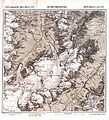
Special map of the Eastern Alps Section Wildspitze, 1874


Web links
- Panorama from the Wildspitz south summit (July 2010)
- Wildspitze on GeoFinder.ch
Individual evidence
- ^ Federal Office for Metrology and Surveying Austria: Austrian Map online (Austrian map 1: 50,000) . Retrieved January 25, 2011.
- ↑ a b Austrian Alpine Club : Alpine Club Card 30/1: Ötztal Alps - Gurgl (1: 25,000) . 12th edition 2015, ISBN 978-3-928777-38-4 .
- ↑ International World Atlas. Buch und Zeit, 1993, ISBN 3-8166-3952-6 , p. 15.
- ^ Richard Goedeke : Alpinist collecting games - Which summits are the main goals? In: Walter Theil (Hrsg.): Alpenvereinsjahrbuch - Berg 2005 . Volume 129. Alpenvereinsverlag, Munich 2004, ISBN 3-937530-04-5 , pp. 312-317.
- ↑ PeakFinder Ltd [email protected]: Mountain panorama: Wildspitze. Retrieved March 18, 2019 .
- ^ Walter Klier : Alpine Club Guide Ötztal Alps. 14th, revised edition. Bergverlag Rother , Munich 2006, ISBN 3-7633-1123-8 , p. 3066ff.
- ↑ Philipp Horak: The new cross . In: Ötztal Tourismus: The Wildspitze - magazine for the intensive experience of the Ötztal . Number 2. CSV-Verlag, Fahndort 2010, p. 8. (PDF; 15.0 MB). Retrieved January 25, 2011.
- ↑ Altes Kreuz der Wildspitze , accessed on August 28, 2017.
- ^ Richard Goedeke: 3000 m in the northern Alps. 1st edition. Bruckmann Verlag , Munich 2004, ISBN 3-7654-4746-3 , p. 93.
- ^ Anton von Ruthner: Ascent of the high Wildspitze in the Oetzthale . In: Communications of the Imperial-Royal Geographical Society. From the Austrian high mountains . tape 6 . Vienna 1861, Chapter XI., P. 216–243 ( full text in Google Book Search).