
Hegau
Hegau was the name of a historical district of the Duchy of Swabia northwest of Lake Constance in the south of today's state of Baden-Württemberg , which was mentioned for the first time in 787 in the Latinized form "in pago Egauinsse" . It reached on the south side from Überlinger See and the city of Konstanz in the south-east to the Upper Rhine between Stein am Rhein and Schaffhausen in the south-west. Its western border stretched, initially in front of the Randen mountain in what is now Switzerland, northwards across the Hegaualb to the young Danube in the northwest. Stockach was in the northeast .
Today, only the young moraine core landscape of the Gau is usually referred to as Hegau, without the parts in today's Swiss canton of Schaffhausen , see section on the natural area of the same name . This is mainly known for the volcanic dominated Hegauer cone mountains (see section on this ) west of the city singing . Its altitude ranges from 395 m on Lake Constance to 844 m on the Hohenhewen basalt mountain .
Hegau natural area
In the first delivery of the handbook of the natural spatial structure of Germany in 1953, the main natural spatial unit 030 Hegau (also: Hegäu ) was delimited to the east by a line between Radolfzell and Stockach , to the west and northwest to the Swabian Alb ( Randen , Hegaualb ) ; in the south, the Schiener Berg already belonged to the neighboring unit 031 Lake Constance basin and the Hegau was 306 km² according to this delimitation. This demarcation also existed in the second mapping in 1960.
When the breakdown was to be refined in 1964 on sheet 186 Konstanz on a scale of 1: 200,000, its author Alfred G. Benzing found that it made no sense in strictly natural terms to separate the Hegau from the Lake Constance basin, which is why it is the main unit on his sheet 030/031 Northern Lake Constance and Hegau Basin defined and refined. His colleague Hansjörg Dongus was even more rigorous when he wrote the neighboring paper 187/193 Lindau / Oberstdorf to the east in 1991 . Dongus merged the "old" units 030 and 031 with the old units 032 Upper Swabian Hügelland and 033 Westallgäuer Hügelland and defined the new main unit 030 Bodensee-Jungmoränenland . This extends east to Adelegg and meets the old moraines of the Danube-Iller-Lech-Platte in the north ( Donau-Ablach-Platten ) and northeast ( Riss-Aitrach-Platten ) .
When the State Institute for the Environment, Measurements and Nature Conservation Baden-Württemberg (LUBW) tried in the immediately following years to combine the individual sheets of their federal state, which were often contradictory at the points of contact, into a coherent breakdown into main units, it was also a goal to use well-known landscape names as natural space names to preserve, which is why the Hegau is again listed as the main unit in the structure there. With an area of 715 km², it is significantly larger than the Hegau defined in the manual and, in addition to the Bodanrück peninsula, includes the Constance peninsula and the island of Reichenau in the extreme southeast as well as the Schiener Berg and the Höri in the south. North of the Überlinger See, it extends east to Owingen .
Natural structure
The finer natural areas from sheet 186 Konstanz can be assigned to the main unit 030 Hegau according to LUBW as follows:
-
(on 030 Bodensee-Jungmoränenland according to Blatt Lindau, Hansjörg Dongus )
- 030 Hegau (according to LUBW)
- 030 / 031.1 Südwesthegauer Bergland
- 030 / 031.10 Hegauer Kegelbergland
- 030 / 031.11 Westhegauer Talwannen (extreme west and south-east in Switzerland)
- 030 / 031.12 Herblinger-Dörflinger Hügelland (mostly in Switzerland)
- 030 / 031.13 Schienerberg (with Höri -Uferland) (extreme west in Switzerland)
- 030 / 031.2 Middle Hegau-Untersee depression
- 030 / 031.20 Bodensee-Untersee - according to LUBW not part of the Hegau
- 030 / 031.21 Reichenau Island
- 030 / 031.22 Constance lowland
- 030 / 031.23 Bodanrück hill country
- 030 / 031.24 Great Hegau lowlands (Singen lowlands)
- 030 / 031.3 Nordosthegauer Bergland
- 030 / 031.30 High Bodanrück-Homburg-Heights
- 030 / 031.31 Engen-Langensteiner edge heights
- 030 / 031.32 Orsingen-Espasinger lowlands
- 030 / 031.33 Stockacher Bergland
- 030 / 031.1 Südwesthegauer Bergland
- 030 Hegau (according to LUBW)
In the north east, the demarcation according to LUBW does not quite match that on the Konstanz sheet. The slightly more flat, wavy , triangular area between Sipplingen , Überlingen and Owingen is part of the unit 030 / 031.40 Überlinger Hügelland and thus the higher unit 030 / 031.4 Überlingen-Friedrichshafener Hügelland ( Niederlinzgauer Hügelland ) , which lies entirely in the historic Linzgau .
Hegauer Kegelbergland

In Hegauer Kegelberg land immediately west singing, a body kuppiger, conical chimneys of extinct volcanoes , the insulated with heights of between 643 m and 867 m in all the 400- 600 m above sea level. Towering above the NN landscape.
Emergence
In the middle of the Miocene (about 14 million years ago) a strong volcanism set in in the Hegau area, which lies at the intersection of two fault systems (at Hohenstoffeln only 1.5 million years later). Around a dozen volcanoes formed, which produced large amounts of tephra . As a result, a 100 m thick tuff layer was formed . 10 million years ago melilithite ("Hegauer Basalt") intruded into the western chimneys . Phonolite intruded into the eastern vents 7 to 8 million years ago . However, this could not reach the surface of the earth and froze under the tuff layer. The reason for this volcanic activity is seen in the rapid subsidence of the Upper Rhine Rift by geological conditions .
In the Pleistocene , in the course of the Riss Ice Age (about 150,000 years ago), the Hegau region was also covered by a thick layer of ice. The glacier cleared molasses and tuff, but the harder phonolite and basalt cores were more resistant and withstood the ice masses. In this way the solidified magma was exposed, and only then did the landscape get its present-day appearance.


Phonolite Mountains
The east of the Kegelbergland is characterized by a series of phonolite mountains.
From north to south these are:
- Mägdeberg ( 654.2 m , towered over by the Sickerberg 660.3 m in the northwest ): extensive, well-preserved castle ruins of Mägdeberg Castle (evidence from around 1240: in castro Megideberc ) on the phonolite cone of the same name. According to legend, the mountain got its name from the pilgrimage of the English king's daughter Ursula , who encamped with thousands of maidservants (name from Old High German maga (i) d "virgin").
- Hohenkrähen (coll. Crows ) ( 636.6 m ) as the smallest, steepest and at the same time most striking cone with the crowning ruin Hohenkrähen .
- Staufen ( 594 m ): The former fortress has been completely destroyed.
- Hohentwiel (coll. Hontes ) ( 696.2 m ), landmark of the city of Singen . The former fortress Hohentwiel (probably Alemannic, from an idg. Root * tu "swell") was the largest and most important of the numerous Hegau castles with a fortress area of 9.92 hectares. It was razed in 1800 by order of Napoleon .
To the northwest of the Mägdeberg, the non-volcanic Philippsberg ( 624.9 m ) leads over to the basalt series.
Basalt mountains
The west of the Kegelbergland is occupied by two basalt mountains that stand in a row that extends significantly further to the north. The row of cones begins at the (northwest) eaves of the Swabian Alb and stretches from the west of Geisingen initially to the southeast, only to gradually slide down to the south, where the natural Hegau is reached.
From north to south these are:
- Wartenberg ( 844.8 m ): Located two kilometers west of the city of Geisingen. The Wartenberg lies on the western edge of the Baaralb (more precisely: on the western edge of the Geisingen-Spaichinger Waldberge ), at the interface with the Baar . Geologically it belongs to the Hegau volcanoes. In the 12th century, the Wartenbergs, the Geisinger local lords, built their first castle here. Today there are both the ruins of the first castle, the Wartenberg castle ruins , and a small pleasure palace with an English garden.
- Höwenegg ( 812 m ), four kilometers south of Immendingen in the Hewenegg nature reserve , in the center of the Hegaualb : the mountain peak has been eroded as a result of old basalt mining. In its place there is only an 80 m deep quarry left with a lake. At the southern foot of the slope - in the sediment area of a former crater lake - one of the most important tertiary fossil sites in Germany exists. Today the Hewenegg is a nature reserve . The former, to rule Hewen belonging Castle Hewenegg also fell victim to the quarry (hence the castle site Hewenegg called); the castle was destroyed together with Neuhewen in 1639. 400 m southwest of the main castle was a small castle (also known as the outer bailey and castle stables); the castle rest Hewenegg , a castle ruin , was preserved from her .
- Neuhewen , the highest of the Hegauberge ( 867.2 m ), also central Hegaualb: Neuhewen castle ruins ("Stettener Schlössle"), near the town of Engen , built around 1200. The castle and town of Stetten were originally owned by the Lords of Höwen (Hohenhewen) . Together with Höwenegg Castle (also known as Hewenegg Castle ), Neuhewen Castle was supposed to secure the territory to the north.
- Hohenhewen (coll. "Höwen") ( 845.3 m ), northern seam of the Kegelbergland to the Hegaualb: Hohenhewen ruins on the basalt cone of the same name (cf. Kelt. "Ceven" = "hilltop"). Local mountain of the town of Welschingen .
- Hohenstoffeln (coll. "Stoffel") ( 841.8 m ): Basalt mountain with formerly three castle ruins Vorder, Mittel and Hinterstoffeln. (1506 called "in Stofola", from ahd. "Stophil" = "little rock"). The rear castle was completely demolished, especially in the 1930s, by the quarry for road construction, remnants of the middle and front castle can still be seen.
All of these mountains have or had a ruined castle on their summit.
The local poet Ludwig Finckh referred to the Hegau as Des Herrgotts Kegelspiel because of the volcanic cone .
Schienerberg and other mountain ranges in the southwest
The landscape between the Kegelberge in the north, the Hegaualb in the northwest, the Randen in the west, the Hochrhein in the south, the Untersee in the southeast and the gently undulating Middle Hegau-Untersee-Senke in the northeast is chambered by a branched system of valleys, which makes it in various individual mountain ranges disintegrate.

To be mentioned are:
- Schiener Berg ( 716.9 m ); extreme southeast, unit 030 / 031.13
- Rauhenberg ( 621.6 m ); west-northwest of the Schiener Berg and north of Gailingen am Hochrhein ; southern locking of the central Westhegau valley basins (030 / 031.11)
- Plören ( 579.7 m ); southeast of Hilzingen ; Northeast of the Westhegau valley basins (030 / 031.11)
- Heilsberg ( 572.5 m , Heilsberg ruins , western summit: Ebersberg ); north of Gottmadingens ; central elevation of the Westhegau valley basins (030 / 031.11)
- Rosenegg (east summit 552.8 m , west summit 549.1 m , Rosenegg Castle ); west of Rielasingen and northwest of the Schiener Berg; Eastern locking of the Westhegau valley basins (030 / 031.11)
- Buechberg ( 546 m , Chapf in the south, base in the northwest even 561.6 m ); northeast of Thayngens (CH), western edge of the Westhegau valley basins (030 / 031.11)
- Berg ( 533 m ) and Kapf ( 532.1 m ); south of Thayngen, in the west of the area; northern edge heights of the wooded Herblinger-Dörflinger hill country (030 / 031.12)
- Sheet ( 501.1 m ); Edge of the Höri peninsula , east-southeast of Moos -Weiler; Northeast of the Schienerberg unit 030 / 031.13
Middle Hegau-Untersee valley
The middle Hegau area with Singen in the extreme west, Aach at the northern interface to the Hegaualb and, on the southern edge of the Bodanrück peninsula (from northwest to southeast) Radolfzell , Allensbach and Konstanz is only slightly elevated in its base compared to Lake Constance - you can see it once on the fact that the transition from the Hohe Bodanrück-Homburg-Heights (see below) to the Bodanrückhügelland, which is elevated within the depression, takes place gradually and without any notable elevation.
At the same time, the Hegau-Untersee valley is also dominated by isolated peaks:

- Friedinger Schlossberg ( 547.2 m , Hohenfriedingen Castle ); east of Friedingen ; Center of the Singen lowlands (030 / 031.24)
- Homberg ( 529.2 m ); south of Dettingen ; Center of the Bodanrück hills (030 / 031.23)
- Fronholz ( 527.9 m ); between Friedingen (SW) and Steißlingen (NE); forms a group with the Friedinger Schlossberg; Center to northeast of the Singener lowlands (030 / 031.24)
- Hartberg ( 517.4 m ); east of Worblingen ; South of the Singen lowland (030 / 031.24)
- Jöhlisberg ( 507.4 m ); east of the Friedinger Schlossberg and connecting summit to the Fronholz; Center of the Singen lowlands (030 / 031.24)
- Galgenberg ( 501.2 m ); north of Bohlingen and southeast extension of the Hardtberg; South of the Singen lowland (030 / 031.24)
- Hochwart ( 439.9 m ); Reichenau Island (030 / 031.21)
High Bodanrück-Homburg-Heights
Of the more than 650 m reach Hegaualb -Randbergen north of Aach runs, immediately northeast of the Middle hegau submarine Valley, just north of a mountain range to the southeast to the peninsula Bodanrück between Lake Überlingen and Mindelsee :

-
Engen-Langensteiner edge heights (030 / 031.31)
- Nameless knoll west of Langenstein Castle ( 586.2 m )
- Wachenholz ( 540.5 m )
-
High Bodanrück-Homburg-Heights (030 / 031.30)
- Kirnberg ( 632.8 m ; Kirnberg Castle )
- Rossberg ( 640.2 m )
- Mühlberg ( 673.6 m ); east of Stahringen
- Nameless hilltop on the Lerchenacker ( 693.4 m ); between Liggeringen in the south and Bodman in the north
- Height ( 570.3 m ); northwest of Dettingen
The Schoren ( 593.1 m ) with its own nature reserve, which is northeast of Neuhausen and faces the Hohenhewen to the east, has a bit of independence within the parts of the Engen-Langensteiner Randhöhen, which are directly adjacent to the Alb, often reaching 600 m .
Stockacher Bergland
In the northwestern extension of the Überlinger See, the Orsingen-Espasinger Niederung (030 / 031.32) stretches over Wahlwies and Nenzingen to Eigeltingen between the Bodanrück-Homburg heights and the Stockacher Bergland (030 / 031.33) to the north-east around Stockach , which is in the far northwest meets the Hegaualb and to the north the old moraines of the Danube-Ablach-Platten . In the south, on the Überlinger See, lies Ludwigshafen on Lake Constance , to the east the mountainous region extends roughly to Owingen .


The Stockacher Aach separates the landscape into a western and a significantly larger eastern part. A northern section is again separated from the latter by the Mahlspürer Aach which flows into Stockach ; their side stream Rickenbach, which flows into winter traces, along with source streams Langenbach / Riedgraben and, to the southwest of it, the Mühlbachtal with the B 31 from Ludwigshafen to Stockach divide the larger southern part again, so that the eastern part is divided into four orographic segments.
Heights over 650 m are assumed in many places at the seams to the Hegaualb and Donau-Ablach-Platten. The following are worth mentioning on independent surveys of the mountainous region:
- Hochbuehl ( 717.1 m ); west of Owingens in the extreme east of the natural area; highest summit of the main ridge of the central eastern part, which stretches to the northwest to the L 194 between Winterspüren (W) and Mahlspüren in Hegau (O)
- Sipplinger Berg ( 706.5 m , waterworks); north of Sipplingen on a ridge parallel to the Hochbühl ridge in the south of the eastern part
- Pfeifferberg ( 687.5 m ); northwest of Deutwang in the north of the eastern part, near the interface with the Donau-Ablach-Platten
- Nellenburger Berg ( 624.9 m , Nellenburg ruins on the 612.8 m high southern summit); (south) west of Stockach in the south-east of the western part of the natural area
- Wilhelmshöhe ( 572.1 m ); highest point in the south-westerly segment of the eastern part, south of Stockach
towns and places
The following alphabetically arranged places are all in the Baden-Württemberg district of Konstanz :
- Aach is the city in which the Aachtopf lies, the strongest spring in Germany.
- Eigeltingen , a small village between the Hegau Mountains, is located between Engen and Stockach.
-
Engen is located in a narrow valley, an "Engi", near the Hohenhewen . Districts:
- Bittelbrunn lies on a plateau sloping to the south in the upper Hegau. In good weather you have a beautiful view of the mountains of the Hegau and, in the case of a foehn, even of the Alps.
- Welschingen , the largest district of Engen, is located on the west side of the Hohenhewen, south of the core town of Engen.
- Neuhausen is located south of the core town of Engen. To the east of the village is the 63.4 hectare nature reserve Schoren .
- Stetten is located northwest of the core town of Engen. To the north of the village are the ruins of Neuhewen Castle (also known as Neuhöwen Castle and popularly known as Stettener Schößle ). The hill castle on the Neuhewen was built in the middle of the 13th century by the Lords of Engen (Hewen).
- Zimmerholz is located northwest of the core town of Engen. Not far to the east is the Biezental-Kirnerberg nature reserve .
- Hilzingen is located in western Hegau, about four kilometers from Singen, in the Rohrbach valley (Riederbach). The place is traversed by the Mühlenbach, which flows into the Riederbach just below the place.
- Mühlhausen-Ehingen is located northwest of Lake Constance, between the cities of Singen and Engen.
- Radolfzell am Untersee was the only imperial free imperial city of Hegau.
- Singen at the foot of the Hohentwiel , the main town of the Hegau, is an industrial city and railway junction, but has only had city rights since 1899 .
- Stockach , the largest city in Hegau before Singen became an industrial city, is not far from the Überlinger See on the Stockacher Aach . The city is widely known for the “ High Coarse Fool's Court”, which meets every year at the “Schmotzige Dunschdig”.
-
Tengen ; Tengen-Hinterburg was once the smallest town in Germany until it was destroyed in 1519. Districts:
- Beuren am Ried , 333 inhabitants. The first documentary mention dates from 965.
- Blumenfeld was later able to claim the title of Germany's smallest city with 150 inhabitants .
- Büßlingen is best known for the Roman manor whose foundation walls are open to the public
- Talheim is located west of the core town of Tengen on county road 6135. The Riedbach flows through the town. The state border with Switzerland runs not far to the south.
- Uttenhofen is located southwest of the core town of Tengen. The beaver flows through the village . The state border with Switzerland runs not far to the southwest.
- Watterdingen is located northeast of the core town of Tengen on Landesstrasse 224 and Kreisstrasse 6131
- Wiechs am Randen is located southwest of the core town of Tengen. The area of the former municipality borders on Switzerland to the east, south and west.
Waters

- The Radolfzeller Aach has the largest spring in Germany thanks to the water from the Danube infiltration with the Aachtopf and is the largest river in the Hegau, although it is only about 32 kilometers long to the confluence with the Untersee .
- In the east and south, the Hegau borders on the Überlinger See , the Zeller See , the Untersee and the Rhine flowing out of it .
- The Stockacher Aach flows through the eastern border area of the Hegau and flows into the Überlinger See.
- The Biber flows through the western border area of the Hegau and flows into the Rhine.
history
Surname
Name forms handed down early for Hegau are pagus Egauinsis (787), pagus Hegaugensis (788), Hegauvi (806), Hegouve (846) and pago Hegowe (920). The basic word is Gau , from Old High German geuwi, gouwi "Landstrich", in the defining word there is probably the mountain name Hewen .
Prehistory and Antiquity

The Hegau is an ancient cultural landscape . At the end of the Ice Age , the reindeer hunters settled in Wasserburgertal, near Petersfels and in the vicinity of Gnirshöhle . Finds from the Petersfels Stone Age cave near Bittelbrunn show that the first people must have been in Hegau as early as the Paleolithic .
In the Neolithic Age (5000–2000 BC) the pile dwellings emerged on the shores of Lake Constance and existed until the Bronze Age (2000–800 BC).
Around 1000 BC One learned about the extraction and processing of iron: In addition to bronze, people used more and more ferrous metals to manufacture weapons and everyday objects. The Hegaualb was a preferred settlement site at that time, which is probably due to the ore present here . In the Iron Age , the area was shaped by the pre-Germanic, here pre-Alemannic high culture of the Celts , who settled large parts of Europe and especially southwestern Germany.
Burial mounds from the so-called Hallstatt period (800–400 BC) and countless finds from the 8th to 2nd centuries BC. BC refer to the Celtic Gauls and Helvetians , who left traces of a great culture with the remains of their mighty prince castles and tombs (such as the Heuneburg and the Hohmichele near Riedlingen).
In 2000 remains of a Celtic grave complex were discovered in Altheim.
When Ariovistus advanced from the north, the Celts had to give way to the Suebi . At about the same time, however, the Romans invaded in 15 AD and also occupied Hegau. The area now belonged to the Roman province of "Raetien". From 50 BC . AD the Romans were two hundred years in the tenth country .
Around 260 AD the Germanic Alemanni succeeded in overcoming the Limes . They broke into the tithe country and northern Raetia , thus also into the Hegau. The place names with the ending " -ingen " indicate that the Hegau was an Alemannic settlement area (e.g. Rielasingen , Markelfingen ). In the middle of the area runs the dialect border between High Alemannic (close to today's Swiss German ) and Middle Alemannic, which is predominantly spoken in today's Baden .
In the second half of the 5th century the Alemanni tried to advance north, but were stopped by the Franks and defeated by their king Clovis I in 496. The Alemanni were from now on under Franconian sovereignty, but initially retained a certain degree of independence. In the blood court of Cannstatt , the Alemannic independence was finally put to an end.
middle Ages

In the 8th century , Pippin , the father of Charlemagne , put an end to the Alemanni striving for independence. The duchy was abolished and Alemannia as part of the Frankish empire was directly subordinate to the king. The administration of the land was entrusted to several counts. In this context, the county was first mentioned in 787 as "Hegau". One of the most powerful early counts was Adalbert the Illuminated , who also administered Thurgau and Albgau .
The Christianization of the region began relatively early after Clovis had defeated the Alemanni. But only when the Alemannic prehistoric monasteries Reichenau and St. Gallen built small churches on their extensive estates (Reichenau 724) during the Carolingian period (8th century) , a broader basis for successful missionary work was created. It is well known that the Alemanni were difficult to access to Christianity .
At the beginning of the 10th century the Hungarians attacked the Hegau and destroyed almost all of the cultural approaches of the Carolingian era with their raids. At the same time, the tribal dukes tried to regain their former independence. The Counts of Bodman rebelled against King Conrad I (911-918). Although they won the Battle of Wahlwies in 915 , they were later captured and had to pay for high treason with their lives. Nevertheless, the younger Burchard succeeded in founding a new tribal duchy, which was soon generally called Swabia . (His name became extinct with Duke Burckhard IV. , The husband of that Hadwig who lived in the old ducal seat of Hohentwiel and whose image is immortalized by Scheffel's Ekkehard ).
After members of the aristocratic Udalrichinger and Hunfridinger had held the dignity of counts in Hegau from the 8th to the 10th century , the county was owned by the Counts of Pfullendorf from the second half of the 11th century and fell with death after they died out of Rudolf von Pfullendorf around 1180 to Emperor Friedrich Barbarossa .
The ducal dignity of Swabia (Alemannia) came in 1079 to Count Friedrich von Staufen , the progenitor of the famous imperial family, until almost two hundred years later with Konradin , the last Hohenstaufen (and his friend Friedrich von Baden ), who was also the last Swabian duke on the scaffold of Naples (1268) ended. (Around 1267 there was an important meeting in Engen between the young Staufer Konradin and Count Rudolf von Habsburg , whom the German princes called to the imperial throne six years later)
At the end of the 12th century there was a lot of building activity in Hegau. The mountain cones were fortified with castles, in the vicinity of which small towns and settlements grew. In the period that followed, the rulers changed depending on the war situation. In the Middle Ages and early modern times, Hohentwiel Castle was often the scene of great politics, while Singen, as an inconspicuous village at the foot of the fortress, was at most a witness and often the victim of power struggles. It was the city of Schaffhausen that supplied the Hegau with important trade goods. Schaffhausen's nobility had a great influence on urban politics, it was the center of the salt trade and the largest city in the immediate vicinity.

King Sigismund's closest advisers came from Hegau: Count Eberhard von Nellenburg (who received his count's rights in Hegau around 1250), Count Hans von Lupfen on Hohenhöwen, Kaspar von Klingenberg on Hohentwiel, Hans Konrad von Bodman and Hans von Heudorf . At the beginning of the 15th century, many of the aristocrats who were members of the Hegau Knights' Association " St.-Jörgen-Schild " fell into robber baronship , whereupon the allied Upper Swabian towns destroyed a large part of the Hegau castles. What was still standing or had been rebuilt was destroyed in the Thirty Years War (1618–1648) on behalf of the Württemberg commander of the Hohentwiel , Konrad Widerholt . When the Counts of Nellenburg died out in 1442, the county passed to that of Tengen . In 1465 they sold the landgraviate to Archduke Sigismund of Austria .
Modern times
From now on, the Landgraviate of Nellenburg belonged to the House of Austria as part of Upper Austria for three hundred and fifty years. First, in 1805, the Württemberg region was allocated, and in 1810, under Napoleonic rule, Hegau, with the exception of Hohentwiel, came to Baden . In 1863 the railway line from Waldshut via Singen to Konstanz was completed, a little later the Black Forest Railway via Singen to Konstanz and in 1875 the line to Winterthur . These transport connections promoted the settlement of industries in Hegau.
Nowadays, tourism is a decisive economic factor that has excellent development opportunities in the delightful cultural landscape of the Hegau between Lake Constance, the Upper Rhine, the Black Forest and the Swabian Alb.
Culture and sights
natural beauties
- The Aachtopf , the largest karst spring in Germany
- The Ice Age Park near Bittelbrunn with its Stone Age sites of Peterfels and Gnirshöhle, which are unique in Europe
- The volcanic mountains, "the Hergott's bowling game".
- The Höri peninsula between Stein am Rhein and Radolfzell
towns and places
- “ Engen , Tengen , Blumenfeld are the most beautiful cities in the world,” says the vernacular in Hegau.
Castles
- Bietinger Castle (municipality of Gottmadingen )
- Bittelbrunner Schlössle (youth center of the KJG Freiburg im Breisgau in Bittelbrunn )
- Blumenfeld Castle in Blumenfeld (nursing home)
- Bodman Castle near Bodman-Ludwigshafen
- Gottmadinger Castle (today town hall)
- Hilzinger Castle (today town hall)
- Hohenfriedingen Castle near Friedingen
- Krenkinger Schlössle in Engen (seat of the Engen-Tengen police station and the Engen notary's office)
- Langenrain Castle near Allensbach
- Langenstein Castle near Aach - Eigeltingen
- Schlössle Meldegg in Beuren an der Aach near Singen
- Schlatt Castle under crows near Singen
- Singen Castle (today mainly the Hegau Archaeological Museum )
- Steißlingen Castle in Steißlingen
- Weiterdingen Castle in Weiterdingen (conference venue and former monastery)
ruins
- Altbodman ruins
- Castle ruins of the Alter Turm Aach
- Hohenhewen ruins
- Hohenkrähen Castle
- Hohenstoffeln ruins
- Hohentwiel
- Homburg (Stahringen)
- Mägdeberg Castle
- Rosenegg Castle (Hegau)
- Schrotzburg ruins
- Tudoburg
Museums
- Archaeological Hegau Museum in Singen Castle with the history of 15,000 years of life in Hegau.
- Municipal art museum in Singen
- Museum Art and Cars (MAC) in Singen
nature
fauna
The northern lynx is one of the extinct animal species in Hegau . The Forest Research Institute (FVA) Freiburg is currently examining whether the reports of sightings of hunters and private individuals who claim to have seen lynx in Bargen near Schaffhausen in Switzerland and in the neighboring German Randen area are plausible. Furthermore, a sheep that was torn in Tengen in December 2009 fell victim to a specimen of the predator. The animal could possibly be an animal that immigrated from Switzerland, where lynxes were released a few years ago.
Landscape protection area
Large parts of the Hegau have been designated as a landscape protection area since September 19, 1952 . The LSG Hegau in the district of Constance (protected area number 3.35.004) extends with a size of currently 8,425 hectares over the districts Anselfingen, Bargen, Bietingen, Binningen, Duchtlingen, Ehaben, Engen, Gottmadingen, Hilzingen, Mühlhausen, Riedheim, Rielasingen, Singen, Watterdingen, Weiterdingen, Weil, Welschingen and Zimmerholz. In the district of Tuttlingen (protected area number 3.27.057) the LSG Hegau is located in the district of Immendingen.
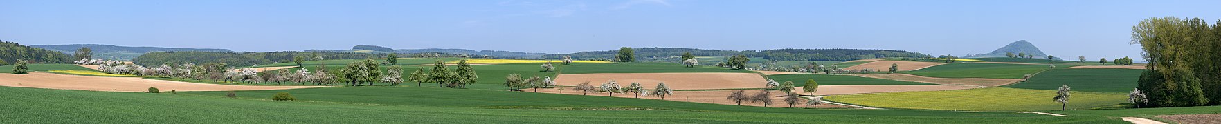
Hegau landscape near Büßlingen (2011)

Hegau landscape near Duchtlingen with Hohentwiel on the left and the Alps in the background

Hegau with the striking mountains Hohenstoffeln , Mägdeberg and Hohenhewen


literature
- Peter Greis (Ed.): The Hegau. Landscape between the Rhine, Danube and Lake Constance. Freiburg im Breisgau 1990, ISBN 3-7930-0578-X
- Andreas Gruschke: The Hegau. Freiburg im Breisgau 1991, ISBN 3-7930-0576-3
Individual evidence
- ↑ Albert Krieger: Topographical Dictionary of the Grand Duchy of Baden, Volume 1, p. 882 (1904)
- ^ Emil Meynen , Josef Schmithüsen (Ed.): Handbook of the natural spatial structure of Germany . Federal Institute for Regional Studies, Remagen / Bad Godesberg 1953–1962 (9 deliveries in 8 books, updated map 1: 1,000,000 with main units 1960).
- ↑ a b c d e f Alfred G. Benzing: Geographical Land Survey: The natural spatial units on sheet 186 Konstanz. Federal Institute for Regional Studies, Bad Godesberg 1964. → Online map (PDF; 4.1 MB)
- ^ Hansjörg Dongus : Geographical land survey: The natural spatial units on sheet 187/193 Lindau / Oberstdorf. Federal Institute for Regional Studies, Bad Godesberg 1991. → Online map (PDF; 6.1 MB)
- ↑ a b c d e f g State Institute for the Environment Baden-Württemberg (LUBW) ( notes )
- ↑ a b Hegau natural area profile (030) - LUBW (PDF; 8.7 MB; notes )
- ↑ Schreiner, Albert .: Hegau and western Lake Constance: with 1 table . 3rd, corrected edition Borntraeger, Berlin 2008, ISBN 978-3-443-15083-9 .
- ↑ Becker, Ernst: The basalts of the Wartenberg near Geisingen in Baden. In: Journal of the German Society for Geosciences , Volume 59. p. 244-274, introduction
- ↑ Helmut Gerber: The Hegau - landscape between the Rhine, Danube and Lake Constance . In: Hegau - magazine for history, folklore and natural history of the area between the Rhine, Danube and Lake Constance issue 1990/91. Self-published by the Hegau-Geschichtsverein e. V., Singen (Hohentwiel) p. 84.
- ^ Peter von Polenz : Landscape and district names in early medieval Germany. Studies on linguistic spatial development. Volume 1: Name types and basic vocabulary. Marburg 1961, p. 89; Volume 2, which should have carried out the information in Volume 1, never appeared.
- ↑ Adalbert the Illuminated, at Genealogy Middle Ages
- ↑ Albert Bittlingmaier: A lynx was allegedly spotted on the edge - Tengener reports that the sheep has been killed. On quiet paws in the Hegau. In: Südkurier of December 30, 2009
Web links
- Natural area profile Hegau (030) - LUBW (PDF; 8.7 MB; notes )
- Geology of the Hegau
- Ottmar F. Schönhuth: The knight castles of the Höhgau, 1836 (digitized)
Coordinates: 47 ° 47 ′ 47 " N , 8 ° 45 ′ 0" E