Untersee (Lake Constance)
| Submarine | ||
|---|---|---|

|
||
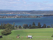
| View from an airplane above Rickenbach ( CH ) to the Untersee with the island of Reichenau ( D ) and the Überlinger See (D) behind it , the northwest part of the Obersee (D / CH / A ) | ||
| Geographical location | - State of Baden-Württemberg ( Germany ) - Cantons Thurgau and Schaffhausen ( Switzerland ) |
|
| Tributaries | Seerhein , Radolfzeller Aach and smaller streams | |
| Drain | Upper Rhine | |
| Islands | Reichenau , Werd Islands | |
| Places on the shore | Radolfzell on Lake Constance | |
| Data | ||
| Coordinates | 47 ° 42 ' N , 9 ° 1' E | |
|
|
||
| Altitude above sea level | 395.11 m above sea level NHN | |
| surface | 62 km² | |
| volume | 0.8 km³ | |
| scope | 87 km | |
| Maximum depth | 45 m | |
| Middle deep | 13 m | |

|
||
| The Untersee with its underwaters | ||


The Untersee in Germany with the state of Baden-Württemberg and in Switzerland with the cantons of Thurgau and Schaffhausen is the smaller of the two lakes of Lake Constance with an area of around 62 km² . Of this, 47 km² belong to Germany (Baden-Württemberg), and the remaining 13 km² to the Swiss cantons of Thurgau and Schaffhausen.
There are three merging parts of the lake : Gnadensee with its Markelfinger Winkel in the northwest, Zeller See in the west (all in Germany) and Rheinsee in the south (in Germany and Switzerland). Its main tributary is the Seerhein and the only outflow is the Hochrhein .
Surname
He was called Lacus Acronius by the Romans . In the Middle Ages, the name Lacus Bodamicus (Lake Constance) prevailed for the Obersee . Over time, the Untersee also came under this name, which is why the actual Lake Constance was given the name "Obersee".
geography
location
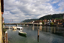
The Untersee lies on the border of Germany with the state of Baden-Württemberg in the north and Switzerland with the eastern Swiss cantons of Thurgau and Schaffhausen in the south. In contrast to the Obersee, there is a fixed border between the two neighboring states in the Untersee ; the much larger part of the lake belongs to Germany. Neighboring communities in Baden are Öhningen , Gaienhofen , Moos , Radolfzell , Reichenau , Allensbach and Konstanz , East Swiss Gottlieben , Ermatingen , Salenstein , Berlingen , Steckborn , Mammern , Eschenz and Stein am Rhein .
The landscape of the Untersee and its surroundings is very structured. In the lake are the islands of Reichenau (4.28 km²; max. 438.7 m above sea level ) and Werd (approx. 1.6 ha; 398 m above sea level ). The Rhine bridge Stein am Rhein marks the border point between the Untersee or Rheinsee and the Upper Rhine. In the northeast is the Bodanrück peninsula ( 693.4 m above sea level ), in the northwest the Hegau lowlands with the Mettnau peninsula (approx. 405 m above sea level ), both of which are located in Germany, and in the west the Höri peninsula with the predominantly German mountain range Schiener Berg ( 715.6 m above sea level ) and in the south the Swiss mountain range Seerücken ( 721 m above sea level ). The most important tributaries of the Untersee are the Seerhein and the Radolfzeller Aach , the only outflow is the Hochrhein .
Data
The Untersee is 62 km² in size and is 395.11 m above sea level. NHN 22 cm lower than the 472 km² Obersee ( 395.33 m ). It is a maximum of 45 m deep and an average of 13 m deep. Its water content is 0.8 km³ and its banks are 87 km long.
Parts of the sea
The Untersee is divided into four lake areas, which have their own names: the Gnadensee in the northeast, the Markelfinger Winkel in the north, the Zeller See in the northwest (all in Germany) and the Rheinsee (in Germany and Switzerland) in the east, south and West Southwest:
Mercy Lake
The Gnadensee stretches between Allensbach on the banks of the Bodanrück in the north and the island of Reichenau in the south, from the tip of the Mettnau in the west and the Reichenaudamm with its poplar avenue in the east.
According to legend, the name of the Gnadensee comes from the time when the jurisdiction was settled on the island of Reichenau. If a defendant was sentenced to death, the execution of the sentence could not be carried out on the island, but only on the mainland, since the whole island was "sacred ground". Therefore, the convict was taken to the mainland in the direction of Allensbach by boat so that the sentence could be carried out there. If the abbot wanted to pardon the condemned, he let a bell ring before the condemned reached the other bank. This signaled to the executioner on the mainland that the condemned had received mercy.
The above legend is a so-called name legend. The name Gnadensee can be better explained with the gracious mother Maria , the “Madonna”, namely as an ellipse of the Mercy See , since the minster of the Reichenau monastery in Mittelzell, located on the Gnadensee, was a St. Mary's Church. The place name Frauenfeld in neighboring Thurgau can be explained in a similar way.
Hegner Bay
The easternmost part of the Gnadensee is the Hegner Bay. It is separated from the Ermatinger basin (Rheinsee) by the Reichenauer Damm.
Mark finger angle
The Markelfinger Winkel is the western end of the Gnadensee, between Markelfingen in the northeast, Radolfzell in the northwest and the Mettnau in the southwest. Its southeast boundary lies between the Mettnauspitze and the Bodanrück. The Markelfinger angle is at a maximum water depth of the shallowest part of the lake 16 m of the sub-sea. The tributary is the Mühlbach , which drains the Mindelsee on the Bodanrück .
Lake Zell
Lake Zell is located between the Mettnau peninsula in the north, the Höri peninsula in the south and the island of Reichenau in the east. In the west lies the mouth of the Radolfzeller Aach .
Rheinsee
The part of the lake that is bordered by the island of Reichenau in the north, by the southeastern part of the Bodanrück in the east, by the Swiss bank of the Seerücken in the south and by the southern bank of the predominantly German peninsula Höri with the Schiener Berg in the west , is called the Rhine lake . It thus roughly follows the demarcation between Germany and Switzerland in force in the Untersee. This part of the lake is usually also meant when speaking of the Untersee in the narrower sense. The term Rheinsee is rarely used in everyday language and is usually only found in specialist publications.
Ermating basin
The easternmost area of the Rhine lake is the Ermatinger basin. It is separated from the Hegner Bay (Gnadensee) in the north by Reichenauer Damm.
Protected areas

On the German side, the following, partly contiguous protected areas are designated:
-
FFH areas
- Mettnau and Radolfzeller Aach below Singen (8219-341)
- Bodanrück and west of Lake Constance (8220-341)
- Schiener Berg and western Untersee (8319-341)
-
Nature reserves
- Wollmatinger Ried - Untersee - Gnadensee (3.004)
- Mettnau Peninsula (3,005)
- Stehlwiesen (3,039)
- Shore of Lake Constance (Öhningen district) (3,058)
- Radolfzeller Aachried (3,088)
- Hornspitze on the Höri (3,235)
- Shore of Lake Constance (Gmk.Gaienhofen, Horn, Gundholzen) (3,582)
- Shore of Lake Constance (Gmk. Wangen, Hemmenhofen) (3,583)
- Shore of Lake Constance (Gmk.Iznang, Moos, Böhringen) (3,585)
- Shores of Lake Constance (Gmk.Allensbach, Hegne, Reichenau) (3,586)
-
Landscape protection areas
- Shore of Lake Constance (3.35.003)
- Reichenau Island (3.35.005)
- Schienerberg (3.35.006)
- Bodanrück (3.35.009)
- Wollmatinger Ried - Untersee - Gnadensee (3.35.012)
-
Bird sanctuaries
- Untersee of Lake Constance (8220-401)
Sea frosts of the Untersee
In January 1940 the Untersee froze over. Refugees and the military could have crossed the lake from Germany to Switzerland. Three hundred meters from the Swiss bank into the lake, an approximately five-meter-wide channel was cut into the ice from Mammern to Berlingen. In 1940 Otto Dix depicted the lake after a foehn storm in his picture Aufbruchendes Eis .
The last sea frost on the Untersee was in February 1987.
literature
- Patrick Brauns , Wolfgang Pfrommer: Untersee nature guide. Nature hiking guide to the unique cultural landscapes on western Lake Constance. (Hiking, cycling, inline skating, canoe tours, boat tours). Naturerbe-Verlag Resch, Überlingen 1999, ISBN 3-931173-14-3 .
Web links
Individual evidence
- ↑ a b c d e f g Shape and functions of Lake Constance and its catchment area ( Memento from May 14, 2012 in the Internet Archive ). In: International Water Protection Commission for Lake Constance (ed.): Lake Constance: State - Facts - Perspectives. 1st edition. Bregenz 2004, ISBN 3-902290-04-8 , pp. 8–11 (PDF; 1.1 MB)
- ↑ International Waters Protection Commission for Lake Constance: Bodensee-Untersee (state description), in the limnological state of Lake Constance , report no. 40, on igkb.org, p. 43 (PDF; 7.6 MB)
- ↑ Administrative areas according to the official data of the national survey : Lake Constance: Map 5, administrative areas (1) , on bodensee-geodatenpool.net (PDF; 2.54 MB)
- ↑ Max Auerbach and Gisela Rottengatter: Investigations into the water exchange of the individual basins of the Untersee (Lake Constance) , Swiss Journal for Hydrology, Volume 22, Issue 1, 1960. P. 49: “The end of the Untersee and thus the entire Lake Constance lies under the Rhine bridge near Stein. "
- ↑ Eugen Nyffenegger and Martin Graf: Thurgauer Namenbuch , Volume 3.1., Frauenfeld / Stuttgart / Vienna 2007, ISBN 978-3-7193-1458-3 , p. 602
- ↑ Markelfinger Winkel ( memento of July 20, 2011 in the Internet Archive ), description of the investigation area of the LUBW, on lubw.baden-wuerttemberg.de
- ↑ Lake Constance: three parts, one lake , in Seespiegel , issue 20 , 12/2004, on seespiegel.de (PDF; 1.16 MB)
- ↑ Helmut Fidler: Aufbruchendes Eis - Die Seegfrörne from 1940 in the mirror of art. In: Hegau-Geschichtsverein eV (Hrsg.): Yearbook. Volume 73/2016. Singing Hohentwiel, pp. 191-204.
