
Lima
| Lima | |
|---|---|
|
Coordinates: 12 ° 2 ′ S , 77 ° 1 ′ W
Lima on the map of Peru
|
|
 Townships
|
|
| Basic data | |
| Country | Peru |
| region | Lima Province |
| City foundation | January 18, 1535 |
| resident | 8,574,974 (2017) |
| - in the metropolitan area | 10,479,899 |
| City insignia | |
 |
 |
| Detailed data | |
| surface | 2672 km 2 |
| Population density | 3,209 inhabitants / km 2 |
| height | 161 m |
| City structure | 43 distritos |
| Post Code | 15000 |
| prefix | +51 1 |
| Time zone | UTC -5 |
| City Presidency | Jorge Muñoz Wells |
| City patron | Rosa of Lima |
| Website | |
 |
|

Lima is the capital of the South American Andean state Peru and by far the largest city in the country. In the administrative area of the city, the province of Lima , live 8,574,974 people (as of 2017). A total of 10,480,000 inhabitants live in the conurbation of Lima with the port city of Callao . Both cities form the Lima Metropolitan Region ( Área Metropolitana de Lima ).
Lima is an important traffic junction as well as the most important economic and cultural center of Peru with numerous universities, colleges, museums and monuments. The old town of Lima was declared a World Heritage Site by UNESCO in 1991 .
geography
Geographical location
Lima is located on the Río Rímac at the foot of the dry western flank of the central Peruvian Andes. According to Javier Pulgar Vidal , the city center is located in the geographic zone of the Chala , at around 160 meters above sea level . The settlement area of the urban region extends into the height zone of the western Yunga (from 500 meters) and reaches a height of almost 1,000 meters near Chosica (Chosica's main square is at around 950 meters).
The administrative area of the city is identical to the province of Lima (also "Municipalidad Metropolitana de Lima") and has an area of 2,672.28 square kilometers (for comparison: Saarland = 2,568.65 square kilometers). Of this, 825.88 square kilometers (30.9 percent) belong to the core city (high density of buildings and closed local form), 1,846.4 square kilometers (69.1 percent) consist of suburbs and areas with a rural settlement structure. The Lima Metropolitan Region ( Área Metropolitana de Lima ) comprises the 43 districts of the Lima Metropolitana Region and the six districts of the Callao Region . It extends over an area of 2,819.26 square kilometers.
The urban area (área urbana) of Lima extends around 60 kilometers in a north-south direction and around 30 kilometers in an east-west direction. The densely built-up urban area is roughly bounded in the north by the Río Chillón and in the south by the Río Lurín , in the east by the confluence of the Río Santa Eulalia with the main river Río Rímac. The city center is located about 15 kilometers inland on the Río Rímac, which is also followed by the Peruvian railway - the second highest in the world (the highest is the Lhasa Railway ) - and the main road towards the Ticliopass (4,781 meters), the main access to the Andes Central country of Peru.
The Río Rímac is of great importance for Lima. He supplies the city with drinking water from pure glacier water. The retreat of the glacier , which is presumably due to climate change, means that there is temporarily more water. If the glaciers were no longer there, the river would dry up and with it the livelihoods of the people, animals and plants in the region. In addition, the entire catchment area of the Río Rímac ensures a large part of the electricity supply for the city through its hydropower (for example the power stations of Huampaní , Matucana and Huinco ).
City structure
The administrative area of the city is identical to the province of Lima . This is divided into 43 districts ( distritos ). Of these, 30 are in the core city . These are (* settlement center under a different name):
Ate (* Vitarte), Barranco , Breña, Cercado de Lima, Chorrillos, Comas , El Agustino, Independencia, Jesús María, La Molina , La Victoria, Lince, Los Olivos, Magdalena del Mar, Miraflores , Pueblo Libre (* Magdalena Vieja) , Puente Piedra, Rímac, San Borja, San Isidro, San Juan de Lurigancho , San Juan de Miraflores, San Luis, San Martin de Porres, San Miguel, Santa Anita, Santiago de Surco, Surquillo, Villa El Salvador and Villa María del Triunfo .
Thirteen districts of Lima are located outside the core city in the suburbs and rural areas. These are: Ancón, Carabayllo, Chaclacayo, Cieneguilla, Lurigancho (* Chosica), Lurin, Pachacámac, Pucusana , Punta Hermosa, Punta Negra, San Bartolo, Santa Maria del Mar and Santa Rosa.
See also : List of municipalities in Lima
climate
The city is located in the tropical climate zone and is also classified as tropical by Carl Troll . The effective climate classification by Koeppen goes into a more detailed climate classification, according to which Lima has a hot desert climate (BWh), which is typical of the Peruvian coastal desert. The annual temperature amplitude of only 5 degrees Celsius also indicates a typically tropical climate. Nevertheless, temperature values and hours of sunshine are very low for a city in the tropics. One reason for these values is the relatively cold Humboldt Current , which cools the country. In winter, as a result of the condensation of water vapor in the air above the relatively cold ocean, this also creates dense coastal or high fog that can envelop the entire city from May to October. The resulting lower solar radiation also contributes to the lower temperatures. This becomes particularly clear when comparing winter and summer (July and January). While the sun only shines an average of 28.6 hours in July, there are around 179.1 hours of sunshine in January, an average of 1284 hours of sunshine per year. For comparison: the annual average of sunshine in Berlin is 1625.6 hours.
Summer (December to March) in Lima is characterized by sustained sunshine and pleasant temperatures. The warmest month is February with an average of 22.3 degrees Celsius, while in winter (coldest month August) the average temperature drops to 15.1 degrees Celsius. The year-round average temperature is 18.2 degrees Celsius. The duration of sunshine throughout the year is around 1,284 hours of sunshine, most of which are in summer. These are exceptionally low values for the city's latitude. Due to the desert climate , there is hardly any rain, which is extremely low with 13 millimeters of precipitation per year. But there are also longer periods with no precipitation at all.
| Lima | ||||||||||||||||||||||||||||||||||||||||||||||||
|---|---|---|---|---|---|---|---|---|---|---|---|---|---|---|---|---|---|---|---|---|---|---|---|---|---|---|---|---|---|---|---|---|---|---|---|---|---|---|---|---|---|---|---|---|---|---|---|---|
| Climate diagram | ||||||||||||||||||||||||||||||||||||||||||||||||
| ||||||||||||||||||||||||||||||||||||||||||||||||
|
Average monthly temperatures and rainfall for Lima
Source: WMO
|
|||||||||||||||||||||||||||||||||||||||||||||||||||||||||||||||||||||||||||||||||||||||||||||||||||||||||||||||||||||||||||||||||||||||
story

origin of the name
The city of Lima got its name because of its indigenous roots; the name probably comes from the Jaqaru word lima - limaq or limaq - wayta , which means "yellow flower". A second possibility is that the name is derived from the Quechua word rimaq (or Wanka limaq ), which translates as "speaker". This is supported by the fact that the river on which the city lies is called Río Rímac (Quechua: Rimaq ).
Colonial times
Even before the arrival of the Spaniards, the Lima area was the most densely populated area on the Peruvian coast. On January 18, 1535, Lima was founded by the Spanish conqueror Francisco Pizarro under the name Ciudad de los Reyes (City of the [Three] Kings ) on a native settlement on the south bank of the Rímac River. For Pizarro, strategic considerations were crucial when he decided on the fertile valley of the Río Rímac. So he was close to his ships in case of an emergency and still had a good starting point to get to the Central Andes relatively quickly. When Manco Cápac began his nationwide uprising against the Spaniards in May 1535 , Lima was unsuccessfully attacked and besieged by his troops.
In 1542 the Spaniards founded the Viceroyalty of Peru , which encompassed almost all of Spanish South America, and Lima became the viceroy's capital and residence. During the 16th and 17th centuries, Lima was the religious, economic and political center of the Spanish colonies of South America and a center of Creole- mestizo culture. The diocese of Lima , founded in 1541, was elevated to an archbishopric and metropolitan seat in 1546 . In 1551 the first university on the American continent was founded with the University of San Marcos .
The city and its port of Callao had a monopoly on the movement of goods between the viceroyalty and the motherland. The gold and silver mined in Peru were shipped from here via Panama to Spain. The wealth increasingly attracted pirates. One of the most famous, Sir Francis Drake , attacked Callao in 1579. It was not until almost a hundred years later that a protective wall was built against the threatened attacks by the privateers.
At this point in time, Lima's population had already risen to over 25,000. Despite the occasional earthquake - on October 20, 1687 (5,000 deaths) and October 28, 1746 (18,000 deaths) - the city continued to grow and prosper unabated. In the 18th century, the position of the city was weakened by the establishment of the viceroyalty of New Granada (1717) and the viceroyalty of the Río de la Plata (1776) and the associated loss of territory.
independence

In December 1820, a rebel army led by the revolutionary José de San Martín defeated the Spaniards in the Battle of Pisco and occupied Lima. On July 28, 1821, San Martín officially proclaimed Peru's independence after it was declared in Trujillo in 1820 , where the freedom monument "La Libertad" is located today. On August 3, 1821, San Martín was elected protector of the new republic with Lima as its capital. In 1861 there were about 100,000 people in the city. In the middle of the 19th century a phase of industrialization began and in 1851 the first railway line in South America was inaugurated in the Peruvian capital.
During the Saltpeter War (1879-1883), Chilean troops occupied the city from January 17, 1881 to October 23, 1883 (three days after the signing of the Treaty of Ancón ), which Chilean soldiers sacked after the invasion. Towards the end of the 19th century, the mining of guano on the islands off the coast brought wealth and prosperity to the city. At the beginning of the 20th century, there was a renewed surge in growth. In 1919 there were 175,000 people in Lima.
20 years later it was already over half a million. Many foreign immigrants also found their way to the Peruvian coast. The Spaniards had already brought black slaves from Africa in the colonial era and the Chinese later came to the country as contract workers. Over the years, a multicultural mixture of peoples has emerged, which has made a decisive contribution to the cosmopolitan flair of the city.

The problems of rural exodus worsened in the second half of the 20th century: population explosion, inadequate infrastructure , the terror of the Sendero Luminoso (Shining Path) in the 1980s and 1990s and natural disasters drove more and more people to the capital, caught by the endless slums .
On October 17, 1966, a strong earthquake struck Lima; more than 100 people were killed.
On June 18, 1986 there was a mutiny of 370 alleged supporters of the Sendero Luminoso in Lurigancho prison , the women's prison and the El Frontón prison island in Callao . The government put down the mutiny by force of arms; only one hostage survived in the men's prisons. A total of 249 prisoners died; 124 of them were shot after surrendering.

On December 17, 1996, the hostage crisis broke out when 14 members of the Movimiento Revolucionario Túpac Amaru stormed the Japanese embassy in Lima during a reception and took numerous important personalities hostage. On April 22, 1997, the army stormed the Japanese embassy and bloody ended the occupation. All 14 hostage-takers, one hostage and two soldiers were killed. 71 hostages were freed.


In the 1990s, up to 200,000 people came to Lima from rural areas every year. The upper middle class had already moved away from the overcrowded city center a few decades earlier. She founded new districts such as Miraflores or San Isidro, while the very rich moved to the new districts of Monterrico and La Molina in eastern Lima. Members of the middle and lower classes live in the districts in between, and their former barracks have now developed into solid, simple residential areas.
Population development


While the first settlement comprised 117 blocks, Lima later expanded mainly to the north. In 1562 another district was built on the other bank of the river. But it wasn't until 1610 that the first stone bridge was inaugurated. At that time Lima had about 16,000 inhabitants. In 1861 the population exceeded 100,000. By 1927 that number had doubled. Most immigrants, however, have been arriving since the 1950s. Today around seven million people live in Lima. The majority of the immigrants settle on the periphery , so that the city expands to the north and south.
In the 1960s, the state tolerated land occupations on the outskirts, distributed property titles and provided the most necessary infrastructure services . In the 1970s, the hour-long bus journeys to the city center every day became a problem for many people living on the periphery. Therefore it was decided by the city administration that Lima should not expand any further. Today, many people looking for a home are illegally settling in public parks, on school lots or in private property, which leads to an intensification of the conflict between poor and rich residents.
The population of the core city ( Ciudad de Lima ) without the suburban belt has increased eightfold in the last five decades: In 1951, 835,000 people lived in the city, compared to 6,960,943 in the 2007 census and 8,574,974 in 2017. Of these, 91% have Spanish and 8% Quechua as their mother tongue. The population density is thus 3209 inhabitants per square kilometer.
In the entire administrative area of the city, which extends over the entire province of Lima , 9,485,405 people lived in 2017. 910,431 people live in the suburbs and rural areas outside the core city. The Lima Metropolitan Region ( Área Metropolitana de Lima ) comprises the 43 districts of the Lima Province (also Lima Metropolitana Region ) and the six districts of the Callao Region with a total of 10,479,899 inhabitants (2017).
The following overview shows the population of the core city (excluding the rural districts of Lima and excluding Callao).


|
|
|
The rapid population growth is also reflected in the continuous expansion of the urban area:

Urban area of Lima for the foundation of the city (1535)

Urban area of Lima and Callao around 1750

Urban area of Lima and Callao around 1910

Urban area of Lima and Callao around 1940

Urban area of Lima and Callao around 1970
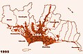
Urban area of Lima and Callao around 1995

Urban area of Lima and Callao around 2006


Development of the living situation


Lima's population has grown explosively since the middle of the 20th century. The city has not only grown together with the port city of Callao and the former fishing villages on the Pacific coast. In addition, large slums have emerged on the dry soils on the periphery (called pueblos jóvenes = “young villages”), in which around two thirds of the population of Lima live today. In terms of urban planning, these are informal settlements .
Many of the older settlements are in a process of gradual consolidation despite the lack of important infrastructure (e.g. tap water). Lima's population growth has slowed in recent years and the influx from rural areas is now increasingly concentrated in the medium-sized cities of Peru.
Since most of the growth in the last few decades was due to land occupation and self-construction on the outskirts of the city (informal settlements), there is practically no condensed residential building with multi-family houses. The whole city is, with a few exceptions, characterized by single-family houses with one to three floors of different quality (from villa to bast mat construction).
In the past, the city center has lost its importance in favor of other locations in the central area, so that a polycentric urban structure of only medium density has developed. On the other hand, loosely built peripheral areas are almost completely absent. The street cross-sections of the younger districts and thus most of the city have been laid out very generously.
politics
City government
The Mayor of Lima has been Jorge Muñoz Wells since January 1st, 2019 . His predecessor was Luis Castañeda Lossio from 2015 to 2018 , who held this position from 2003 to 2010. In October 2010 he resigned to run for the presidency of the "Alianza Electoral Unidad Nacional". In the meantime, Susana Villarán de la Puente was mayor. She was only the second woman to hold this office.
In his previous two terms in office, Castañeda had primarily aimed at improving the inadequate infrastructure and combating high crime rates. One of his first measures at the beginning of his tenure was the banishment of up to a dozen daily protests from the city center and government district of Lima, with the support of traders and businessmen suffering from the protests. Several neuralgic traffic congestion points have been defused and some major road construction projects have started. The large-scale program to green the city, which increased the city's recreational value, was positively received by the citizens. In addition, he succeeded in improving waste disposal during his tenure.
See also : List of Mayors of the City of Lima
Town twinning
Lima maintains various kinds of relationships - city partnerships, city friendships, cooperations - with the following cities:
|
|
Culture and sights

Museums

Lima has numerous museums and exhibition centers. The Huaca Pucllana archaeological complex (also known as Huaca Juliana ) - now a park and museum - was an administrative ceremonial center of the Lima culture between 200 and 700 AD .
The Instituto Riva-Agüero , founded in 1947 as a research center for social sciences of the Pontifical Catholic University of Peru , houses, among other things, sections for archeology and art and folk culture. The institute also includes the Museum of Art and Popular Cultures and the Archaeological Museum Josefina Ramos de Cox .
One of the most important museums in the city is the Rafael Larco Herrera Archaeological Museum . It has the world's largest private collection of pre-Hispanic art. This emerged from the collections and finds from the excavations of Rafael Larco Hoyle. The Banco Central De Reserva del Perú museum houses collections of archeology, contemporary Peruvian painting and folk art, among others.
The Museo de Arquelogía y Antropología de la Universitario Mayor de San Marcos (Museum of Archeology and Anthropology of the University of San Marcos) was founded in 1919 by Julio C. Tello and was the first archaeological museum in Peru to focus on research from the start .

The Gold Museum ( Museo d'Oro ) houses a collection of gold ornaments from various pre- Hispanic Andean cultures , such as jewels and other items made by goldsmiths. There is also a large collection of weapons from around the world and important fabrics from the pre-Inca period. Many of the exhibits come from dubious sources and are thus deprived of their archaeological and cultural context.
The National Museum ( Museo de la Nación ) offers an overview of the history and geography of Peru , which not only shows archaeological finds but also three-dimensional models of well-known Peruvian archaeological sites ( e.g. Machu Picchu , Nazca Lines , Chavín de Huántar ). However, the permanent exhibitions are currently closed.
The Museo del Banco Central de Reserva del Peru offers an overview of pre-Inca cultures in its exhibition.
The Museo de Arte Italiano has presented Italian art since 1923.
In 1981 the Museum of Japanese Immigration in Peru was established.
Since 1997, a museum tram has been traveling a short section of the remaining tram tracks in Avenida Pedro Osma in the Barranco district. A restored Breda railcar from 1924 is used. The operator is the municipal electricity museum ( Museo de la Electricidad ).

Buildings
The old town of Lima with its checkerboard-like streets and magnificent buildings from the colonial era has been under UNESCO protection since 1991 and is therefore a World Heritage Site .
The Cathedral of Lima , built from 1535 to 1625 - 1746 to partially restored - with a glass coffin in which the founder of Lima, Francisco Pizarro should be; the Church and Convent of San Francisco, considered by its size and color to be the best-built architectural complex in Latin America ; and Santo Domingo, with a beautiful main retreat, are just a few well-known buildings of inestimable value that are located in Lima.

Next to the Rosary Basilica is the convent of the Dominican monastery, most of which has been recently renovated. The cloister is decorated with tiles from Seville (dated 1604 and 1606). A chapter house with pictures from the Cusquen school and richly carved furniture dates from 1730. Behind it there is a second cloister with a central fountain. The grave of St. Rosa of Lima and in a chapel the tomb of St. Martin de Porres . From the church tower, which has already been rebuilt several times, you have a very nice view over the old town.
The splendor and shimmer of life in the viceroyalty of Peru are symbolized by the houses of Lima such as the Aliaga house, which was built above the temple of the gods of the Kaziquen Taulichusco, the Goyoneche or Rada house with a clear French influence, and the Palais des Torre Tagle, one of the most beautiful Residences from 1735.
Lima also preserves pre-Hispanic heirlooms that lie on the banks of the Rimac River and the Pacific coast. The great sanctuary of Pachacámac is the most important heirloom. It was built in honor of the god of the same name. The Pucllana sanctuary in Miraflores is another heirloom that was an important administrative center of the Lima culture in AD 400.
Also worth seeing are the large Plaza Mayor ( Plaza de Armas ) and the nearby town hall, the presidential palace from 1938 and some sacred buildings from the 16th and 17th centuries such as the basilica of La Merced and San Pedro , which survived the great earthquake of 1746. The basilica San Pedro was repaired after the earthquake under the direction of the Jesuit priest Johann Roehr and received a barrel vault over the central nave , developed by Roehr, in a new type of construction , which is better able to withstand the tremors of an earthquake. The archbishop's palace, built in neo-colonial style, is adorned with arcades and wooden balconies. The Acho bullring, built in 1794 and restored in 1945, is located north of the Río Rímac.
Parks
.jpg)
One of the most famous parks in Lima is the University Park ( Parque Universitario ). In 1870 the colonial walls that surrounded Lima were destroyed and 20,000 square meters were allocated for the construction of the square. It was only laid out with paving stones in 1921 and a 30-meter-high tower clock was erected on the 100th anniversary of Peru's independence , which plays the national anthem at 12 noon.
Miraflores is also interesting with its well-tended parks and gardens. The district is known for its parks overflowing with flowers. The Parque Central and Parque Kennedy are worth mentioning there . Avenida Larco runs past both parks towards the sea. The beaches of the area are part of the "Costa Verde" area, where many thousands of surfers practice their sport in summer. Both Parque del Amor and Parque El Olivar in San Isidro with its olive trees, which were imported from Spain in the 15th century, are worth a visit .
In the south of Lima is the protected area Refugio de Vida Silvestre Los Pantanos de Villa . The 263 hectare water reserve is mainly of interest to bird lovers. 154 bird species have been identified there, half of them migratory birds. There are also 55 species of plants. The marshland is located in the Chorrillos district, at the end of Avenida Huaylas, very close to the Panamericana Sur.
_T2_p307_DESTAPADA,_VROUW_VAN_LIMA.jpg)
|
_T2_p303_TAPADA,_VROUW_VAN_LIMA.jpg)
|
|
|
Destapada
|
Tapada
|
Another park in the south of Lima is Reserva Park . There are colored water features in it at night, combined with laser shows and sculptures.
Tapada limeña fashion
Tapada limeña is a dress code introduced by the Spanish upper class in the 16th century for the girls and women of Lima, which shaped the appearance of the city's affluent quarters until around 1860. The main feature of this fashion was the covering of the face with veils, but one eye was always visible. The women were able to move around the streets of the city almost anonymously or speak to neighbors from the windows and balconies of their apartment, their good reputation was always preserved, and physical flaws could also be hidden by their clothing. Destapada was the name given to those women who defied this rule and flaunted their faces. This peculiarity of Lima only disappeared in the middle of the 19th century with the influence of Parisian fashion.
Sports
The El Nacional in Lima is the most historic stadium in Peru. The Peruvian national team usually plays there and the opening game and the final of the Copa America took place there in 2004 . The stadium was inaugurated in 1952 and has space for 45,000 spectators.
In recent years it has been equipped with modern commentator booths, the seating and the electrical installations have been renewed. Since then, the stadium, where the country's two series champions, Alianza Lima and Sporting Cristal , regularly meet, has had a modern electronic scoreboard and floodlights.
Another popular sport is bullfighting. In the main season in October and November internationally known toreros come to Lima, in the other months bullfights usually take place on Saturday and Sunday afternoons. These are held in the Plaza de Acho , America's oldest bullring. Also interesting are the cockfights that are held in the Coliseo Tradicional Sandia in Barranco and in El Rosedal in Surco.
Horse races take place in the Jockey Club del Perú in Monterrico, cycling in the Velódromo de la Videna .
freetime and recreation

.jpg)

There are no clean beaches near Lima and the quality of the water is very poor. Swimming is prohibited on 51 beaches.
The Costa Verde (Green Coast) is the name of the coastal strip between the districts of Miraflores and Chorrillos. However, vegetation is only present in a few places on the cliffs. The beaches mostly consist of gravel with smaller sandy pieces. Miraflores includes the surfing beaches Punta Roquitas , Pampillas , Miraflores , Makaha and Redondo .
The most popular beach on the Costa Verde is La Herradura in Chorrillos at the foot of the Morro Solar mountain , as well as the Barranquito beach , which is part of the Barranco district. The bays usually only have a simple infrastructure , offer no shade (even on cloudy days, the sunshine is strong) and the ocean currents of the Pacific are quite dangerous. Nevertheless, the beaches are well visited between January and March.
Popular in the winter months from April to November are the inland recreational areas between the towns of Chaclacayo at an altitude of 650 meters and Chosica at an altitude of 850 meters. They are located about 25 and 40 kilometers east of Lima along the Carretera Central. There are various country clubs, restaurants and private leisure areas.
The valley is framed on both sides by soaring, bare mountain ranges. Only in the area of the Río Rímac is a little vegetation to be found. The reconstructed pre-Inca adobe palace Puruchuco stands on the road to Chosica . It lies behind the village of the same name. In addition to rooms and corridors, a small museum exhibits finds from the excavation site.
Further recreational areas can be found inland in the valley of the river Lurín, in the district of Cieneguilla, with leisure facilities, horse riding facilities and clubs. Access is possible via La Molina, Rinconada and Musa. Amusement areas and parks have also been built in the estuary of the same river near the village of Pachacámac (inland from the ruins of Pachacamac near Lurín).
Callao is 15 kilometers northwest of Miraflores . There you will find the port, a naval base and the Aeropuerto Internacional Jorge Chávez . A trip from Callao to the headland of La Punta is worthwhile. From there, boat trips to the offshore island of Palomino or harbor tours can be undertaken. In addition to the San Felipe Museum Fortress, there are numerous small restaurants that mainly serve seafood dishes.
Regular events

A procession in honor of Lima's patron saint, Saint Santa Rosa de Lima (1586–1617), takes place annually on August 30th. Rosa von Lima's real name was Isabel de Flores. Her parents were called Gaspar de Flores and María de Oliva. At the age of 20 she entered the Third Order of the Dominicans and called herself Rosa a Santa Maria. From then on she lived in a hut near her parents' house. She earned her living by weaving and gardening. In atonement, she led a harsh life of penance .
Rosa helped found the first contemplative monastery in South America , which could only be opened after her death in 1623. Soon after her death, she began to be venerated as saints, first in Lima, later in Peru and finally in all of Latin America. In 1671 she was officially canonized by Pope Clement X, making her the first saint in America.
Another important event is the annual military parade on July 28th in the Plaza Mayor on the occasion of the national holiday (Fiestas Patrias). On the first Sunday in August, in honor of the Virgen Shiquita, María de la Asunción, the patron saint is celebrated with parades, processions and Andean dances in the "Iglesia San José de Barrios Alto" . On October 18th, a large procession with several hundred thousand believers in honor of Señor de los Milagros , the Lord of Miracles, passes through the city.
Culinary specialties / restaurants

Especially in the south of the city, in the affluent Miraflores district and in Barranco further south, there is a rich and diverse range of restaurants, cafes and bars. A specialty is the typical Criollo cuisine of Lima with dishes with fish and seafood.
These typical specialties also include ceviche - a dish made from raw fish, which is cooked by adding lime juice.
Another specialty is the Causa Limeña , a cold starter that consists of mashed potatoes almost like puree, tuna and mayonnaise. The ingredients are stacked on top of each other like in a baking dish.
The Turrón de Doña Pepa is a very decorative dessert that is made especially in October, in connection with the ecclesiastical festival of Señor de los Milagros .
Other specialties that can be found especially at small food stalls in the streets of the city are: Anticuchos (skewers with marinated beef heart ), Emoliente (nutritious drink made from flaxseed and other ingredients) and Picarones (dessert made from fried sweet potatoes with sugar syrup ).
A very special mixture of different international dishes is the Peruvian-Chinese cuisine Chifa , which is popular in all classes of the population and, in contrast to the Chinese cuisine that is common around the world, contains various elements of the Andean and European cuisine.
Poultry on skewers, called Pollo a la brasa , which is served in numerous restaurant chains in all price ranges , are also very popular with the city's population .
In 2016, three restaurants in Lima - Central , Astrid & Gaston and Maido - were voted among the 50 best restaurants in the world. Das Central in 4th place, Astrid & Gaston in 14th and Maido in 44th.
trade

The Centro Comercial Jockey Plaza in Surco is one of the largest shopping centers in the city. The temple of consumption was built in the style of a US mall. There you will find supermarkets, banks, boutiques, sports shops, do-it-yourself shops and restaurants, among other things.
The Centro Comercial San Isidro has a similar store structure as Jockey Plaza, but smaller. The Centro de Entretenimiento Larcomar is a modern shopping center located on the waterfront with numerous restaurants, cafés, a large cinema and bowling alleys. Another large-scale shopping center is the Centro Comercial San Miguel , located near Lima's most important zoo, Parque de las Leyendas .
The Mercado Central , a fruit and vegetable market, is located in the center of Lima, between Huallaga and Ucayali. On the back of the Parque Reducto you can find organic products that have been awarded the “Bio Latina” eco-label, such as whole-grain bread, eggs, honey and coffee. The Bioferia takes place every Saturday morning. The Mercado Indio in Miraflores, the Centro Artesanal Carabaya and the Centro Artesanal Santo Domingo offer a large selection of Peruvian handicrafts (including leather, silver, wood, textiles, ceramics).
Economy and Infrastructure
business

The capital is the country's largest economic center. The metropolitan area of Lima has become around 7,000 companies in the dominant focus of industrial development. The large number and higher quality of the workforce, the importance of the sales market, the favorable infrastructure and, in particular, the traffic development all contribute to this. The most important branches of industry are the textile and clothing industry, as well as the food and luxury goods processing industries. It also manufactures chemicals, vehicles, fish and petroleum products, and leather goods.
See also: Gamarra Textile Center
Lima's port in Callao is one of the most important fishing and trading ports in South America and handles 75 percent of Peru's imports and exports. It also has extensive cold store capacities and several dry docks. The port's most important export goods are oil, copper, iron, silver, zinc, lead, cotton, sugar and coffee. This role is to be expanded further through the San Lorenzo Hub Port on Isla San Lorenzo .
.png)
According to a study from 2014, the Lima metropolitan area generates a gross domestic product of 176.4 billion US dollars (KKB), which is a significant part of the country's total economic output. In the ranking of the economically strongest metropolitan regions worldwide, he finished 70th. The GDP per capita was $ 16,530. Average annual economic growth over the past five years has been between four and five percent. The average monthly income in Lima is S / .1.238 (approx. 400 euros) for the male residents, while it is S / .839 for women (only 67.8% of the income of the men).
Tourism plays an important role in Lima's economy. With almost 4 million foreign visitors, Lima was the 32nd most-visited city in the world in 2016 and first place in South America. Tourists brought in $ 1.4 billion in revenue that same year. Most of the foreign visitors came from South America, Europe and the USA.
Lima is the seat of almost all major national corporations, banks and insurance companies as well as the Bolsa de Valores de Lima (BVL), the Peruvian Stock Exchange. The stock exchange, founded in 1860 as "Bolsa de Comercio de Lima", was given its current name in 1971. Most of the foreign companies in Peru have also settled in Lima. This has led to a strong concentration of industry, especially management, research and sales departments in Lima. The regional interdependencies of industry are also predominantly determined by the capital, so that the metropolitan region has a pronounced center- periphery relationship.
Problems are caused by the high level of air pollution caused by pollutant emissions from industry and the exhaust gases from motor vehicles (high ozone and carbon monoxide values ) as well as traffic noise. In the industry, which is concentrated in the metropolitan area of Lima, there are only inadequate disposal and cleaning capacities for sewage, exhaust gas and waste. The people in the marginal settlements in particular are at risk from infectious diseases, which are favored by inadequate hygienic conditions and an inadequate drinking water supply. In addition, there are respiratory and skin diseases due to the toxic emissions from numerous industrial companies and car traffic.
In a ranking of cities according to their quality of life, Lima was ranked 124th out of 231 cities worldwide in 2018. Compared to other South American capitals, it was behind Montevideo (place 77), Buenos Aires (place 91), Santiago de Chile (place 92) and Brasília (place 108) but still ahead of Bogotá (place 128) and Caracas (place 193)
traffic
Long-distance transport


The largest city in the country is the most important transport hub in Peru with an international airport and links to the Panamericana . The latter is the most important road connection out of Lima. It leads north (Panamericana Norte; border with Ecuador ) and south (Panamericana Sur; border with Chile ) along the Pacific coast to the respective border. The journey time is around 15 to 20 hours. The west-east connection into the Andes is called Carretera Central. It first leads to La Oroya , where the road forks. To the north you get to Pucallpa via Tingo Maria , to the south you go to Huancayo .
There are 131 bus stations in Lima, 49 of which work without official approval. Official bus terminals include Yerbateros, (Carretera Central, San Luis); Atocongo, (C./Los Álamos, Surco) and Plaza Norte (Av.Túpac Amaru Independencia).
The first railway line in South America was put into operation on May 17, 1851 between Lima and Callao, 13 kilometers away. The departure point for the well-known route to Huancayo is the Estación de Desamparados in Javier Ancash, not far from Plaza Mayor in the center of Lima. The second highest standard-gauge railway line in the world with 4781 m at La Galera - the highest is the Lhasa Railway with 5072 meters - leads via La Oroya (3,726 meters) to Huancayo (3,261 meters) and passes 58 bridges, six switchbacks and 69 tunnels. The railway line is operated twice a month between April and November by a Ferrocarril Central Andino train . In the “Desamparados” train station there is also a museum that shows ethnic exhibitions.
Lima's international airport is called Aeropuerto Internacional Jorge Chávez . It is located on Avenida Faucett, around 15 kilometers northwest of the city center in Callao. All national and international flights take off and land there. The airport opened in 1960 and has one runway. Since 2001 it has been operated by Lima Airport Partners (LAP), a joint venture between Alterra Partners and Fraport AG . Furthermore, located in the southern district of San Bartolo the airfield Lib Mandi .
Local transport
On March 24, 1878, the first horse-drawn tram and on February 17, 1904, the first electric tram ran in Lima . Operations ceased on September 18, 1965. Trolleybuses ran in the city between 1928 and 1931.
In Lima there is a 35-kilometer section of the Metro de Lima, which opened on January 18, 2003 . The metro runs daily between 6 a.m. and 10 p.m. A second line is under construction and should be completed in 2024.
Articulated buses run in separate lanes between the south ( Chorrillos ) and the north. The length of the bus lane is 26 km. There are 38 stops. The construction of the "Metropolitano" transport system began in 2006 under Luis Castañeda Lossio . It has been in operation since July 28, 2010. There are also shuttle buses that bring passengers from the outskirts to the junctions.
Local public transport is also handled privately by buses, minibuses, taxis and, in some parts of the city, also by mototaxis. Road traffic is correspondingly chaotic. Fixed stops can only be found in a few places. If you want to ride, stand at the side of the road and make a hand signal. On the main traffic axes of the city, means of transport run every second. The destination is written on the windshield.
In recent years, the number of taxis on Lima's streets has multiplied. The reasons for this are the poor economic situation, low salaries and high unemployment. So it is no exception if a taxi driver has a university degree or has worked as a doctor in a hospital. Many of the private taxi drivers do not have their own vehicle and have to pay the car rental from their low wages .
Sometimes there are bike paths in Lima. Especially in the more affluent areas like Miraflores.
In the future, the surrounding areas and cities will be served by regional trains that connect to local public transport in Lima at certain points (e.g. the terminus of the metro).
media

The most important daily newspapers in Lima include the official journal El Peruano , the left-wing opposition La República , the conservative newspaper El Comercio , the daily Expreso , which is considered to be pro-government, and the magazine Caretas . Other newspapers in the capital are Diario Correo , El Bocón , Informalisimo , Ojo and Gestión .
Important radio stations are Radio Alpamayo , Radio América , Radio Nacional , Radio A , Radio Inca Sat , CPN and RPP Noticias 2 , all of which broadcast a wide range of information and music. Other radio stations are the Christian stations Radio Santa Rosa , Radio María , Sol - Frecuencia Primera and La Luz , the sports stations Radio Ovación and RPP Noticias 1 , Radio 100 (first Peruvian radio in the FM broadcasting range), Radio Rítmo Romantica and Panamericana Radio .
The main television stations broadcast nationwide are América Televisión , ATV , Frecuencia Latina , Panamericana and Red Global . The stations offer a mix of information, entertainment, sports and films. Cable and satellite television is not yet very widespread and is used almost exclusively by people in the upper income bracket.
training
Of the 13 universities in Lima, the Universidad Nacional Mayor de San Marcos opened on May 12, 1551 - the oldest in South America - the University of Engineering ( Universidad Nacional de Ingeniería ), established in 1896, and the University of Agricultural Sciences ( Universidad Nacional Agraria La Molina ) from 1902 the most popular.
The University of San Marcos was founded in the Dominican monastery of Lima on the instructions of Fray Thomas de San Martín, but under the rule of the viceroy Francisco de Toledo (1515–1582) it was withdrawn from the Dominicans and placed under secular administration. The monastic orders continued to provide university lecturers according to a proportional system, who were trained for this purpose in the order's own colegios. In 2002 29.710 students and other 3549 were at the University postgraduate students enrolled . The Catholic University ( Pontificia Universidad Católica del Perú ), opened in 1917, is the oldest private university in the country. It is divided into ten faculties. Around 40 different courses are offered at these.
Water supply
The state-owned company SEDAPAL (Servicio de Agua Potable y Alcantarillado para Lima) is responsible for the water supply. Lima is the largest city in a desert after Cairo. The water comes from three treatment plants in the Andes (Chillón, Huachipa and y La Atarjea).
Panoramic views


sons and daughters of the town
The sons and daughters of the city of Lima include: following personalities.
Politician:
- Juan Egaña Risco (1768–1836), Chilean politician of Peruvian origin and head of state of Chile for a week in 1823
- Felipe Santiago de Salaverry (1806–1836), General and President of Peru from 1835 to 1836
- Antonio Arenas (1808–1891), lawyer, military, politician and President of Peru from 1885 to 1886
- Juan González de la Pezuela y Ceballos (1809–1906), Spanish politician and diplomat
- José Pardo y Barreda (1864–1947), politician, President of Peru from 1904 to 1908 and from 1915 to 1919
- Fernando Belaúnde Terry (1912–2002), architect and politician, President of Peru from 1963 to 1968 and from 1980 to 1985
- Javier Pérez de Cuéllar (1920–2020), diplomat, politician, Secretary General of the United Nations from 1982 to 1991 and Prime Minister of Peru from 2000 to 2001
- Alberto Fujimori (* 1938), Japanese-Peruvian politician, President of Peru from 1990 to 2000
- Carlos Ferrero Costa (* 1941), Prime Minister of Peru and President of the Congress of Peru
- Allan Wagner Tizón (* 1942), diplomat and politician
- Alan García (1949–2019), lawyer and politician; President of Peru from 1985 to 1990 and from 2006 to 2011
- Pedro Cateriano (* 1958), former Minister of Defense, Prime Minister
Athlete:
- Alejandro Villanueva (1908-1944), football player
- Alberto Gallardo (1940-2001), football player and coach
- Luis Cruzado (1941-2013), football player
- Nicolás Fuentes (1941–2015), football player
- Oscar Quiñones Carrillo (* 1941), chess player and teacher
- Cecilia Tait (* 1962), national volleyball player
- Jaime Yzaga (* 1967), tennis player
- Roberto Carcelén (* 1970), cross-country skier
- Claudio Pizarro (* 1978), football player
- Rodrigo Pacheco (* 1983), badminton player
- Jefferson Farfán (born 1984), football player
- Pedro Aquino (* 1995), football player
- Matías Succar (* 1999), football player
Musician:
- José Bernardo Alcedo (1788–1878), composer
- Renzo Bracesco (1888–1982), Italian composer and music teacher
- Raoul de Verneuil (1899–1975), composer and conductor
- Celso Garrido Lecca (* 1926), composer
- Luigi Alva (* 1927), singer
- Pozzi Escot (* 1933), American composer
- Betty Missiego (* 1945), Spanish pop singer of Peruvian origin
- Ernesto Palacio (* 1946), tenor and opera agent
- Lissette (* 1947), Cuban singer, composer and actress
- Lorenzo Palacios Quispe (1950–1994), singer and musician
- Juan Diego Flórez (* 1973), Peruvian-Austrian opera singer
- Jorge Villavicencio Grossmann (* 1973), composer and music teacher
writer
- Ricardo Palma (1833-1919), writer and poet
- Isabel Allende (* 1942), Chilean-American writer and journalist
- Alonso Cueto (* 1954), writer
- Álvaro Vargas Llosa (* 1966), writer and publicist
literature
- Carlos Aguirre, Charles F. Walker (Eds.): The Lima Reader: History, Culture, Politics. Duke University Press, Durham 2017, ISBN 978-0-8223-6348-4 .
- Henry A. Dietz: Urban poverty, political participation, and the state. Lima, 1970-1990 . University of Pittsburgh Oress, Pittsburgh 1998 ( full text ).
- Peter Faecke: Lima, the beautiful, Lima, the terrible. Edition Cologne, Cologne 2005, ISBN 3-936791-16-3 .
- Gustavo Gutierrez (preface), Franz Marcus: Church and violence in Peru. Liberating pastoral care using the example of a slum in Lima. LIT, Münster 1998, ISBN 3-8258-3958-3 .
- Eberhard Kross: The barriadas of Lima. Urban development processes in a Latin American metropolis. Ruhr University, Bochum 1992, ISBN 3-931128-44-X .
- Stefan Roggenbuck: Street children in Latin America. Comparative social science study - Bogotá (Colombia), São Paulo (Brazil) and Lima (Peru). Peter Lang, Frankfurt am Main 1993, ISBN 3-631-45894-0 .
- Gerhard Stapelfeldt: Impoverishment and Urbanization in the Third World. The Lima / Peru case. Verlag für Entwicklungspolitik, Saarbrücken 1990, ISBN 3-88156-477-2 .
Web links
- Website of the Municipalidad Metropolitana de Lima
- Goethe Institute Lima
- Entry on the website of the UNESCO World Heritage Center ( English and French ).
Individual evidence
- ↑ a b Instituto Nacional de Estadística e Informática (INEI): Directorio Nacional de Centros Poblados - Censos Nacionales 2017 . Lima 2018, vol. 1, p. 11 ( online ).
- ↑ UNESCO: Entry of the old town of Lima in the UNESCO World Heritage List
- ↑ Instituto Nacional de Estadística e Informatica: Banco de Información Distrital ( Memento of the original of April 23, 2008 in the Internet Archive ) Info: The archive link was inserted automatically and has not yet been checked. Please check the original and archive link according to the instructions and then remove this notice.
- ↑ Universidad Complutense de Madrid: Lima, un clima de desierto litoral ( Memento of June 29, 2010 in the Internet Archive ) (PDF).
- ^ WMO: World Weather Information Service
- ↑ Javier Tantaleán Arbulú: La gobernabilidad y el Leviatán guanero. Desarrollo, crisis y guerra con Chile . Instituto de Estudios Peruanos (IEP), Lima 2011, p. 379.
- ↑ Instituto Nacional de Estadistica e Informatica: 2017 Census. Accessed October 7, 2018 (Spanish).
- ↑ Al 100% de resultados Jorge Muñoz es electo alcalde de Lima , Radio Programas del Perú (RPP), October 13, 2018, accessed on October 17, 2018.
- ↑ Susana Villarán is the new mayor of Lima . The standard. Retrieved March 13, 2011.
- ↑ Municipalidad de Lima - Hermanamientos ( Memento of November 21, 2016 in the Internet Archive ), accessed on November 21, 2016
- ^ Museo del Banco Central de Reserva del Peru.
- ↑ Convent of the Dominican Monastery ( Memento from October 29, 2014 in the Internet Archive )
- ↑ M. Hahn: Discover Peru for yourself. Rainbow travel guide. 2004.
- ^ Georg Petersen, Hartmut Fröschle : The Germans in Peru . In: Hartmut Fröschle (ed.): The Germans in Latin America. Fate and achievement . Erdmann, Tübingen 1979, ISBN 3-7711-0293-6 , pp. 696-741, here p. 699.
- ^ Dia de playa (no saludable) . In: El Comercio . Lima February 19, 2018, p. 10 .
- ↑ Peter Burghardt: New gastronomic territory: The Peruvian capital has turned into a place of pilgrimage for gourmets. Some chefs are more popular there than international soccer stars , in: Süddeutsche Zeitung March 3, 2016; in 2015 the same three restaurants were also represented in the top 50.
- ↑ see lists at http://www.theworlds50best.com/list/1-50-winners and previous years
- ^ Alan Berube, Jesus Leal Trujillo, Tao Ran, and Joseph Parilla: Global Metro Monitor . In: Brookings . January 22, 2015 ( brookings.edu [accessed July 19, 2018]).
- ↑ proinversion.gob.pe: Main demographic and economic characteristics (PDF; 191 kB)
- ↑ February 2011: elcomercio.pe
- ↑ Global Destination Cities Report 2016. (PDF) (No longer available online.) Mastercard, archived from the original on September 24, 2016 ; accessed on July 11, 2018 .
- ↑ Bolsa de Valores de Lima: Official website
- ↑ Mercer's 2018 Quality of Living Rankings. Retrieved August 18, 2018 .
- ^ María del Carmen Yrigoyen: Cierre de terminal Fiori traslada el caos a la calle . In: ElComercio.pe . January 26, 2018 (Spanish).
- ↑ PeruTren: Railroads of Central Peru and Lima ( Memento of April 16, 2008 in the Internet Archive )
- ^ Ferrocarril Central Andino: Official website
- ↑ tramz.com: The Tramways of Lima, Peru.
- ↑ tramz.com: Trolleybus Pioneers in Latin America.
- ↑ Metro de Lima: Side of Line 1, which is currently in operation
- ↑ ¿Cómo será el Tren de Cercanías Barranca-Ica y cuánto costará? In: https://publimetro.pe/ . Retrieved February 16, 2018 .
- ↑ http://rpp.pe/lima/actualidad/sedapal-garantizo-el-abastecimiento-agua-potable-en-lima-y-callao-noticia-1101157 Article Sedapal garantizó el abastecimiento de agua potable en Lima y Callao, 23 / 01/2018

Heritage: City of Cuzco (1983) | Chavin Archaeological Site (1985) | Chan Chan Ruined City (1986, R ) | Franciscan monastery and old town of Lima (1988) | Lines and floor drawings of Nasca and Pampas de Jumana (1994) | Historic city center of Arequipa (2000) | Holy City of Caral-Supe (2009) | Qhapaq Ñan - Andean Road System (2014)
Natural heritage: Huascarán National Park (1985) | Manú National Park (1987)
Cultural / Natural Heritage: Machu Picchu (1983) | Río Abiseo National Park and Archaeological Park (1990)