Paso Ticlio
| Paso Ticlio | |||
|---|---|---|---|
|
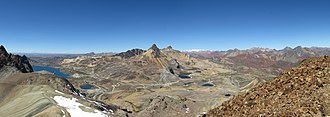
View from the summit of Yuraccocha I to the pass |
|||
| Compass direction | west | east | |
| Pass height | 4818 m | ||
| region | Lima region | Province Huarochirí | |
| expansion | Ruta nacional PE-22 | ||
| Mountains | To the | ||
| profile | |||
| Ø pitch | 3.2% (4816 m / 150 km) | 1.2% (1418 m / 121 km) | |
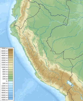
| Map (Lima) | |||
|
|
|||
| Coordinates | 11 ° 35 '54 " S , 76 ° 11' 33" W | ||
The Paso Ticlio or Abra de Anticona is a high mountain pass in the Peruvian Andes . It reaches a height of 4818 m . The pass connects the Peruvian capital Lima with the eastern parts of the country, including the large cities of Huancayo , Jauja and Tarma . This makes it one of the most important west-east connections in the country. The road Ruta nacional PE-22 leads over it , the Peruvian Central Railway passes under the pass just below the pass in a vertex tunnel.
location
The pass is entirely in the Chicla district , in the Huarochiri province , in the Lima region . Thus the pass still belongs to the northern part of the Andes. The pass crossing is right at the saddle point . The provincial border a little further east.
The total difference in altitude between the seafront in Lima and the pass is 4816 m. The gradient of the pass road is mostly between 5 and 6%, only in small sections there can be gradients of 7 or 8%.
traffic
The national road Ruta nacional PE-22 leads over the pass and connects the capital Lima with the Junin region in the center of Peru, it is one of the highest roads in the world. It has a total length of 173.66 km and is well paved . Due to the consistently good and sufficiently wide asphalting, with a few small exceptions in some towns, the road can be used by all types of vehicles and bicycles . However, landslides are common between December and March .
The Peruvian Central Railway connects the port of Callao with the town of La Oroya and runs through the Estación de Desamparados in the heart of Lima. The railway line has a length of 335 km and runs through 68 tunnels , over 61 bridges and 9 switchbacks . She crosses the pass in a vertex tunnel . The highest station on the route is Galera with a height of 4781 m , around 1500 meters south of the pass at the west portal of the summit tunnel. The station was built in 1886 and was then the highest standard gauge station on the American continent.
climate
The average temperatures are between +8 ° C and −5 ° C. The low oxygen content in the air can lead to altitude sickness on the pass . Due to the location on the equator and the proximity to the Pacific with the relatively cold Humboldt Current, the air on the coast warms up during the day and rises, so that a suction from the sea to the land forms and this increases in the afternoon. Cumulus clouds often form in the afternoon hours , which can also develop into storms, so that there can also be precipitation in the form of snow or sleet at higher altitudes .
Web links
Individual evidence
- ↑ a b c d Paso Ticlio (4818 m). Retrieved July 14, 2017 .
- ^ The Magic of the Andes. Climbing Through the Clouds in South America. In: Mike's Railway History. 1935, accessed on August 17, 2017 .


