
Olbendorf
|
Olbendorf
|
||
|---|---|---|
| coat of arms | Austria map | |
 |
|
|
| Basic data | ||
| Country: | Austria | |
| State : | Burgenland | |
| Political District : | Gussing | |
| License plate : | GS | |
| Surface: | 17.37 km² | |
| Coordinates : | 47 ° 11 ' N , 16 ° 12' E | |
| Height : | 380 m above sea level A. | |
| Residents : | 1,433 (January 1, 2020) | |
| Postal code : | 7534 | |
| Area code : | 03326 | |
| Community code : | 1 04 11 | |
| NUTS region | AT113 | |
| Address of the municipal administration: |
Dorf 1 7534 Olbendorf |
|
| Website: | ||
| politics | ||
| Mayor : | Wolfgang Sodl ( SPÖ ) | |
|
Municipal Council : ( 2017 ) (21 members) |
||
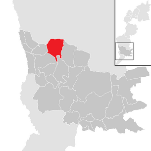
| Location of Olbendorf in the Güssing district | ||
  |
||
 Parish Church Olbendorf |
||
| Source: Municipal data from Statistics Austria | ||

Olbendorf (Hungarian Óbér , Croatian Lovrenac ) is a municipality with 1433 inhabitants (as of January 1, 2020) in the Güssing district in Burgenland ( Austria ).
geography
Geographical location
The community is located in southern Burgenland northeast of Stegersbach on the connecting road Stegersbach - Olbendorf - Oberdorf - Unterwart - Oberwart . The distance to Stegersbach is about six kilometers and to Oberwart about twelve kilometers. On clear days you have a view of the Riegersburg in Styria .
Community structure
Olbendorf consists of a single cadastral community or town of the same name . The nine districts are:
- Mountains,
- Village,
- Eisenberg,
- Greiner,
- Haxbach,
- Mittermühl,
- Schoada,
- Tulips and
- Untermühl.
The altitude of the municipality is officially stated as 285 m, but this is only an average. The highest point is in the Schoada district and reaches around 400 m.
With an area of 1,737 ha, the municipality of Olbendorf is one of the largest scattered settlements in Burgenland . Houses are scattered almost over the entire municipality. According to the chronicles, this has always been the case.
history
In the Hungarian State Archives Olbendorf was mentioned as "Castro Olber" (Castle Olber) for the first time in 1272 in a document. In 1289 the castle complex was conquered by Duke Albrecht I. This means that Olbendorf belonged to the Counts of Güssing before 1289 and after 1291 to 1468 . In 1469, King Matthias Corvinus gave "Alber or Alberdorff" and various other communities to the aristocrat Andreas Baumkirchner. From 1538 to 1566 we find "Albyr or Holbendorf" owned by Longinus von Pukhamar or Puchhaim, the lord of the castle of Schlaining. From 1566 until the end of the manorial rule, the Batthyány were the landlords of Olbendorf. As a result of the campaign of 1605, most of the village burned down.
Even the plague epidemic of 1678/79 did not spare the village. The revolutionary years 1848/49 did not pass Olbendorf without a trace. The tithe was abolished and the fundamental freedom decreed.
Like all of Burgenland, the place belonged to Hungary (German-West Hungary) until 1920/21 . Since 1898 had due to the Magyarization of the government in Budapest of Hungarian name top be used.
After the end of the First World War, after tough negotiations, German-West Hungary was awarded to Austria in the Treaties of St. Germain and Trianon in 1919. The place has belonged to the newly founded federal state of Burgenland since 1921 (see also the history of Burgenland ).
Both world wars claimed great victims among the population. In April 1945 the first Soviet soldiers came to Olbendorf, many buildings were destroyed or badly damaged. After the end of the war, reconstruction began. Important roads were paved and electrification was connected for the entire municipality by 1950. The water pipeline was expanded or partially rebuilt in all districts.
Population development
In contrast to many other municipalities in Burgenland, the population has grown steadily over the past 30 years. The high proportion of second homes is due to the large number of commuters, most of whom work in Vienna, but who build a house in their home community.

Culture and sights


- Catholic parish church Olbendorf hl. Laurentius
Economy and Infrastructure
The road network has more than 100 km of paved freight roads, around 50 km of which are paved municipal roads. In the last few years the over 22 km long sewer network up to the sewage treatment plant in Glasing near Güssing has been completed. The community and registry office, elementary school, kindergarten and Raiffeisen bank as well as a local general practitioner form a good infrastructure. In 1993 a large building project, the multi-purpose hall, was realized.
In cooperation with the volunteer fire brigade Olbendorf, the community built a new fire station . It was completed in 1997. The elementary school was also renovated. Since spring 2001 there has been the possibility of owning an apartment from the Oberwart settlement cooperative in Olbendorf. The service yard with waste collection point was opened in 2002. In 2003 the renovated municipal office including starter apartments and shops was opened.
politics
Municipal council
The council comprises a total of 19 members based on the number of eligible voters.
| Political party | 2017 | 2012 | 2007 | 2002 | 1997 | ||||||||||
|---|---|---|---|---|---|---|---|---|---|---|---|---|---|---|---|
| Sti. | % | M. | Sti. | % | M. | Sti. | % | M. | Sti. | % | M. | Sti. | % | M. | |
| SPÖ | 855 | 78.73 | 17th | 901 | 80.23 | 18th | 816 | 73.91 | 15th | 789 | 69.58 | 14th | 755 | 68.14 | 13 |
| ÖVP | 154 | 14.18 | 3 | 191 | 17.01 | 3 | 205 | 18.57 | 4th | 263 | 23.19 | 4th | 234 | 21.12 | 4th |
| FPÖ | 77 | 7.09 | 1 | 31 | 2.76 | 0 | 44 | 3.99 | 0 | 82 | 7.23 | 1 | 119 | 10.74 | 2 |
| FBL | not running | not running | 39 | 3.53 | 0 | not running | not running | ||||||||
| Eligible voters | 1547 | 1529 | 1491 | 1426 | 1434 | ||||||||||
| voter turnout | 75.95% | 78.55% | 77.06% | 84.04% | 84.38% | ||||||||||
Parish council
In addition to Mayor Wolfgang Sodl (SPÖ) and Deputy Mayor Florian Ohrhofer (SPÖ), the executive councils Anita Holpfer (SPÖ), Ewald Heschl (SPÖ), Hannes Weber (SPÖ), Kurt Laschalt (SPÖ) and Franz Wappel (ÖVP) also belong to the community council on.
mayor
Mayor is Wolfgang Sodl (SPÖ). After Otto Holper (SPÖ), who has headed the community since 2002, announced in June 2012 that he would no longer be available for another term of office, the local SPÖ organization nominated Olbendorf Sodl as the top candidate for the community elections. In the direct mayor election on October 7, 2012, Sodl prevailed with (84.45%) against Franz Wappel (ÖVP, 13.40%) and Evelyn Berger (FPÖ, 2.15%). In the election on October 1, 2017, the ÖVP and FPÖ refrained from nominating competitors, and Sodl, who has also been a member of the Burgenland state parliament since 2010 , was confirmed as mayor with 92.62%.
The local council elected Florian earshofer (SPÖ) as vice mayor.
The head of the municipal office is Elke Lang.
List of Mayors of Olbendorf
- 1984–1996 Karl Konrath (SPÖ)
- 1996-2002 Anton Fetz (SPÖ)
- 2002–2012 Otto Holper (SPÖ)
- since 2012 Wolfgang Sodl (SPÖ)
Personalities
Sons and daughters of the church
- Karl Konrath (* 1941), former mayor and member of the state parliament
Web links
- 10411 - Olbendorf. Community data, Statistics Austria .
- Homepage of the community
Individual evidence
- ↑ a b Province of Burgenland: Olbendorf 2017 election results (accessed on January 31, 2018)
- ↑ a b Province of Burgenland: election results Olbendorf 2012 (accessed on January 31, 2018)
- ↑ Province of Burgenland: election results Olbendorf 2007 (accessed on January 31, 2018)
- ↑ a b Province of Burgenland: Olbendorf election results 2002 (accessed on January 31, 2018)
- ↑ a b Municipality of Olbendorf: Municipality representatives (accessed on February 1, 2018)
- ↑ BVZ of June 20, 2012: Change in Olbendorf (accessed on February 1, 2018)
- ↑ Municipality of Olbendorf: Administration (accessed on February 1, 2018)
Picture in | Bocksdorf | Burgauberg-Neudauberg | Eberau | Gerersdorf-Sulz | Crabby | Güssing | Güttenbach | Hackerberg | Heiligenbrunn | Hay trench | Inzenhof | Mellow | Kukmirn | Mosque village | Neuberg im Burgenland | Neustift near Güssing | Olbendorf | Ollersdorf in Burgenland | Rauchwart | Rohr in Burgenland | Sankt Michael im Burgenland | Stegersbach | Stinatz | Strem | Tobaj | Tschanigraben | Mountain of words