
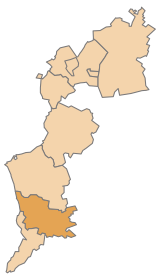
Güssing district
| location | |
|---|---|
  |
|
| Basic data | |
| state | Burgenland |
| NUTS III region | AT-113 |
| Administrative headquarters | Gussing |
| surface | 485 km² |
| Residents | 25,699 (January 1, 2020) |
| Population density | 53 inhabitants / km² |
| License Plate | GS |
| District Commission | |
| District chief | Nicole Christina Wild |
| website | BH Güssing |
| map | |
  |
|
The district of Güssing ( Hungarian Németújvári járás ) is a political district of Burgenland .
The European Center for Renewable Energy (EEE) in Güssing is of economic importance, and the thermal baths in Stegersbach are also important for tourism .
Administrative division
The Güssing district consists of a total of twenty-eight communities, including one town and eight market communities.

| local community | Hungarian | Croatian | location | Ew | km² | Ew / km² | Judicial district | region | Type
|
photo | Metadata |
|---|---|---|---|---|---|---|---|---|---|---|---|
Bildein
|
Beled |

|
347 | 15.9 | 22nd | Gussing | local community
|

|
According to code: 10426 |
||
|
Bocksdorf |
Baksafalva |

|
807 | 9.98 | 81 | Gussing | local community
|

|
According to code: 10401 |
||
Burgauberg-Neudauberg
|
Burgóhegy-Magashegy |

|
1,326 | 10.91 | 122 | Gussing | local community
|

|
Acc. To code: 10402 |
||
Eberau
|
Monyorókerék | Eberava |

|
936 | 30.72 | 30th | Gussing | market community
|

|
According to code: 10403 |
|
Gerersdorf-Sulz
|
Németszentgrót-Sóskut |

|
992 | 21.62 | 46 | Gussing | local community
|

|
Acc. To code: 10404 |
||
|
Merrily |
Alsómedves | Veliki Medveš |

|
237 | 7.92 | 30th | Gussing | local community
|

|
According to code: 10420 |
|
Gussing
|
Németújvár | Novigrad |

|
3,667 | 49.28 | 74 | Gussing | urban community
|

|
Acc. To code: 10405 |
|
Güttenbach
|
Pinkóc | Pinkovac |

|
880 | 15.89 | 55 | Gussing | market community
|

|
According to code: 10406 |
|
Hackerberg
|
Vághegy | Stinjački Vrh |

|
368 | 3.87 | 95 | Gussing | local community
|

|
According to code: 10418 |
|
Heiligenbrunn
|
Szentkút |

|
753 | 33.49 | 22nd | Gussing | local community
|

|
According to code: 10407 |
||
Hay pit
|
Sirovnicza | Žarnovica |

|
232 | 6.47 | 36 | Gussing | local community
|

|
According to code: 10424 |
|
Inzenhof
|
Borosgödör |

|
315 | 5.97 | 53 | Gussing | local community
|

|
According to code: 10421 |
||
Petty
|
Felsőmedves |

|
230 | 4.29 | 54 | Gussing | local community
|

|
According to code: 10422 |
||
Kukmirn
|
Kukmér |

|
1,983 | 40.48 | 49 | Gussing | market community
|

|
Acc. To code: 10408 |
||
Mosque village
|
Nagysároslak |

|
394 | 13.17 | 30th | Gussing | local community
|

|
Acc. To code: 10428 |
||
Neuberg in Burgenland
|
Újhegy | Nova Gora |

|
968 | 17.6 | 55 | Gussing | local community
|

|
Acc. To code: 10409 |
|
Neustift near Güssing
|
Újtelep |

|
464 | 11.44 | 41 | Gussing | local community
|

|
According to code: 10410 |
||
Olbendorf
|
Óbér | Lovrenac |

|
1,433 | 17.37 | 82 | Gussing | local community
|

|
According to code: 10411 |
|
Ollersdorf in Burgenland
|
Barátfalva |

|
938 | 8.85 | 106 | Gussing | market community
|

|
Acc. To code: 10412 |
||
Rauchwart
|
Rábort |

|
442 | 17.5 | 25th | Gussing | local community
|

|
According to code: 10427 |
||
|
Rohr in Burgenland |
Nád |

|
376 | 8.37 | 45 | Gussing | local community
|

|
Acc. To code: 10425 |
||
Saint Michael in Burgenland
|
Pusztaszentmihály | Sveti Mihalj |

|
977 | 18.36 | 53 | Gussing | market community
|

|
Acc. To code: 10413 |
|
Stegersbach
|
Szentelek | Santalek |

|
2,661 | 17.76 | 150 | Gussing | market community
|

|
According to code: 10414 |
|
Stinatz
|
Pásztorháza | Stinjaki |

|
1,195 | 9.49 | 126 | Gussing | market community
|

|
According to code: 10415 |
|
Strem
|
Strém |

|
871 | 23.76 | 37 | Gussing | market community
|

|
Acc. To code: 10416 |
||
Tobaj
|
Tobaj | Tobaj |

|
1,359 | 58.1 | 23 | Gussing | local community
|

|
According to code: 10417 |
|
Tschanigraben
|
Sándorhegy |

|
65 | 1.71 | 38 | Gussing | local community
|

|
According to code: 10423 |
||
Mountain of words
|
Vörthegy |

|
483 | 4.76 | 101 | Gussing | local community
|

|
Acc. To code: 10419 |
Population development

Web links
Commons : Güssing district - collection of images, videos and audio files
- District Güssing on burgenland.at
Eisenstadt | Eisenstadt area | Güssing | Jennersdorf | Mattersburg | Neusiedl am See | Oberpullendorf | Oberwart | Rust
Coordinates: 47 ° 4 ′ N , 16 ° 19 ′ E