List of streets and squares in Berlin-Biesdorf

The list of streets and squares in Berlin-Biesdorf describes the complete street system in the Berlin district of Biesdorf in the Marzahn-Hellersdorf district with the corresponding historical references. At the same time, this compilation is part of the lists of all Berlin streets and places .
overview
The municipality of Biesdorf belonged to the Niederbarnim district in the Prussian province of Brandenburg until 1920 . In the Berlin address book, Biesdorf and its streets are only listed after the rural community became part of Greater Berlin and the Lichtenberg administrative district there.
The eastern border of Biesdorf to the districts of Hellersdorf and Kaulsdorf forms the eastern bank of the Wuhle . Biesdorf is bordered by Marzahn in the north and west, Friedrichsfelde and Karlshorst adjoin it in the west, and Köpenick in the south .
The district is cut through in a west-east direction by the route on which the joint federal highways B 1 and B 5 run. The Prussian Ostbahn with the S-Bahn station Biesdorf on the S 5 crosses the district from west to east. Between the Berlin outer ring on the border with Friedrichsfelde and the Wuhletal station , the U5 underground line crosses the district from southwest to northeast along the former VnK route as an embankment. The subway stations Biesdorf-Süd and Elsterwerdaer Platz are in the Biesdorf area .
The street names of the residential quarters in the Biesdorf district (south and north) and the suburbs of Hellersdorf (with parts of the Daheim colony ), which were built between 1900 and the late 1920s, were usually numbered during the planning phase or when they were first constructed (street 1 to street 81) or marked with letters. After their completion in 1933, further streets in Biesdorf-Nord were designated according to types of grain, crops or agricultural implements, and two were added in 1961.
Since the political turnaround , numerous new homes such as the Habichtshorst settlement west of the Wuhletal hiking trail with new road networks have been built in the existing small settlements or on former fallow land . In Habichtshorst-Ost five new streets were named after ornamental plants and one after the Berlin gardening director Albert Brodersen . In Habichtshorst-West 17 new street names were assigned to Faltern between November 1998 and 2007 .
The longest traffic routes are the Blumberger Damm –Köpenicker Straße with about 6500 meters, which crosses the entire district from north to south, and Alt-Biesdorf in a west-east direction with about 3100 meters, which divides the district into a north and a south area structured.
According to the information in Berlin address books of the 1930s and 1940s, Biesdorf was divided into the northern area (north of the railway line), Biesdorf-Mitte (between the railway line and Alt-Biesdorf ) and the southern area. Statistically, Biesdorf distinguishes between the living-world-oriented rooms (LOR) Oberfeldstraße (LOR 24), Buckower Ring (LOR 25), Alt-Biesdorf (LOR 26) and Biesdorf-Süd (LOR 27). Before its structural development, Biesdorf-Süd was the Biesdorfer Busch , an extensive, wooded, wetland area.
Biesdorf has 28,069 inhabitants (as of December 30, 2019) and includes the postcode area 12683.
Overview of the streets
The following table gives an overview of the streets and squares in the district as well as some related information.
- Name / location : current name of the street or square. Via the link Location , the street or the square can be displayed on various map services. The geoposition indicates the approximate center of the street length.
- Traffic routes not listed in the official street directory are marked with * .
- Former or no longer valid street names are in italics . A separate list may be available for important former streets or historical street names.
-
Length / dimensions in meters:
The length information contained in the overview are rounded overview values that were determined in Google Earth using the local scale. They are used for comparison purposes and, if official values are known, are exchanged and marked separately.
For squares, the dimensions are given in the form a × b for rectangular systems and for (approximately) triangular systems as a × b × c with a as the longest side.
If the street continues into neighboring districts, the addition ' in the district ' indicates how long the street section within the district of this article is. - Name origin : origin or reference of the name.
- Notes : further information on adjacent monuments or institutions, the history of the street and historical names.
- Image : Photo of the street or an adjacent object.
| Name / location | Length / dimensions (in meters) |
Origin of name | Date of designation | Remarks | image |
|---|---|---|---|---|---|
|
Corn Path
( Location ) |
420 | Ear of wheat , term for the fruit cluster of cereal plants | Apr 5, 1934 | The name is related to the structural development of the area north of the Biesdorf S-Bahn station. At first the traffic route was called Straße 6a . It leads from the Gerstenweg in a south-easterly direction and then bends to the south. After the intersection with Roßlauer Straße, it continues as a dead end . |

|
| Alberichstrasse
( Location ) |
1470 | Alberich , dwarf from the song of the Nibelungs with magic hat , opponent of Siegfried | June 27, 1925 | The first name was street A . As a continuation of Dornacher Strasse, it leads from Alfelder Strasse in a north-south direction to the Habubrandweg / Hadubrandstrasse street. Alberichstrasse has been designated as a bicycle street since 2000 and was Berlin's first bicycle street. |

|
| Alfelder Strasse
( Location ) |
1200 | Alfeld (Leine) , city in Lower Saxony | Nov 9, 1926 | The road runs in a west-east direction in Biesdorf-Süd in the middle of a villa colony. The southern side up to about the middle of the street length borders on allotment gardens, which are located on an elevated area (1954 on a city map as "Fuchsberge" with a height of 42.7 meters above sea level ). |

|
|
Avenue of the Cosmonauts
( Location ) |
460 (in the district) |
Cosmonaut , Russian term for a spaceman | 22 Sep 1978 | The road was laid out around 1975 in the current route and was initially called Springpfuhlstraße . It bends twice from west to east. Only a small section on the southern side in the middle section (house numbers 132-140) belongs to Biesdorf. |

|
| Cyclamen Trail
( Location ) |
80 | Cyclamen , flower | Apr 2, 2002 | The street in the Biesdorf-Süd villa colony is not open to the public . |

|
|
Alt-Biesdorf
( Location ) |
3060 | Alt-Biesdorf , center of the first settlement | July 26, 1927 | The street, part of the eastern arterial road from Berlin, the federal highways 1 and 5 , connects to the east of the Alt-Friedrichsfelde street and continues as Alt-Kaulsdorf and finally Frankfurter Chaussee to Frankfurt (Oder) . After a major fire in 1839, the two halves of the village green were widened and straightened. The Biesdorf village church in the center of the Angers and the Alt-Biesdorf 6–9, 16, 18/19, 21–30, 55–60, 62–66, 68/69, 71a, 73 and 75 street names are listed as historical monuments were Frankfurter Strasse (around 1925–1927), Dorfstrasse (eastern section; until 1927) and road to Mahlsdorf (western section; until 1927) | |
|
Old Friedrichsfelde
( Location ) |
150 (in the district) |
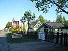
Friedrichsfelde , district of Berlin | July 26, 1927 | Only two house numbers on this street, east of the car bridge to Märkische Allee, belong to the district of Biesdorf. Before the name was given (again) in 1992, this traffic route was called Frankfurter Chaussee (around 1700 to 1800), Frankfurter Allee (around 1800 to 1900), Berliner Straße (around 1900 to 1927), Straße der Befreiung (1975–1992). |
|
| Altentreptower Strasse
( Location ) |
1180 + 450 | Altentreptow , town in Mecklenburg-Western Pomerania | June 16, 1989 | The street was laid out in connection with the construction of the Wuhletal S and U-Bahn station . It runs from Blumberger Damm in the west to the north and parallel to the S-Bahn route to Parchimer Strasse in the neighboring district of Hellersdorf . The bridge over the Wuhle forms the district boundary. Approximately in the middle of the street there is a ring-shaped branch to develop a small industrial area, which mainly houses service facilities of the neighboring medical facilities Unfallkrankenhaus Berlin and eye clinic Marzahn and some residential buildings (lower picture). |

|
| Alwineweg
( Location ) |
370 | Alwine , old German female first name; derived from the male first name Alwin with the meaning "noble", "noble" and "friend" | Apr 4, 1934 | The first name was road D . The route runs from the Elisabethstrasse / Blumberger Damm intersection west to Irmfriedstrasse. There it continues in a straight line as Völklinger Straße. At Alwineweg 26 (corner of Diethelmweg) is the Mormon community building of the " Church of Jesus Christ of Latter-day Saints ". |

|
| At the Binsengrund
( Location ) |
160 + 120 | Rushes , marsh plants | Nov 9, 1926 | In the first development plan it was entered as Straße 44 . It is a west-east street between Köpenicker Straße and Schwabenallee. At Schwabenallee, the street continues offset to Dramburger Straße. |

|
| At the Brodersengarten
( Location ) |
360 | Albert Brodersen (1857–1930), garden architect , a. a. Planner of the former Biesdorf Castle Park | Apr 2, 2002 | The road runs in a north-west-south-east direction and, together with the Heidekrautweg in the south, the Pfingstrosenweg in the east and two angled street sections in the north, encloses a housing estate in Biesdorf-Süd that was newly developed at the beginning of the 21st century. In the south, a footpath connects the street with the Wuhleufer . The naming was also based on the already existing streets in the area, named after flowers. |

|
| At the business park
( Location ) |
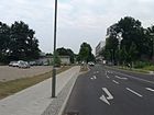
100 | to the adjacent MEON industrial park | March 29, 2014 | The street branches off in an easterly direction from Blumberger Damm. It serves as an entrance to the MEON industrial park. It was originally named Grimmener Straße in 2013 . It was renamed at the request of the operating company of the business park. |
|
| At the great
( Location ) |
140 | Groen , Dutch for green space | Dec 10, 2017 | The access road in the new development area starts as a circular route from the Möwenweg and has an extension. A garden city in the style of a Dutch quarter has emerged directly on the Wuhle. |

|
|
At the castle courtyard
( Location ) |
300 | Courtyard of Biesdorf Castle , the elongated shape of which was recorded here | July 1, 1999 | The street connects Warener Straße with Spatenweg in a straight north-south orientation and runs in two parallel branches. It is located east of the Blumberger Damm near the Berlin Accident Hospital . The two branches open up an area on which six similar multi-family houses were built using ecological construction. |

|
| On the forest mountain
( Location ) |
760 | after 'forest' and 'mountain' a hilly, wooded area; here a historical field name from previous centuries | Nov 9, 1926 | The first names were Street 31 and Street 31a . The north-south road begins on Schackelsterstrasse, makes an offset to the west at Dohlengrund and then leads in a straight line to Alfelder Strasse. |

|
| At the willow break
( Location ) |
290 | Willows (botany) and broken forest | Nov 9, 1926 | It connects Schackelsterstrasse with Kreuzschnabelstrasse and bends slightly to the south from house number 6. |

|
| On the canals
( Location ) |
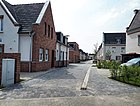
225 | Grachten , Dutch and Low German term for canal , ditch or moat . | Dec 10, 2017 | The access road in the new development area goes from Möwenweg to Grüne Aue. A garden city in the style of a Dutch quarter has emerged directly on the Wuhle. |
|
| Annenstrasse
( Location ) |
1010 | Anne, female first name, nickname of Anna and short form of Annemarie, Anneliese, Annelore or Marianne | before 1920 | The road is in the Biesdorf-Nord area and runs from west to east. The house number range 2–4 extends from Maratstraße to Allee der Kosmonauten and forms a dead end street with commercial units. The rest of the count (up to number 90) runs from Maratstraße to Hiltrudstraße in a straight line in the middle of a small settlement area. |

|
| Anselmstrasse
( Location ) |
400 | Anselm , old Germanic male first name, analogously: "under the protection of the gods" | June 27, 1925 | In the first development plans was as street K referred. In the Berlin address book of 1922 it is said to be shown as Paradiesstrasse , but this has not (so far) been documented. It is located in the Biesdorf-Süd area and runs slightly curved between Köpenicker and Nitzwalder Straße in a west-east direction. When the name was renamed, all west-east streets were given female first names and north-south streets were given male names. |

|
| Codling Moth Street
( Location ) |
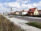
180 | Codling moth , moths and fruit pest | July 17, 2007 | It is located in the Habichtshorst residential area in Biesdorf-Süd and runs from the Habichtshorst street northwards as a dead end . A footpath leads to Mohrenfalterstraße.
In this street (house numbers 4–6) the new building of the primary school at Fuchsberg was opened on October 4, 2018 , which was founded in 1992, but until then had been housed in containers on the premises of another Biesdorf school. |
|
| Apollofalterallee
( Location ) |
640 | Apollo butterfly, Central European butterfly species |
October 29, 1998 (opened to traffic on December 15, 1998) |
The slightly arched street connects Köpenicker Straße with Alt-Biesdorf in a northeast direction and is located in the Habichtshorst residential area. It was the first road completed here. |

|
| Arnfriedstrasse
( Location ) |
140 | Arnfried , old German male first name | June 27, 1925 | The road was part of development plans of the 1920s and was first called road E . The Arnfriedweg and the Arnfriedstraße form a west-east street; Arnfriedstrasse connects Alberichstrasse with Köpenicker Strasse. Its eastern extension is Dubickstrasse , which leads to Schwabenallee. |

|
| Arnfriedweg
( Location ) |
380 | after the street of the same name | 28 Sep 1959 | The street was laid out in 1959 as a western extension of Arnfriedstraße in the Biesenhorst I settlement area as a private street. It runs in a west-east direction between Bahnstrasse / Geraldstrasse and Alberichstrasse. |

|
| Arno-Philippsthal-Strasse
( Location ) |
150 | Arno Philippsthal (1887–1933), doctor in Biesdorf, victim of the Nazi regime | March 8, 2002 | The street is in the Biesdorf-Süd area. It branches off as a cul-de-sac in a southerly direction from Weißenhöher Strasse. The house of care and nursing, named after Arno Philippsthal, is located next to it. It was built in 2000 as a new building on the area of the former “care home Grabensprung”. |

|
| Arnsberger Strasse
( Location ) |
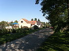
840 | Arnsberg , city in North Rhine-Westphalia | Nov 9, 1926 | The north-south road runs between Schackelster Strasse and Alfelder Strasse. Here is an entrance to the allotment garden 'Am Fuchsberg'. |
|
| Augenfalterstrasse
( Location ) |
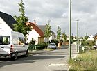
280 (160) | Eye butterfly, butterfly species | July 17, 2007 | The road runs in a west-east direction in parts as an unpaved footpath from a green area on Pollnower Weg to Feuerfalterstraße. |
|
| Auricle path
( Location ) |
80 | Auricle , spring flower | Apr 2, 2002 | The Aurikelweg is located south of the Alt-Biesdorf road and leads from Am Brodersengarten to the Pfingstrosenweg. |

|
| Aurorafalterweg
( Location ) |
340 | Aurora butterfly, butterfly species | July 17, 2007 | The street runs in a west-east direction from Köpenicker Straße to Segelfalterweg. A branch path leads to the butterfly meadow. |

|
|
Baggerseestrasse
( Location ) |
150 | Biesdorfer Baggersee , a body of water created during the extraction of building material | March 1, 1997 | When the Berlin outer ring was built, Budsiner Strasse was divided. Above all, gravel was "dredged" from a nearby depression and used for the route. The resulting pit gradually filled with groundwater, creating the quarry pond. The eastern part of the street (formerly house numbers 37-47) north of this lake, now separated by the railway line, was given its own name in 1997. The street runs as a dead end between the railway embankment and a sports field in the east . |

|
| Railway path
( Location ) |
320 | after the parallel outer Berlin ring | 28 Sep 1959 | The north-south traffic route east of the railway line was created through the construction of the railway line. It forms the western boundary of the Biesenhorst I colony and was nameless for a long time. After his northern section (previously up / down Dankratweg; offset) in the 1980s deconsecrated was, he now joins the Balzerstraße straight to the Arnfriedweg. |

|
| Balzerplatz
( Location ) |
140 × 50 | Paul Balzer (16th century), gardener and landowner in Biesdorf or Balzer von Pfuhl , who founded the manor Biesdorf in 1572 and whose ancestors owned the Angerdorf Biesdorf | March 11, 1937 | Before place G , in whose name the street running north and south of the place was included. |

|
| Balzerstrasse
( Location ) |
430 | Paul Balzer (16th century), gardener and landowner in Biesdorf or Balzer von Pfuhl , who founded the manor Biesdorf in 1572 and whose ancestors owned the Angerdorf Biesdorf | March 11, 1937 | The street is the eastern continuation of the Balzerweg and runs as a west-east street from Balzerplatz to Fortunaallee. |

|
| Balzerweg
( Location ) |
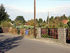
420 | after the street of the same name | 28 Sep 1959 | The first name was Bodostraße from the 1920s . With the more intensive development of the "Biesenhorst" colony, the street going west from Balzerplatz was given its current name. |
|
| Beethovenstrasse
( Location ) |
380 | Ludwig van Beethoven (1770–1827), composer | around 1920 | At first it was called Street 6 . It was divided when the railway was built. Its eastern section connects Haydnstrasse in a west-east direction with Braunsdorfstrasse. The western section is a cul-de-sac going east from Oberfeldstrasse. |

|
| Bentschen way
( Location ) |
1740 (in the district) |
Bentschen , town in the province of Poznan , since 1920 Zbąszyń in Poland | May 11, 1938 | The road runs from the Märkische Spitze in Marzahn to Oberfeldstrasse in a straight line from west to east. There it continues as Roßlauer Straße . |

|
| Beruner Strasse
( Location ) |
580 | Berun , town in Eastern Upper Silesia , since 1922 Bieruń in Poland | Nov 9, 1926 | Laid out around 1906, it was first called Straße 11 . It leads from the quarry pond in a south-south-west direction, under the subway at Biesdorf-Süd station, through to Dohlengrund. From here it turns south and turns into Lauchhammerstraße at the intersection with Stader Straße. |

|
| Biesdorf flower meadow
( Location ) |
120 | Biesdorf and flower meadow | Sep 11 2006 | The street is located in the north of Biesdorf, which as a north-south train creates a walking connection between Charlottenstraße and Annenstraße. The Biesdorfer Heimatmuseum, a converted workshop building of the Siemens-Schuckert-Werke, is located next to it . In 1909 an airship was built and stationed in a revolving hall on the site. |

|
| Biesdorfer Friedhofsweg
( Location ) |
660 | Biesdorf cemetery | May 1, 1995 | The street leading only to the cemetery was nameless from the time it was built in the late 19th century until 1995. The eponymous Biesdorf cemetery is a listed building. The path runs from the north side of Alt-Biesdorf to the east, parallel to the underground line . On the area between this path, the Wuhle and Alt-Biesdorf, rubble was dumped between 1952 and 1958, which was created during the removal of the buildings in central Berlin that had been destroyed by the war . In the 1980s, the hill was greened and redesigned to Biesdorfer Höhe . |

|
|
Biesdorf promenade
( Location ) |
1460 | Biesdorf , part of the Marzahn-Hellersdorf district | around 1977 | The promenade is a pure pedestrian and bike path that runs along a ditch in a north-west-south-east direction. It leads from a branch of the Allee der Kosmonauten to Hafersteig and was first called the waterway . In the same direction, but slightly offset, the path then continues as a spade path to Blumberger Damm. |

|
| Biesdorf way
( Location ) |
870 | Biesdorf , part of the Marzahn-Hellersdorf district | around 1929 | The long unnamed and unpaved path between the village of Biesdorf and Köpenick was not officially known as the Heuweg . It initially belonged to the Biesdorf district in the municipality of Cöpenick . Between 1927 and 1929 it was called Biesdorfer Waldweg . On December 1, 1993, an eastward-moving section of the road was spun off and renamed the Wateweg . The Biesdorfer Weg leads in a slightly curved shape from Hadubrandweg southwards to Wuhlestrasse / Am Wuhleufer. |

|
| Birch avenue
( Location ) |
380 | Birch trees , widespread deciduous trees in Central and Northern Europe | around 1900 | It connects Köpenicker Strasse in a west-east direction with Fortunaallee. |

|
| Bischofstaler Strasse
( Location ) |
80 (in the district) |
Bischofstal , town in the province of Upper Silesia , since 1945 Ujazd in Poland | Jan. 7, 1928 | It was first called Straße 9 , after the renaming it was initially written as Bischofsthaler Straße . Only a small western section belongs to Biesdorf, the longer stretch of road beyond the Wuhle is part of the road system in the Berlin-Kaulsdorf district . |

|
| Bismarcksfelder Strasse
( Location ) |
220 (in the district) |
Bismarcksfelde , place in the province of Posen , since 1920 Wiktorowo, part of the municipality of Buk in Poland | Jan. 7, 1928 | It was first called Straße 10 and belonged to Köpenick. In 1938 she came to Lichtenberg and around 1975 to Marzahn . It runs from Biesdorfer Straße (Kaulsdorf) over the Bismarcksfelder Bridge to Kaulsdorfer Straße. The Wuhle divides this street into a western section in Biesdorf and an eastern section in Kaulsdorf. |

|
|
Blumauer Strasse
( Location ) |
220 | Blumau , town in the province of Poznan , since 1920 Kwieciszewo in Poland | Jan. 7, 1928 | Around 1902 it was laid out as Straße 11 and was initially part of Köpenick. In 1938 bloomauer road came to Lichtenberg , later to the district Marzahn-Hellersdorf. It connects the Biesdorfer Weg northeast with the Nitzwalder Straße. |

|
|
Blumberger Dam
( Location ) |
2960 (in the district) |
Blumberg , part of the municipality of Ahrensfelde in Brandenburg | Jan. 31, 1992 | The traffic route initially only ran between Cecilienstraße and Alt-Biesdorf and was called Globsower Straße since 1937 . During the construction of the large housing estate Marzahn, it was extended in a northerly direction, between Havemannstrasse (then Erich-Glückauf-Strasse) and Rapsweg, and in 1978 it was named Otto-Buchwitz-Strasse on this section (after the GDR politician Otto Buchwitz ). After a road bridge was built over the S-Bahn and long-distance railway , the four-lane route was connected to the Alt-Biesdorf road in 1986 and was named Otto-Buchwitz-Straße along its entire length . Only the southern section from Elisabethstraße to Alt-Biesdorf belongs to the district of Biesdorf. |

|
| Boschpoler Platz
( Location ) |
120 × 65 | Large and small Boschpol , places in Pomerania , since 1945 Bożepole Wielkie and Bożepole Małe, districts of Łęczyce in Poland | May 11, 1938 | After the installation around 1906 it was called Goetheplatz . It lies between Otto-Nagelstrasse and Eckermannstrasse and divides Boschpoler Strasse. It is a counterpart to Lappiner Platz, which is about 1080 meters further south. |

|
| Boschpoler Strasse
( Location ) |
710 | Large and small Boschpol , places in Pomerania , since 1945 Bożepole Wielkie and Bożepole Małe, districts of Łęczyce in Poland | May 11, 1938 | It was called Viktoriastraße when it was first built around 1906 and runs in a west-east direction from Allee der Kosmonauten to Oberfeldstraße and into a small industrial area. In the middle, it is interrupted by Boschpoler Platz. |

|
| Brachfelder Strasse
( Location ) |
710 | Brachfeld , a place in East Prussia , disappeared after the Second World War, its area belongs to the municipality of Uslowoje | March 8, 1935 | At first it was called Strasse 14 . It leads in a north-south direction from Weißenhöher to Debenzer Straße with a longer section on the east bank of the quarry pond. |

|
| Brachliner Strasse
( Location ) |
210 | Brachlin , place in West Prussia , since 1920 Zbrachlin, part of the municipality of Pruszcz in Poland | Jan. 7, 1928 | At first it was called Street 12 . The street forms a west-east connection between Biesdorfer Weg (continuation of Irmastraße) and Nitzwalder Straße. |

|
| Brandorfer Weg
( Location ) |
180 | Brandorf , place in the province of Poznan , since 1920 Przyprostynia, part of the municipality of Zbąszyń in Poland | March 8, 1935 | First the path was laid out as road 5 . The west-east route between the west bank of the Baggersee / Brachfelder Strasse and Trench Jump continues to the east as Haltoner Strasse. |

|
| Braunsdorfstrasse
( Location ) |
600 | Friedrich Braunsdorf (1852–1933), local politician | before 1920 | The nursery owner Braunsdorf was shown in the Biesdorf address book for the years 1909 to 1915 as an honorary community leader . At that time he lived at Dorfstrasse 41 (later renamed Alt-Biesdorf ). The road initially runs eastwards from Haydnstrasse to the railway embankment, where it bends south and ends at Alt-Biesdorf road. |

|
| Brebacher way
( Location ) |
1460 | Brebach , district of Saarbrücken in Saarland | Feb 21, 1940 | The Brebacher Weg opens up the area to the former Wilhelm-Griesinger-Hospital , a "sanatorium and nursing home for epileptics " which was created by Hermann Blankenstein at the end of the 19th century and is now a listed building . At first the way was called Straße 62 . The name change, made in 1940, took place on the occasion of the reorganization of the Saar area into the German Reich in 1935. It begins in the north as a continuation of Zum Forsthaus and then runs straight south as far as possible on the site of the former hospital. Then the path crosses Altentreptower Straße, crosses the embankment of the S-Bahn and U-Bahn as a footpath and ends at Frankenholzer Weg / Walsheimer Straße. On the clinic premises, it is only accessible for special vehicles. |

|
| Breitenfelder Strasse
( Location ) |
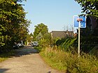
210 | Breitenfelde , town in the province of Poznan , since 1920 Przyborówo, part of the municipality of Łubowo in Poland | Jan. 7, 1928 | At first it was called Street 12 . Street 3 in Biesdorf-Süd. It connects the Biesdorfer Weg with the Nitzwalder Straße in a south-west-north-east direction. |
|
| Bruchgrabenweg
( Location ) |
320 | Bruch und Graben , the name of a water-bearing ditch that drained to the Tierpark Berlin until the 1970s | March 8, 1935 | The path was laid out as road 54 and was divided when the railway systems were later built. The remaining eastern and newly named section now runs in a west-east direction from Schlochauer Straße to Lötschbergstraße and is bordered on both sides by railway embankments. |

|
| Buchenhainer Strasse
( Location ) |
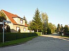
160 | Buchenhain , place in the province of Poznan , since 1920 Boguniewo, part of the municipality of Rogoźno in Poland | Jan. 7, 1928 | The street in the south of Biesdorf was called Straße 14 when it was first built . It runs from Biesdorfer Weg slightly to the northeast to Nitzwalder Straße. |
|
| Buckower Ring
( Location ) |
1150 | Buckow , city in Brandenburg | Nov. 27, 1980 | The street was built at the end of the 1970s on previous fields when new prefabricated apartments were being built in Biesdorf-Nord. The street begins on the east side of Blumberger Damm (main route), runs in a U-shape and ends at Wuhlestraße 19, so it does not form a complete ring. |

|
| Budapest way
( Location ) |
300 |
Budapest , capital of Hungary, the XV. The Rákospalota district of Budapest is the partner district of the Marzahn-Hellersdorf district |
Aug 26, 2010 | The name was given in connection with the redevelopment of the Haltoner Strasse / Minsker Strasse area at the request of the district administration.
It runs in a west-east direction between Grabensprung and Elsterwerdaer Platz / Minsker Straße, south of the Stadtgarten Biesdorf, and is a public pedestrian path. |

|
| Budsiner Strasse
( Location ) |
350 | Budsin , town in the province of Poznan , since 1920 Budzyń in Poland | March 8, 1935 | When it was first installed, it was called Straße 2 . It runs across a small settlement area south of Alt-Friedrichsfelde / Alt-Biesdorf and the feeder to Märkische Allee . |

|
|
Bültenring
( Location ) |
330 | Bülte also 'Bult' ( Low German ), for small hills that are formed from moss and grass and occur in raised bogs | Jan. 1, 1999 | The street was created in connection with the construction of apartment buildings. It forms a mushroom-shaped loop with protuberances east of Schwabenallee and is marked with a street sign in white letters on a blue background. |

|
| Burghardweg
( Location ) |
460 | Burghard , male first name, analogously: "strong protection" | Apr 4, 1934 | First was the way street A . It connects the Alwineweg in a straight line with the Ingeweg. When it was renamed, (almost) all west-east streets were given female names and north-south streets were given male names. |

|
| Buschiner Platz
( Location ) |
70 × 60 | Bushin , town in West Prussia , since 1920 Buśnia, part of the Warlubie municipality in Poland | May 11, 1938 | When the road system was first constructed, the green area was called Lessingplatz after the German poet Gotthold Ephraim Lessing . The square is located between Maratstraße (west), Buschiner Straße (south) and Prignitzstraße (east). To the north it is bounded by the house gardens on Eitelstrasse. The Protestant Reconciliation Church is located on top of it , the main entrance of which is at Maratstraße 100. Since 1990, newly built multi-family villas have been added on Buschiner Strasse and Prignitzstrasse, which have led to a reduction in the original space, and a corresponding street sign is missing. |

|
| Buschiner Strasse
( Location ) |
580 | Bushin , town in West Prussia , since 1945 Buśnia, part of the Warlubie municipality in Poland | May 11, 1938 | When it was first installed around 1920, it was called Hermannstrasse . It runs in a west-east direction between Luise-Zietz-Strasse and Oberfeldstrasse. At its eastern end - slightly offset to the south - joins the Hirseweg. |

|
|
Cecilienstraße
( Location ) |
2740 (in the district) |
Cecilie zu Mecklenburg (1886–1954), Prussian Crown Princess |
around 1910 (with interruptions) |
The road, which was laid out more than 100 years ago, connects the neighboring towns of Marzahn and Hellersdorf; it was first called Strasse 14 . When the street was named after the Prussian noblewoman, it was first written on Cäcilienstraße . The name was extended in 1984 when new apartment blocks were built here and renamed in Albert-Norden-Straße after the GDR politician Albert Norden . The Senate resolution to rename street names led to the re-assignment of the historical name in 1992. An eastern section of the street (around 1000 meters) belongs to Hellersdorf . |

|
| Charlottenstrasse
( Location ) |
800 | Charlotte , female name | around 1906 | It runs from sports facilities behind Maratstrasse eastwards over Oberfeldstrasse to Hiltrudstrasse. |

|
| Christelweg
( Location ) |
430 | Christel, nickname of Christine or Christiane , female first name | Apr 4, 1934 | In the initial investment, the path was called road E . It runs in a west-east direction between Fridolinweg and Irmfriedstraße. An earlier part of it was given the name Mettlacher Straße. When the name was renamed, all west-east streets were given female first names and north-south streets were given male names. |

|
|
Dankratstrasse
( Location ) |
320 | Dankrat, old German male first name, also legendary figure from the Nibelungenlied , father of Kriemhild and husband of Ute |
June 27, 1925 | The west-east street between Bahndamm / Bahnweg and Alberichstraße is Dankratweg, which then continues as Dankratstraße to Schwabenallee via Köpenicker Straße. The Klingenberg High School is here. |

|
| Dankratweg
( Location ) |
500 | according to the street of the same name | 28 Sep 1959 | The west-east street between Bahndamm / Bahnweg and Alberichstraße is Dankratweg, which then continues as Dankratstraße. The path was previously nameless and was named much later than the road; it is located in the area of the Siedlergemeinschaft Biesenhorst e. V. |

|
| Debenzer Strasse
( Location ) |
760 | Debenz, town in West Prussia , since 1920 Dębiniec, part of the Radzyń Chełmiński municipality in Poland | March 8, 1935 | It runs from the embankment of the Berlin outer ring to the trench jump parallel to the route of the U-Bahn line 5 south of the Biesdorfer Baggersee . It was laid out as Street 7 at the beginning of the 20th century . |

|
| Diethelmweg
( Location ) |
440 | Diethelm , old German male first name | Apr 4, 1934 | The Road was first road C called. It connects the Alwineweg in a straight line with the Ingeweg. When the name was renamed, all west-east streets were given female names, the north-south streets were given male names. At its northern end at the corner of Alwineweg is the “ Church of Jesus Christ of Latter-day Saints ” ( Mormon parish hall of Marzahn) with a Y-shaped base and a separate bell tower . |

|
| Dillinger way
( Location ) |
380 | Dillingen , city in Saarland | Feb 21, 1940 | At the first installation the way was called Straße 58 . In 1942, the eastern extension to today's Walsheimer Strasse was incorporated into Dillinger Weg. Its renaming is in connection with the reorganization of the Saar area into the German Reich in 1935. The paradise settlement was built along this street in the late 1990s on a former NVA site . |

|
| Dingolfinger Strasse
( Location ) |
240 | Dingolfing , city in Bavaria | March 17, 2003 | The name of the street was given on the initiative of the investor in the new industrial park, the BMW Group . It runs between Blumberger Damm in the west and Walsheimer Straße to the east. |

|
| Painted Lady Street
( Location ) |
280 | Painted lady , butterfly species | July 17, 2007 | The road runs in a west-east direction from a green area on the Wuhletal (bike and hiking trail) to Rapsweißlingstraße. To the east it leads with the name to the butterflies over the Pollnower Weg to the Green Aue. |

|
| Jackdaw Ground
( Location ) |
1030 | Jackdaw and ground for deep land | Nov 9, 1926 | When it was first installed, it was called Dohlengrund Strasse 20 . The west-east road runs between Beruner and Köpenicker Straße. |

|
| Dornacher Strasse
( Location ) |
300 | Dornach, district of the city of Mulhouse in France | Nov 9, 1926 | When it was first installed, it was called Straße 34b . It runs from Garziner Platz or Straubinger Straße southwards to Alfelder Straße. Alberichstrasse is its southern continuation. |

|
| Dramburger Strasse
( Location ) |
740 | Dramburg , town in Pomerania , since 1945 Drawsko Pomorskie in Poland | Nov 9, 1926 | This traffic route runs slightly curved in north-south direction between Habichtshorst and Heesestrasse, in the lower area parallel to the Wuhleufer. It is connected at its north end by a footpath. Hörisfelder Straße in the Kaulsdorf district starts at one knee over a bridge . The street was merged from street 36 and street 41 . |

|
| Dubickstrasse
( Location ) |
180 | Carl Dubick (1860–1917), farmer in Biesdorf | around 1922 | The road laid out around 1920 was named after his death in honor of the Biesdorf farmer. It is believed that Ludwig Dubick, the first mayor of Marzahn , was a relative of Karl. It is the eastern continuation of Arnfriedstrasse and extends to Wuhlesee. |

|
| Dudweilerstrasse
( Location ) |
380 | Dudweiler , district of Saarbrücken in Saarland | March 8, 1935 | At first it was called Street 22a . When it was named, it was written apart on Dudweiler Strasse . According to the rules for building street names, this was corrected on October 16, 2000 - it has been written in one word since then. An extension designed for a new residential area was added on January 10, 1986. It runs in a west-east direction between Irmfried- and Joachim-Ringelnatz-Straße. |

|
| Ducat Butterfly Path
( Location ) |
290 | Ducat butterfly, species of butterfly | July 17, 2007 | The path runs from Schillerfalterallee in a west-east direction to the butterfly meadows. The Dukatenfalterweg is mainly designated as a private road and has other internal access routes. |

|
|
Eckermannstrasse
( Location ) |
1770 | Johann Peter Eckermann (1792–1854), poet, close confidante of Goethe | May 24, 1951 | Around 1906 it was laid out as Kaiserstraße ; other parallel streets were given general names after rulers (Fürsten-, Herzog-, Prinzen- and Königstraße). After the Second World War , the rulers' titles were replaced by new street names. Eckermannstraße connects Cecilienstraße in the north with Kulmseestraße in the south. There are tennis courts next to Lappiner Platz. |

|
| Oak alley
( Location ) |
500 | Oaks , deciduous trees | around 1900 | The west-east traffic route in Biesdorf-Süd connects Köpenicker Straße with Fortunaallee, the avenue forks in a square at the Schwabenallee intersection. Another, but not public, street with this name is located on the grounds of the Wilhelm Griesinger Hospital . |

|
| Eisfalterweg
( Location ) |
280 | Large kingfisher and small kingfisher , butterfly species from the noble butterfly family, popularly known as ice butterflies | July 17, 2007 | The street runs in a west-east direction from a green area on Wuhletal-Weg to Schillerfalterstraße. |

|
| Eitelstrasse
( Location ) |
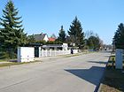
630 | Prince Eitel Friedrich of Prussia (1883–1942), son of Kaiser Wilhelm II. | around 1906 | The street that used to belong to Marzahn runs between Allee der Kosmonauten and Oberfeldstraße in a west-east direction. To the east it continues as Kornmandelweg into a small housing estate with a footpath and bike path to Blumberger Damm. |
|
| Elisabethstrasse
( Location ) |
610 | Elisabeth , female name | around 1900 | It connects the Allee der Kosmonauten in a west-east direction with the Blumberger Damm . The road continues to the east as Alwineweg. |

|
| Elsenallee
( Location ) |
280 | Elsen or Ellern, dialect for alder | around 1920 | The West-Ost- Allee was laid out around 1910 and was nameless for the first few years. It was given its current name when new street trees were planted . It connects Köpenicker Straße with Fortunaallee. |

|
|
Elsterwerdaer Platz
( Location ) |
290 × 270 (irregular square) |
Elsterwerda , city in Brandenburg | Nov 9, 1926 | When Biesdorf was being developed, the green space was called Place C , where no development was carried out. It stayed that way until 2007, when the subway station and the Biesdorf Center shopping complex were built in a rural style (brick, single storey; see picture). The name of the square was transferred to the newly created city square at this time . It is bordered by Weißenhöher Strasse (north), Köpenicker Strasse (east), Haltoner Strasse (south) and Minsker Strasse (west). |
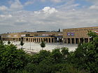
|
| Ernstroder way
( Location ) |
160 | Ernstrode , town in West Prussia , since 1920 Pigża, part of the municipality of Łubianka in Poland | March 8, 1935 | At first the way was called Straße 9 . The short north-south street opens up a settlement area between Bundesstraße 1, the railway embankment and the quarry pond. |

|
| Thanksgiving Path
( Location ) |
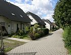
410 | Thanksgiving , Christian feast after the harvest in the fall, because of the simultaneous appointment of Bückeberg- and Erbhofweg (see right), however, the Nazi here primarily Reich Thanksgiving recognizable as naming motif | Apr 5, 1934 | Around 1906 the path was first referred to as Straße 2 . It was renamed along with the Bückebergweg (later Roßlauer Straße) and the Erbhofweg .
The Erntedankweg is north of the Biesdorf S-Bahn station and west of the Blumberger Damm and runs in a west-east direction; in the middle section it is just a footpath. |
|
| Erwinstrasse
( Location ) |
120 | Erwin , male first name, analogously: "Friend in war" | June 27, 1925 | It leads from Köpenicker Straße to Biesdorfer Weg in a west-east direction in the Biesdorf-Süd area. |

|
| Eugen-Roth-Weg
( Location ) |
340 (in the district) |
Eugen Roth (1895–1976), poet | Aug 4, 1997 | A small part of the street is in Marzahn . There are extensive outdoor sports facilities at the southern end of the path. Until the name was given, the path between Marchwitzastrasse and the sports fields on Lappiner Strasse was nameless. |

|
|
Fechinger way
( Location ) |
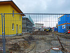
90 | Fechingen , district of Saarbrücken in Saarland | July 16, 2012 | A traffic route that was run as a private road during the construction work and runs east of the Theater am Park between Frankenholzer Weg and Walsheimer Strasse in a slight bend was publicly designated and designated at the request of the construction company NCC Germany . The name adapts to the surrounding street names according to places in the Saarland. |
|
| Feuerfalterstrasse
( Location ) |
120 | Fire butterfly, butterfly species | July 17, 2007 | The West-Ost-Straße begins at Wuhletal and extends to Kohlweißlingstraße. Then it continues as Brimstone Butterfly Road. |

|
| Fortunaallee
( Location ) |
860 | Fortuna , goddess of happiness | around 1900 | The avenue runs from Heesestrasse (north) to Zimmermannstrasse (south). The Catholic Herz-Jesu-Kirche is located on plot 27 . The house numbers 31-37 show a very compact building that was built as a retreat house. This became a rest home in the 1920s. |

|
| Frankenholz way
( Location ) |
400 | Frankenholz , part of the city of Bexbach in Saarland | Feb 21, 1940 | First the way was called Straße 59 . It connects the Blumberger Damm with the Walsheimer Straße. Its renaming is in connection with the reorganization of the Saar area into the German Reich in 1935. The paradise settlement was built along this street in the late 1990s on a former NVA site . Worth mentioning is a sandstone sculpture sun worshiper by Eberhard Bachmann , placed in front of house number 4 in 1964. It is almost identical to the work of the same name in the Oberseepark . |

|
| Fred-Löwenberg-Platz
( Location ) |
Ferdinand Löwenberg (1924–2004), resistance fighter | April 19, 2012 | The town square was built in three construction phases from 2009 on the corner of Cecilienstrasse and Wuhlestrasse. Up until 2007 there were three eleven-storey high-rise buildings that could no longer be rented and were therefore torn down. The new town square was created with funds from Stadtumbau Ost (around 330,000 euros) and designed with a fountain and paddling area. |

|
|
| Fridolinweg
( Location ) |
690 | Fridolin , male first name, analogously: "small, powerful prince" | Apr 4, 1934 | The traffic route was initially in residential areas Marzahn and was the road A . When the name was renamed, all west-east streets were given female first names and north-south streets were given male names. |

|
| Fuchsbergeweg
( Location ) |
260 | after the previous survey of the Fuchsberge in this area | around 1970 | The path, previously running through the Biesenhorst settlement without a name, is the northern continuation of the railway path and ends at Dankratweg. |

|
|
Sheaf path
( Location ) |
180 | Sheaf (agriculture) , bundle of grain | Apr 5, 1934 | Around 1906 the way was called Straße 5b . The Garbenpfad runs between Roßlauer Straße and Erntedankweg in a north-south direction, but it is a dead end. The name is related to the structural development of the area north of the Biesdorf S-Bahn station. Cereals, useful plants or |

|
| gardenstreet
( Location ) |
100 | Garden , cultivated grassland | March 24, 1907 | In the development planning around 1902 it was called Straße 2 . When it was named, it led to the nursery of Friedrich Braunsdorf. It first runs northeast from Köpenicker Strasse, then bends to the southeast and ends as a dead end . |

|
| Garzauer Strasse
( Location ) |
480 | Garzau, part of the community Garzau-Garzin in Brandenburg | Nov. 27, 1980 | The road, which is being laid out for a new large residential area, runs in the shape of a fork between Cecilienstraße and Buckower Ring. |

|
| Garziner Platz
( Location ) |
140 × 60 | Garzin, part of the community of Garzau-Garzin in Brandenburg | Nov. 27, 1980 | At first the green space was called place E ; the name was given with the inclusion of the street 34a running through the square . This green space in Biesdorf-Süd is bordered by Husumer Straße (north), Wulkower Straße (east), Straubinger Straße (south) and the imaginary northern extension of Dornacher Straße (postally Garziner Platz) (west). |

|
| Geraldstrasse
( Location ) |
300 | Gerald , male first name, analogously: "The one with the spear Waltende" | June 27, 1925 | The street, called street F at the first installation , connects the main path over Köpenicker Straße with a hiking trail on the Wuhlesee in a west-east route. |

|
| Geraldweg
( Location ) |
260 | after the street of the same name | 28 Sep 1959 | As a western continuation of Geraldstrasse, Geraldweg opens up the settlement area up to the railway embankments. Before that he was nameless. |

|
| Barley path
( Location ) |
1360 | Barley , cereal | Apr 5, 1934 | The traffic route was created by merging Street 1 and Street 7 . In later years a northern area fell away due to development (from 1962 University of the German People's Police , after 1990 Police Section 62 of Berlin). The name is related to the structural development of the area north of the Biesdorf S-Bahn station. The Gerstenweg runs from the Kornmandelweg in the north to the Erntedankweg in the south. |

|
| Gladauer way
( Location ) |
320 | Gladau , place in West Prussia , since 1920 Głodowo, part of the municipality of Ruciane-Nida in Poland | March 8, 1935 | When it was first installed, the path was called Straße 13 . It leads from Weißenhöher Strasse southwards to Wilhelmsbrücker Strasse. There it continues as Brachfelder Straße. |

|
| Gleiwitzer Strasse
( Location ) |
460 | Gliwice , town in Upper Silesia , since 1945 Gliwice in Poland | Apr 4, 1934 | When it was first installed, it was called Straße 26 . It leads from Grabensprung (W) to Köpenicker Straße (O). |

|
| Gottfried-Funeck-Weg
( Location ) |
600 | Gottfried Funeck, City Garden Director of East Berlin from 1975 to 1990. Under his leadership, the Berlin Garden Show was created in 1987, which in 1991 became the Marzahn Recreational Park. | Jan. 11, 2017 | Foot and bike path from Blumberger Damm to Hellersdorfer Straße |

|
| Ditch jump
( Location ) |
1900 | a historical field name, derived from the Bruchgraben , part of a drainage system | Nov 9, 1926 | The street, first street 15 , leads in a north-south direction from Alt-Biesdorf to the route of the underground line 5 (formerly VnK route ). Since the subway line was built, it has crossed this with a pedestrian bridge and then continues in the same direction to the colony on Fuchsberg on Alfelder Straße. The most noticeable building is the "House of Care and Care Dr. Arno Philippsthal ”under house number 29. Simple two-story houses were built here in 1939, which initially served as accommodation for prisoners of war and forced laborers. In 1945 the building became a hospital, and in the mid-1950s it became the Grave Jump Nursing Home (top picture). After the fall of the Wall , the old buildings were torn down and a new building complex was built in 2000. (lower picture) |

|
|
Green floodplain
( Location ) |
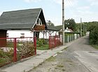
630 | Grassland and floodplain | 29 Sep 1988 | The street runs from Alt-Biesdorf southwards to the Wuhleufer . The Möwenweg joins there and the Green Aue now forms a dead end westwards . From here there is a walking connection to the Schillerfalterweg. The name is derived from an allotment garden previously located here, which was already recorded in the address book in 1913. |
|
| Guntramstrasse
( Location ) |
200 | Guntram , male first name | June 27, 1925 | At first it was called Street H . It runs between Köpenicker Straße and Biesdorfer Weg. To the west there is a footpath through a park to the railway embankments. |

|
|
Habichtshorst
( Location ) |
380 | Goshawk and Nest , a historical field name of this area | Nov 9, 1926 | The former street 46 became an access street in the 21st century in the new homonymous housing estate, which was planned around the year 2000 and implemented in stages by around 2010. A primary school with a sports hall along the streets Habichtshorst and Apfelwicklerstraße has been in planning since the 2000s, but has not yet been implemented (as of February 2016).
The road runs in a west-east direction from Köpenicker Straße to Pollnower Weg / butterfly meadow as a driveway. |

|
| Hadubrandstrasse
( Location ) |
360 | Hadubrand, son of Hildebrand ( Hildebrandlied ) | June 27, 1925 | At first it was called Road G . The Hadubrandweg and Hadubrandstraße streets run between Langer Weg and Biesdorfer Weg in a west-east direction and continue as a dead end on both sides . |

|
| Hadubrandweg
( Location ) |
500 | after the street of the same name | 28 Sep 1959 | Hadubrandweg, located in the Biesenhorst I settlement area, extends Hadubrandstrasse in a westerly direction to the former Berlin Wuhlheide marshalling yard . The private route was previously nameless. |

|
| Oat dough
( Location ) |
1370 | Oats , type of grain | Apr 5, 1934 | The result of the merging of Straße 2 and Straße 8 , the Hafersteig connects the Kornmandelweg (north) with the Erntedankweg (south). In later years it was shortened by rebuilding in the north area (today's police sports facility). The name is related to the structural development of the area north of the Biesdorf S-Bahn station. |

|
| Haltoner Strasse
( Location ) |
520 | Halton , town in the county of Cheshire in England, twin town of the Marzahn-Hellersdorf district | 8 Sep 2003 | The traffic route between Grabensprung and Elsterwerdaer Platz is also the eastern extension of Brandorfer Weg. It forms the center of a new housing estate. |

|
| Hannaweg
( Location ) |
120 |
Hanna , female first name, short form of Johanna or
modern spelling of the biblical Hannah , analogously: "the gifted" |
March 8, 1935 | At first the path was called street 20a . The Hannaweg runs between Ketschendorfer Weg and Cecilienstraße in a north-south direction. |

|
| Hanoier Street
( Location ) |
150 | Hanoi , capital of Vietnam , whose district Hoàng Mai is partner district of the district Marzahn-Hellersdorf | Nov 2015 | The traffic route branches off as a cul-de-sac south of Weißenhöher Straße. | |
| Hans Fallada Street
( Location ) |
490 | Hans Fallada (actually Rudolf Ditzen , 1893–1947), writer | Jan. 10, 1986 | Hans-Fallada-Strasse is a north-south street between a housing estate (east) and modern villas (west side). It has small cross branches to access the residential complex. |

|
| Main way
( Location ) |
870 | according to the importance of the road in the settlement | 28 Sep 1959 | The private road in north-south direction opens up the Biesenhorst I colony in the middle. |

|
| Haydnstrasse
( Location ) |
320 | Joseph Haydn (1732–1809), composer | around 1920 | It runs southwards from Waldbacher Weg and ends as a dead end under the access loop to Märkische Allee. There is a walking connection between Waldbacher Weg and Märkische Allee. |

|
| Heesestrasse
( Location ) |
520 | Heese, a family based in Biesdorf in the 19th and 20th centuries. | before 1920 | This traffic route in west-east direction leads from Köpenicker Straße to a bridge over the Wuhle just after the confluence with Dramburger Straße. To the east it continues as Heerstraße in Kaulsdorf. It was laid out around 1910 and named Straße 43 . The street was given its current name after a farming family from Biesdorf, of which several members have contributed to the development of the village. |

|
| Heidefalterweg
( Location ) |
380 | Heather colored owl , popularly known as "heather butterfly" |
July 17, 2007 (The handover took place on August 1, 2008.) |
The street runs in a west-east direction from Köpenicker Straße to Segelfalterweg. |

|
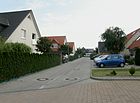
| Heather path
( Location ) |
90 | Heather family | Apr 2, 2002 | The road lies south of Alt-Biesdorf and connects Am Brodersengarten with the Pfingstrosenweg in a west-east direction. |
|
| Hiltrudstrasse
( Location ) |
580 | Hiltrud , old German female first name; analogously: "strong in battle" | March 8, 1935 | At first it was called Straße 21 . When it was renamed, almost all west-east streets were given female names and north-south streets were given male names. Contrary to the naming practice, Hiltrudstraße runs straight from north to south between Elisabeth and Cecilienstraße. |

|
| Behind the post ( location ) | 100 | Description of the location of the post office in Oberfeldstrasse | Aug 15, 1997 | The street section between Schulstrasse and Beethovenstrasse (north-south route, west parallel to Oberfeldstrasse) was nameless for many years. In 1997 it was named after the striking building. |

|
| Millet route
( Location ) |
500 | Millet , cereal | July 15, 1961 | The street connects the Oberfeldstraße with the Gerstenweg in a west-east direction and has a small continuation as a dead end until shortly before the Blumberger Damm. Between 1934 and 1961 the Hirseweg was the eastern part of the Erntedankweg , the name of which was later given to the Bückebergweg . The name is related to the structural development of the area north of the Biesdorf S-Bahn station. |

|
| Husumer Strasse
( Location ) |
540 | Husum , city in Schleswig-Holstein | Nov 9, 1926 | It was laid out as Straße 22 and unofficially called August-Behrend-Weg . The traffic route connects the trench jump with Köpenicker Straße in a west-east direction and touches Garziner Platz to the north at about half its length. |

|
|
Ingeweg
( Location ) |
410 | Inge , female first name, short form of Ingeborg, Ingetraut, Ingelore etc. | Apr 4, 1934 | First was the way road F . When it was renamed, almost all west-east streets were given female names and north-south streets were given male names. The Ingeweg runs from Fridolinweg to Irmfriedstraße and continues to the east as Dudweiler Straße. |

|
| Irmastrasse
( Location ) |
300 | Irma , female first name, short form of Irmgard; analogously: "world (citizen)" | June 27, 1925 | The slightly pivoted west-east route was laid out as the L road at the beginning of the 20th century . It connects Köpenicker Straße with Biesdorfer Weg. Beyond, it continues - slightly to the north - as Brachliner Strasse. |

|
| Irmfriedstrasse
( Location ) |
620 | Irmfried , old German male first name, analogously: "great protection" | June 9, 1933 | When the road network was laid out, it was called Straße 63 . When the name was renamed, all west-east streets were given female names, the north-south streets were given male names. The traffic route connects the Alwineweg / Völklinger Straße with the Cecilienstraße. |

|
|
Joachim-Ringelnatz-Strasse
( Location ) |
680 + 130 + 120 + 100 + 70 + 50 | Joachim Ringelnatz (actually Hans Gustav Bötticher , 1883–1934), poet | Jan. 10, 1986 | The arched street runs between Mettlacher Strasse (north) and Hans-Fallada-Strasse (southwest). It opens up new residential buildings that were completed in 1995 and offer around 400 apartments. All buildings and the streets in between - interrupted in the middle by a north-south green corridor - are grouped under the name Joachim-Ringelnatz-Siedlung. The cross streets in the west-east direction do not have their own names (indicated with "+" for the length). On January 11, 2017, the foundation stone for the extension of the Ringelnatz estate was laid. Seven new buildings with a further 299 apartments should be ready for occupancy in winter 2018 [obsolete] . |

|
|
Ketschendorfer way
( Location ) |
920 | Ketschendorf , part of the city of Fürstenwalde in Brandenburg | May 11, 1938 | When it was first built at the beginning of the 20th century, the route was called Luisenstrasse . The Ketschendorfer Weg runs in a west-east direction between Maratstrasse and Hiltrudstrasse in Biesdorf-Nord. |

|
| Klara-Schabbel-Strasse
( Location ) |
500 | Klara Schabbel (1894–1943), journalist and resistance fighter | Jan. 14, 1976 | The road leads from the Güteraußenring in the west to the Grabensprung road in the east.
It was originally called Street 26a . In the mid-1930s it was incorporated into Warmbader Strasse from Karlshorst , which was named in 1914 after the place Warmbad in the former colony of German South West Africa . From 1941 the newly built outer freight ring crossed the street at the same level. In June 1948, the Warmbader Strasse passenger station for the new suburban line Grünau – Kaulsdorf was put into operation, but suburban traffic was discontinued in March 1949. Before 1942, the Reichsbahn had already started building the Wuhlheide marshalling yard , which was to extend four and a half kilometers west of Biesdorf. The only passage was the level crossing at Warmbader Straße, over which a bus line ran. On August 15, 1952, the level crossing was permanently closed and the road was split into two parts. The almost 200-meter-long middle section of the road between the district boundary of Karlshorst / Biesdorf and the railway line was demolished and built over, and the Wuhlheide marshalling yard extended to this point. Only the continuous street name remained until 1976, when the Biesdorfer part was renamed Klara-Schabbel-Strasse and the western section in Karlshorst was renamed Robert-Siewert-Strasse . |

|
| Kleiner-Heufalter-Weg
( Location ) |
160 | Small hay moth , butterfly species | July 17, 2007 | The path is a dead end in the Biesdorf-Süd area. It connects the Rapeseed White Road with the Pollnower Weg. |

|
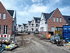
| Klompenweg
( Location ) |
95 | Klompen , the Dutch and Low German term for wooden shoes. | Dec 10, 2017 | The access road in the new development area goes from an der Grachten to Grüne Aue. A garden city in the style of a Dutch quarter has emerged directly on the Wuhle. |
|
|
Köpenicker Strasse
( Location ) |
3670 (in the district) |
Köpenick , direction of the historical traffic route between the village green Biesdorf and the city of Cöpenick | before 1838 | The street begins in the north as a continuation of the Blumberger Damm on the Alt-Biesdorf street . At Elsterwerdaer Platz underground station, it crosses the route of underground line 5 . In its northern part it bends slightly several times and continues in the Köpenick district to Rudolf-Rühl-Allee at the Wuhlheide S-Bahn station . The district boundary is directly behind property no. 317. In the middle section of Köpenicker Straße is the community center south of the Biesdorf Evangelical Reconciliation Church (lower picture). Köpenicker Straße is not only the main access road to Biesdorf-Süd, but also an important north-south traffic connection that is often congested. The planned extension of the Tangentialen Link Ost (TVO) should reduce the traffic load. |

|
|
Cabbage White Road
( Location ) |
490 | Large cabbage white butterfly, species of butterfly | July 17, 2007 | The street in the Habichtshorst area is the south-eastern continuation of Lauinger Straße and leads to Dukatenfalterweg. In addition, it runs as a footpath and bike path to the Wuhle. |

|
| Kornmandelweg
( Location ) |
530 | Corn almond : Almond , former North German measure for 16 pieces. This refers to the number of grain stacks (= grain ) that are set up . | Apr 5, 1934 | When it was first constructed, the path was run as Road IV . The name is related to the structural development of the area north of the Biesdorf S-Bahn station. It is bordered by a larger area that is used as a police school (dog training). The Eitelstrasse joins as a western continuation; to the east it is a dead end. Pedestrians and cyclists have access to Blumberger Damm. |

|
| Kreuzschnabelstrasse
( Location ) |
480 | Crossbill , songbird | Nov 9, 1926 | The original street 19 got its name after the development. The straight street runs between Grabenprung in the west and Köpenicker Straße in the east. |

|
| Kulmseestrasse
( Location ) |
660 | Kulmsee , town in West Prussia , Chełmża in Poland since 1920 | May 11, 1938 | At the first alignment it was called Auguststrasse . It runs in the western section directly north of the embankment of the U- and S-Bahn in a west-east direction between Luise-Zietz-Straße and Oberfeldstraße. In terms of traffic, it is divided into an east and west section, which is only connected by a footpath. |

|
|
Landhausring
( Location ) |
740 | Landhaussiedlung, the former residential colony for women on the grounds of the Wilhelm Griesinger Hospital | Aug 20, 2007 | The 13 individual buildings were erected at the same time as the hospital and, together with the remaining structures, are now under monument protection. Due to the reduction in area of the site (until 2012 Vivantes Klinikum Hellersdorf , since then owned by the Unfallkrankenhaus Berlin ), the country houses are outside and are to be sold. The access road, previously nameless, was given the descriptive name at the request of the real estate agent asenticon AG. |

|
| Long way
( Location ) |
1400 | Length of the traffic route | 28 Sep 1959 | The traffic route leading in north-south direction from Dankratweg to Hadubrandweg is a private road and opens up the settlement area of Biesenhorst I. Before 1959 it was nameless. |

|
| Lappiner Platz
( Location ) |
120 × 60 | Lappin , place in West Prussia , since 1920 Lapino, part of Gdańsk in Poland | May 11, 1938 | The square was inaugurated as Schillerplatz around 1906 . Lappiner Platz is in the middle of Lappiner Straße, which it divides. The square is bounded by Otto-Nagel-Straße to the west and by Eckermannstraße to the east. It is a counterpart to Boschpoler Platz, which is about 1080 meters further north. There is a large outdoor sports facility on Lappiner Platz. |

|
| Lappiner Strasse
( Location ) |
370 + 130 | Lappin , place in West Prussia , since 1945 Lapino, part of Gdańsk in Poland | May 11, 1938 | This street runs in a west-east direction between Eugen-Roth-Weg and Oberfeldstraße. To the east it continues as a corn path. |

|
| Lauchhammerstrasse
( Location ) |
260 | Lauchhammer , city in Brandenburg | Nov 9, 1926 | The street was laid out as street 30 . Running slightly to the southwest, it connects Stader Strasse with Pirolstrasse in the south. The trench jump curve , a railway line belonging to the outer freight ring , ran along the east side of the road from 1940 to 1978. |

|
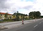
| Lauinger Strasse
( Location ) |
340 | Lauingen , city in Bavaria, twin town of the Marzahn-Hellersdorf district | Aug 30, 2002 | Lauinger Straße is located in the Biesdorf-Süd area, parallel to Alt-Biesdorf. It runs between the embankment of the U5 underground line and Apollofalterallee in a north-west-south-east direction. To the south it continues as Kohlweißlingstrasse. Your development is dominated in the north by the back of a hardware store . Since 2010 private homes have been built on the south side. |
|
| Lindenstrasse
( Location ) |
280 | Linden (genus) , genus of deciduous trees | around 1907 | It runs between Köpenicker Straße at Elsterwerdaer Platz and Apollofalterallee in a north-west-south-east direction. |

|
| Lissaer Strasse
( Location ) |
360 | Lissa , town in the province of Poznan , since 1920 Leszno in Poland | Nov 9, 1926 | When the land was parceled out, it was laid out as Street 23 . It runs between Am Waldberg and Grabensprung in a west-east direction. |

|
| Lobelienweg
( Location ) |
80 | Lobelia , Campanulaceae, named after the Flemish botanist and doctor Matthias de L'Obel (Lobelius) | Apr 2, 2002 | The private road is located south of Alt-Biesdorf and connects Am Brodersengarten with the Pfingstrosenweg in a west-east direction. |

|
|
Lötschbergstrasse
( Location ) |
480 | Lötschberg , Alpine crossing in Switzerland | March 8, 1935 | It runs as a southern continuation of Mozartstraße between Alt-Biesdorf (N) and Bruchgrabenweg (S). First it was named after the direction Karlshorster Weg (until around 1930) and Karlshorster Straße (around 1930 to 1935). |

|
| Luise-Zietz-Strasse
( Location ) |
1200 (in the district) |
Luise Zietz (1865–1922), writer and politician | May 24, 1951 | Around 1906 it was laid out as Fürstenstrasse ; other parallel streets were given general names for rulers (Fürsten-, Herzog-, Prinzen-, König- and Kaiserstraße). After the Second World War, the rulers' titles were replaced by new street names.
The house number range 87–129 (odd; west side between Marchwitzastraße and Allee der Kosmonauten) belongs to Berlin-Marzahn . The street runs in a straight line from north to south between Allee der Kosmonauten and Kulmseestrasse and opens up a residential area. In the area around Berlin-Hellersdorf, other traffic routes have been renamed after artists or writers. |

|
|
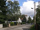
Corn way
( Location ) |
1040 | Corn , a type of grain | Apr 5, 1934 | When it was first installed, the path was called Straße 3 . The name is related to the structural development of the area north of the Biesdorf S-Bahn station. The Maisweg runs north-south from the Kornmandelweg over the Rapsweg intersection and, after a bend, joins the Oberfeldstraße westward. |
|
| Maratstrasse
( Location ) |
1950 | Jean-Paul Marat (1743–1793), French revolutionary | May 24, 1951 | When the road system was laid out, it was called Herzogstrasse ; other parallel streets were given general names after rulers (Fürsten-, Prinzen-, König- and Kaiserstraße). The street runs in a north-south direction between Annenstraße and Kulmseestraße.
After the Second World War, the rulers' titles were replaced by new street names. The northern parish of the Church of Reconciliation is located at number 100 . |

|
| Mettlacher Strasse
( Location ) |
180 | Mettlach , municipality in Saarland | March 8, 1935 | At first it was called Straße 24 . It runs in a west-east direction as a connection between Christelweg and Joachim-Ringelnatz-Straße. In 1986 it was extended a little to the east. |

|
| Minsk Street
( Location ) |
330 | Minsk , capital of Belarus; the Minsk city districts "Partisan" and "Oktjabr" are city partners of the Marzahn-Hellersdorf district | 8 Sep 2003 | It runs from Weißenhöher southwards to Haltoner Straße, touching Elsterwerdaer Platz. |

|
|
Seagull path
( Location ) |
430 + 120 | Seagulls , a bird family within the plover species | 29 Sep 1988 | It runs parallel to the Wuhle to the west between Alt-Biesdorf and Grüne Aue. The path was expanded and named with the inclusion of a previously unnamed Wuhlepfad. It has three western cross arms. |

|
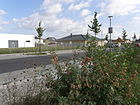
| Mohrenfalterstrasse
( Location ) |
360 | Mohrenfalter , butterfly species | July 17, 2007 | The street runs in a west-east direction from Köpenicker Straße to Segelfalterweg, it forms some access arms, u. a. to the butterfly meadows. |
|
| Mozartstrasse
( Location ) |
350 | Wolfgang Amadeus Mozart (1756–1791), composer | before 1922 | The north-south road connects the Waldbacher Weg with Alt-Biesdorf. It continues to the south as Lötschbergstrasse. |

|
|
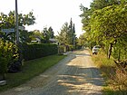
Nitzwalder Strasse
( Location ) |
400 | Nitzwalde , place in West Prussia , since 1920 Nicwałd in Poland, part of the municipality of Gruta | Jan. 7, 1928 | When it was first installed, it was called Straße 15 . It is located in the very south of Biesdorf and runs parallel to the Wuhleufer between Buchenhainer and Bismarcksfelder Straße. The last stretch is a dead end. |
|
| North promenade
( Location ) |
550 | Direction North and Promenade | before 1957 | This street, initially nameless in the development, can be used by motor vehicles at the western end. Then it runs as a footpath and bike path through the Biesdorf Castle Park to Oberfeldstrasse. The Waldbacher Weg to the west and the Frankenholzer Weg to the east continue in the same direction. |

|
|
Oberfeldstrasse
( Location ) |
630 | Oberfeld, historical name of a field in the Biesdorf area | May 3, 1935 | The road was partially re-routed at the beginning of the 20th century. The previous streets ( Marzahner Straße and Bahnhofstraße ), which already existed in the 19th century, have been included. At number 58 is the Catholic church "Maria, Queen of Peace ", which was inaugurated in September 1984 (picture). In May 1986 the road was divided into a north and a south section when the level crossing was closed for motor vehicles. It was previously one of the busiest streets in northern Biesdorf. | |
|
Öseler Strasse
( Location ) |
640 | Ösel , German name of the Estonian island Saaremaa | May 11, 1938 | When it was first installed around 1906, it was called Karlstrasse . |

|
|
Otto-Nagel-Strasse
( Location ) |
1780 | Otto Nagel (1894–1967), painter | Jan. 4, 1968 | It was first laid out as Königstrasse . The street name given in 1968 honors the artist, who had just died at the time, who was President of the Academy of Arts of the GDR until 1962 and also a member of the People's Chamber until 1954 .
Stolpersteine were laid in front of parcel number 38 on June 18, 2003 in honor of the Fanny, Phillip and Margot-Edith Feibusch family who lived here. Massive fascist riots drove all three out of Germany in 1938. |

|
|
Park path
( Location ) |
180 | Biesdorfer Stadtpark , created from parts of the estate park and an industrial area added later in the 19th century | after 1954 | After the downsizing of the city park, the Parkweg was laid out as a short west-east road between Oberfeldstrasse (as a continuation of Beethovenstrasse) via Wildrosenweg to the west side of the park for traffic development. A part of the Biesdorf Park is located on the south side of the Parkweg. |

|
| Paulinenauer Strasse
( Location ) |
260 | Paulinenaue , municipality in Brandenburg | Nov 9, 1926 | After the land was parceled out, it was called Straße 18 . It is a west-east traffic route between Schackelsterstrasse / Am Weidenbusch and Köpenicker Strasse. |

|
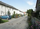
| Peony Path
( Location ) |
440 | Peonies , ornamental plants | Apr 2, 2002 | The private road is located south of the Alt-Biesdorf road and connects Am Brodersengarten with the Heidekrautweg. |
|
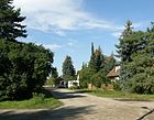
| Oriole Street
( Location ) |
560 (in the district) | Golden Oriole , native songbird | Nov 9, 1926 | Before the laying of the railway line on an embankment, the street, at its first installation street 25 , was continuous from Karlshorst to Biesdorf in a west-east direction. Now each of the two districts has a remaining section of the Oriole Road. In Biesdorf it connects Lauchhammerstraße with the Graben jump. |
|
| Pollnower Weg
( Location ) |
670 | Pollnow , town in Pomerania , since 1945 Polanów | March 11, 1937 | At first the path was called Straße 37 . The Pollnower Weg is a cul-de-sac that begins on the Habichtshorst street and leads south. |

|
| Prignitzstrasse
( Location ) |
1740 | Prignitz , landscape in Brandenburg and Mecklenburg-Western Pomerania | May 24, 1951 | Around 1906 it was laid out as Prinzenstrasse ; other parallel streets were given general names after rulers (Fürsten-, Herzog-, König- and Kaiserstraße). The street runs in a north-south direction (from Cecilienstraße to Kulmseestraße) and opens up the former suburban settlement of Hellersdorf. |

|
|
Püttlinger Strasse
( Location ) |
220 | Püttlingen , city in Saarland | Feb 21, 1940 | When it was first installed it was called Straße 61 . It leads from the Ostbahn southwards to the Frankenholzer Weg. Its renaming is in connection with the reorganization of the Saar area into the German Reich in 1935. It is located in the paradise settlement that emerged in the 1930s. |

|
|
Rägeliner Strasse
( Location ) |
200 | Rägelin, part of the municipality Temnitzquell in Brandenburg | Nov 9, 1926 | At first it was called Straße 29 . It runs in a north-south direction from the VnK line (since 1988 underground line 5 ) parallel to the Berlin outer ring to Stader Strasse. It is connected to Richard-Kolkwitz-Weg in Berlin-Karlshorst by a pedestrian tunnel under the Berlin outer ring . |

|
| Rapeseed Route
( Location ) |
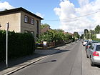
800 | Oilseed rape , a useful plant of the cruciferous family | July 15, 1961 | First the way was called Straße II , after the passing of the Reichserbhofgesetz in 1934 it got the name Erntedankweg . The naming made in 1961 is based on useful plants. The Rapsweg is north of the Biesdorf S-Bahn station. |
|
| Rapeseed White Road
( Location ) |
350 | Rapeseed white butterfly, species of butterfly |
July 17, 2007 (The handover took place on August 1, 2008.) |
The access road runs in a north-south direction between Apollofalterallee and Mohrenfalterstraße. |

|
| Rauhkopfweg
( Location ) |
120 |
Orange fox , a poisonous lamellar fungus , "Mushroom of the year 2002" |
December 15, 2006 (The handover took place on April 5, 2007.) |
The Rauhkopfweg runs in a north-south direction from Budapester Weg to Haltoner Strasse in a newly developed residential area. The name was given at the request of a local mushroom grower . |

|
| Rye dough
( Location ) |
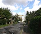
480 | Rye , grain | Apr 5, 1934 | At first it was called Steig Strasse 4 ; the new name is related to the structural development of the area north of the Biesdorf S-Bahn station. The Roggensteig connects the area south of the Kornmandelweg (starting at a cross arm of the Oberfeldstraße) in a north-south direction with the Rapsweg and is located in Biesdorf-Nord. |
|
|
Roßlauer Strasse
( Location ) |
520 | Roßlau , district of Dessau-Roßlau in Saxony-Anhalt | July 31, 1947 | First it was called Straße 1 , from 1934 it was named Bückebergweg , named after the Bückeberg near Hameln survey , on which the National Socialists held the annual Reichserntedankfest . The street was renamed at the same time as the Erbhof and Erntedankweg. The Roßlauer Straße is north of the Biesdorf S-Bahn station and connects the Oberfeldstraße with the Ährenweg. |

|
| Rotraudstrasse
( Location ) |
540 | Rotraud , female first name, analogously: "fame" and "strength" | before 1902 | At first it was also written on Rottrautstrasse . When it was renamed, (almost) all west-east streets were given female names and north-south streets were given male names. |

|
| Flatly
( Location ) |
310 | after the arched street layout | March 8, 1935 | Despite the name, it is not a path that leads around another area, but merely represents a segment of a circle. At first it was called Straße 56 . |

|
|
Schackelsterstrasse
( Location ) |
1240 | one ( "schack, schack") to its reputation designated Magpie bird | Nov 9, 1926 | The street, known as Straße 17 when it was first built , runs in a west-east direction from Rägeliner to Wulkower Straße, parallel to the route of the U-Bahn line 5 in the south . The trench jump curve , a railway line belonging to the outer freight ring , crossed the road from 1940 to 1978 at a level crossing west of the confluence with Am Waldberg . Behind house no. 63, the former route can still be clearly seen today. |

|
| Schillerfalterstrasse
( Location ) |
520 | Large Schiller Butterfly and Small Schiller Butterfly, butterfly family | July 17, 2007 | The street in the former Habichtshorst colony connects the Augenfalterstraße with the Dukatenfalterweg in a north-west-south-east route. |
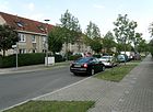
|
| Schlochauer Strasse
( Location ) |
440 | Schlochau , a town in West Prussia , since 1945 Człuchów | before 1902 | It is the westernmost street of the district and connects the Weißenhöher Straße with the Bruchgrabenweg in a north-south direction. In addition, it is a 100 meter long dead end street. |

|
| Schmellwitz path
( Location ) |
260 | Schmellwitz , district of Cottbus in Brandenburg | June 7, 2004 | It is located in a small settlement between Bundesstraße 1, the railway embankment and the quarry pond. The private road was created during the structural expansion of the settlement. At the request of the construction and real estate company operating here, the street name was assigned after their headquarters. |

|
| Schrodaer Strasse
( Location ) |
480 | Schroda , town in the province of Poznan , since 1920 Środa Wielkopolska | March 11, 1937 | The street was laid out as street 6 . It runs in stages between Debenzer and Beruner Strasse and surrounds the Klein-Biesdorf-Süd colony. |

|
| School alley
( Location ) |
250 | School , a primary school built for the catchment area Biesdorf-Süd in this alley | 28 Sep 1959 | The lane connects the long way in the former colony Biesenhorst I via a nameless footpath running in north-south direction with the Alberichstraße. In terms of traffic, it is a dead end . |
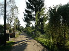
|
| Schulstrasse
( Location ) |
340 + 310 | School , the former village school, in the GDR 17th polytechnic high school "Otto Nagel", since the 1990s Otto-Nagel-Gymnasium | around 1920 | The street was named after one of the first structures in the early 20th century; the school is now a listed building (top picture). When the railway line was built to the south, the road was divided into an eastern and a western section (lower picture: eastern "stub"). The western section connects Haydnstrasse with Braunsdorfstrasse. The eastern section extends from the railway line to Oberfeldstrasse. In addition, it leads as a footpath across the residential courtyard to Wildrosenweg. |
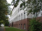
|
| Schwabenallee
( Location ) |
1550 | Swabia , landscape in Baden-Wuerttemberg and Bavaria | May 24, 1951 | When it was first built around 1900, it was called Königsallee . It is located in the Biesdorf-Süd area and connects Habichtshorst (north) with Arnfriedstrasse (south). In the lower third it is interrupted by Schwabenplatz. |
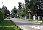
|
| Schwabenplatz
( Location ) |
80 × 60 | Swabia , landscape in Baden-Wuerttemberg and Bavaria | May 24, 1951 | The square - first called Königsplatz - is a rectangle placed on a corner. It is located on the intersection of Schwaben- / Eichenallee in the middle of a residential area. There are no buildings on the green area; its edges are composed of a double row of trees. |

|
| Segelfalterweg
( Location ) |
100 | Sail butterfly , butterfly species | July 17, 2007 | The path is a short north-south road between Aurorafalterweg, Heidefalterweg and Mohrenfalterstraße. |

|
| Scythe path
( Location ) |
100 | Scythe , garden tool | Apr 5, 1934 | The traffic route was initially called Straße 6 . The short access road goes east from Gerstenweg. The path is only connected to the Blumberger Damm via a foot / bike path. The new name is related to the structural development of the area north of the Biesdorf S-Bahn station. |

|
| Siegmarstrasse
( Location ) |
720 | Siegmar , male first name, analogously: "legendary" | June 9, 1933 | At first the traffic route was called Straße 81 . When the name was renamed, all west-east streets were given female names, the north-south streets were given male names. Siegmarstraße runs from a footpath that separates the Wuhletal Landscape Park and the Gardens of the World via Völklinger Straße to Cecilienstraße. |

|
| Spatenweg
( Location ) |
420 | Spade , garden tool | Apr 5, 1934 | The first name was Straße 11 . The new name is related to the structural development of the area north of the Biesdorf S-Bahn station. The Spatenweg connects the Hafersteig with the Blumberger Damm and at the same time forms the continuation of the Biesdorf promenade. To the east of Blumberger Damm there is a walking extension to Warener Straße. |

|
| Stachelbartweg
( Location ) |
80 | Branched goatee , an edible mushroom with a coral-like structure, "Mushroom of the Year 2006" |
December 16, 2006 (The traffic was opened on April 5, 2007.) |
The Stachelbartweg leads north-south from Budapester Weg to Haltoner Straße in a newly developed residential area. The name was given at the request of a local mushroom grower . |

|
| Stader Strasse
( Location ) |
240 | Stade , city in Lower Saxony | Nov 9, 1926 | The street was created from street 21 and street 21a . The Stader Straße connects the Rägeliner with the Am Waldberg street as a west-east train. In the 2000s, it was lengthened by reducing Walslebener Platz. |
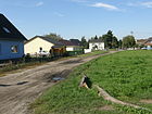
|
| Stawesdamm
( Location ) |
160 | Stawes (proper name) and Damm (Wall) | before 1890 | The route is already marked on earlier maps, but it has no name. It connects the southern carriageway of Alt-Biesdorf with Weißenhöher Strasse. According to a site plan from 1733, there was “Stawes Wiesen” in Biesdorf, so the street was probably named after the owner. |

|
| Straubinger Strasse
( Location ) |
510 | Straubing , city in Bavaria | Nov 9, 1926 | At first it was called Straße 24 . The straight west-east street runs between Grabensprung and Köpenicker Strasse. |

|
|
Tiergartenstrasse
( Location ) |
420 | Zoo , spacious park for animals | before 1920 | At first it was called Street N . The new name is based on the abundance of wild animals in the Biesdorf Forest to the west and south. Tiergartenstrasse runs between Köpenicker Strasse and Biesdorfer Weg in a gently curved west-east route. |

|
| Tychyer Street
( Location ) |
140 | Tychy , (German: 'Tichau'), city in the Silesian Voivodeship in Poland; Sister town of Marzahn-Hellersdorf | Aug 30, 2002 | The street runs between Alt-Biesdorf and Lauinger Straße. |

|
|
Völklinger Strasse
( Location ) |
210 | Völklingen , city in Saarland | March 8, 1935 | First it was laid out as Road 25a . It is the easternmost section of the west-east street Elisabethstraße - Alwineweg - Völklinger Straße and ends as a dead end . Its renaming is related to the reorganization of the Saar area into the German Reich in 1935. |

|
| Suburban way
( Location ) |
350 |
Suburb , term for a village in front of a larger city (this refers to the situation of Biesdorf in relation to the city of Lichtenberg further to the west or Berlin at the time the name was given) |
March 8, 1935 | At first the way was called Straße 55 . It goes south from Bruchgrabenweg and after the confluence of the circular path it continues as a dead end for around 90 meters. |
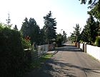
|
|
Waldbacher way
( Location ) |
340 + 200 | Waldbach , place in Austria in Styria | Feb 12, 1935 | When it was first set up, the route was called Wagnerstrasse . At its western end, the street runs under the Märkische Allee. It will then be interrupted by a railway embankment on Braunsdorfstrasse. To the east, the path continues to Oberfeldstrasse. The further course is called the north promenade and runs parallel to the south along the S-Bahn route through the Biesdorf city park to Blumberger Damm . |
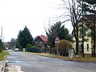
|
| Walsheimer Strasse
( Location ) |
600 | Walsheim , part of the municipality of Gersheim in Saarland | Feb 21, 1940 | When it was first installed, it was called Straße 60 . The name was given in connection with the reorganization of the Saar area into the German Reich in 1935. It runs in a north-east-south-west direction parallel to the embankment of the subway . To the north of this street, the paradise settlement was built at the end of the 20th century on a former NVA site . The road is divided into three parts according to traffic, a middle section is a pure footpath. |
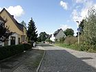
|
| Walslebener Platz
( Location ) |
120 × 80 | Walsleben , municipality in Brandenburg | Nov 9, 1926 | First, the area was called Square D . The trench jump curve , a railway line belonging to the outer freight ring , ran across the square from 1940 to 1978. The eastern half has now been built on with twelve villas. The area has no recognizable space character . On the western half there is a public building (school?), Which is followed by a sports field as far as Pirolstraße. |
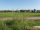
|
| Waren Street
( Location ) |
840 + 130 | Waren (Müritz) , town in Mecklenburg-Western Pomerania | Aug 1, 1995 | In 1995 the extension of the Rapsweg east of the Blumberger Damm up to the Wilhelm-Griesinger-Hospital and the branch to the MEON-Gewerbepark in Warener Straße were named.
The street initially runs (130 meters) in a west-east direction to the main entrance of the Unfallkrankenhaus Berlin (ukb) . From there it continues in a T-shape in north and south directions. |

|
| Wateweg
( Location ) |
430 | Wate, figure of Gudrun Sage whose back and forth in the water ebb and tide to create | Dec. 1, 1993 | Before the name was given, the Wateweg was part of the Biesdorfer Weg . It runs between Köpenicker Strasse and the west bank of the Wuhlesees in a north-south direction and connects Geraldstrasse with Hadubrandstrasse. |

|
|
Weissenhöher Strasse
( Location ) |
1310 | Weißenhöhe , town in the province of Poznan , since 1920 Białośliwie in Poland | June 27, 1925 | The traffic route, first designated as street 1 , leads in a west-east direction from Schlochauer Straße to Köpenicker Straße. The most striking buildings are the Biesdorf Center shopping center and the Arno-Philippsthal-Heim complex on its south side (picture), house number 64. |
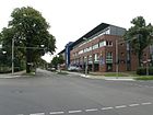
|
| Wheat path
( Location ) |
920 | Wheat , type of grain | Apr 5, 1934 | At first it was called Street 5 ; the new name is related to the structural development of the area north of the Biesdorf S-Bahn station. The Weizenweg connects a cross arm of Oberfeldstraße in north-south direction with Roßlauer Straße and is located in Biesdorf-Nord. |

|
| Wettersternweg
( Location ) |
220 |
Weather star , a mushroom that reacts to humidity;
"Mushroom of the year 2005" |
December 16, 2006 (the traffic was opened on April 5, 2007) |
The Wettersternweg leads in a north-south direction from Budapester Weg to Haltoner Straße in a newly developed residential area. The name was given at the request of a local mushroom grower . |
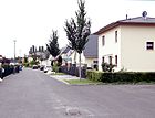
|
| Wild rose trail
( Location ) |
220 | Wild roses , flowering shrubs with edible fruits | around 1953 | The street runs in a north-south direction between the north promenade and Parkweg. It was created during the expansion of the village center north of Alt-Biesdorf. Your development consists of uniform three-story building wings. |
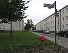
|
| Wilhelmsbrücker Strasse
( Location ) |
140 | Wilhelmsbrück , town in the province of Poznan , since 1920 Podzamcze, part of the city of Wieruszów | June 27, 1925 | It is the west-east connection between Brachfelder Straße and the trench jump at the level of the quarry pond. The entire length of the north side is occupied by sports fields, the south side is developed with residential properties. When it was first installed, it was called Straße 4 . |

|
| Wuhlestrasse
( Location ) |
460 + 140 + 60 | Wuhle , river through Biesdorf | Nov. 27, 1980 | This street was laid out as part of the construction of further residential buildings in what was then the Hellersdorf district. It has belonged to the Biesdorf-Nord area since 2001 and has a main branch in north-south direction between Cecilienstraße and Buckower Ring. There are also cross branches of the same name to develop the residential area. |
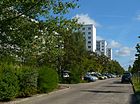
|
| Wuhletal
( Location ) |
590 | Wuhle , river through Biesdorf | around 2007 | The straight road between Alt-Biesdorf and the southern branch of the Grünen Aue is a cycling and hiking trail. |
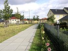
|
| Wuhleweg
( Location ) |
120 | Wuhle , river through Biesdorf | Oct 1, 1993 | The previously unnamed street was named after the nearby allotment garden 'Neues Leben Wuhleweg'. It leads in a west-east direction from the Grünen Aue to the Möwenweg. |

|
| Wuhlgartenweg
( Location ) |
140 + 530 | Wuhlgarten , former name of the park along the Wuhle, who is also in the first name of Wilhelm Griesinger Hospital was used | May 15, 1995 | The footpath, which existed long before the name was given, runs between Oberfeldstrasse and Altentreptower Strasse under the Blumberger Damm. A short distance to the Biesdorf S-Bahn station can be traveled by motor vehicle. |

|
| Wulkower Strasse
( Location ) |
1080 | Wulkow , part of the community Neuhardenberg in Brandenburg | Nov 9, 1926 | At first it was called Straße 34 . It runs between Köpenicker Strasse and Straubinger Strasse, initially about 70 m in an east-west direction, then further in a north-south direction. |

|
|
Zauchwitzer Strasse
( Location ) |
180 | Zauchwitz , part of the city of Beelitz in Brandenburg | Nov 9, 1926 | At first it was called Street 17a . It is a connection between Arnsberger Straße and Grabensprung in the Biesdorf-Süd area. |

|
| Zimmermannstrasse
( Location ) |
320 (in the district) |
Otto Zimmermann (1863–1927), local politician in Biesdorf | around 1922 | The street was laid out around 1900, but was not listed in the Berlin address book until 1923. It runs in a west-southeast direction between Köpenicker and the street An der Wuhle (in the Kaulsdorf district ) over a Wuhle bridge. |

|
| Lemon Butterfly Trail
( Location ) |
140 | Brimstone , Central European butterfly species | July 17, 2007 | The street runs in a west-east direction from a green area on Wuhle-Weg to Schillerfalterstraße. |

|
| To the butterflies
( Location ) |
220 | butterfly | 2009 | The road to the Faltern was laid out a few years later in the new settlement area and leads in a west-east direction as an extension of the Distelfalterstraße to Am Brodersengarten as a footpath, then as a traffic route to the Green Aue. |

|
| To the forester's house
( Location ) |
200 | a former forester's house here | March 15, 1999 | The road leads from Buckower Ring to Warener Straße and - only usable for special vehicles - through the area of the accident hospital to Brebacher Straße. She was previously nameless. |

|
No longer existing or only planned streets in Biesdorf
On the site between Cecilienstraße, Blumberger Damm, Kornmandelweg and Oberfeldstraße, the Sämannweg and the Schnitterweg were planned between 1930 and 1943; the Roggensteig should run consistently in a north-south direction.
In the Berlin address book from 1925 and further (1930) the following no longer existent streets are also mentioned:
|
|
Allotment gardens (KGA, formerly colonies )
|
|
|
Other locations in Biesdorf (selection)
- Bismarcksfelder Brücke : Small bridge over the Wuhle in the course of Bismarcksfelder Strasse
- Buchenhainer Bridge : Small bridge over the Wuhle in the course of Buchenhainer Straße
- Wuhletal landscape park
- Noise protection wall on Blumberger Damm: is partly run as a street, but it does not officially exist.
- Biesdorf Castle
- Stadtpark or Schlosspark Biesdorf:
- It was built on the site of the former Biesdorf estate. Here was Werner von Siemens , among others, the first electric locomotive Germany can build later a hall for airships (came Siemens-Schuckert-Werke ) added.
- There are some traffic routes here that have been given the following names: Apple avenue, pear avenue, oak avenue, cherry avenue, Neue Allee, sweet cherry avenue. The non-public roads are not included in the official directory of Biesdorfer Strasse.
- Wuhletal hiking trail
See also
literature
- Berlin Plan 1977; 1.25.000, published by VEB Tourist-Verlag Berlin / Leipzig
- Berlin plan 1980, VEB Tourist Verlag Berlin / Leipzig
Web links
- Map of Berlin 1: 5000 with district boundaries. Senate Department for Urban Development Berlin, 2009, accessed on July 7, 2011 .
- Official street directory of the Marzahn-Hellersdorf district; pdf (as of February 2015)
- Street directory Biesdorf. kaupert media gmbh, accessed on September 9, 2011 . (some information such as year numbers and OT assignment are incorrect or out of date)
Individual evidence
- ^ Berlin-Biesdorf . In: Berliner Adreßbuch , 1922, IV, p. 1694.
- ^ Part Cöpenick> Interest group of the Colonie Daheim . In: Berliner Adreßbuch , 1925, Part III, p. 201.
- ↑ a b c d e Biesdorf . In: Berliner Adreßbuch , 1925, Part IV, p. 1878.
- ↑ Development plan for the Habichtshorst settlement, published by the Marzahn-Hellersdorf district office in 2007 ( memorial from December 22, 2015 in the Internet Archive ) (PDF; 1.4 MB)
- ↑ Environmentally oriented spaces in the regional reference system of the State of Berlin 2013 . Key and name directory as well as maps of the lifeworld-oriented forecast areas, district regions and planning areas (PDF)
- ↑ Address directory for the living-world-oriented rooms Berlin-Marzahn-Hellersdorf . Status: January 2015 (PDF)
- ↑ Biesdorfer Busch on a map from 1899 ( Memento from September 4, 2012 in the web archive archive.today )
- ↑ Motorized vehicles have to stay outside . In: Berliner Zeitung , August 12, 1999
- ↑ Berlin city map from 1954 ( Memento from August 4, 2012 in the web archive archive.today )
- ↑ Institute for Monument Preservation (Ed.): The architectural and art monuments of the GDR. Capital Berlin-II . Henschelverlag, Berlin 1984, p. 249 ff .
- ↑ Monument ensemble Alt-Biesdorf 6–9, 16, 18/19, 21–30, 55–60, 62–66, 68/69, 71a, 73, 75, village green Biesdorf with open spaces
- ↑ Template 689 / IV of the Marzahn-Hellersdorf District Office from January 31, 2014 ( Memento from March 4, 2016 in the Internet Archive )
- ↑ The road to the Meon business park is given a new name . In: Berliner Woche edition Marzahn, April 16, 2014
- ↑ a b c d e f g h i j k l m n o p Template for information for the meeting of the District Assembly of Marzahn-Hellersdorf in July 2007 ( Memento from October 1, 2015 in the Internet Archive ).
- ↑ After 20 years the new school is finally ready. In: Berliner Morgenpost , September 12, 2018
- ↑ Katharina Pini: Biesdorf Süd now has an Apollofalter Allee , in: Berliner Zeitung , October 30, 1998, accessed on August 28, 2015.
- ↑ Balzerplatz, Balzerstraße on Kauperts.de
- ↑ a b c Biesdorf in the administrative district of Lichtenberg . In: Berliner Adreßbuch , 1930, Part IV, p. 2014.
- ↑ Website showing the airship hangar in Biesdorf-Süd ( Memento from July 12, 2012 in the web archive archive.today )
- ↑ Alt-Biesdorf, municipal cemetery, laid out in 1898, with cemetery chapel; Hereditary funerals, around 1910 to 1920
- ^ Angela M. Arnold, Gabriele von Griesheim: rubble, railways and districts ; Self-published Berlin 1992, p. 128
- ^ Cöpenick> Biesdorfer Weg . In: Berliner Adreßbuch , 1925, Part IV, p. 1842.
- ↑ Brief information . In: Verkehrsgeschichtliche Blätter , 1987, issue 1, p. 19
- ↑ Braunsdorfstrasse on Kauperts.de
- ↑ Template of the BA Marzahn-Hellersdorf on the naming of the Budapest Way ( Memento of December 10, 2015 in the Internet Archive ) (PDF; 25 kB)
- ↑ Berlin. Book plan. VEB Tourist Verlag, 1980; P. 20, grid square A19
- ↑ Page no longer available , search in web archives: Resolution draft of BVV Marzahn-Hellersdorf of July 10, 2012 with map (PDF; 89 kB), accessed on July 26, 2012
- ↑ Homepage of the Catholic community with a reference to the merger with the church "Maria, Königin des Friedens" in Oberfeldstrasse 58, also in Biesdorf.
- ^ Postcard with the retreat house in Biesdorf , accessed on September 9, 2012
- ↑ Photo sun worshiper on www.flickr.com
- ↑ According to information on Kauperts.de , the new place name was already given on June 25, 2011. The 2012 date could be the official unveiling.
- ↑ Klaus Teßmann: Confession to anti-fascism. Fred-Löwenberg-Platz is inaugurated today in Marzahn. In: Neues Deutschland , April 19, 2012.
- ^ Official name of the Gottfried-Funeck-Weg. In: berlin.de. January 10, 2017, accessed June 19, 2019 .
- ↑ Welcome to Dr. Arno Philippsthal on www.alpenland-berlin.de
- ↑ The Wuhlgarten sanatorium and nursing home 1933 to 1945 - A place acknowledges its past at www.wuhletal.de
- ↑ A house in honor of the doctor . In: Berliner Zeitung , September 6, 2000
- ↑ Template 1096 / IV of the Marzahn-Hellersdorf district office from October 16, 2015
- ↑ Berlin city map from 1943 ( Memento from August 1, 2012 in the web archive archive.today )
- ↑ Ringelnatz settlement in Biesdorf is growing . In: Berliner Zeitung , January 12, 2017, p. 12.
- ↑ Berlin address book 1934 , p. 2002
- ^ Berlin address book 1935 , p. 2015
- ^ Warmbader Straße in the street dictionary of the Luisenstädtischer Bildungsverein
- ↑ Peter Bley: From the freight bypass to the Berlin outer ring. Volume 2: Development 1945 - 1961, Verlag Bernd Neddermeyer, Berlin (2016), pp. 17–18 and 27.
- ↑ Peter Bley: From the freight bypass to the Berlin outer ring. Volume 2: Development 1945 - 1961, Verlag Bernd Neddermeyer, Berlin (2016), pp. 215–216.
- ↑ Monument ensemble Brebacher Weg 15, former sanatorium and nursing home for epileptics, Wuhlgarten
- ↑ Berliner Zeitung , May 2, 1986, p. 8
- ↑ Seven stumbling blocks in Marzahn-Hellersdorf ( Memento from May 26, 2015 in the Internet Archive )
- ↑ Berlin city map from 1954, on which the area between Oberfeldstrasse and Stadtpark Biesdorf is initially only indicated as a development ( memento from July 31, 2012 in the web archive archive.today )
- ↑ Stawesdamm on Kauperts.de
- ↑ Explanation of the name on Kauperts.de
- ↑ Brochure Alpenland Pflegeheime Berlin GmbH & Co.KG/Arno Philippsthal (pdf; 315 kB)
- ↑ Berlin city map from 1943 ( Memento from July 17, 2012 in the web archive archive.today )
- ^ Streets in Biesdorf . In: Berliner Adreßbuch , 1935, Part IV, p. 2007.
- ↑ Birgitt Eltzel: Prickle test with paracress . Allotment gardeners show more than 250 different varieties in the Marzahner show herb garden. In: Berliner Zeitung of September 8, 2011, p. 19.
- ↑ We are clubs on Kienberg at Kleingarten-Marzahn.de , accessed on January 2, 2017.
- ↑ a b The property , Journal des VDGN, 11 / 12-2016, p. 07.
- ↑ KGA "Köpenicker Wiesen" on kleingarten-marzahn.de
- ↑ Website with the history of the electric locomotive from Biesdorf ( Memento of the original from February 22, 2016 in the Internet Archive ) Info: The archive link was inserted automatically and has not yet been checked. Please check the original and archive link according to the instructions and then remove this notice. Retrieved April 9, 2012


