Bieruń
| Bieruń | ||
|---|---|---|

|
|
|
| Basic data | ||
| State : | Poland | |
| Voivodeship : | Silesia | |
| Powiat : | Bieruń-Lędziny | |
| Area : | 40.31 km² | |
| Geographic location : | 50 ° 6 ′ N , 19 ° 6 ′ E | |
| Height : | 240 m npm | |
| Residents : | 19,539 (Jun. 30, 2019) |
|
| Postal code : | 43-150 to 43-155 | |
| Telephone code : | (+48) 32 | |
| License plate : | SBL | |
| Economy and Transport | ||
| Street : | Cieszyn - Warsaw , Krakow - Wroclaw | |
| Next international airport : | Krakow | |
| Gmina | ||
| Gminatype: | Borough | |
| Residents: | 19,539 (Jun. 30, 2019) |
|
| Community number ( GUS ): | 2414011 | |
| Administration (as of 2015) | ||
| Mayor : | Krystian Grzesica | |
| Address: | Rynek 14 43-150 Bieruń |
|
| Website : | www.bierun.pl | |
Bieruń ( German Berun ) is the district town of the Powiat Bieruńsko-Lędziński ( Berun-Lendzin District ) in the Polish Silesian Voivodeship and has almost 20,000 inhabitants.
geography
location
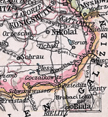
The city is located in the south of Upper Silesia on the Mletzna River and a large lake at 258 m above sea level. NHN , about 25 km south of Katowice .
City structure
Bieruń is divided into the following districts:
- Bieruń Stary (Old Berun)
- Bieruń Nowy (Neuberun)
- Bijasowice (Biassowitz)
- Czarnuchowice (Czarnuchowitz)
- Jajosty (Jajost)
- Ściernie (Sciern)
history
The first permanent settlement on the site of today's Bieruń already existed in the 13th century. In 1327 the settlement fell to Bohemia. In 1376 a settlement called de Berouna was mentioned. Berun received its town charter in 1387 from Duke Johann II the Iron. A beer brewery started operations in 1525. In 1526 the Habsburgs took control of the area.
In 1742 the area fell to Prussia, and at the same time Berun lost its town charter. The city was in 1816 the county Pless in the administrative district of Opole the Prussian province of Silesia assigned and was right on the border with Poland. About 100 years later, the first interstate road in Upper Silesia was built that went through the town. On June 18, 1845, a devastating city fire destroyed Berun. The Prussian King Friedrich Wilhelm IV donated 9,000 thalers for the reconstruction of the city . The inhabitants lived mainly from agriculture, their colloquial language was partly German and partly Polish . In the middle of the 19th century, an explosives and a cigarette factory were built in Berun. In 1865 the previous market town of Berun was given town rights again. The place name was changed to Alt Berun because in 1833 the village of Berun Zabrzeg near Zabrzeg had been renamed Neuberun. At the beginning of the 20th century, Berun had two Catholic churches, a synagogue and explosives and match production.
After the First World War , insurgents in the region tried to forcibly annex the area to the new Polish state. In the referendum in Upper Silesia in 1921 on state membership, 1427 or 82.1% of the votes were cast in Alt Berun and 292 or 58.4% for Poland in Neuberun. So the city became Polish in 1922.
In 1975 the place lost its independence and became part of Tychy . In 1991 Bieruń became independent again.
Demographics
| year | population | Remarks |
|---|---|---|
| 1816 | 618 | |
| 1825 | 784 | including ten Protestants, 90 Jews |
| 1840 | 1210 | thereof eleven Evangelicals, 1096 Catholics, 103 Jews |
| 1855 | 1251 | |
| 1861 | 1334 | including six Evangelicals, 1247 Catholics, 81 Jews |
| 1867 | 1604 | on December 3rd |
| 1871 | 1720 | According to other data, 1738 inhabitants (on December 1), including 26 Evangelicals, 1622 Catholics, 90 Jews |
| 1885 | 1077 | |
| 1900 | 2073 | mostly Catholics |
| 1905 | 2145 | |
| 1910 | 2221 |
Graphic representation of the population of Bieruń (including the manor district) until today :

Industry
See: Kopalnia Węgla Kamiennego Piast , mine
Attractions
- The scrap wood church has been consecrated to St. Valentine (Św. Walenty) since 1680 and was built between 1634 and 1626. A fire in 1972 badly damaged the building, which was subsequently restored true to the original and still has rich baroque furnishings.
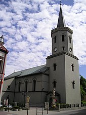
- St. Bartholomew Church on the Ring
- Sacred Heart Church
- St. Barbara Church
- Historic town houses on the Ring
- Jewish Cemetery
Town twinning
- Moravský Beroun (Czech Republic), since 1992
- Gundelfingen (Germany), since 1997
- Ostroh , (Ukraine) since 2005
sons and daughters of the town
- Stanisław Nagy (1921–2013), Polish Roman Catholic theologian and cardinal
literature
- Felix Triest : Topographical Handbook of Upper Silesia , Wilh. Gottl. Korn, Breslau 1865, pp. 586-588
- Johann Georg Knie : Alphabetical-statistical-topographical overview of the villages, towns, cities and other places of the royal family. Preusz. Province of Silesia. 2nd Edition. Graß, Barth and Comp., Breslau 1845, pp. 30-31 .
Web links
Individual evidence
- ↑ a b population. Size and Structure by Territorial Division. As of June 30, 2019. Główny Urząd Statystyczny (GUS) (PDF files; 0.99 MiB), accessed December 24, 2019 .
- ↑ Cf. Felix Triest: Topographisches Handbuch von Oberschlesien. Breslau 1865 ( digitized version )
- ↑ a b c Meyer's Large Conversation Lexicon . 6th edition, Volume 2, Leipzig / Vienna 1905, p. 742.
- ↑ a b Johann Georg Knie : Alphabetical-statistical-topographical overview of the villages, towns, cities and other places of the royal family. Preusz. Province of Silesia. 2nd Edition. Graß, Barth and Comp., Breslau 1845, pp. 30-31 .
- ↑ Cf. oberschlesiende.de ( Memento of the original from May 10, 2008 in the Internet Archive ) Info: The archive link was inserted automatically and has not yet been checked. Please check the original and archive link according to the instructions and then remove this notice. ; down. on August 16, 2008
- ↑ Alexander August Mützell and Leopold Krug : New topographical-statistical-geographical dictionary of the Prussian state . Volume 1: AF , Halle 1821, p. 100, paragraph 1982 .
- ↑ Johann Georg Knie : Alphabetical-statistical-topographical overview of the villages, spots, cities and other places of the royal family. Prussia. Province of Silesia, including the Margraviate of Upper Lusatia, which now belongs entirely to the province, and the County of Glatz; together with the attached evidence of the division of the country into the various branches of civil administration. Melcher, Breslau 1830, p. 35 .
- ↑ a b Felix Triest : Topographisches Handbuch von Oberschlesien , Wilh. Gottl. Korn, Breslau 1865, p. 568, paragraph 38 .
- ^ A b Royal Statistical Bureau: The municipalities and manor districts of the province of Silesia and their population. Based on the original materials of the general census of December 1, 1871. Berlin 1874, pp. 342–343, item 1 .
- ^ Gustav Neumann : The German Empire in geographical, statistical and topographical relation . Volume 2, GFO Müller, Berlin 1874, p. 180 .
- ^ A b c Michael Rademacher: German administrative history from the unification of the empire in 1871 to the reunification in 1990. sch_pless.html. (Online material for the dissertation, Osnabrück 2006).
-
↑ Sources of population figures :
- 1845: [1] - 1855, 1861: [2] - 1885, 1905, 1910: Michael Rademacher: German administrative history from the unification of the empire in 1871 to the reunification in 1990. sch_pless.html. (Online material for the dissertation, Osnabrück 2006). - 1940: [3] - 1995, 2000, 2005: [4]


