
bad Salzungen
| coat of arms | Germany map | |
|---|---|---|

|
Coordinates: 50 ° 49 ' N , 10 ° 14' E |
|
| Basic data | ||
| State : | Thuringia | |
| County : | Wartburg district | |
| Fulfilling municipality : | for Leimbach | |
| Height : | 241 m above sea level NHN | |
| Area : | 98.5 km 2 | |
| Residents: | 20,097 (Dec. 31, 2019) | |
| Population density : | 204 inhabitants per km 2 | |
| Postcodes : | 36433, 36469 | |
| Primaries : | 03695, 036925 (Ettenhausen ad Suhl), 036963 (Dönges, Frauensee, Springen) | |
| License plate : | WAK, SLZ | |
| Community key : | 16 0 63 003 | |
| LOCODE : | DE BSZ | |
| City structure: | Core city and 14 districts | |
City administration address : |
Ratsstrasse 2, 36433 Bad Salzungen | |
| Website : | ||
| Mayor : | Klaus Bohl ( Free Voters ) | |
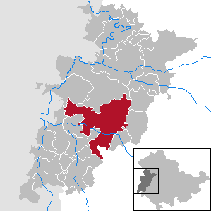
| Location of the district town of Bad Salzungen in the Wartburg district | ||
  |
||

Bad Salzungen (until 1923: Salzungen ) is a spa town in Thuringia ( Germany ). It is the district town of the Wartburg district . Since the beginning of 2009 the city has been a state-approved saltwater spa .
geography

Bad Salzungen is located on the central reaches of the Werra , between the Thuringian Forest in the north and the Rhön in the south and belongs to the transnational region of Franconia . Bad Salzungen is surrounded by wooded hills and mountains with mainly agriculturally used valleys and plains.
City structure

In addition to the core town, the town consists of the districts Dorf Allendorf , Kloster , Wildsprechtroda , Kaltenborn , Langenfeld , Hohleborn , Tiefenort , Oberrohn , Unterrohn , Dönges , Hämbach , Frauensee and Ettenhausen an der Suhl . The Sorghöfe belong to the district of Kaltenborn, the village of Springen and the small settlements Knottenhof , Möllersgrund and Schergeshof to Frauensee , Hüttenhof and Röhrigshof to Oberrohn and Weißendiez to Tiefenort . The small settlement Hetzeberg belongs to Ettenhausen .
Neighboring communities
Adjacent communities are (clockwise, starting in the south) Urnshausen , Weilar , Stadtlengsfeld , Leimbach , the Krayenberg community , Vacha , Werra-Suhl-Tal , Gerstungen , Moorgrund and Barchfeld-Immelborn in the Wartburg district and Breitungen / Werra in the Schmalkalden-Meiningen district .
history
Historical overview

Long before Bad Salzungen was first mentioned in a document, people who can be assigned to the Celtic culture (Leimbach burial ground) settled in the Werra Valley and the neighboring Rhön . Around the birth of Christ, the Rhine-Weser-Germanic tribe of Chatten settled in the area between Werra and Fulda , as well as further west. During the Franconian eastward expansion, between the 5th and 8th centuries, the Salzungen, located in the Thuringian Westergau , was also included in a network of Franconian fortifications. With the Frankish colonization of the East, the written traditions began.
On January 5, 775, Charlemagne issued a deed of tithe donation from his Villa Salsunga to the Hersfeld monastery in the royal palace of Quierzy . This is the first documented mention of the town of Salzungen. In 841 the place came to the Fulda monastery . In the early 12th century the up-and-coming Counts of Henneberg expanded their domain in southern Thuringia to the central Werra. The Salzungen area was the (east) Franconian border region to Thuringia and Hesse.

In today's urban area of Salzungen, several settlement centers developed around the year 1000. The power center of the region was formed by the Henneberg castle complex Frankenstein , its emergence as a fortification to protect the Breiter monastery foundations is said to have taken place in the first third of the 12th century. The lords of Salzungen later arrange the foundation of the Frauensee monastery and the Allendorf monastery (first mentioned in 1272) at the foot of their ancestral castle, in what is now the Kloster district . Decisively weakened by war and conquests and heavily in debt, the Frankensteiners had to sell their possessions in 1330. This shift in power was mainly used by the Wettins who sought to expand their sphere of influence towards the Rhön . The city, attested as civitas since 1306 , was ruled in realpolitical terms as a twin city with a Henneberg and a Saxon administrative seat; the income from the salt trade, from customs duties and trade was shared. The expansion of the city proceeded rapidly. The city fortifications with towers, walls and moat had four gates (Nappentor, Obertor, Lindentor and New Gate). With the discovery of more salt springs , the tax income rose, but so did the desires of the neighbors.
The Salzung Office was formed from the surrounding villages . The Reformation was introduced in 1524, and a year later, during the Peasants' War , the townspeople joined the Werrahaufen , an 8,000-strong troop from the upper Werra region, under massive threats . During the Thirty Years War , Salzungen was sacked by the Swedes on June 10, 1640, and in the same year the city came to Saxe-Gotha . From 1680 to 1918/1920 Salzungen was part of the Duchy of Saxony-Meiningen .
In 1868 the office of Salzungen was opened in the Meiningen district and, with this legacy, is also part of the historic Henneberger Land . Bad Salzungen was already connected to the railway network in 1858. This happened through the Werra Railway from Eisenach in the north to Coburg and Lichtenfels in the south.
With the beginning of the National Socialist era , committed citizens responded to the political persecution by forming resistance groups. A cemetery of honor was established in Rathenau Park in 1956 for the more than 250 victims of forced labor. On April 4, 1945, the city was occupied by American troops without a fight, and exactly three months later, according to the Allied agreements, the Red Army moved in . In 1950, Bad Salzungen became the district town of the newly established Bad Salzungen district through a regional reform in the GDR and, after the district reform in Thuringia, the district town of the Wartburg district .
The Salzunger Saline


The salt production, which was already practiced in prehistoric times, was already so profitable in the 14th century that there was a privileged wealthy pawnshop since 1321 . This was headed by so-called salt counts , who were elected annually. Since 1590, the salt extraction process, which is much more productive than the earlier process, has been used. As early as the 16th century, the salt springs were also used as medicinal products and these places were called Sauerbrunnen . In the 19th century the healing properties of the brine were used . The first bathhouse was built in 1821, from which an increasing spa business developed. In 1911 the city already had 5,000 spa guests. On May 31, 1923, the responsible Thuringian ministry granted the city's application to use the name Bad Salzungen .
Religions
.jpg)

The Saxon areas were reformed very early on . Martin Luther's family lived in neighboring Möhra until shortly before his birth.
- Since the Reformation in the 16th century, the area around Bad Salzungen has been predominantly Evangelical-Lutheran . There are three parishes in the city with a total of around 3,500 members in 2000. Bad Salzungen is the seat of the Superintendentur Salzungen.
- The 1,500 members of the Catholic Church own the parish of St. Andreas as their community center. After the Second World War , the Catholic community grew rapidly due to the influx of refugees, especially from Silesia. In 2008 the parish of St. Andreas Salzungen was affiliated with the church of St. Kilian in Bad Liebenstein as a branch church .
- Other religious communities are the New Apostolic Church , the Evangelical Regional Church Community with 30 parishioners (in Bad Salzungen since 1899) and the Evangelical Free Church parish with around 50 members.
Incorporations
The following communities and districts were incorporated into Bad Salzungen:
| date | Incorporated places |
|---|---|
| 16th century (1) | Husen (desert) |
| July 1, 1950 | Village Allendorf , Kloster Allendorf , Wildprechtroda |
| 1st January 1974 | Kaltenborn , Langenfeld and Hohleborn |
| 6th July 2018 | Tiefenort , Frauensee and Ettenhausen an der Suhl |
Population development
Development of the population (from 1960 December 31) :
|
1833 to 1946
|
1950 to 1999
|
2000 to 2010
|
from 2011
|
|

- Data source from 1994: Thuringian State Office for Statistics
1) October 29th
2) August 31st
politics
City council
The city council has had 30 members since 2019 (previously: 24). In the city council election on May 26, 2019 , the following distribution of seats resulted:
| Political party | Seats |
|---|---|
| Free voters | 14 (+6) |
| CDU | 5 (−1) |
| THE LEFT | 4 (−1) |
| AfD | 4 (+4) |
| SPD | 1 (± 0) |
| FDP | 1 (± 0) |
| GREEN | 1 (± 0) |
mayor
Mayor of Bad Salzungen has been Klaus Bohl (Free Voters Bad Salzungen eV) since July 1st, 2006 .
coat of arms
.jpg)

Blazon : "On a blue background a bishop in golden regalia with red shoes, in his right hand a golden crook and in his left hand a red book with a black cross."
Meaning: The oldest city seal from 1329 shows St. Boniface in the manner shown above. Bonifatius was a mission bishop and also worked in the areas of what is now Thuringia. To give the church a structure, he founded the dioceses of Würzburg, Büraburg and the diocese of Erfurt , which only existed for ten years and was then added to the archbishopric of Mainz. The Archbishop of Mainz also exercised secular power in Salzungen for a long time. The Fulda Monastery also had a great influence here for centuries. Bonifatius appears as patron in the coat of arms of Bad Salzungen. He holds the crosier in his right hand and the Bible in his left. Since the Fulda abbot also exercised secular power at that time, he appears as patron in the coat of arms.
Old coat of arms: From December 1, 1949 to June 26, 1991, the city had a coat of arms that turned away from the historical coat of arms. The coat of arms showed a silver wavy ribbon on a blue background, a red three-bowl fountain and two red mill wheels. On June 26, 1991, the city council of Bad Salzungen repealed the statute on coats of arms, seals and colors of the city from 1949 and decided to continue the historical coat of arms (1345-1945).
Town twinning
- Mezőkövesd ( County Borsod-Abaúj-Zemplén in Hungary , 13 August 1969)
- Strakonitz ( South Bohemian Region in the Czech Republic , since April 22, 1977)
- Bad Hersfeld ( Hessen in Germany , since March 3, 1990)
- Ishøj ( Hovedstaden region in Denmark , since October 31, 1994)
Culture and sights
Museums
The eye-catching half-timbered house with the turret on August-Bebel-Strasse in the village of Allendorf is reminiscent of the Reformation period . The pilgrimage chapel, built in 1499, later served as a residence for the shepherd and farmhand. When the monastery was secularized in 1528, there was no need for a sheep farm across the street. A turret was placed on top of the shepherd's house to accommodate the bell of the former St. Jacobus chapel. Later, a Saxon coat of arms, held by an angel, was attached to the top of the gable. The small building later became the parish hall and was given a clock tower around 1900. Since its inauguration on May 7, 1995, the now restored half-timbered house has housed the city museum, in whose rooms you can get an overview of the 1,230-year history of the city of Bad Salzungen. There are also special exhibitions on a wide variety of topics every 4 to 6 weeks.
Buildings


- Frankenstein Castle
- Frankenstein art ruin
- Schnepfenburg
- Wildsprechtroda Castle
- Remains of the medieval Salzung city fortifications
- Haunscher Hof , an aristocratic court from the Renaissance
- Salunger graduation tower with historical half-timbered central building, former inhalatorium (now museum), brine drilling tower and modern brine bath Solewelt (formerly: Keltenbad)
- Kurhaus am Burgsee (now hotel and Burgseeklinik)
- town hall
- Museum Altes Gemeindehaus Allendorf
- Bad Salzungen train station
- planetarium
- Protestant town church St. Simplicius , end of construction 1791
- St. Andrew's Catholic Church , consecrated in 1923
- Wendelskirche
- Ruin of the Husenkirche
Burgsee
.jpg)
.jpg)
The Burgsee is located in the city center . It has an area of 10.33 hectares and is 25.5 m deep. The Erlensee is a specialty - as an inland salt point with a rare halophyte flora , it was declared a natural monument as early as 1940.
Parks and natural monuments
With the Rathenaupark, Bad Salzungen has an extensive park that surrounds the Burgsee , which is located directly in the city center . The so-called Pushkin Park, which follows the course of the Werra , is also located in the spa area not far from the graduation house .
The three pedunculate oaks by the swimming pool, each over 200 years old , were placed under protection as a natural monument in 1956 .
Historical monuments
The remains of the Allendorf monastery, the town church, the Husenkirche and the Wendelskirche are considered to be evidence of the church's history .
In the area of the city of Bad Salzungen there are several monuments that deal with the history of the 19th and 20th centuries from different perspectives. On the one hand, the victims are commemorated among the forced laborers , prisoners of war and concentration camp prisoners in the Second World War , on the other hand, the German soldiers who died in the two world wars are remembered:
- Cemetery of honor in Rathenau Park with stone sculpture “Der Mahner” by Erich Wurzer for 250 victims of forced labor
- Memorial stone on the Husenfriedhof on Leimbacher Strasse for 13 Polish prisoners of war
- Memorial plaque in the Langenfeld cemetery in memory of 15 concentration camp prisoners buried there
- War memorial in Rathenaupark: The memorial for the soldiers who fell in Salzung in the Franco-Prussian War from 1870 to 1871 was inaugurated on October 23, 1904 in what was then the municipal park and was updated three times in the following 100 years. After the First and Second World Wars , the soldiers who fell were also included in the memory. The war memorial received its last stand after the German reunification and has since been dedicated to the victims of all wars.
There is also the Wucke monument in Rathenaupark , a memorial column made from a Rhön basalt block, which was inaugurated on April 30, 1911 in memory of the poet and researcher of local history, legends and dialects, Christian Ludwig Wucke .
Regular events
The city festival has been celebrated annually since 1992, which the city organizes with the support of local associations.
The press works is a club in Bad Salzungen and is also known beyond the region. Since 1996 there have been regular events from house parties to film, theater, hip-hop, rock, pop, jazz to chanson. (so far including: Rio Reiser , Mother Tongue , Nina Hagen , Fish , Chumbawamba , Stefan Stoppok , Anne Clark , Roger Chapman , Hans Söllner , H-Blockx , Jazzkantine , Ulla Meinecke , Blumentopf , Afrob , Napalm Death , Subway to Sally , In Extremo , Dive , false colors )
Economy and Infrastructure
Commercial areas
The industrial area Gewerbepark West is located on the western outskirts of Bad Salzungen. It has a total area of 16.0 ha (as of 2009). The Ober der Brück industrial park is located on the southern outskirts of the Langenfeld district. It has a total area of 40.0 ha (as of 2009).
traffic

train
The station Bad Salzungen is located at the Werra Railway (Eisenach- Meiningen - Eisfeld ) and is the starting point of the railway line Bad Salzungen-Vacha , but without passengers.
Road traffic
The federal highway 62 runs through the city in the section Bad Hersfeld - Barchfeld . The federal road 285 , which leads to Mellrichstadt in Lower Franconia, begins in the urban area, branching off from this . The nearby federal road 19 (Eisenach – Meiningen– Würzburg ) can also be reached via the B 62 . The closest motorway entrances are approx. 30 kilometers away in Friedewald , Eisenach and Waltershausen (all federal motorway 4 ) and Meiningen ( federal motorway 71 ).
Public transport
The city bus and regional buses are operated by the Wartburgmobil (VUW) transport company and its partners.
- City lines
As of June 1, 2019
| line | Line route | operator | Cycle Mon-Fri | Clock Sa | Cycle Sun / Ftg |
|---|---|---|---|---|---|
| 51 | Bus station - clinic - medical center - bus station | VUW | 30 ' | 30 ' | 30 ' |
| 52 | Bus station - swimming pool - Kaltenborn - Stadtfriedhof - Hersfelder Str. - bus station | VUW | 60 ' | 120 ' | 120 ' |
| 53 | Bus station - Allendorf - bus station | VUW | 30 ' | 30 ' | 30 ' |
| 54 | Bus station - parking clinic - bus station | VUW | no traffic | 60-120 ' | 60-120 ' |
| 55 | Bus station - Langenfeld - Hohleborn | VUW | 4 courses | no traffic | no traffic |
Biking and hiking trails
Bad Salzungen is on the Werratal cycle path and is the end point
- the 28 kilometer long Pummpälzweg hiking trail coming from Eisenach ,
- the 175-kilometer-long Hochrhöner , a premium hiking trail that leads from here through the Rhön Biosphere Reserve to Bad Kissingen .
Clinics

- The Bad Salzungen Clinic, sponsored by the Wartburg district, is a basic and standard care hospital with 422 beds.
- The private Asklepios clinics operate two rehabilitation clinics , the Park Clinic and the Burgsee Clinic .
- The Charlottenhall Children's Clinic is a rehabilitation clinic for children operated by the Charlottenhall Rehabilitation and Prevention Clinic gGmbH.
media
The regional daily newspaper Südthüringer Zeitung appears in Bad Salzungen, the content of which is largely identical to that of the local edition of the regional newspaper Freies Wort .
State institutions
Bad Salzungen is the seat of the district office of the Wartburg district as well as the district court of Bad Salzungen , which belongs to the district of the district court Meiningen . The Panzergrenadierbataillon 391 and the 2nd company of the supply battalion 131 Bad Frankenhausen of the Bundeswehr are stationed in the Werratal barracks ; they are subordinate to the Panzergrenadierbrigade 37 "Free State of Saxony " in Frankenberg . The employment agency has an office in Bad Salzungen.
education
The Dr. Sulzberger Gymnasium is the only gymnasium in town with around 780 students. In Bad Salzungen there are also four primary schools , three regular schools , the main office of the municipal " Musikschule Wartburgkreis" and the adult education center of the Wartburgkreis, a state vocational training center with a medical college, two special schools and a higher vocational college for physiotherapy .
Water supply and sanitation
Except for the area of the district Ettenhausen an der Suhl, the city of Bad Salzungen and the rest of the city area are members of the Bad Salzungen Water and Wastewater Association. After the expiry of an earlier purpose agreement with the municipality of Gerstungen, the city of Bad Salzungen is responsible for water supply and wastewater disposal in the area of the former municipality of Ettenhausen an der Suhl, until this district is also included in the Bad Salzungen water and wastewater association.
Personalities
literature
- Salting . In: Meyers Konversations-Lexikon . 4th edition. Volume 14, Verlag des Bibliographisches Institut, Leipzig / Vienna 1885–1892, p. 248.
- Cyriacus apple; Justus Valentin Fleischhauer: Haligraphia, or simple and short description of the wonderful salt dwarf in salt tongues. Schmalkalden 1674 ( digitized version ).
- Rudi Berkes: Bad Salzungen . In: Our little hiking booklet . No. 113 . Brockhaus-Verlag, Leipzig 1965.
- Harry Gerlach: Bad Liebenstein hiking atlas, Bad Salzungen . In: tourist-hiking atlas . tourist Verlag, Berlin, Leipzig 1988, ISBN 3-350-00218-8 , p. 66 .
- Frankensteingemeinde - Association for Salzung History eV 1992 (Ed.): Salzungen. Historical excursion through the Salzunger Land . Bad Salzungen 1992, p. 64 .
- City administration Bad Salzungen (Ed.): Festschrift for the city anniversary of 1225 years Bad Salzungen . Bauer & Malsch-Druck Immelborn, Bad Salzungen 2000, p. 64 .
- Hartmut Ruck et al: Bad Salzungen with a chronological excerpt from the city's history and city center map, important information about the city and company portraits . ETRO-Verlag, Bad Sooden-Saalmünster, p. 72 (no year (2000)).
- Tobias Günther, Hartmut Ruck: Bad Salzungen . Stadt-Bild-Verlag, Leipzig 2005, ISBN 3-937126-13-9 .
Web links
Individual evidence
- ^ Population of the municipalities from the Thuringian State Office for Statistics ( help on this ).
- ↑ Announcement of the city of Bad Salzungen
- ↑ Now "state-approved saltwater spa" . In: osthessen-news.de, January 16, 2009.
- ↑ Bad Salzungen in facts and figures. Website of the city of Bad Salzungen, accessed on July 6, 2018 .
- ↑ Law and Ordinance Gazette for the Free State of Thuringia from July 5, 2018. (PDF) Retrieved July 6, 2018 .
- ↑ Hartmut Ruck Chronicle Bad Salzungen Bad Salzungen (without year) pp. 9–21.
- ^ Brückner regional studies of the Duchy of Meiningen, second part. Pp. 3-68.
- ^ Brückner regional studies of the Duchy of Meiningen, second part. P. 9.
- ^ Ernst Julius Walch Historical, statistical, geographical and topographical description… Duchy of Saxony-Coburg-Meiningen Nuremberg 1831 p. 215.
- ↑ Hartmut Ruck Chronicle Bad Salzungen Bad Salzungen (without year) pp. 21–59.
- ↑ Hans Joachim Kessler: Healing water and bubbling springs. Encounters with historical baths in Thuringia . Ed .: Sparkassen-Kulturstiftung Hessen-Thüringen. E. Reinhold Verlag, Altenburg 2001, ISBN 3-910166-44-X , Bad Salzungen, p. 31-37 .
- ^ Churches in Bad Salzungen. Bad Salzungen city administration, 2011, accessed on July 8, 2011 .
- ↑ Local elections in Thuringia on May 26, 2019. Elections of the community and city council members. Preliminary results. The regional returning officer, accessed on May 29, 2019 .
- ^ Hartmut Ulle Thuringian Wappenbuch - Arbeitsgemeinschaft Genealogie eV (editor).
- ↑ Weilbach, Ute; May, Marita: The "little tower", once a chapel, ... In: MFB Verlagsgesellschaft mbH Eisenach (Ed.): StadtZeit. City journal with information from the Wartburg district . May issue. Druck- und Verlagshaus Frisch, Eisenach 1999, p. 18-21 .
- ^ Biedermann: Natural monuments in the Wartburg district; District Office Wartburgkreis, 2014, page 66 f.
- ↑ Thuringian Association of the Persecuted of the Nazi Regime - Bund der Antifaschisten und Studienkreis deutscher Resistance 1933–1945 (Ed.): Heimatgeschichtlicher Wegweiser to places of resistance and persecution 1933–1945, series: Heimatgeschichtliche Wegweiser Volume 8 Thüringen, Erfurt 2003, p. 316f ., ISBN 3-88864-343-0 .
- ↑ Business parks in the Wartburg region. (No longer available online.) In: Wartburgkreis-Online. Archived from the original on June 12, 2011 ; Retrieved February 18, 2010 .
- ↑ badsalzungen.de .
- ↑ Publication on the website of the former community of Marksuhl
Bad Salzungen | Dönges | Allendorf village | Ettenhausen an der Suhl with Hetzeberg | Frauensee with Knottenhof , Möllersgrund and Schergeshof | Hämbach | Hohleborn | Kaltenborn with Sorghöfe | Monastery | Langenfeld | Oberrohn with Hüttenhof and Röhrigshof | Jumping | Tiefenort with Weißendiez | Unterrohn | Wildsprachtroda
Office of Creuzburg | Bad Liebenstein | Bad Salzungen | Barchfeld-Immelborn | Berka vd Hainich | Bischofroda | Buttlar | Dermbach | Empfertshausen | Frankenroda | Geisa | Barley ground | Barley | Hallings | Hörselberg-Hainich | Krauthausen | Krayenberg Community | Lauterbach | Leimbach | Moorgrund | Nazza | Oxen | Ruhla | Schleid | Seebach | Treffurt | Unterbreizbach | Vacha | Weilar | Werra-Suhl Valley | Wiesenthal | Wutha Farnroda