
Breitungen / Werra
| coat of arms | Germany map | |
|---|---|---|

|
Coordinates: 50 ° 45 ' N , 10 ° 20' E |
|
| Basic data | ||
| State : | Thuringia | |
| County : | Schmalkalden-Meiningen | |
| Fulfilling municipality : | for Fambach for Rosa for Roßdorf |
|
| Height : | 250 m above sea level NHN | |
| Area : | 44.87 km 2 | |
| Residents: | 4759 (Dec. 31, 2019) | |
| Population density : | 106 inhabitants per km 2 | |
| Postal code : | 98597 | |
| Area code : | 036848 | |
| License plate : | SM, MGN | |
| Community key : | 16 0 66 013 | |
| Address of the municipal administration: |
Rathausstrasse 24 98597 Breitungen / Werra |
|
| Website : | ||
| Mayor : | Ronny Römhild (independent - nominated by SPD) | |
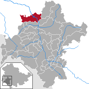
| Location of the municipality Breitungen / Werra in the district of Schmalkalden-Meiningen | ||
  |
||


.jpg)
Breitungen / Werra is a municipality in the district of Schmalkalden-Meiningen in Thuringia (Germany).
geography
Breitungen lies on the Werra between the Thuringian Forest and the Rhön and is a fulfilling municipality for the communities of Fambach , Rosa and Roßdorf . The place also includes seven so-called courtyards, which are located a bit outside and consist of the settlements of several farms: Winne , Bußhof , Knollbach , Craimar , Grumbach , Neuhof and Farnbach .
history
→ Main article: History of the municipality of Breitungen (Werra)
The place was first mentioned in a document in 933 as bretinga and arose at an important Werra ford. The settlement then covered an area of 280 square kilometers. With this size, the administrative seat of the court and the mother church, Breitungen was the political and cultural center of the region in the 10th century. The town of Breitungen grew out of three settlement centers and is still divided into three districts:
- Altenbreitungen , located on the left and right banks of the Werra, is the oldest part of Breitens and emerged from asettlement foundedby the Alemanni .
- Frauenbreitungen , located on the left bank of the Werra, was founded as Königsbreitungen , a Franconian villa. An Augustinian convent was foundedhere in 1150and existed until 1528. After the founding of this nunnery, the place was renamed to Frauenbreitungen.
- Herrenbreitungen was created simultaneously with the establishment of the royal villa in Frauenbreitungen on the hill on the right bank of the Werra by a royal palace (castle), which initially gave the district the name Burgbreitungen. After the destruction in the 10th century, Count Palatine Siegfried von Orlamünde founded a Benedictine monastery , and so Burgbreitungen became Herrenbreitungen.
Frauen- und Herrenbreitungen, which became a fiefdom of the Hersfeld Monastery around 1300 , were ruled as a bailiwick and office of Henneberg counts and Meiningen princes after the abolition of the monasteries during the Reformation . The Henneberger Graf Poppo XII. had a new Renaissance castle built after 1560, incorporating the remains of the abolished monastery. In 1583 the Henneberg family died out , and the Landgraviate of Hessen-Kassel became the owner of Herrenbreitungen Castle and the Herrenbreitungen Office . The castle was damaged in the Thirty Years' War , but the original building fabric from the 16th century was largely preserved. In the 18th and 19th centuries, the castle served as a judicial office, prison and rent office.
The districts Frauen- and Altenbreitungen formerly belonged to Sachsen-Meiningen ( Office Frauenbreitungen ), the district Herrenbreitungen to Hessen-Kassel ( Office Herrenbreitungen of the Schmalkalden rule ). While women and old people have always formed a political unit, it was not until 1950 that all three districts merged to form the village of Breitungen (Werra).
During the Second World War , around 1,740 prisoners of war as well as women and men from the countries occupied by Germany had to do forced labor : in the metal goods factory Scharfenberg & Teubert GmbH in Poststraße and Eisenacher Straße , in the company Heller & Söhne , in the sawmill , on the manor Farnbach . In the cemetery of Frauenbreitungen numerous victims of forced labor from Breitungen and from Allendorf at were Bad Salzungen , Kaltenborn and Wernshausen buried. A memorial there commemorates them.
The Renaissance castle was occupied by evacuees from aerial warfare areas during the Second World War and, from 1945, for decades with refugees and displaced persons from the eastern regions.
On July 1, 1950, the previously independent municipality of Herrenbreitungen was incorporated.
From 1993 to 1996 Breitungen / Werra was a member community and seat of the administrative community Werratal . With the dissolution of this, the congregation became a fulfilling congregation for the other two member congregations Fambach and Heßles as well as for Rosa and Roßdorf. The last two municipalities mentioned belonged to the Vorderrhön administrative community, which was dissolved at the same time . Hessles was incorporated into Fambach on December 1, 2008.
Population development
Development of the population (December 31) :
|
|
|
|
|
- Data source: Thuringian State Office for Statistics
The inhabitants of Breitungen are also known as the Breitcher Sandhasen in the neighboring villages . The specific names are very typical for this region. The background to these names is not yet fully understood. In any case, ethnologically they belong to the joking relationships and are widely used in Germany as local niche names .
religion
43% of the population belong to a regional Protestant church, 2% to the Catholic Church .
The Lutheran Church of St. Mary in Frauenbreitungen belongs to the Bad Salzungen-Dermbach parish of the Evangelical Church in Central Germany , while the Michaelskirche in Herrenbreitungen belongs to the Schmalkalden parish of the Uniate Evangelical Church of Kurhessen-Waldeck .
The few Catholics belong to the parish of St. Andreas (Bad Salzungen) . The next branch church is St. Kilian (Bad Liebenstein) after the divine services in the chapel in Engelshof were discontinued in 2012.
Furthermore, the Borntalkapelle exists in Breitungen, which belongs to the church district of Saxony-Thuringia of the independent Evangelical Lutheran Church .
politics
mayor

Since the local elections on July 15, 2012, Ronny Römhild (independent, set up by the SPD) has been mayor of the municipality of Breitungen / Werra. With 51.1% of the votes, he achieved the post of full-time mayor in the first ballot. On April 15, 2018, Römhild was re-confirmed in office with 89.7% of the votes. In this election he was the only admitted nomination for the election of the mayor. He also holds the office of community chairman for the communities of Fambach, Rosa and Roßdorf, for which the fulfilling community of Breitungen / Werra takes on the administrative tasks.
Municipal council
The municipal council has consisted of 16 honorary council members since the 2014 election, after having previously had 20 members. The local election on May 25, 2014, with a turnout of 47.8% (−3.1), led to the following result:
| Party / list | Share of votes | +/- | Seats | +/- |
| SPD | 41.5% | −2.7 | 7th | −2 |
| CDU | 34.6% | +10.8 | 5 | ± 0 |
| Citizens Friends Breitungen e. V. | 23.9% | +4.1 | 4th | ± 0 |
coat of arms
The municipal coat of arms of Breitungen was designed by the citizen of Breitungen Hubert Rockenberger and proposed as the result of a public tender on February 28, 1991 by the main committee of the municipal council as the official coat of arms of the municipality Breitungen. With the representation of the Saxon diamond band, the coat of arms indicates that the districts of Frauen- and Altenbreitungen belonged to Saxony-Meiningen for centuries, and the Hessian-Thuringian lion indicates that of the district of Herrenbreitungen of Hesse. The water lily on the green field symbolizes the primary importance of nature conservation for the water-rich landscape around Breitungen.
Blazon : "In the gepel cut in front five black bars covered with a green tendril, behind on a blue background an erect lion divided nine times by red and silver and at the top on a green background a gold inseminated, silver water lily."
Community partnerships
- Partner communities: Petersberg near Fulda, Cisek ( Poland )
Culture and sights


Buildings
- The Henneberger Graf Poppo XII. had a new Renaissance castle built after 1560, incorporating the remains of the abolished monastery. In 1583 the Henneberg family died out , and the Landgraviate of Hessen-Kassel became the owner of Herrenbreitungen Castle and the Herrenbreitungen Office . The castle was damaged in the Thirty Years' War , but the original building fabric from the 16th century was largely preserved. Parts of the former monastery wall and large manor buildings have also been preserved. The castle has been privately owned since 2007 and has been renovated since then. Some rooms of the castle are used by the association Das Aktivmuseum - rural customs , which also looks after the neighboring basilica and the well-tended herb garden.
- Romanesque basilica
- The basilica was consecrated as a monastery church of the Benedictine monks in 1112. The sandstone building in Romanesque style was a cruciform basilica with a three-aisled nave, transept and a choir, the three naves of which ended in apses . The basilica was badly damaged in the Thirty Years War. The apses could not be saved, but the east wall of the choir, rebuilt after 1660 excluding the apses, prevented the complete destruction of the building, the Romanesque interior of which has been preserved to this day. The building, which was renovated in the 1990s, serves as an exhibition and concert space as well as a branch of the Breitungen registry office. The 28 meter high tower is the symbol of the municipality of Breitungen.
- Sootworm manor
- Michaelskirche
- Marienkirche
- 240 year old watermill
- chapel
- Chimney of the former thermal power station (position: 50 ° 45 ′ 29.4 ″ N , 010 ° 18 ′ 54.3 ″ E )
- The chimney , which with a height of 204 meters was one of the tallest structures in Thuringia , was blown up on August 6, 2005 when the thermal power station was demolished.
- Observation tower on the Pleß , built in 1999 with an observation platform and panoramic view of the Thuringian Forest, Thuringian Rhön, Wartburg and Wasserkuppe
- Half-timbered ensemble on the market square from the 17th century
- The Sachsenstein on the Pless
Natural monuments and nature reserves
- Local mountain Pleß with observation tower
- Broad lakes
Sports
- The Breitungen sports center, built in June 1976, was expanded to include a grandstand area in 1996 so that there is enough space for spectators at larger sporting events.
- The Werratal cycle path leads through Breitungen .
- In the community there is a beach with mini golf, beach volleyball courts and caravan and camping spaces.
- The soccer team FSV Rot-Weiß Breitungen currently plays in the eight-class district top division Rhön-Rennsteig.
- The HSG Werratal plays its games in the Thuringian League.
Regular events
- Ox festival of the volunteer fire brigade - in the Farnbach - annually on Whit Monday
- Mini golf championships organized by the Breiten clubs
- big street festival, annually in June, along the main road or in the village center
- Young and oldtimer meeting at the fire station
- BRETINGA Open Air , annually in July / August
- Plesslauf, annually in August
- Broad fair, every year at the end of September / beginning of October
- Breiter Star Market - Christmas market, annually on the 3rd Advent
Economy and Infrastructure
economy
The economic structure of the municipality is determined by smaller medium-sized companies and small businesses. There are two business parks, namely the north business park (approx. 31 hectares) and the west business park (approx. 8 hectares). There is also the Schafwerra village center (approx. 4 hectares), which is designated as a mixed area and was built in 1994, with numerous service facilities.
Established businesses
- ANC netcontrol GmbH
- Elektrobau GmbH Breitungen
- Kunststofftechnik Breitungen GmbH & Co.KG (formerly Zahn GmbH)
- Leuchtstoffwerk Breitungen GmbH
- Roese Energietechnik GmbH
education
There is a regular school in Breitungen and there is a library with around 10,000 media units. The Breitungen community has a day-care center that is run by the Kinder- und Jugenddorf Regenbogen eV Zella-Mehlis. The facility is a regular kindergarten with a capacity of up to 200 places for children from the age of 1 to school entry.
traffic
The federal highway 19 , which used to run through crossings in a north-south direction , was passed by the construction of a bypass north of the town in the early 1990s. When the bypass was built, a route started before the Second World War as route 85 of the Reichsautobahn was used .
Breitungen has a stop on the Werra Railway from Eisenach to Meiningen, from where trains of the South Thuringia Railway run every hour in each direction .
Sons and daughters of the church
- Günter Baumann (* 1932), enduro athlete
- Tamara Danz (1952–1996), singer and front woman of the band Silly
- Karl-Heinz Gläser (* 1948), soccer referee
literature
- Wilhelm Uehling (Ed.): Breiter Heimatbuch. Self-published by the festival committee, Breitungen / Werra 1933.
- Ernst Badstübner : The Romanesque buildings in Breitungen on the Werra (= Corpus of Romanesque art in the Saxon-Thuringian area. Series A: Architecture. Vol. 3, ZDB -ID 192193-9 ). Akademie-Verlag, Berlin 1972.
- Walter Höhn: Thuringian Rhön. Cities, villages and landscapes between Werra and Ellenbogen. Michael Imhof, Petersberg 2005, ISBN 3-86568-060-7 , p. 30 f.
- 1075 years of Breitungen (Werra). 933 - Festschrift - 2008. Municipality of Breitungen, Breitungen 2008.
Individual evidence
- ^ Population of the municipalities from the Thuringian State Office for Statistics ( help on this ).
- ^ SPD defends town hall in Breitungen. SPD Thuringia, July 16, 2012, accessed on August 13, 2012 .
- ↑ Thuringian Association of the Persecuted of the Nazi Regime - Association of Antifascists and Study Group of German Resistance 1933–1945 (Ed.): Local history guide to sites of resistance and persecution 1933–1945. Volume 8: Thuringia. VAS - Verlag für Akademische Schriften, Frankfurt am Main 2003, ISBN 3-88864-343-0 , p. 251.
- ↑ census database .
- ^ Thuringian State Office for Statistics .
- ↑ Schornstein Breitungen , accessed on September 26, 2018
- ↑ The Broad Lakes.
- ^ Thuringian State Office for Building and Transport: Project list of current road construction projects.
- ↑ Ulricke Bischoff: Breitungen dedicates a street to Tamara Danz. On www.insuedthueringen.de, December 13, 2012.
Web links
- Homepage of the community
- Homepage of Herrenbreitungen Castle
- Basilica Herrenbreitungen
- Village church of St. Michael Herrenbreitungen
- Pictures of the castle hill and guided tours in: Mittelalter-Breitungen

Belrieth | Birx | Breitungen / Werra | Brotterode-Trusetal | Christes | Dillstädt | Einhausen (Thuringia) | Ellingshausen | Erbenhausen | Fambach | Flea Seligenthal | Frankenheim / Rhön | Friedelshausen | Grabfeld | Kaltennordheim | Kühndorf | Leutersdorf (Thuringia) | Mehmels | Meiningen | Neubrunn (Thuringia) | Oberhof | Ober Maßfeld-Grimmenthal | Oberweid | Rhönblick | Rippershausen | Ritschenhausen | Pipe | Pink | Roßdorf (Thuringia) | Schmalkalden | Surge | Schwarza (Thuringian Forest) | Steinbach-Hallenberg | Sülzfeld | Undersize field | Utendorf | Vachdorf | Wasungen | Zella Mehlis
Altenbreitungen | Penitentiary | Craimar | Farnbach | Women spreads | Grumbach | Man spreads | Knollbach | Neuhof | Winne