
Schmalkalden-Meiningen district
| coat of arms | Germany map |
|---|---|

|

Coordinates: 50 ° 38 ' N , 10 ° 24' E |
| Basic data | |
| State : | Thuringia |
| Administrative headquarters : | Meiningen |
| Area : | 1,251.2 km 2 |
| Residents: | 124,916 (Dec. 31, 2019) |
| Population density : | 100 inhabitants per km 2 |
| License plate : | SM, MGN |
| Circle key : | 16 0 66 |
| NUTS : | DEG0B |
| Circle structure: | 39 municipalities |
| Address of the district administration: |
Obertshäuser Platz 1 98617 Meiningen |
| Website : | |
| District Administrator : | Peggy Greiser (independent) |
| Location of the district of Schmalkalden-Meiningen in Thuringia | |
  |
|

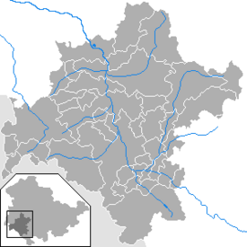
The district of Schmalkalden-Meiningen is a district in the Franconian -influenced southwest of Thuringia , district town and at the same time the largest city is Meiningen . In terms of spatial planning , the district belongs to the Southwest Thuringia planning region and is a member of the Southwest Thuringia planning community .
geography
The district covers an area of 1251.2 km². It stretches from the Rennsteig in the north to Grabfeld in the south and borders the federal states of Bavaria and Hesse . Neighboring districts are the district of Gotha in the northeast, the Ilm district and the independent city of Suhl in the east, the district of Hildburghausen in the southeast, the Bavarian district of Rhön-Grabfeld in the south, the Hessian district of Fulda in the west and the Wartburg district in the northwest .
The landscape of Thuringia's second largest district in terms of area and third largest in terms of population is very diverse. The west of the district is occupied by the Thuringian Rhön , where the 814 m high elbow is the highest mountain in the Thuringian Rhön and the Rhön foreland is characterized by the dominant 751 m high Gebaberg massif . To the east, at 250-300 m above sea level, the Werra valley joins, which flows through the Werra from south to north and into which a large number of tributaries flows. The Werra valley is first followed by the foreland and then the low mountain range Thuringian Forest itself, which delimits the district in the northeast with the Großer Inselsberg (916 m), the Sommerbachskopf (941.5 m) near Zella-Mehlis as the highest elevations and the Rennsteig trail . Between the two mountains, southeast of the Rhön and south of the Werra valley, lies the Grabfeld , a wide hilly area at an altitude of between 300 and 500 m.
Waters
The most important and largest river in the district of Schmalkalden-Meiningen is the Werra , the right source river of the Weser . Larger tributaries of the Werra are the Hasel and the Schmalkalde from the right and the Sülze , the Herpf and the Katza from the left . Larger standing waters form the ponds in Untermaßfeld and the Breiter Lakes .
geology
history
The district was formed in 1994 by amalgamating the existing districts of Meiningen and Schmalkalden with large parts of the district of Suhl . The district of Schmalkalden-Meiningen is part of the historic Henneberger Land , which was later mainly occupied by the Duchy of Saxony-Meiningen and the Schmalkalden lordship belonging to the Landgraviate of Hesse .
Population development
Since the formation of the district, the number of inhabitants has decreased continuously. The only exceptions since 2011 have been the two largest cities, Meiningen and Schmalkalden, as well as some of the two cities surrounding communities, whose population numbers are subject to only slight fluctuations. The district town of Meiningen has been able to record population growth again since 2011 in terms of territorial count.
Development of the population:
|
|
|
|
|
- Data source: from 1994 Thuringian State Office for Statistics - values from December 31st
Religions
politics
District Administrator
Peggy Greiser has been the district administrator since 2018 , replacing Peter Heimrich , who will not be running again for election .
In the district elections on April 15, 2018, Peggy Greiser got an absolute majority of votes with 52.8% of the three candidates. Christiane Barth (CDU) and Hartmut Kremmer (FDP) competed against Peggy Greiser. Christiane Barth received 33.3% and Hartmut Kremmer 13.8% of the vote.
Susanne Reum (independent) acts as the first full-time alderman and thus the deputy of the district administrator, the post of the second honorary alderman is occupied by Rolf Baumann (SPD). The third honorary alderman is Peter Casper (FDP).
Ralf Luther (CDU) was the district administrator from 1994 to 2012 when the district was founded. He was one of the initiators of the “Golden Bridge” , the steel-and-glass figure “Barbarossa” and the steel sculptures “Shot on the run” and “Expulsion” in the National Monument Sculpture Park German Unity . Luther did not stand for re-election in 2012. In 2012, Peter Heimrich won the district administrator elections and held this office for a term until 2018.
District council
The local elections on May 26, 2019 yielded the following result (right), compared to the 2014 local elections .
The district council is the local representative body at the district level in the Schmalkalden-Meiningen district. The district council is the main decision-making body for elementary matters at the district level. It has 50 seats for as many politicians, which are distributed among the individual parties as follows:
| Political party | Share of votes | Seats | |
| CDU | 26.1% | 13 (-5) | |
| SPD | 23.9% | 12 (± 0) | |
| AfD | 18.3% | 9 (+9) | |
| THE LEFT. | 10.5% | 5 (-5) | |
| GREEN | 7.3% | 4 (+1) | |
| FREE VOTERS | 6.9% | 3 (–2) | |
| FDP | 5.7% | 3 (+1) | |
| PIRATES | 1.2% | 1 (+1) |
(As of: local election on May 26, 2019 )
coat of arms

The Thuringian State Administration Office approved the following coat of arms for the Schmalkalden-Meiningen district on July 15, 1995.
- Description of coat of arms
- "The coat of arms is quartered and shows in field 1 in gold on a green three-hill a black hen with a red comb and red rags, in field 2 in blue a gold crowned lion with gold reinforcement, divided seven times by silver over red, in field 3 in Blue an oblique golden lance with a red and white quartered flag, the left edge of which shows a semicircular indentation in each field; Field 4 is divided nine times from black to gold and covered with a diagonal green diamond wreath. "
The district coat of arms represents the various sovereigns who once ruled in what is now the district. The hen on the top left represents the county of Henneberg , the red and white flag on the bottom left represents the Würzburg monastery (Meiningen, Walldorf, Leutersdorf), the red and white striped lion on the top right refers to Hesse (Schmalkalden, Brotterode and Steinbach-Hallenberg) , the diamond with the black and yellow stripes at the bottom right stands for the Duchy of Saxony-Meiningen (Meiningen, Wasungen, Breitungen).
An overview of the coats of arms of cities and municipalities in the district can be found in the list of coats of arms in the district of Schmalkalden-Meiningen .
flag
The flag approved by the Thuringian State Administration Office on July 15, 1995 is quartered with green and white and bears the coat of arms.
Economy and Infrastructure
Culture and tourism
- Culture
With the Meininger Theater , the Meininger museums and the Meininger Hofkapelle, there are nationally important cultural institutions in the district. Numerous nationally important cultural events such as the Meininger Kleinkunsttage or the Thuringian fairy tale and legends festival also take place in the district town . The Meiningen Steam Engine Days are a major attraction for steam locomotive enthusiasts from all over Europe .
- tourism


Tourist attractions include the residential town of Meiningen with the castles Elisabethenburg and Landsberg and the half-timbered town of Schmalkalden with the Wilhelmsburg castle and the state horticultural show, the winter sports resort Oberhof and the hiking regions in the Rhön and on the Rennsteig in the Thuringian Forest. Numerous cycling and hiking trails run through the district, including the Werratal cycle path , the Main-Werra cycle path and the Rhön-Rennsteig hiking path . The Werra offers a water hiking trail. Well-known excursion destinations are the sea aquarium in Zella-Mehlis , the Trusetal waterfall, the volcanic mountain Dolmar with its sports airfield, the Viba nougat world in Schmalkalden, the fairy tale and sandstone cave in Walldorf and the Goetz cave in Meiningen. The Wasungen Forest Botanical Garden is a special natural experience .
Protected areas
There are 29 designated nature reserves in the district (as of January 2017).
traffic
- Street
With the construction of the federal motorway 71 Sangerhausen - Erfurt - Schweinfurt in 2003 the district found connection to the German motorway network. Junction points are at Zella-Mehlis, Meiningen and Rentwertshausen . Other major roads are the B 19 Eisenach -Meiningen- Würzburg , the B 89 Meiningen- Sonnenberg - Kronach and the B 285 through the Rhön.
- train
As railway lines cross the county's neudietendorf-ritschenhausen railway with the railway lines Erfurt- Grimmenthal -Würzburg / Meiningen that Werrabahn with the railway line Eisenach-Meiningen- Eisfeld - Sonnenberg , the Schweinfurt-Meiningen railway and the railway Zella-Mehlis Schmalkalden-Wernshausen , on which regional trains run.
- Air traffic
The nearest international airport is in the state capital Erfurt (80 kilometers). It is around 175 kilometers via Fulda to the important Frankfurt am Main airport .
economy
The district is economically diverse. Metal processing, tool and plastics industries can be found in Schmalkalden, Steinbach-Hallenberg and Zella-Mehlis in particular. Mechanical engineering , electrical engineering and the high-tech industry have mainly settled in Meiningen. Food businesses and agriculture are located in the Werra Valley, Grabfeld and parts of the Rhön. The district town is a traditional location for administration and medical facilities. With 11,416 positions (2017), Meiningen offers the most jobs subject to social security contributions in the district, followed by Schmalkalden (8,683) and Zella-Mehlis (5,156). The largest employer in the district is the Helios Klinikum Meiningen with around 900 employees.
In the district of Schmalkalden-Meiningen there are currently 63 commercial and industrial sites with a gross area of 950 ha. 170 hectares of this can be built immediately. The largest free contiguous area is located in the IG "Thuringian Gate" with 78.3 ha. Large contiguous industrial and commercial areas with a net area of 25 ha or more are, in addition to the "Thuringian Gate" with 95 ha, the industrial area Zella-Mehlis-Ost I-III 88.57 hectares, the Meiningen-Drei 30sacker business park with 87.5 hectares, the “Rohrer Berg” business park in Meiningen with 30.4 hectares and the “Am Scherzer” business park in Steinbach-Hallenberg with 25.66 hectares.
In the Future Atlas 2016 , the district of Schmalkalden-Meiningen was ranked 334 out of 402 districts and independent cities in Germany and is therefore one of the regions with “future risks”.
Public safety and fire protection
There are around 100 volunteer fire brigades in the district, as well as a plant fire brigade at the Brotteroder company "Automotive Lighting". Together, the fire brigades in the district have around 200 to 250 emergency vehicles and trailers at their disposal. The Thuringian police also maintain a police station in Meiningen and a police station in Schmalkalden. It is subordinate to around 200 civil servants and a double-digit number of so-called contact area officers (KOBB).
In Meiningen there is also a location of the Federal Police in the Meiningen train station . The rescue service , which is taken over by two DRK district associations, maintains ten rescue stations in the district in the municipalities of Meiningen, Meiningen OT Dreißigacker, Schmalkalden, Wernshausen , Brotterode , Zella-Mehlis , Steinbach-Hallenberg , Erbenhausen , Wolfmannshausen and Rippershausen . Disaster control and water patrols complete the public safety of the district with several locations at central points.
The responsible rescue control center of the district is located in building 3 of the district office in Meiningen.
Medical institutions
Medical coverage in the Schmalkalden-Meiningen district is ensured by three clinics . The largest hospital in the district and the second largest hospital in South Thuringia is the Meiningen Clinic, operated by the Helios Kliniken clinic group, with a supraregional supply mandate (focus supply). The Elisabeth Klinikum Schmalkalden as the second hospital with basic care belongs to the district's own company "Kreiswerke Schmalkalden-Meiningen", which is also responsible for the hospital. The social work Meiningen der Diakonie operates the geriatric specialist clinic "Georgenhaus" as a specialist clinic for geriatrics with an inpatient hospice . In addition to the usual medical practices, the medical offer is complemented by several medical care centers (MVZ) distributed throughout the district and the specialist medical center (medical centers and health center) in Meiningen-Drei 30acker.
education
In Schmalkalden there is a university with around 3000 students specializing in electrical engineering, computer science, economics and mechanical engineering. Meiningen offers a technical college of the Thuringian police for the higher police service in the education center of the Thuringian police .
Vocational training centers exist in Schmalkalden (with a high school branch), Meiningen and Zella-Mehlis. A high school diploma can be taken in the five grammar schools in the district: in Meiningen in the Henfling grammar school and the Evangelical grammar school , in Schmalkalden in the Philipp Melanchthon grammar school , in Zella-Mehlis in the Heinrich Ehrhardt grammar school and in Kaltensundheim in the "Rhön grammar school ".
Communities


Divided in functions and across districts, Suhl / Zella-Mehlis is designated as a middle center with partial function of an upper center. Meiningen and Schmalkalden are designated as medium-sized centers according to the regional plan.
The basic centers are Breitungen / Werra , Brotterode-Trusetal , Kaltennordheim , Steinbach-Hallenberg and Wasungen .
(Residents on December 31, 2019)
|
community-free municipalities
|
|

Administrative communities
* Administrative headquarters
|
|
For the terms "administrative community" and "fulfilling community" see administrative community and fulfilling community (Thuringia) .
Territorial changes
Communities
- Dissolution of the Struth-Helmershof community - incorporation into Floh-Seligenthal (January 1, 1996)
- Dissolution of the communities Bettenhausen , Gerthausen , Helmershausen , Hermannsfeld , Stedtlingen and Wohlmuthhausen - formation of the community Rhönblick also from the OT Seeba of the community Herpf (August 1, 1996)
- Liquidation of the health resort Kleinschmalkalden - incorporation into Floh-Seligenthal (February 1, 2006)
- Dissolution of the communities of Behrungen , Berkach , Bibra , Exdorf , Jüchsen , Nordheim , Queienfeld , Rentwertshausen , Schwickershausen and Wolfmannshausen - formation of the Grabfeld community (December 1, 2007)
- Dissolution of the community of Heßles - incorporation into Fambach (December 1, 2008)
- Dissolution of the municipality of Wernshausen - incorporation into Schmalkalden (December 1, 2008)
- Dissolution of the Herpf community - integration into Meiningen (December 1, 2010)
- Incorporation of the town of Brotterode into the municipality of Trusetal - Renaming of the municipality of Trusetal to the town of Brotterode-Trusetal (December 1, 2011)
- Dissolution of the Bauerbach community - integration into the Grabfeld community (January 1, 2012)
- Dissolution of the Springstille community - integration into the city of Schmalkalden (July 6, 2018)
- Dissolution of the communities of Altersbach , Bermbach , Oberschönau , Rotterode , Unterschönau and Viernau - integration into Steinbach-Hallenberg (January 1, 2019)
- Dissolution of the community of Benshausen - incorporation into Zella-Mehlis (January 1, 2019)
- Dissolution of the communities of Henneberg , Wallbach and Walldorf - integration into Meiningen (January 1, 2019)
- Dissolution of the municipalities of Hümpfershausen , Metzels , Oepfershausen , Unterkatz and Wahns - incorporation according to Wasungen (January 1, 2019)
- Dissolution of the community of Wölfershausen - incorporation into Grabfeld (January 1, 2019)
- Integration of the city of Kaltennordheim from the Wartburg district into the Schmalkalden-Meiningen district (January 1, 2019)
- Dissolution of the communities of Aschenhausen , Kaltensundheim , Kaltenwestheim , Melpers , Oberkatz and Unterweid - incorporation into Kaltennordheim (January 1, 2019)
- Dissolution of the Stepfershausen community - incorporation into Meiningen (December 31, 2019)
Administrative communities and fulfilling communities
- Expansion of the Salzbrücke administrative community to include the municipality of Bauerbach (November 4, 1994)
- Dissolution of the administrative communities of Amt Sand , Walldorf and Wasungen - formation of the administrative community of Wasungen-Amt Sand (June 30, 1995)
- The city of Meiningen becomes a fulfilling municipality for Herpf, Rippershausen, Sülzfeld and Untermaßfeld (July 28, 1995)
- The city of Meiningen becomes a fulfilling municipality for Henneberg (May 1, 1996)
- The city of Meiningen becomes a fulfilling municipality for Stepfershausen (August 1, 1996)
- Dissolution of the administrative communities Vorderrhön and Werratal - Breitungen / Werra becomes a fulfilling municipality for the other four member communities Fambach, Heßles, Rosa and Roßdorf (August 1, 1996)
- Dissolution of the administrative community Rhönblick - formation of the community Rhönblick from the member communities and other communities (August 1, 1996)
- Expansion of the administrative community Hohe Rhön to include the communities Frankenheim / Rhön and Unterweid (January 1, 1997)
- Dissolution of the Rennsteig administrative association - incorporation of the health resort Kleinschmalkalden into the municipality of Floh-Seligenthal ; the town of Brotterode becomes an independent municipality (February 1, 2006)
- Dissolution of the administrative community Grabfeld - formation of the municipality Grabfeld from the member communities (December 1, 2007)
- The municipality of Breitungen / Werra is no longer a fulfilling municipality for Hessles (December 1, 2008)
- The city of Meiningen is no longer a fulfilling municipality for Herpf (December 1, 2010)
- Expansion of the administrative community Wasungen-Amt Sand to include the municipality of Schwallungen (January 1, 2012)
- Dissolution of the administrative communities Dolmar and Salzbrücke - new formation of the administrative communities Dolmar-Salzbrücke (January 1, 2012)
- Spin-off of the Springstille community from the Haselgrund administrative community (July 6, 2018)
- Dissolution of the administrative community Haselgrund - incorporation of the member communities into the city of Steinbach-Hallenberg (January 1, 2019)
- The city of Meiningen is no longer fulfilling municipality for Henneberg (January 1, 2019)
- Outsourcing of the communities Wallbach and Walldorf from the administrative community Wasungen-Amt Sand (January 1, 2019)
- Expansion of the administrative community Hohe Rhön to include the town of Kaltennordheim from the Wartburg district (January 1, 2019)
- The city of Meiningen is no longer a fulfilling municipality for Stepfershausen (December 31, 2019)
License Plate
The official license plates are SM for the district of Schmalkalden-Meiningen and MGN for Meiningen. Both license plates can be registered in the entire district.
history
On July 1, 1994 the district was assigned the vehicle distinguishing signs MGN (Meiningen) and SM (Schmalkalden), which were introduced in 1991 . From February 1st 1995 only the abbreviation SM (Schmalkalden-Meiningen) was official. Since November 24, 2012, the distinctive sign MGN is available again.
Until about the year 2000 vehicles from the sub-circles were given special SM identification numbers :
| area | Letters | numbers |
|---|---|---|
| Altkreis Schmalkalden | A to Z | 1 to 999 |
| AA to SZ | 1 to 99 | |
| Part of the Altkreis Suhl-Land with Zella-Mehlis |
ZA to ZZ | 1 to 999 |
| Old district of Meiningen | A to Z | 1000 to 9999 |
Web links
See also
Individual evidence
- ^ Population of the municipalities from the Thuringian State Office for Statistics ( help on this ).
- ↑ http://www.wahlen.thueringen.de/datenbank/wahl1/WAHL.asp?wahlart=LR&wjahr=2018&habenErg=WK&auswert=1&wknr=066&gemnr=&terrKrs=&gemteil=000&buchstabe=&Langname=&wahlvorschlag=&sort=&druck=&XLS=&nummerH = 0 & non_existing = & x_vollbildDatteil = & optik = & actual = & ShowLand = & ShowWK = & ShowPart =
- ↑ https://www.insuedthueringen.de/lokal/meiningen/meiningen/Gehen-die-Christdemokrats-am-Donnerstag-im-Kreistag-leer-aus;art83442,3452441
- ↑ http://www.insuedthueringen.de/lokal/meiningen/meiningen/Rolf-Baumann-bleibt-erster-Vizelandrat;art83442,3457790
- ↑ District election in Schmalkalden-Meiningen 2019 In: wahlen.thueringen.de .
- ↑ PDF brochure “ Coats of arms and flags of the Free State of Thuringia and its districts as well as independent cities ( Memento of March 2, 2012 in the Internet Archive )”, State Center for Civic Education Thuringia, 2000
- ↑ Employment Agency, employees subject to social security contributions
- ↑ www.beste-lage.com , published by the Schmalkalden-Meiningen District Office, as of 2017.
- ↑ Zukunftsatlas 2016. Archived from the original ; accessed on March 23, 2018 .
- ^ Regional plan Southwest Thuringia from February 22, 2011 , accessed on October 16, 2016
- ^ Population of the municipalities from the Thuringian State Office for Statistics ( help on this ).
Cities : Eisenach | Erfurt | Gera | Jena | Suhl | Weimar
Districts : Altenburger Land | Eichsfeld | Gotha | Greiz | Hildburghausen | Ilm district | Kyffhäuserkreis | Nordhausen | Saale-Holzland district | Saale-Orla district | Saalfeld-Rudolstadt | Schmalkalden-Meiningen | Sömmerda | Sonneberg | Unstrut-Hainich Circle | Wartburg district | Weimar Country