
Saale-Holzland district
| coat of arms | Germany map |
|---|---|

|

Coordinates: 50 ° 55 ' N , 11 ° 45' E |
| Basic data | |
| State : | Thuringia |
| Administrative headquarters : | Eisenberg |
| Area : | 815.24 km 2 |
| Residents: | 82,950 (Dec. 31, 2019) |
| Population density : | 102 inhabitants per km 2 |
| License plate : | SHK, EIS, SRO |
| Circle key : | 16 0 74 |
| NUTS : | DEG0J |
| Circle structure: | 91 municipalities |
| Address of the district administration: |
In the castle 07607 Eisenberg |
| Website : | |
| District Administrator : | Andreas Heller ( CDU ) |
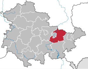
| Location of the Saale-Holzland district in Thuringia | |
  |
|
The Saale-Holzland-Kreis is a district in the east of Thuringia . In terms of spatial planning , the district belongs to the Eastern Thuringia planning region and is a member of the Eastern Thuringia planning community . It is named after the Saale flowing through the district and the Thuringian woodland .
geography
Neighboring districts are the Saxony-Anhalt Burgenlandkreis in the north, the independent city of Gera and the district of Greiz in the east, the Saale-Orla district in the south, the district of Saalfeld-Rudolstadt in the south-west and the district of Weimarer Land and the independent city of Jena in the west . Saale and Weisse Elster flow through the district .
history
The Saale-Holzland-Kreis was created in the course of the district reform in Thuringia in 1994, initially with the name Holzlandkreis from the former districts of Eisenberg , Jena and Stadtroda .
Population development
Development of the population:
|
|
|
|
|
- Data source: from 1994 Thuringian State Office for Statistics
politics
On September 23, 2008 the district received the title “ Place of Diversity ” awarded by the Federal Government .
District Administrator
District administrator of the Saale-Holzland district is Andreas Heller ( CDU ).
In the runoff election on May 21, 2006, Heller prevailed with 52.6% against Knuth Schurtzmann ( Die Linke ) with 47.4% of the votes and was elected as the new district administrator. In the elections on April 22, 2012 , Heller was able to unite the absolute majority of the valid votes with 56.3% in the first ballot and was thus confirmed in office for a further six years.
Former district administrators
- 1994-2006: Jürgen Mascher (CDU)
District council
The 46 seats in the district council have been distributed among the individual parties as follows since the election on May 26, 2019 :
| Political party | Seats | |
| CDU | 14 (−3) | |
| AfD | 7 (+7) | |
| THE LEFT. | 7 (−4) | |
| BI | 5 (+1) | |
| farmers | 4 (+1) | |
| SPD | 3 (−2) | |
| Green | 3 (+1) | |
| FDP | 3 (+1) | |
| NPD | 0 (−2) |
administration
The seat of the district administration is located in the baroque castle Christiansburg in Eisenberg , the former residential castle of the Duchy of Saxony-Eisenberg from the 17th century. Branch offices of the district administration are located in Stadtroda and Jena.
coat of arms
The Saale-Holzland-Kreis has had a coat of arms since 1997 with the following blazon : “Split by a curved, ascending golden tip studded with red hearts, inside a black growing lion; right in red a silver diagonal right bar; on the left in the field divided nine times by black and gold, a diagonal green diamond wreath. "
The coat of arms shows the symbolism used in the past for the lords, counts and princes who predominate in what is now the Saale-Holzland district. Until the end of the 14th century these were the lords of Lobdeburg (top right) and the counts of Orlamünde (at the top). After that, almost the entire area belonged to the Wettin princes (top left). For a short time (1680 to 1714) the Duchy of Saxony-Eisenberg emerged in this area ; the current district town of Eisenberg was the residential town under Duke Christian.
An overview of the coats of arms of the towns and communities in the district can be found in the list of coats of arms in the Saale-Holzland district .
Economy and Infrastructure
economy
The economic focus of the district is in the region around Hermsdorf . A mix of sectors is growing on the former industrial site of Tridelta AG, around 70% of the renovated and newly developed industrial area is occupied. The Saale-Holzland-Kreis works closely with the city of Jena in the field of economy. As part of the JenArea project, there are diverse economic relationships, especially between companies from Jena and Hermsdorf.
Health economy
The Waldkrankenhaus Rudolf Elle in Eisenberg is an acute hospital with the special feature that orthopedics is connected to the chair at the University of Jena. There is a specialist clinic for psychiatry and neurology in Stadtroda, and several rehabilitation clinics in Bad Klosterlausnitz.
traffic
Bus transport
The bus traffic is taken over by the JES Verkehrsgesellschaft mbH. The buses run almost throughout the entire district on workdays.
rail
The first railway line of the Thuringian Railway Company , which was opened in 1859 from Leipzig to Gera , initially only touched today's district area in the municipality of Crossen an der Elster.
It was not until 1874 that the main line of the Saal Railway Company in the Saale valley from Naumburg via Jena to Saalfeld was built . Already two years later it was crossed by the Weimar – Gera line in Göschwitz, which had its own station in Jena West.
The Saal-Eisenbahn-Gesellschaft opened a cross connection from Orlamünde to Pößneck ( Orlabahn ) in 1889 .
Today's district town Eisenberg had already received a connection to the Leipzig – Gera line in 1880 by the Crossen – Porstendorf railway line , which was extended by the Prussian State Railway in 1905 to Porstendorf in the Saale valley. The Zeitz – Osterfeld – Camburg railway line, also built further north by the KPStE in 1897, only touched the small town of Schkölen in today's district. Like a total of 37 km of routes, it has also been closed:
- 1945: Molau – Camburg, 3 km
- 1965: Osterfeld – Schkölen – Molau, 4 km
- 1969: Eisenberg – Bürgel – Porstendorf, 21 km
- 1998: Crossen – Eisenberg, 9 km
The network once covered 122 km.
Street
The district's means of transport is the Hermsdorfer Kreuz as the intersection of federal motorways 4 and 9 .
The federal highway 7 runs through the district from west to east . Coming from Jena, the B 7 leads via Bürgel and Eisenberg and leaves the district in the direction of Gera. The federal highway 88 runs from north to south and leads via Camburg, Dornburg, Jena, Kahla to Orlamünde and leaves the Saale-Holzland district in the direction of Rudolstadt .
Protected areas
There are 18 designated nature reserves in the district (as of January 2017).
Communities
Eisenberg , Hermsdorf / Bad Klosterlausnitz (functionally divided) and Stadtroda are designated as medium-sized centers according to the regional plan.
The basic centers are the cities of Bürgel , Dornburg-Camburg and Kahla , as well as Bad Köstritz / Crossen an der Elster , which is divided into functions and across all districts .
(Residents on December 31, 2019)
|
community-free municipalities
|
|
  |
* Seat of an administrative association
For the terms "administrative community" and "fulfilling community" see administrative community and fulfilling community (Thuringia) .
Territorial changes
Communities
- Dissolution of the community of Gernewitz - incorporation into Stadtroda (October 12, 1994)
- Dissolution of the municipalities of Dothen , Graitschen auf der Höhe , Hainchen , Nautschütz , Rockau and Wetzdorf and the city of Schkölen - amalgamation to form the city of Schkölen (January 1, 1997)
- Dissolution of the municipality of Zöthen - incorporation into Camburg (April 1, 1999)
- Dissolution of the Seifartsdorf community - incorporation into Silbitz (March 16, 2004)
- Dissolution of the municipality of Dorndorf-Steudnitz and the city of Dornburg / Saale - incorporation into Camburg - name change to Dornburg-Camburg (December 1, 2008)
- Dissolution of the municipalities of Bollberg and Quirla - incorporation into Stadtroda (January 1, 2019)
Administrative communities and fulfilling communities
- Dissolution of the administrative community Gleistal-Gemdental - incorporation of the member communities into the administrative community Dornburg (December 29, 1994)
- Dissolution of the administrative community Quirla - Stadtroda becomes a fulfilling community for the two member communities (October 20, 1995)
- Dissolution of the administrative community Stadtroda - Stadtroda becomes a fulfilling municipality for the other member municipality (October 20, 1995)
- The municipality of Serba leaves the administrative community Wethautal - Bad Klosterlausnitz becomes a fulfilling municipality for the municipality (December 28, 1995)
- Dissolution of the administrative community Auf der Heide - incorporation of the communities Heideland and Walpernhain into the administrative community Elstertal ; Gosen becomes an independent community (March 14, 1996)
- Dissolution of the administrative community Bürgel - Bürgel becomes a fulfilling municipality for the other three member municipalities (June 4, 1996)
- Dissolution of the administrative community Wethautal - Eisenberg becomes a fulfilling community for the three member communities (August 1, 1996)
- Eisenberg becomes a fulfilling community for Gösen (August 1, 1996)
- Dissolution of the administrative community Schkölen - incorporation of the Thierschneck community into the administrative community Camburg ; Eisenberg becomes a fulfilling community for Mertendorf ; Merger of the other seven member communities to form the new city of Schkölen (January 1, 1997)
- Dissolution of the administrative community Camburg - Camburg becomes a fulfilling municipality for the five other member municipalities (June 30, 1999)
- Dissolution of the administrative community Holzland - Bad Klosterlausnitz becomes a fulfilling community for the other nine member communities (June 30, 1999)
- Dissolution of the administrative community Dornburg - amalgamation of the member communities with the communities whose fulfilling municipality is Camburg, to form the new administrative community Dornburg-Camburg (February 1, 2005)
- Expansion of the administrative community Heideland-Elstertal to include the city of Schkölen (January 1, 2012)
- The city of Stadtroda is no longer fulfilling municipality for Bollberg and Quirla (January 1, 2019)
Name changes
- of administrative community Hartmannsdorf to manage Community Elster (11 October 1994)
- from administrative community Elstertal to administrative community Heideland-Elstertal (March 14, 1996)
- from administrative community Heideland-Elstertal to administrative community Heideland-Elstertal-Schkölen (January 1, 2012)
License Plate
On July 1, 1994, the district was assigned the distinguishing signs EIS (Eisenberg) and SRO (Stadtroda). These were replaced on February 1, 1995 by the new SHK distinguishing mark . Since November 24, 2012 the abbreviations EIS and SRO are available again.
See also
Web links
- Official website of the Saale-Holzland-Kreis
- Link catalog on the topic of Saale-Holzland-Kreis at curlie.org (formerly DMOZ )
Individual evidence
- ^ Population of the municipalities from the Thuringian State Office for Statistics ( help on this ).
- ↑ District election in the Saale-Holzland district 2019 In: wahlen.thueringen.de .
- ^ Page of the Thuringian regional returning officer on the 2012 district elections
- ^ Approval of the Thuringian State Administration Office of August 18, 1997
- ↑ Description of coat of arms Saale-Holzland-Kreis, District Office Saale-Holzland-Kreis. Eisenberg 1997
- ^ Regional plan East Thuringia of October 28, 2011 , accessed on October 16, 2016
- ^ Population of the municipalities from the Thuringian State Office for Statistics ( help on this ).
Cities : Eisenach | Erfurt | Gera | Jena | Suhl | Weimar
Districts : Altenburger Land | Eichsfeld | Gotha | Greiz | Hildburghausen | Ilm district | Kyffhäuserkreis | Nordhausen | Saale-Holzland district | Saale-Orla district | Saalfeld-Rudolstadt | Schmalkalden-Meiningen | Sömmerda | Sonneberg | Unstrut-Hainich Circle | Wartburg district | Weimar Country