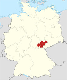
Planning region East Thuringia
The planning region of East Thuringia is a unit of spatial planning that includes the east of Thuringia . The participating municipalities work together in the regional planning community for East Thuringia based in Gera.
The Eastern Thuringia planning region includes:
- City of Gera
- City of Jena
- Altenburger Land district
- Saale-Holzland district
- District of Greiz
- Saale-Orla district
- District of Saalfeld-Rudolstadt
The planning region East Thuringia borders in the north and east on the federal states of Saxony and Saxony-Anhalt , in the north-west on the planning region Central Thuringia and in the south on the planning region south-west Thuringia and Bavaria .
The planning regions in Thuringia were created in 1991 on the basis of the Thuringian State Planning Act (ThLPlG). Regional development concepts based on the guidelines for promoting regional development have been financially supported with state funds since 1998.
Spatially, the region is identical to the Gera district between 1952 and 1990, expanded to include the Altenburg and Schmölln districts .
- Largest cities (as of December 31, 2019):
- Jena (111,343)
- Gera (93,125)
- Altenburg (31,633)
- Saalfeld / Saale (29.278)
- Rudolstadt (24,943)
- Greiz (20,392)
- Zeulenroda shoot (16,350)
swell
- Thuringian State Planning Act (ThürLPlG) in the version of May 15, 2007
- Thuringian regulation on the spatial delimitation of the planning regions in the state of Thuringia (regional regulation -LRegVO-) of August 22, 1991
