
Großpürschütz
| coat of arms | Germany map | |
|---|---|---|

|
Coordinates: 50 ° 49 ' N , 11 ° 36' E |
|
| Basic data | ||
| State : | Thuringia | |
| County : | Saale-Holzland district | |
| Management Community : | Southern Saale Valley | |
| Height : | 168 m above sea level NHN | |
| Area : | 3.92 km 2 | |
| Residents: | 389 (Dec. 31, 2019) | |
| Population density : | 99 inhabitants per km 2 | |
| Postal code : | 07751 | |
| Area code : | 036424 | |
| License plate : | SHK, EIS, SRO | |
| Community key : | 16 0 74 033 | |
| Association administration address: | Bahnhofstrasse 23 07768 Kahla |
|
| Website : | ||
| Mayor : | Rainer Franke | |
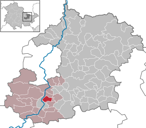
| Location of the community Großpürschütz in the Saale-Holzland district | ||
  |
||


Großpürschütz is a municipality in the south of the Saale-Holzland district in Thuringia and part of the administrative association Südliches Saaletal .
geography
The Rundlingsdorf Großpürschütz in the east of Thuringia is approx. 15 km south of Jena . The municipality is part of the "Mittleres Saaletal" nature reserve and belongs to the Saale-Holzland district. The place Kleinpürschütz belongs to Großpürschütz .
history
It can be assumed from evidence that the Slavic settlement took place in the period from 900–1100.
The Slavic round village is first documented in writing for 1411. A church was built outside the village as early as 1100 .
The construction of the bridge began in 1848 and the inauguration took place in 1849. Shortly before the end of the Second World War , the bridge was blown up in order to stop the approaching Americans. In 1946, after a makeshift repair, the bridge could be used again. In 1969 and 1974 the bridge was renewed. In 1993 the decision was made to build a new bridge. At the end of September, the last Saale bridge with wooden covering was demolished.
1987–1989, a village community center "Die Bauernstube" was built in Kleinpürschütz without any official involvement. After the reunification , Großpürschütz and the district of Kleinpürschütz each expanded by a residential area with single-family houses.
At the end of October 1993, twenty communities from the Saale-Holzland district in Thuringia, including Großpürschütz, merged to form the "Südliches Saaletal" administrative association.
coat of arms
Blazon : “Split between gold and red; in front a red crab directed towards the head of the shield , behind an equally posed golden fish . "
In 1672 the seal of Großpürschütz, with a picture of a fish and a cancer, was mentioned for the first time. Over time, the size and appearance of the seal have changed several times, in particular the arrangement of fish and crab. This can be attributed to the different district affiliations, e.g. For example: 1920 - "Land Thuringia District Jena", after 1945 - "District Stadtroda-Gemeinde Großpürschütz", 1952 - "Municipality Großpürschütz", 1956 - "German Democratic Republic Council of the Municipality Großpürschütz-Kreis Jena", 1991 - " Thuringia community Großpürschütz ".
In 2000 a new coat of arms (see above) was created, which is still valid today.
Individual evidence
- ^ Population of the municipalities from the Thuringian State Office for Statistics ( help on this ).
Web links
- www.grosspuerschuetz.de - Information page about Großpürschütz
Albersdorf | Altenberga | Bad Klosterlausnitz | Bibra | Bobeck | Bremsnitz | Bucha | Bürgel | Crossing the Elster | Dornburg-Camburg | Eichenberg | Eineborn | Eisenberg | Frauenprießnitz | Outdoor orla | Geisenhain | Gneus | Golmsdorf | Gosen | Graitschen at Bürgel | Greater buckedra | Grosseutersdorf | Großlöbichau | Großpürschütz | Gumperda | Hainichen | Hainspitz | Hartmannsdorf | Heathland | Hermsdorf | Hummelshain | Jenalöbnitz | Kahla | Karlsdorf | Little buckedra | Kleinebersdorf | Kleineutersdorf | Laasdorf | Lehesten | Lindig | Lippersdorf-Erdmannsdorf | Löberschütz | Mertendorf | Meusebach | Milda | Möckern | Mörsdorf | Nausnitz | Neuengönna | Oberbodnitz | Orlamünde | Ottendorf | Petersberg | Poxdorf | Rattelsdorf | Rauda | Rauschwitz | Rausdorf | Reichenbach | Reinstädt | Renthendorf | Rothenstein | Ruttersdorf-Lotschen | Scheiditz | Schkölen | Grinding trips | Schlöben | Schöngleina | Schöps | Side rod | Serba | Silbitz | Stadtroda | St. Gangloff | Sulza | Tautenburg | Tautendorf | Tautenhain | Animal snail | Tissa | Trobnitz | Trockenborn-Wolfersdorf | Unterbodnitz | Waldeck | Walpernhain | Waltersdorf | Weissbach | Weißenborn | Wichmar | Rooms | Zollnitz