
Schkölen
| coat of arms | Germany map | |
|---|---|---|

|
Coordinates: 51 ° 2 ′ N , 11 ° 49 ′ E |
|
| Basic data | ||
| State : | Thuringia | |
| County : | Saale-Holzland district | |
| Management Community : | Heideland-Elstertal-Schkölen | |
| Height : | 210 m above sea level NHN | |
| Area : | 53.43 km 2 | |
| Residents: | 2622 (Dec. 31, 2019) | |
| Population density : | 49 inhabitants per km 2 | |
| Postal code : | 07619 | |
| Area code : | 036694 | |
| License plate : | SHK, EIS, SRO | |
| Community key : | 16 0 74 116 | |
| LOCODE : | DE SNT | |
| City structure: | 15 districts | |
City administration address : |
Naumburger Str. 4 07619 Schkölen |
|
| Website : | ||
| Mayor : | Matthias Darnstädt | |
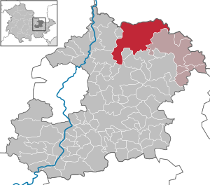
| Location of the city of Schkölen in the Saale-Holzland district | ||
  |
||

Schkölen is a city in the northern part of the Saale-Holzland district in Thuringia. By resolution of the Thuringian state parliament , the unified community "Stadt Schkölen" was formed on January 1, 1997 , to which the formerly independent communities Dothen , Graitschen ad Höhe , Nautschütz , Hainchen , Rockau , Wetzdorf , the city of Schkölen and nine other districts belong equally. Schkölen has been part of the Heideland-Elstertal-Schkölen administrative community since January 1st, 2012 .
geography
Geographical location
Schkölen is located in northeast Thuringia directly on the border with Saxony-Anhalt on a hilly and almost unwooded plateau at an altitude of 200 to 250 meters above sea level, which is bordered in the west by the Saale and in the east by the Weisse Elster and by the valley of the Wethau im eastern municipal area is interrupted. The wooded Thuringian woodland connects to the south .
Structure of the unified municipality of the city of Schkölen
In addition to the core town of Schkölen, the following districts belong to the unitary municipality (in brackets: year of first mention, if known):

- Core city Schkölen (1046)
- Graitschen ad Höhe (1040) with grave village
- Dothen (1261) with Launewitz , Willschütz (1145), Poppendorf and Tünschütz (1323)
- Hainchen (1282) with Kämmeritz (1153)
- Nautschütz with Böhlitz , Pratschütz (between 1234 and 1241), Zschorgula (between 1234 and 1241) and Wüstung Sausdorf
- Rockau (1253)
- Wetzdorf (1219)
history


The area of the city of Schkölen and the surrounding area was settled at the latest from the Neolithic Age, as evidenced by burial mounds in Lohholz and near Dorstewitz, a ring system uncovered in the course of the JAGAL route archeology , stone crosses and the medieval moated castle .
The castle gained national importance in the 12th and 13th centuries. While the area was initially only sparsely populated, the castle developed into a town. The former upper castle, on which the church now stands and the cemetery is located, were a retreat for people and cattle. Around 900 Schkölen was the eastern tip of the Dornburg estate and its fortifications served as protection for Dornburg. Remains of the lower castle (moated castle) lie below the spur-like ridge. In 1031 a castle warden Szoln (= Schkölen) is mentioned on a certificate from Emperor Conrad II. In addition to other castles and fortified royal courts, the Schkölen court was mentioned in a document in 1158 in a table goods register of the royal state of Pleißenland under Friedrich Barbarossa . Between 1197 and 1253 the Margraves of Meißen held a state parliament in the city. The place was mentioned in documents in 1036 and the city in 1156.
In the middle of the 15th century the castle was rebuilt by the Lords of Bünau. A fire caused by the war in 1536 led to the abandonment of the castle and subsequent deterioration. In the 11th century, Wiprecht von Groitzsch administered the castle, which was part of the imperial estate. In 1556 looters destroyed the fortification.
In 1140 Bertha von Groitzsch founded a provost office of the Pegau monastery in Schkölen . The settlement had belonged to the Hohenstaufen family since 1135 . In 1158 the place got market rights and in the 15th century city rights. Then Schkölen came to the Wettins . In 1485 Schkölen became Albertine and belonged to the Weißenfels office , from 1656-1746 to the Duchy of Saxony-Weißenfels and subsequently to the Albertine Saxony until 1815, when the Weißenfels office in the Thuringian district became Prussian . In the Kingdom and later Free State of Prussia, the city was located in the newly formed district of Weißenfels, where it remained until 1952. After the dissolution of the states in the GDR in 1952, Schkölen was annexed by the state of Saxony-Anhalt to the newly founded district of Gera. In 1859 a glue factory was founded and in 1897 the rail connection to Camburg and Zeitz followed , which lasted until 1965 at least as far as Molau .
Towards the end of the Second World War and the Nazi era , the communist Alfred Kästner , who had joined the resistance group around Georg Schumann in Leipzig , was murdered by the SS in Lindenthal . Alfred-Kästner-Strasse reminds of him.
The city was occupied by American troops around April 12, 1945 and - like all of Thuringia - passed to the Red Army at the beginning of July . So it became part of the Soviet Zone and from 1949 of the GDR . It went through all the corresponding political and economic changes.
In 1945 the family of the landowner Tellemann was banned from living in the district, as a result of which they left the Soviet occupation zone . In 1946 the estates were expropriated without compensation and divided among smallholders and refugees. Around 50 new farms were created , each with 10 hectares of usable space. In addition, an independent people's own estate (VEG) was founded, which had been responsible for plant production since the 1970s. The new farms and other traditional individual farms were merged at the beginning of the 1960s to form an agricultural production cooperative (LPG), which was named after the resistance fighter Alfred Kästner. Since the 1970s she ran the animal production in the city and the surrounding area. Other commercial enterprises were the VEB Dichtungswerk and the VEB Fruchtverarbeitung, in which most of the city's employees had their jobs.
The moated castle , which has been in ruins in the town center since the 17th century, was essentially reconstructed through excavation and renovation work from 1977 onwards, largely through the initiative of a teacher. A local history association set up a small museum on the history of the place and the castle. After the establishment of German unity, the castle complex was supplemented by a local catering service for tourists.
The city Schkölen has since 1950 a nursery . In 1958 the foundation stone was laid for a modern school building, which was inaugurated in 1959 and has 14 classrooms and numerous specialist cabinets. The new school was named after the poet Maxim Gorki , after whom the previous institution had been named since 1950. In 1974 a large sports facility was completed, which was named “25. Anniversary of the GDR ”. In 1978 the school was completed by an extension with additional specialist rooms. Since 1990, the school and the associated outdoor facilities have been renovated, modernized and z. T. redesigned.
Incorporations
- July 1, 1950: Grabsdorf (incorporated into Graitschen auf der Höhe)
- June 20, 1957: Kämmeritz (incorporated into Hainchen)
- January 1, 1965: Poppendorf (incorporated into Dothen)
- January 1, 1974: Tünschütz (incorporated into Dothen)
- January 1, 1997: Dothen
- January 1, 1997: Graitschen on the heights
- January 1, 1997: Hainchen
- January 1, 1997: Nautschütz
- January 1, 1997: Rockau
- January 1, 1997: Wetzdorf
Population development
Development of the population (from 1994 on each December 31st)
| year | number |
|---|---|
| 1823 | 1024 |
| 1994 | 1602 |
| 1995 | 1579 |
| 1996 | 1555 |
| 1997 | 3266 (1) |
| 1998 | 3259 |
| 1999 | 3184 |
| 2000 | 3112 |
| 2001 | 3048 |
| 2002 | 3028 |
| 2003 | 2968 |
| 2004 | 2934 |
| 2005 | 2895 |
| 2006 | 2843 |
| 2007 | 2784 |
| 2008 | 2729 |
| 2009 | 2709 |
| 2010 | 2684 |
| 2011 | 2659 |
| 2012 | 2641 |
| 2013 | 2658 |
| 2014 | 2649 |
| 2015 | 2585 |
| 2016 | 2590 |
| 2017 | 2575 |
| 2018 | 2590 |
| 2019 | 2622 |
- Data source: Thuringian State Office for Statistics
politics
City council
The local elections on May 25, 2014 led to the following result with a turnout of 60.3%:
| Party / list | Share of votes | Seats |
| CDU | 39.6% | 5 |
| The left | 11.6% | 2 |
| LI / BV / BI (1) | 48.7% | 7th |
mayor
Mayor of Schkölen is Matthias Darnstädt (rural interests / farmers 'association / citizens' initiative). He was elected on June 7, 2015 with 92.1% of the votes cast.
Culture and sights


- Ruins of the moated castle from the 10th century in the center of the city
- City Church Schkölen
- Castle pharmacy in Schkölen, founded in 1850
- Ratskeller with coat of arms above the entrance
- Listed house on the market
- Asphalted Schkölen-Zeitz cycle path on the route of the former railway line
- Bronze Age barrows in the Hainchen district
- Bell towers of the village churches in Poppendorf and Wetzdorf
- the birth house of Samuel Heinicke , the inventor of the German method of deaf education, in Nautschütz
- the lawn labyrinth in Graitschen ad height
- the Wethau valley with its natural beauty
- largely historically preserved village complexes in Poppendorf (Reihendorf)
- In a park in front of the moated castle, a memorial commemorates the victims of fascism
Economy and Infrastructure

Schkölen is the center of the arable hill country in the north of the Saale-Holzland district and is surrounded by very fertile loess soils , which are the basis of the region's economy. Today three large farms and three resettlers cultivate approx. 1,800 hectares and thus offer around 130 jobs. Vegetable production Schkölen GmbH is known for organic tomato production in an 8.8 hectare greenhouse with 320,000 plants. 3,500 tons of tomatoes are harvested annually.
Since 1990, up-and-coming craft businesses, but also industrial companies such as NESTRO Lufttechnik, have settled and developed in Schkölen and the municipalities, which enrich the previously predominantly agricultural economic structure. Since 1993, Schkölen has become known for the first straw heating plant in Germany (3.15 MW nominal output), which uses the renewable energy sources available on site and thermally utilizes them in an environmentally friendly manner (approx. 20,000 t of straw annually , about a third of the amount within a 10 km radius ). The Schkölen agricultural cooperative has been operating a biogas plant since 2006.
traffic
The city was formerly connected to the surrounding towns by means of the Zeitz – Camburg railway line , although there had been no more trains to Schkölen since 1966, as operations were no longer profitable. In 1971, the dismantling of the tracks and embankments began, and Schkölen station was demolished.
The A 9 motorway with the Droyßig (21 b) junction approx. 10 km away runs in the east, the B 88 near Camburg approx. 9 km away in the west.
Personalities
sons and daughters of the town

- Matthias Berlichius (1586–1638), German lawyer and attorney
- Samuel Heinicke (1727–1790), deaf educator
- Karl Theodor Albert Liebner (1806–1871), Lutheran theologian, philologist and historian
- Martin Sommer (1915–1988), member of the SS and "executioner of Buchenwald"
- Juliane Richarde Peter (1843–1910), city poet
Other personalities with a connection to the city
- Volckmar Leisring (around 1588–1637), 1612–1618 rector, cantor and town clerk in Schkölen
- Alfred Kästner (1882–1945), communist and resistance fighter against the Nazi regime, was married to a daughter of the master shoemaker Reinhard Bergmann from Pfeifergasse 234 in Schkölen
Individual evidence
- ^ Population of the municipalities from the Thuringian State Office for Statistics ( help on this ).
- ↑ StBA Area: changes from 01.01. until December 31, 1997
- ^ Wolfgang Kahl : First mention of Thuringian cities and villages up to 1300. A manual. 2nd, improved edition. Rockstuhl, Bad Langensalza 2001, ISBN 3-934748-58-9 .
- ↑ Sven Ostritz (Ed.): Saale-Holzland-Kreis, Ost (= Archaeological Hiking Guide Thuringia. H. 9). Beier & Beran, Langenweißbach 2007, ISBN 978-3-937517-51-3 , pp. 10-26.
- ↑ E. Wirth: The Castle Schkölen A brief explanation . Friends of Burg Schkölen eV R. Gothe, N. Metzler: The old castle in Dornburg . Self-published, Weimar 1994; Pp. 4-9.
- ^ Walter Schlesinger , edited by Thomas Lang: "The historical prerequisites of the Glauchau city foundation", In: Contributions to the history of the city of Glauchau. Edited by Enno Bünz. Thelem Verlag, Dresden 2010, "Hof Schkölen" p. 44.
- ^ Wolfgang Kahl: First mention of Thuringian cities and villages up to 1300. A manual. 2nd, improved edition. Rockstuhl, Bad Langensalza 2001, ISBN 3-934748-58-9 , p. 53.
- ↑ a b Michael Köhler: Thuringian castles and fortified prehistoric and early historical living spaces. Jenzig-Verlag Köhler, Jena 2001, ISBN 3-910141-43-9 , pp. 223-224.
- ↑ Thomas Bienert: Medieval castles in Thuringia. 430 castles, castle ruins and fortifications. Wartberg-Verlag, Gudensberg-Gleichen 2000, ISBN 3-86134-631-1 , pp. 223-224.
- ↑ Thuringian Association of the Persecuted of the Nazi Regime - Association of Antifascists and Study Group of German Resistance 1933–1945 (Ed.): Local history guide to sites of resistance and persecution 1933–1945. Volume 8: Thuringia. VAS - Verlag für Akademische Schriften, Frankfurt am Main 2003, ISBN 3-88864-343-0 , p. 216.
- ↑ History of the castle. In: wasserburg-schkoelen.de. Retrieved April 23, 2020 .
- ↑ 50 years of the Schkölen School; o. O., o. J. Schkölen 2009. (No longer available online.) Formerly in the original ; accessed on August 24, 2015 . ( Page no longer available , search in web archives )
- ^ 2014 municipal council elections in Thuringia - Schkölen
- ^ Free State of Thuringia - Ministry of Agriculture, Forests, Environment and Nature Conservation: Bioenergy in Thuringia. Decentralized and sustainable in the regions. TMLFUN, Erfurt 2011, pp. 28-29.
- ^ Gunther Wilde / Hans-Jürgen Bartfeld: The branch line Zeitz-Osterfeld-Camburg . Kenning Verlag, 1997, ISBN 3-927587-76-1 .
literature
- Eberhard Wirth - Booklets on Schkölen's history 2010/2011
- Eberhard Wirth "Contribution to the history and building history of the city of Schkölen"
- Silvio Nimmler - City council of Schkölen 1769 - 1831
- Isabell Kaiser - Juliane Richarde Peter - A biographical consideration of the life of the poet from the city of Schkölen
Web links
- City of Schkölen - homepage. In: schkoelen.de.
Dothen with Launewitz , Poppendorf , Tünschütz and Willschütz | Graitschen on the height with Grabsdorf | Grove with Kämmeritz | Nautschütz with Böhlitz , Pratschütz , Zschorgula and Wüstung Sausdorf | Rockau | Core city Schkölen | Wetzdorf
Albersdorf | Altenberga | Bad Klosterlausnitz | Bibra | Bobeck | Bremsnitz | Bucha | Bürgel | Crossing the Elster | Dornburg-Camburg | Eichenberg | Eineborn | Eisenberg | Frauenprießnitz | Outdoor orla | Geisenhain | Gneus | Golmsdorf | Gosen | Graitschen at Bürgel | Greater buckedra | Grosseutersdorf | Großlöbichau | Großpürschütz | Gumperda | Hainichen | Hainspitz | Hartmannsdorf | Heathland | Hermsdorf | Hummelshain | Jenalöbnitz | Kahla | Karlsdorf | Little buckedra | Kleinebersdorf | Kleineutersdorf | Laasdorf | Lehesten | Lindig | Lippersdorf-Erdmannsdorf | Löberschütz | Mertendorf | Meusebach | Milda | Möckern | Mörsdorf | Nausnitz | Neuengönna | Oberbodnitz | Orlamünde | Ottendorf | Petersberg | Poxdorf | Rattelsdorf | Rauda | Rauschwitz | Rausdorf | Reichenbach | Reinstädt | Renthendorf | Rothenstein | Ruttersdorf-Lotschen | Scheiditz | Schkölen | Grinding trips | Schlöben | Schöngleina | Schöps | Side rod | Serba | Silbitz | Stadtroda | St. Gangloff | Sulza | Tautenburg | Tautendorf | Tautenhain | Animal snail | Tissa | Trobnitz | Trockenborn-Wolfersdorf | Unterbodnitz | Waldeck | Walpernhain | Waltersdorf | Weissbach | Weißenborn | Wichmar | Rooms | Zollnitz