
Molau
|
Molau
Community Molauer Land
Coordinates: 51 ° 3 ′ 26 ″ N , 11 ° 46 ′ 43 ″ E
|
|
|---|---|
| Height : | 263 m above sea level NN |
| Area : | 13.39 km² |
| Residents : | 542 (Dec 31, 2008) |
| Population density : | 40 inhabitants / km² |
| Incorporation : | January 1, 2010 |
| Postal code : | 06618 |
| Area code : | 036694, 036421 |
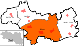  Location of Molau in Molauer Land
|
|
Molau is a district of the municipality of Molauer Land in the Burgenland district in Saxony-Anhalt .

geography
Molau is about 13 km south of Naumburg (Saale) and is the eponymous place of the Molauer Platte . This is colloquially a largely flat, poorly forested and sparsely populated landscape between the federal highway 88 , the Wethau valley and the Tautenburg forest , which in turn forms the westernmost part of the Altenburg-Zeitz loess area. Sieglitz (incorporated into Molau on July 1, 1961) and Aue (incorporated into Molau on January 1, 1957) were designated as districts of the former municipality.
history
Molau was first mentioned in the 13th century in connection with two manors belonging to the von Molau family. A local branch of the Vargula taverns was named after the town of Molau .

Molau, Aue and Sieglitz belonged to Thuringia like most of today's districts of the municipality of Molauer Land until 1952 . While Molau and Aue belonged to the northern part of the Eisenberg district office until 1826 , Sieglitz was under the administration of the Camburg district . The Wettin offices of Eisenberg and Camburg belonged to different Ernestine duchies due to several divisions in the course of their existence . In 1826 Molau, Sieglitz and Aue came from the Duchy of Saxony-Gotha-Altenburg to the Duchy of Saxony-Meiningen and became part of the Camburg exclave. From 1922 to 1939 they belonged to the Camburg district department .
On January 1, 2010, the previously independent communities of Molau, Casekirchen , Abtlöbnitz and Leislau merged to form the new community of Molauer Land.
Culture and sights
The museum of local history with a collection of local rarities, such as B. Classic cars . Traditional events are a classic car meeting in August as well as the annual fountain festival in Bad Kösen in May and the Naumburg Hussite cherry festival in June.
For decades, a landmark on the southern outskirts was a water tower from the GDR era with a spherical container. However, after the water supply in the area was rebuilt, it was dismantled between the end of 2018 and mid-2019.

Economy and Infrastructure
traffic
To the federal highway 88 , which runs west of Molau from Naumburg (Saale) to Camburg , it is approx. 4.5 kilometers. The community was formerly connected to the surrounding towns by means of the Zeitz – Camburg railway line . After the Saale bridge near Camburg was blown up, Molau was the end point of the Zeitz line from 1945 until the Molau-Osterfeld section was closed in 1965.
Economy and tourism
In the vicinity of Molau there is a wind park that takes advantage of the good wind supply on the plateau. Hops are grown in the vicinity of the village . After completion of the cycle and hiking trail on the former Zeitz – Camburg railway line, the Saale-Unstrut-Elster-Rad-Acht will lead through Molau, a currently 178 km long cycle path through northeast Thuringia and southern Saxony-Anhalt.
Web links
Individual evidence
- ↑ BfN landscape profile 46600 Altenburg-Zeitzer-Loess area. Retrieved September 22, 2019 .
- ^ Molau on the homepage of VGEM Wethautal
- ^ The offices of the Eisenbergische Kreis before 1815 in the book "Geography for all Stands", from p. 224
- ↑ Places of the Saxon-Meiningen district of Saalfeld
- ^ History of the Camburg district department in the Thuringia archive portal
- ↑ StBA: Area changes from January 01 to December 31, 2010