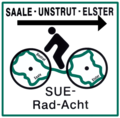
Saale-Unstrut-Elster-Rad-Acht
| Saale-Unstrut-Elster-Rad-Acht | |||
|---|---|---|---|

|
|||
| overall length | 178 km | ||
| location |
|
||
| Starting point | Naumburg (Saale) | ||
| Target point | Naumburg (Saale) | ||
| Places along the way |
West route:
(Naumburg) (Naumburg) East route: (Naumburg) (Naumburg) |
||
| Height difference | Ascent 1410 m, descent 1410 m (circular route) | ||
| difficulty | easy to difficult | ||
| Connection to | Unstrut-Radweg , Ilmtal-Radweg , Saale-Radweg , Elster-Radweg , Ostsee – Oberbayern (D11) | ||
| Website URL | https://www.saale-unstrut-tourismus.de/saale-unstrut-elster-rad-acht | ||
The Saale-Unstrut-Elster-Rad-Acht is a 178 km long regional tourist cycle route in Saxony-Anhalt and Thuringia , which connects the cycle routes along the Saale , Unstrut and Weißen Elster . This creates two interconnected circuits (east and west route) with Naumburg in the center, which appear on the map as a horizontal figure eight (∞).
Route profile
The cycle route mainly leads over paved paths away from the main roads, but all surface qualities occur. On some sections, country roads with moderate traffic have to be used without special consideration of bicycle traffic. Pushing may be necessary on very short sections. Most of the sections are passable regardless of the weather, as long as it is frost-free. There are parallel connections to the near-natural sections on country roads with little to moderate traffic.
The route has been changed several times since the route was first designated in the 1990s. For example, a variant extended to the west via Nebra (Unstrut) - Wendelstein - Wiehe - Lossa (Finne) is known. Further changes are possible in the future.
See also
literature
- Bicycle map Naumburg - Saale-Unstrut-Elster-Radacht, 1: 75,000, Verlag green heart , 2012, ISBN 978-3-86636-181-2
Individual evidence
- ↑ Topographic map 1: 50,000: Burgenlandkreis West, edition with hiking and biking trails . State Office for Surveying and Data Processing Saxony-Anhalt, Halle, 1st edition 2000. ISBN 3-89761-098-1
