Qaarsuarsuk
| Qaarsuarsuk (small rock) | ||
|---|---|---|
| K'aersuarssuk | ||
| Qaarsuarsuk (between 1905 and 1909) | ||
| Commune | Avannaata Communia | |
| District | Uummannaq | |
| Geographical location | 70 ° 44 '28 " N , 52 ° 41' 28" W | |
|
|
||
| Residents | 0 (1953) |
|
| founding | 1905 | |
| Time zone | UTC-3 | |
Qaarsuarsuk [ qɑːsːuˌɑsːuk ] (the old spelling K'aersuarssuk ) is a desolate fallen Greenlandic settlement in the district Uummannaq in Avannaata Come Unia .
location
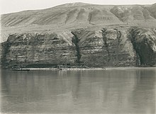
Qaarsuarsuk is located 2.3 km northwest of Qaarsut . In front of it runs the Uummannap Kangerlua fjord , and west of Qaarsuarsuk is the Aarrusap Kussinersua river delta .
history

Coal deposits were first found in Qaarsuarsuk as early as 1778. Without being able to speak of orderly mining, the easily accessible deposits were used by the local population from 1878 onwards.
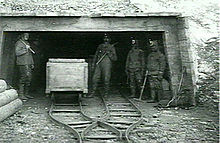
In 1905, Qaarsuarsuk was founded as a coal mine. In the first year, 200 tons of coal were mined. In 1906 a power station was built.
In 1915 there were 47 Greenlanders and five Europeans at the place of residence. Three hunters worked in the village, the other men were miners who had to go hunting to survive. The Europeans were the mine manager, a housekeeper, a blacksmith, a carpenter and a laborer. There were sixteen houses in Greenland, which was excessive for the population. Four belonged to the mining company and nine were occupied by workers. There were also two coal stores, one from 1903 and one from 1908 and a small coal shed from 1910. There was also a material house from 1905, a powder house from 1906, a petroleum house from 1910 and a weighing house from 1911. The forge was built in 1905 and the carpentry workshop was from 1907. A large house for the Danish team from 1905 had six rooms, a kitchen, pantry and cellar. There was also a separate apartment for a craftsman, built in 1907, which was originally built in 1892 for Erich von Drygalski's expedition north of Sermeq Kujalleq . The mine manager's house was built in 1912 and had two rooms and a kitchen.
In 1917, 1,700 tons of coal were mined in one year. When the deposits were exhausted, the mine was closed in 1924 and the mining activities relocated to the newly established Qullissat .
In 1930 Qaarsuarsuk still had 30 residents. In the 1940s the population was 17 to 21 people. In 1952 the place to live was given up.
Qaarsuarsuk was part of the Qaarsut community from 1911. With the administrative reform of 1950 it became part of the new municipality of Uummannaq .
Qaarsut Airport is now located on the site of the former residential area .
Individual evidence
- ↑ Map with all official place names confirmed by Oqaasileriffik , provided by Asiaq
- ↑ a b c d Hans P. Steenfos, Jørgen Taagholt: Grønlands teknologihistorie . Gyldendal, 2012, ISBN 978-87-02-13561-9 , pp. 103 f . ( limited preview in Google Book search).
- ^ Alfred Bertelsen , Hother Ostermann : Beskrivelse af Distrikterne i Nordgrønland: Ũmánaĸ district. De grandson Bopladser. Kaersuarssuk . In: Georg Carl Amdrup , Louis Bobé , Adolf Severin Jensen , Hans Peder Steensby (eds.): Grønland i tohundredeaaret for Hans Egedes landing (= Meddelelser om Grønland . Volume 60-61 ). tape 1 . C. A. Reitzel Boghandel, Copenhagen 1921, p. 403 ff . ( Digitized in the Internet Archive ).
- ↑ Jens Christian Madsen: Udsteder og bopladser i Grønland 1901-2000 . Atuagkat, 2009, ISBN 978-87-90133-76-4 , pp. 171 f .


