
Oberbodnitz
| coat of arms | Germany map | |
|---|---|---|
 Help on coat of arms |
Coordinates: 50 ° 49 ' N , 11 ° 40' E |
|
| Basic data | ||
| State : | Thuringia | |
| County : | Saale-Holzland district | |
| Management Community : | Hills / valleys | |
| Height : | 270 m above sea level NHN | |
| Area : | 6.43 km 2 | |
| Residents: | 234 (Dec. 31, 2019) | |
| Population density : | 36 inhabitants per km 2 | |
| Postal code : | 07646 | |
| Area code : | 036424 | |
| License plate : | SHK, EIS, SRO | |
| Community key : | 16 0 74 064 | |
| Association administration address: | Pfarrwinkel 10 07646 Tröbnitz |
|
| Website : | ||
| Mayor : | Steffen Feind | |
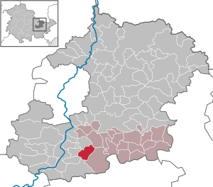
| Location of the municipality of Oberbodnitz in the Saale-Holzland district | ||
  |
||


Oberbodnitz is a municipality in the south of the Saale-Holzland district in Thuringia and part of the Hügelland / Täler administrative community .
geography
Oberbodnitz is five kilometers east of Kahla , embedded in a valley that is crossed by the road to the Leuchtenburg . The district of Seitenbrück , which belongs to Oberbodnitz, is located southwest of the main town in a flat basin of the Rietschenbach.
history
The place name can be traced back to the year 873 , when it first appeared as "Butenicz" in the meaning of "guardian village". From 1271 at the earliest, clergymen from the Catholic period lived in this place. Seitenbrück, the current part of the municipality, appeared for the first time in 1411 in the documents, then called "Sidenbrugke".
There used to be a chapel in Oberbodnitz , which must have been built before the Reformation . Noteworthy is a swarm of locusts that attacked the area around the Leuchtenburg on August 16, 1697 and caused great harvest losses. The first industrial activities began in Oberbodnitz with a brickworks opened in 1850 . In 1900 a long-standing brewery was closed. In 1905 (water supply) and 1910 ( electricity network ) , the place was connected to the pipeline network infrastructure that is common today .
In 1921 a memorial was erected in Oberbodnitz for the soldiers who fell in the First World War . In 1933/34 the road between Ober- and Unterbodnitz was built. In April 1945 the place was occupied by the US Army and passed on to the Red Army in early July . Like all of Thuringia, Oberbodnitz became part of the Soviet occupation zone and, from 1949, the GDR . The first LPG dissolved again in 1953, and in 1960 the last farmers were forced to join the LPG "Thomas Müntzer". On October 3, 1990, the community planted an oak in the Kulturhausgarten for the “Day of German Unity”. In 1998 the facade of the church was renovated. As part of the village renewal from 2006 to 2010, the renovation of the culture house from the 1950s, the design of the village square and a renovation of the village street took place.
→ See Oberbodnitz village church
Attractions
One of the sights of the place is the church ( location → ). There are also considerable half-timbered buildings, such as the parish hall.
Individual evidence
- ^ Population of the municipalities from the Thuringian State Office for Statistics ( help on this ).
Web links
Albersdorf | Altenberga | Bad Klosterlausnitz | Bibra | Bobeck | Bremsnitz | Bucha | Bürgel | Crossing the Elster | Dornburg-Camburg | Eichenberg | Eineborn | Eisenberg | Frauenprießnitz | Outdoor orla | Geisenhain | Gneus | Golmsdorf | Gosen | Graitschen at Bürgel | Greater buckedra | Grosseutersdorf | Großlöbichau | Großpürschütz | Gumperda | Hainichen | Hainspitz | Hartmannsdorf | Heathland | Hermsdorf | Hummelshain | Jenalöbnitz | Kahla | Karlsdorf | Little buckedra | Kleinebersdorf | Kleineutersdorf | Laasdorf | Lehesten | Lindig | Lippersdorf-Erdmannsdorf | Löberschütz | Mertendorf | Meusebach | Milda | Möckern | Mörsdorf | Nausnitz | Neuengönna | Oberbodnitz | Orlamünde | Ottendorf | Petersberg | Poxdorf | Rattelsdorf | Rauda | Rauschwitz | Rausdorf | Reichenbach | Reinstädt | Renthendorf | Rothenstein | Ruttersdorf-Lotschen | Scheiditz | Schkölen | Grinding trips | Schlöben | Schöngleina | Schöps | Side rod | Serba | Silbitz | Stadtroda | St. Gangloff | Sulza | Tautenburg | Tautendorf | Tautenhain | Animal snail | Tissa | Trobnitz | Trockenborn-Wolfersdorf | Unterbodnitz | Waldeck | Walpernhain | Waltersdorf | Weissbach | Weißenborn | Wichmar | Rooms | Zollnitz