
Ruttersdorf-Lotschen
| coat of arms | Germany map | |
|---|---|---|
 Help on coat of arms |
Coordinates: 50 ° 53 ' N , 11 ° 44' E |
|
| Basic data | ||
| State : | Thuringia | |
| County : | Saale-Holzland district | |
| Fulfilling municipality : | Stadtroda | |
| Height : | 250 m above sea level NHN | |
| Area : | 8.46 km 2 | |
| Residents: | 327 (Dec. 31, 2019) | |
| Population density : | 39 inhabitants per km 2 | |
| Postal code : | 07646 | |
| Area code : | 036428 | |
| License plate : | SHK, EIS, SRO | |
| Community key : | 16 0 74 081 | |
| Association administration address: | Straße des Friedens 17 07646 Stadtroda |
|
| Website : | ||
| Mayor : | Volker Baumann | |
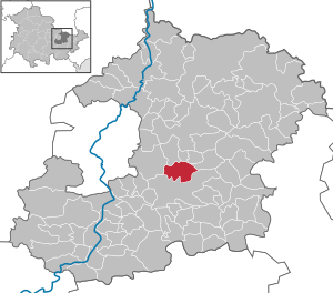
| Location of the municipality of Ruttersdorf-Lotschen in the Saale-Holzland district | ||
  |
||

Ruttersdorf-Lotschen is a municipality in the Saale-Holzland district in Thuringia . The fulfilling municipality is the city of Stadtroda .
The community has two districts: Ruttersdorf with 261 inhabitants and Lotschen with 61 inhabitants.
geography


Ruttersdorf is located north of the city of Stadtroda and the federal highway 4 on the state road 2315 in a corridor surrounded by forest. The Ruttersdorf water reservoir is to the east of the hamlet of Lotschen .
history
The first documentary mention of Ruttersdorf in 1216 and of Lotschen in 1406.
The community was created on July 1, 1950 through the merger of the previously independent communities Lotschen and Ruttersdorf.
Culture and sights
Regular cultural events include setting the maypole on the last weekend in May and the fair on the last weekend in October. The fire brigade association is responsible for these events. V. Ruttersdorf-Lotschen.
Individual evidence
- ^ Population of the municipalities from the Thuringian State Office for Statistics ( help on this ).
- ^ Otto Dobencker : Regesta diplomatica necnon epistolaria historiae Thuringiae. Volume 2: (1152-1227). Gustav Fischer, Jena 1900, p. 315, no.1718 .
- ↑ Hans Apel: Jena's inhabitants from the time from 1250 to 1600. Source book for the Jena family history. Starke, Görlitz 1937.
Web links
Albersdorf | Altenberga | Bad Klosterlausnitz | Bibra | Bobeck | Bremsnitz | Bucha | Bürgel | Crossing the Elster | Dornburg-Camburg | Eichenberg | Eineborn | Eisenberg | Frauenprießnitz | Outdoor orla | Geisenhain | Gneus | Golmsdorf | Gosen | Graitschen at Bürgel | Greater buckedra | Grosseutersdorf | Großlöbichau | Großpürschütz | Gumperda | Hainichen | Hainspitz | Hartmannsdorf | Heathland | Hermsdorf | Hummelshain | Jenalöbnitz | Kahla | Karlsdorf | Little buckedra | Kleinebersdorf | Kleineutersdorf | Laasdorf | Lehesten | Lindig | Lippersdorf-Erdmannsdorf | Löberschütz | Mertendorf | Meusebach | Milda | Möckern | Mörsdorf | Nausnitz | Neuengönna | Oberbodnitz | Orlamünde | Ottendorf | Petersberg | Poxdorf | Rattelsdorf | Rauda | Rauschwitz | Rausdorf | Reichenbach | Reinstädt | Renthendorf | Rothenstein | Ruttersdorf-Lotschen | Scheiditz | Schkölen | Grinding trips | Schlöben | Schöngleina | Schöps | Side rod | Serba | Silbitz | Stadtroda | St. Gangloff | Sulza | Tautenburg | Tautendorf | Tautenhain | Animal snail | Tissa | Trobnitz | Trockenborn-Wolfersdorf | Unterbodnitz | Waldeck | Walpernhain | Waltersdorf | Weissbach | Weißenborn | Wichmar | Rooms | Zollnitz