
Outdoor orla
| coat of arms | Germany map | |
|---|---|---|

|
Coordinates: 50 ° 46 ' N , 11 ° 33' E |
|
| Basic data | ||
| State : | Thuringia | |
| County : | Saale-Holzland district | |
| Management Community : | Southern Saale Valley | |
| Height : | 180 m above sea level NHN | |
| Area : | 6.84 km 2 | |
| Residents: | 337 (Dec. 31, 2019) | |
| Population density : | 49 inhabitants per km 2 | |
| Postal code : | 07768 | |
| Area code : | 036423 | |
| License plate : | SHK, EIS, SRO | |
| Community key : | 16 0 74 021 | |
| Association administration address: | Bahnhofstrasse 23 07768 Kahla |
|
| Website : | ||
| Mayor : | Ulrich Eismann | |
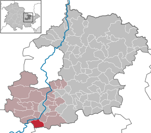
| Location of the community of Freienorla in the Saale-Holzland district | ||
  |
||

Freienorla is a municipality in the Saale-Holzland district in Thuringia .
geography
The place and the Pritschroda estate are located in the south of the Saale-Holzland district in the scenic surroundings of the Saale valley. Here the Orla flows into the Saale .
history

As early as 500 BC There are first indications of a settlement (urn fire sites at Hahnenborn). References to a watermill on the Orlafurt date back to 1176 AD . The first documentary mentions go back to the time 1235–1237. In this century the church with churchyard wall was built in Gothic style. In 1378 the name Vrienorla appeared for the first time in a document. The neighboring communities belonged to the Orlamünder Burggericht. It has not been established whether Freienorla was ever one of them. The Freienorlaer claim to have never been subject to foreign rule.
In 1547, Freienorla made a name for itself when Colonel Joachim von Brandenstein pinched Spanish soldiers at the narrow point of Freienorla and sent them home with bloody heads.

Two of the 15 mills in the Orla area were in Freienorla. The lower mill, which is under monument protection, can still be visited today. There are references to them as early as 1447 . At that time, the Untermühle was already licensed . Originally it belonged to the nobles of Eichenberg. On December 15, 1895 , the mill burned down. In the following three years (1896–98) it was rebuilt using modern mill technology and a 5.5 m water wheel. She then worked as a trading mill with bakeries between Jena and Pößneck. The second mill in Freienorla was the upper mill, which was operated as a grinding mill, sawmill and oil mill. The porcelain factory, which operated until the early 1960s, was later built in its place.

The historic, listed train station still exists today. It is on the Orlamünde – Freienorla – Pößneck railway line , which opened on October 1, 1889.
Seven victims of a concentration camp death march that were driven through the town by SS men in April 1945 were buried in the cemetery . About 1,500 prisoners had to spend two nights in barns and in the garden of the porcelain factory before they were driven on. In 1985 a death march stele was erected in the center of the village to commemorate her .
Personalities
- Gotthold Gundermann (1856–1921) classical philologist, professor in Giessen and Tübingen.
Individual evidence
- ^ Population of the municipalities from the Thuringian State Office for Statistics ( help on this ).
- ↑ Thuringian Association of the Persecuted of the Nazi Regime - Association of Antifascists and Study Group of German Resistance 1933–1945 (Ed.): Local history guide to sites of resistance and persecution 1933–1945. Volume 8: Thuringia. VAS - Verlag für Akademische Schriften, Frankfurt am Main 2003, ISBN 3-88864-343-0 , p. 209.
Web links
Albersdorf | Altenberga | Bad Klosterlausnitz | Bibra | Bobeck | Bremsnitz | Bucha | Bürgel | Crossing the Elster | Dornburg-Camburg | Eichenberg | Eineborn | Eisenberg | Frauenprießnitz | Outdoor orla | Geisenhain | Gneus | Golmsdorf | Gosen | Graitschen at Bürgel | Greater buckedra | Grosseutersdorf | Großlöbichau | Großpürschütz | Gumperda | Hainichen | Hainspitz | Hartmannsdorf | Heathland | Hermsdorf | Hummelshain | Jenalöbnitz | Kahla | Karlsdorf | Little buckedra | Kleinebersdorf | Kleineutersdorf | Laasdorf | Lehesten | Lindig | Lippersdorf-Erdmannsdorf | Löberschütz | Mertendorf | Meusebach | Milda | Möckern | Mörsdorf | Nausnitz | Neuengönna | Oberbodnitz | Orlamünde | Ottendorf | Petersberg | Poxdorf | Rattelsdorf | Rauda | Rauschwitz | Rausdorf | Reichenbach | Reinstädt | Renthendorf | Rothenstein | Ruttersdorf-Lotschen | Scheiditz | Schkölen | Grinding trips | Schlöben | Schöngleina | Schöps | Side rod | Serba | Silbitz | Stadtroda | St. Gangloff | Sulza | Tautenburg | Tautendorf | Tautenhain | Animal snail | Tissa | Trobnitz | Trockenborn-Wolfersdorf | Unterbodnitz | Waldeck | Walpernhain | Waltersdorf | Weissbach | Weißenborn | Wichmar | Rooms | Zollnitz