
Einborn
| coat of arms | Germany map | |
|---|---|---|
 Help on coat of arms |
Coordinates: 50 ° 50 ' N , 11 ° 51' E |
|
| Basic data | ||
| State : | Thuringia | |
| County : | Saale-Holzland district | |
| Management Community : | Hills / valleys | |
| Height : | 285 m above sea level NHN | |
| Area : | 7.83 km 2 | |
| Residents: | 328 (Dec. 31, 2019) | |
| Population density : | 42 inhabitants per km 2 | |
| Postal code : | 07646 | |
| Area code : | 036426 | |
| License plate : | SHK, EIS, SRO | |
| Community key : | 16 0 74 017 | |
| Association administration address: | Pfarrwinkel 10 07646 Tröbnitz |
|
| Website : | ||
| Mayor : | Bodo Pufe | |
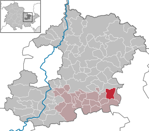
| Location of the community of Eineborn in the Saale-Holzland district | ||
  |
||

Eineborn is a municipality in the southeast of the Saale-Holzland district and part of the Hügelland / Täler administrative community .
geography

Neighboring communities
Neighboring communities are Kleinebersdorf , Ottendorf , Renthendorf , St. Gangloff and Tautendorf .
history
Einborn was first mentioned in documents in 1280.
|
|
|
|
|
politics
Distribution of seats in the municipal council (6 seats):
FDP: 6
Memorials
- In the local cemetery , a grave with a plaque commemorates a named Yugoslav who was abducted to Germany for forced labor in the Second World War and murdered in 1943.
- Since 1985, the place commemorates a stele in the local situation of the concentration camp prisoners , which in April 1945 from the satellite camp Ohrdruf of the Buchenwald concentration camp were coming driven through the town.
Individual evidence
- ^ Population of the municipalities from the Thuringian State Office for Statistics ( help on this ).
- ^ Otto Dobencker : Regesta diplomatica necnon epistolaria historiae Thuringiae. Volume 4: (1267-1288). G. Fischer, Jena 1939, No. 1874.
- ↑ Data source: Thuringian State Office for Statistics
- ↑ wahlen.thueringen.de
Web links
Albersdorf | Altenberga | Bad Klosterlausnitz | Bibra | Bobeck | Bremsnitz | Bucha | Bürgel | Crossing the Elster | Dornburg-Camburg | Eichenberg | Eineborn | Eisenberg | Frauenprießnitz | Outdoor orla | Geisenhain | Gneus | Golmsdorf | Gosen | Graitschen at Bürgel | Greater buckedra | Grosseutersdorf | Großlöbichau | Großpürschütz | Gumperda | Hainichen | Hainspitz | Hartmannsdorf | Heathland | Hermsdorf | Hummelshain | Jenalöbnitz | Kahla | Karlsdorf | Little buckedra | Kleinebersdorf | Kleineutersdorf | Laasdorf | Lehesten | Lindig | Lippersdorf-Erdmannsdorf | Löberschütz | Mertendorf | Meusebach | Milda | Möckern | Mörsdorf | Nausnitz | Neuengönna | Oberbodnitz | Orlamünde | Ottendorf | Petersberg | Poxdorf | Rattelsdorf | Rauda | Rauschwitz | Rausdorf | Reichenbach | Reinstädt | Renthendorf | Rothenstein | Ruttersdorf-Lotschen | Scheiditz | Schkölen | Grinding trips | Schlöben | Schöngleina | Schöps | Side rod | Serba | Silbitz | Stadtroda | St. Gangloff | Sulza | Tautenburg | Tautendorf | Tautenhain | Animal snail | Tissa | Trobnitz | Trockenborn-Wolfersdorf | Unterbodnitz | Waldeck | Walpernhain | Waltersdorf | Weissbach | Weißenborn | Wichmar | Rooms | Zollnitz