
Grinding trips
| coat of arms | Germany map | |
|---|---|---|

|
Coordinates: 50 ° 53 ' N , 11 ° 49' E |
|
| Basic data | ||
| State : | Thuringia | |
| County : | Saale-Holzland district | |
| Management Community : | Hermsdorf | |
| Height : | 330 m above sea level NHN | |
| Area : | 6.95 km 2 | |
| Residents: | 421 (Dec. 31, 2019) | |
| Population density : | 61 inhabitants per km 2 | |
| Postal code : | 07629 | |
| Area code : | 036601 | |
| License plate : | SHK, EIS, SRO | |
| Community key : | 16 0 74 084 | |
| Association administration address: | Am Alten Versuchsfeld 1 07629 Hermsdorf |
|
| Website : | ||
| Mayoress : | Jacqueline Wulf | |
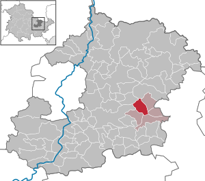
| Location of the municipality of Schleifreisen in the Saale-Holzland district | ||
  |
||

Schleifreisen is a municipality in the Saale-Holzland district in Thuringia and part of the Hermsdorf administrative community .
geography
Schleifreisen is located on a high plateau, two kilometers west of Hermsdorf and immediately northwest of the Hermsdorf Cross , which is partly in the municipality. The district of the village is bounded to the west and north by the Zeitzgrund , in which the Zeitzbach runs. The community has a share of the FFH area Zeitzgrund - Teufelstal - Hermsdorfer Moore .
history
On August 13, 1351, Schleifreisen was first mentioned in a document. The place belonged to the Lords of Lichtenhain from 1433 to 1655 , then to those of Brand .
The plague broke out in the village during the Thirty Years War . From 1618 on, the Schleifreisen farmers litigated before the court court Jena against compulsory service to their liege lords. The proceedings ended in 1621 with a settlement . In 1856 the front money was finally abolished.
In 1996 the community joined the administrative community of Hermsdorf.
politics
The honorary mayor Jaqueline Wulf was re-elected on June 5, 2016.
The municipal council consists of six members. All are provided by the community of voters for grinding trips .
Culture and sights


Sightseeing and tourism
- The village church Schleifreisen was built in 1769/70 in place of its dilapidated predecessor St. Jacobus .
- The water tower Schleifreisen at the entrance to the village is visible from afar . It was built in 1929 to connect the place to the public water supply. With a capacity of 160 m³, the tower, which was completely renovated in 2008/09, is now used as an extinguishing water reservoir.
- The Zeitzgrund with the goat and goat mill in the north of the municipality, the Hasental and the Teufelstal with the Teufelstalbrücke , at the time of construction one of the world's largest bridges, are part of the attractive tourist area of the place.
Regular events
Since 2002, the “Hasentallauf” fun run , which runs through grinding journeys, has taken place every year in August .
economy
The place has a 7.27 hectare industrial park. Several craftsmen from various trades are based in the village itself.
Web links
- Grinding trips on the homepage of VG Hermsdorf
Individual evidence
- ^ Population of the municipalities from the Thuringian State Office for Statistics ( help on this ).
- ↑ 5136-301 Zeitzgrund - Teufelstal - Hermsdorfer Moore. (FFH area) Profiles of the Natura 2000 areas. Published by the Federal Agency for Nature Conservation . Retrieved March 12, 2017.
- ^ Wolfgang Kahl : First mention of Thuringian towns and villages. A manual. 5th, improved and considerably enlarged edition. Rockstuhl, Bad Langensalza 2010, ISBN 978-3-86777-202-0 , p. 250.
- ↑ Mayoral election 2016 , accessed on February 15, 2017
- ↑ 2014 municipal council election , accessed on February 15, 2016
- ↑ Timo Jahn: Hasentallauf . Laufservice-jena.de. Archived from the original on July 5, 2012. Info: The archive link was inserted automatically and has not yet been checked. Please check the original and archive link according to the instructions and then remove this notice. Retrieved June 10, 2012.
Albersdorf | Altenberga | Bad Klosterlausnitz | Bibra | Bobeck | Bremsnitz | Bucha | Bürgel | Crossing the Elster | Dornburg-Camburg | Eichenberg | Eineborn | Eisenberg | Frauenprießnitz | Outdoor orla | Geisenhain | Gneus | Golmsdorf | Gosen | Graitschen at Bürgel | Greater buckedra | Grosseutersdorf | Großlöbichau | Großpürschütz | Gumperda | Hainichen | Hainspitz | Hartmannsdorf | Heathland | Hermsdorf | Hummelshain | Jenalöbnitz | Kahla | Karlsdorf | Little buckedra | Kleinebersdorf | Kleineutersdorf | Laasdorf | Lehesten | Lindig | Lippersdorf-Erdmannsdorf | Löberschütz | Mertendorf | Meusebach | Milda | Möckern | Mörsdorf | Nausnitz | Neuengönna | Oberbodnitz | Orlamünde | Ottendorf | Petersberg | Poxdorf | Rattelsdorf | Rauda | Rauschwitz | Rausdorf | Reichenbach | Reinstädt | Renthendorf | Rothenstein | Ruttersdorf-Lotschen | Scheiditz | Schkölen | Grinding trips | Schlöben | Schöngleina | Schöps | Side rod | Serba | Silbitz | Stadtroda | St. Gangloff | Sulza | Tautenburg | Tautendorf | Tautenhain | Animal snail | Tissa | Trobnitz | Trockenborn-Wolfersdorf | Unterbodnitz | Waldeck | Walpernhain | Waltersdorf | Weissbach | Weißenborn | Wichmar | Rooms | Zollnitz