Vardø
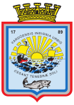
| coat of arms | map | |
|---|---|---|

|
|
|
| Basic data | ||
| Commune number : | 5404 | |
| Province (county) : | Troms and Finnmark | |
| Administrative headquarters: | Vardø | |
| Coordinates : | 70 ° 0 ′ N , 31 ° 0 ′ E | |
| Surface: | 600.61 km² | |
| Residents: | 2,029 (Feb 27, 2020) | |
| Population density : | 3 inhabitants per km² | |
| Language form : | Bokmål | |
| Website: | ||
| politics | ||
| Mayor : | Ørjan Jensen (MDG) (2019) | |
| Located in the province of Troms and Finnmark | ||

|
||
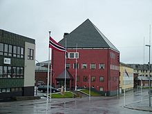
(sam .:Várggát,Kvenisch:Vuorea) is a city and amunicipalityin theFylke Troms og FinnmarkinNorway. It is the easternmost municipality in Norway. Vardø is even further east thanIstanbul,Saint PetersburgandCairo.
Location and dates
The city is located off the east coast of Norway on the small island Vardøya and the offshore bird cliffs of the island Hornøy on the Barents Sea and is the most easterly point of the country. The municipality of Vardø also extends partly on the mainland. The two parts are connected by the Vardøtunnel .
The community has 2029 inhabitants (as of February 27, 2020). The main industries are fishing and fish processing.
history
Archaeological finds indicate that the area was already settled around 9,000 years ago. The present settlement was founded in 1306. Vardø was supposed to exist as a bulwark against Russia . In 1789 the community received city rights . Trade with Russia was abundant at the time. The end of trade came with the Russian Revolution . The city was completely destroyed during World War II , but was rebuilt after the war, although there were also plans to rebuild the city on the mainland.
The Globus II radar
Vardø played an important role in NATO's early warning system during the Cold War . The domes of the radars, which dominate the image of the community, were also used for civil purposes.
A radar station called Globus II has been located in Vardø since 1998. The official task is the tracking of space debris . This X-band radar , however, is also used for the National Missile Defense of the United States . Another system, Globus III, has been built since mid-2017; it should be completed in 2020. In February 2018 it was announced that it will be larger than previously known. Residents of Vardø criticized this and accused the responsible authorities in Norway and the USA of targeted misinformation.
climate
The polar night lasts from November 23rd to January 21st. The sun, on the other hand, does not sink below the horizon on 74 days, from May 16 to July 29. The city is located in the arctic climate zone . The coldest months are December, January, February and March, with temperatures averaging between −3 and −5 ° C. The mean temperature of the warmest months of July and August is around 9 ° C. The absolute temperature extremes are −22 ° C and +24 ° C. The annual total of precipitation is around 570 mm on a long-term average. Precipitation of at least 0.1 mm falls on an average of 210 days per year.
| Vardø | ||||||||||||||||||||||||||||||||||||||||||||||||
|---|---|---|---|---|---|---|---|---|---|---|---|---|---|---|---|---|---|---|---|---|---|---|---|---|---|---|---|---|---|---|---|---|---|---|---|---|---|---|---|---|---|---|---|---|---|---|---|---|
| Climate diagram | ||||||||||||||||||||||||||||||||||||||||||||||||
| ||||||||||||||||||||||||||||||||||||||||||||||||
|
Average monthly temperatures and rainfall for Vardø
Source: wetterkontor.de
|
|||||||||||||||||||||||||||||||||||||||||||||||||||||||||||||||||||||||||||||||||||||||||||||||||||||||||||||||||||||||||||||||||||||||
traffic
A road tunnel under the Arctic Ocean connects the old fortress city with the mainland. The tunnel was built as Norway's first underwater tunnel. It is 2890 m long and its deepest point is 88 m below the surface of the water.
The community is the landing stage for the Hurtigruten ships and the end of European route 75 , which begins on the Greek island of Crete .
The Vardo Airport (IATA code: VAW ICAO ENSS) use about 13,000 passengers a year.
Attractions
- The Vardøhus festning is an octagonal fortress that the Finnmark should protect against Russian attacks. It was laid out in the 14th century and has been the northernmost fortress in the world ever since. King Christian had it converted into an octagonal star shape between 1734 and 1738.
- The Vardømuseum is a reminder of the witch burnings in the 17th century, but also the polar expeditions at the beginning of the 20th century and the Second World War.
- Vardø Church from 1958
- The Pomormuseet, a museum dedicated to the trading Pomors recalls the 19th century.
- Witch memorial by the Swiss architect Peter Zumthor and the French-American sculptor Louise Bourgeois .
- The lighthouse of the place has a luminosity of 2 million light intensities sm a range of 28th
- Hamningberg is an abandoned fishing village about 40 km from Vardø. The houses date from the time of the Pomors trade. Today Hamningberg is a holiday resort that can only be reached by snowmobile in winter and by car in summer. The chapel is from 1949.
Trivia
Vardø is not only Norway's easternmost city. It is also the easternmost city with Central European Time .
Personalities
- Ada Egede-Nissen (1899–1981), actress
- Øivind Bolstad (1905–1979), writer
- Oddvar Berrefjord (1918–1999), lawyer, policeman and politician
- Karl Eirik Schjøtt-Pedersen (* 1959), politician
- John Norum (born 1964), guitarist
- Stefan Johansen (* 1991), soccer player
Web links
- Official website of Vardø Municipality (Norwegian)
- Pages of the Statistics Office of Norway (Norwegian)


