Måsøy
| coat of arms | map | |
|---|---|---|

|
|
|
| Basic data | ||
| Commune number : | 5434 | |
| Province (county) : | Troms and Finnmark | |
| Administrative headquarters: | Havøysund | |
| Coordinates : | 70 ° 55 ' N , 24 ° 41' E | |
| Surface: | 1,135.83 km² | |
| Residents: | 1,225 (Feb 27, 2020) | |
| Population density : | 1 inhabitant per km² | |
| Language form : | Bokmål | |
| Website: | ||
| politics | ||
| Mayor : | Bernth R. Sjursen ( Ap ) (2019) | |
| Located in the province of Troms and Finnmark | ||

|
||
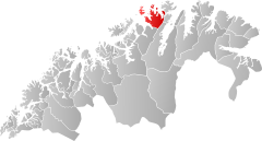
Måsøy ( Sami Muosátsullo ) is a town and municipality in the Norwegian province ( Fylke ) Troms og Finnmark .
The municipality is located on the west coast of Finnmark on the Porsanger peninsula and some offshore islands. It includes several scattered coastal settlements. The administrative seat was moved from the eponymous place Måsøy to Havøysund ; other settlements are Snefjord, Kokelv, Ingøy and Rolvsøy. Until December 31, 1983, western parts of the island of Magerøya , in particular the place Gjesvær , belonged to the municipality of Måsøy.
The lighthouse Fruholmen fyr is the northernmost in Norway and the world.
The Hurtigruten ships call at Havøysund harbor every day. In addition to a road that is often impassable in winter, this is the most important connection to the outside world.
Personalities
- Magnus Brostrup Landstad (1802–1880), Lutheran pastor, author of hymns, editor of church hymn books and collector of folk songs
- Johannes Olai Olsen (1895–1974), politician
- Trygve Olsen (1921–1979), politician
- Ingalill Olsen (* 1955), politician
Web links
Individual evidence
- ↑ Statistisk sentralbyrå - Befolkning
- ^ Einar Richter-Hanssen: Nordkapp - Gate to the Arctic Ocean. Publisher: Arctic Suvenir AS, 2011, ISBN 978-82-998690-0-3 , p. 83 f.

