Gamvik
| coat of arms | map | |
|---|---|---|

|
|
|
| Basic data | ||
| Commune number : | 5439 | |
| Province (county) : | Troms and Finnmark | |
| Administrative headquarters: | Mehamn | |
| Coordinates : | 71 ° 4 ′ N , 28 ° 15 ′ E | |
| Surface: | 1,416.34 km² | |
| Residents: | 1,132 (Feb 27, 2020) | |
| Population density : | 1 inhabitant per km² | |
| Language form : | neutral | |
| Website: | ||
| politics | ||
| Mayor : | Alf Normann Hansen ( SV ) (2019) | |
| Located in the province of Troms and Finnmark | ||

|
||
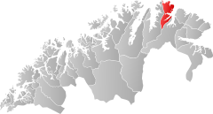
Gamvik is a Norwegian municipality in the province ( Fylke ) Troms og Finnmark . It includes the settlements of Mehamn , Skjånes, Langfjordnes, Nervei and Gamvik. The administrative seat is in Mehamn.
Gamvik is located on the coast of the Barents Sea in the eastern half of the Nordkyn peninsula . With Cape Kinnarodden , the northernmost point of continental Europe lies on the communal area. Until 2000, Gamvik was the northernmost landing point of the Hurtigruten .
About 3 kilometers north of the village is the northernmost lighthouse on the European mainland Slettnes fyr , which can also be visited for a fee.
Likewise, what was perhaps the northernmost mainland campsite in the world at the time, the so-called "Camp 71 ° N", was located in Gamvik. It is now closed.
coat of arms
Description : Three golden net needles slanted to the right in red .
