
Dillstädt
| coat of arms | Germany map | |
|---|---|---|

|
Coordinates: 50 ° 35 ' N , 10 ° 32' E |
|
| Basic data | ||
| State : | Thuringia | |
| County : | Schmalkalden-Meiningen | |
| Management Community : | Dolmar salt bridge | |
| Height : | 340 m above sea level NHN | |
| Area : | 13.97 km 2 | |
| Residents: | 764 (Dec. 31, 2019) | |
| Population density : | 55 inhabitants per km 2 | |
| Postal code : | 98530 | |
| Area code : | 036846 | |
| License plate : | SM, MGN | |
| Community key : | 16 0 66 016 | |
| Address of the municipal administration: |
Dorfstrasse 18 98530 Dillstädt |
|
| Website : | ||
| Mayoress : | Liane Bach (individual candidate) | |
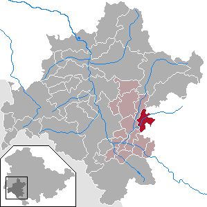
| Location of the municipality of Dillstädt in the district of Schmalkalden-Meiningen | ||
  |
||


Dillstädt is a municipality in the district of Schmalkalden-Meiningen in the Free State of Thuringia, which is part of the Dolmar-Salzbrücke administrative community .
geography
Dillstädt is located on the Hasel in the southern Thuringian Forest on the road between Suhl and Meiningen . To the southwest of the village is the 503 meter high Hölschberg. Its name probably comes from the goddess of the dead Hel or from the goddess Holle or Holda.
Community structure
The Ziegelhütte district belongs to the municipality of Dillstädt.
history
The place was first mentioned in documents in 1206, the desert areas of Germelshausen and Sieholz even in older documents from 800 to 845. The place belonged to the County of Henneberg , from 1500 also to the Franconian Empire and until 1815 was in the Saxon office of Kühndorf . From 1816 to 1944 Dillstädt was part of the Erfurt administrative district of the Prussian province of Saxony .
In 2010, an archaeological excavation found the foundation walls of a high mediaeval castle on the site of today's church. Two exposed tower foundations point to a still unknown noble family resident in the village. The current church was built according to the church chronicle between 1593 and 1596, but the building findings indicate that there was at least one previous building.
Population development
Development of the population (December 31) :
|
|
|
|
|
- Data source: Thuringian State Office for Statistics
Culture and sights
Buildings
- The church dates from 1593, the current nave was built between 1593 and 1596. From the previous Gothic building, there are still tracery parts, a keystone and a piscina .
- On the Silbachskuppe, 2.5 km east of the village, there is a rampart with a church ruin in a heavily wooded area. To the east, a wall and a moat protect this area. The church was a pilgrimage church of St. Laurentius . In the eastern part of the Lorenze forest there are several barrows . This place was already important in the Bronze Age.
Natural monuments
- The Wichtelsteine on the road in the direction of Wichtshausen are about 300 m long chain of heavily fissured shell limestone rocks .
traffic
The L1140 runs through the village and connects Dillstädt with Suhl (approx. 12 km) and with Meiningen (approx. 10 km). Furthermore, the L2628 branches off to Marisfeld (approx. 5 km away). The closest motorway junctions are junction 21 “Meiningen-Nord” of the A 71 (approx. 5 km away) and junction 2 “Suhl-Zentrum” of the A 73 (approx. 13 km away).
Individual evidence
- ^ Population of the municipalities from the Thuringian State Office for Statistics ( help on this ).
- ↑ G. Altenkirch: From Hel-Berg to Hölschberg. In: Saarpfalz calendar. 2007, ISSN 1614-9084 .
- ↑ Jürgen Glocke: Walls of a residential tower from Ottonian times: instead of the suspected burial ground, the remains of a medieval castle complex were found during construction work in Dillstädt . In: Faith and Home . No. 41, 2010, p. 8 . (Digitized version) (PDF; 942 kB)
- ↑ Michael Köhler : Pagan sanctuaries. Pre-Christian places of worship and suspected cult sites in Thuringia. Jenzig-Verlag Köhler, Jena 2007, ISBN 978-3-910141-85-8 , pp. 199-200.
Web links
- thueringenfotos.de - Photos from the village from 1989
- thueringenfotos.de - Photos from the village from 1989
- Dillstädt on the homepage of the administrative association

Belrieth | Birx | Breitungen / Werra | Brotterode-Trusetal | Christes | Dillstädt | Einhausen (Thuringia) | Ellingshausen | Erbenhausen | Fambach | Flea Seligenthal | Frankenheim / Rhön | Friedelshausen | Grabfeld | Kaltennordheim | Kühndorf | Leutersdorf (Thuringia) | Mehmels | Meiningen | Neubrunn (Thuringia) | Oberhof | Ober Maßfeld-Grimmenthal | Oberweid | Rhönblick | Rippershausen | Ritschenhausen | Pipe | Pink | Roßdorf (Thuringia) | Schmalkalden | Surge | Schwarza (Thuringian Forest) | Steinbach-Hallenberg | Sülzfeld | Undersize field | Utendorf | Vachdorf | Wasungen | Zella Mehlis