
Fambach
| coat of arms | Germany map | |
|---|---|---|

|
Coordinates: 50 ° 44 ' N , 10 ° 22' E |
|
| Basic data | ||
| State : | Thuringia | |
| County : | Schmalkalden-Meiningen | |
| Fulfilling municipality : | Breitungen / Werra | |
| Height : | 270 m above sea level NHN | |
| Area : | 18.33 km 2 | |
| Residents: | 2060 (Dec. 31, 2019) | |
| Population density : | 112 inhabitants per km 2 | |
| Postal code : | 98597 | |
| Area code : | 036848 | |
| License plate : | SM, MGN | |
| Community key : | 16 0 66 022 | |
| Address of the municipal administration: |
Platz der Republik 6 98597 Fambach |
|
| Website : | ||
| Mayor : | Ralf-Peter Schmidt ( CDU ) | |
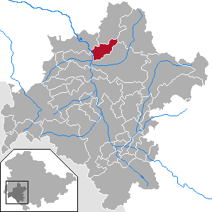
| Location of the municipality of Fambach in the district of Schmalkalden-Meiningen | ||
  |
||


Fambach is a municipality in the Schmalkalden-Meiningen district in Thuringia . The fulfilling municipality for Fambach is the municipality of Breitungen / Werra .
geography
The place Fambach is located in the upper Werra valley between Meiningen and Bad Salzungen directly on the federal road 19 , which has been gradually relocated to the route of the Reichsautobahn route 85 , which was planned in the 1930s and remained unfinished, since the 1990s .
The community of Fambach consists of the districts of Fambach with Oelmühle and Heßles with Nüßleshof.
history
The place was first mentioned in 1183 as Vanebach . The castle Todenwarth already in 1185 mentioned as a fortification. In 1456 the Wölffe von Todenwarth were enfeoffed with the castle. These castle bailiffs later became imperial barons and sat in the fortifications until the 19th century. The irregular square castle was the entrance gate to the Landwehr in the Schmalkalden area. The street once led directly through the complex. The Fambacher Katherina Krech , who emigrated to the USA, founded the first Fambacher parish house with a nurses' station, a toddler classroom, the rooms of the women's association and the Bible study. It was inaugurated on November 10, 1912 as the "Katharinenheim". Also in 1912, the Rommel factory was built in the Oelmühle district , a metal works. After the expropriation of the factory owner F. Rommel in 1947, the factory became the VEB Werkzeuge Fambach Oelmühle and from 1969 belonged to the Schmalkalden (Smalcalda) tool combination, one of the four combinations of the VVB machine tools and tools . Another company in the Oelmühle district was the VEB Trusetal-Werk, which was integrated in 1979 as VEB Sportgeräte Fambach or Operation II into the VEB Kombinat Sportgeräte Schmalkalden . Here, for example, ice skates were made for the Germina brand .
From 1993 to 1996 the community belonged to the administrative community Werratal . With its dissolution, Breitungen / Werra became the fulfilling municipality for Fambach.
Incorporations
On December 1, 2008, the formerly independent municipality of Heßles was incorporated into the municipality of Fambach.
Population development
Development of the population:
|
- Data source: from 1994 Thuringian State Office for Statistics - values from December 31st
politics
Municipal council
The local council from Fambach is made up of 14 councilors.
(As of: local election on May 26, 2019)
mayor
The honorary mayor Jürgen Herrmann (BI / SPD) was elected on November 4, 2012 after Ronny Römhild became mayor of Breitungen.
coat of arms
|
|
Blazon : “Square of gold and blue; in field 1 a green linden tree, in fields 2 and 3 two silver stakes each, in field 4 a red wolf with silver reinforcement. " |
| Establishment of the coat of arms: As early as 1950, the municipality of Fambach had an official seal with a linden tree in the middle and the inscription: Municipality of Fambach. In 1991, the municipal council decided to use this official seal as a provisional coat of arms. Walter Nickel from Roßdorf took on the task of designing a new municipal coat of arms. In January 1995 the municipality of Fambach received the approval to use this coat of arms. |
Culture and sights
Attractions
Leisure and recreation
- With the Nüßleser Grund around the Nüßleshof, there is a local recreation area with a campsite and gastronomy within the community
Regular events
- In the middle of September there is always a three-day fair in town.
- The fire brigade festival takes place on May 1st every year.
- From 2014 to 2018 there was a tent festival on the 2nd weekend in July, to which well-known artists were engaged. Ute Freudenberg , Christian Lais , Dorfrocker , Bonnie Tyler , Voxxclub , Glasperlenspiel , Chris Norman have already performed ; DJ Ötzi , Christina Stürmer , Matthias Reim , Stefanie Hertel , Johannes Oerding , Sandra (singer) , Thomas Anders & Modern Talking-Band, Suzi Quatro and Andy Borg .
- The Famberglauf takes place every year.
- The pumpkin festival takes place in autumn.
Web links
Individual evidence
- ^ Population of the municipalities from the Thuringian State Office for Statistics ( help on this ).
- ↑ Thomas Bienert: Central German castles in Thuringia. 430 castles, castle ruins and fortifications. Wartberg Verlag, Gudensberg-Gleichen 2000, ISBN 3-86134-631-1 , p. 251.
- ↑ Todenwarth.
- ^ The inauguration of the Katharinenheim in Fambach on November 10, 1912. In: Thuringian Association for Home Care. Yearbook. 1913, ZDB -ID 554725-8 , p. 153 .
- ↑ StBA Area: changes from 01.01. until December 31, 2008
- ^ Homepage of the municipality of Fambach

Belrieth | Birx | Breitungen / Werra | Brotterode-Trusetal | Christes | Dillstädt | Einhausen (Thuringia) | Ellingshausen | Erbenhausen | Fambach | Flea Seligenthal | Frankenheim / Rhön | Friedelshausen | Grabfeld | Kaltennordheim | Kühndorf | Leutersdorf (Thuringia) | Mehmels | Meiningen | Neubrunn (Thuringia) | Oberhof | Ober Maßfeld-Grimmenthal | Oberweid | Rhönblick | Rippershausen | Ritschenhausen | Pipe | Pink | Roßdorf (Thuringia) | Schmalkalden | Surge | Schwarza (Thuringian Forest) | Steinbach-Hallenberg | Sülzfeld | Undersize field | Utendorf | Vachdorf | Wasungen | Zella Mehlis