
Ellingshausen
| coat of arms | Germany map | |
|---|---|---|
 Help on coat of arms |
Coordinates: 50 ° 33 ' N , 10 ° 28' E |
|
| Basic data | ||
| State : | Thuringia | |
| County : | Schmalkalden-Meiningen | |
| Management Community : | Dolmar salt bridge | |
| Height : | 310 m above sea level NHN | |
| Area : | 6.77 km 2 | |
| Residents: | 220 (Dec. 31, 2019) | |
| Population density : | 32 inhabitants per km 2 | |
| Postal code : | 98617 | |
| Area code : | 036949 | |
| License plate : | SM, MGN | |
| Community key : | 16 0 66 018 | |
| Address of the municipal administration: |
Dorfstrasse 46 98617 Ellingshausen, Germany |
|
| Website : | ||
| Mayor : | Reiner Baumann ( CDU ) | |
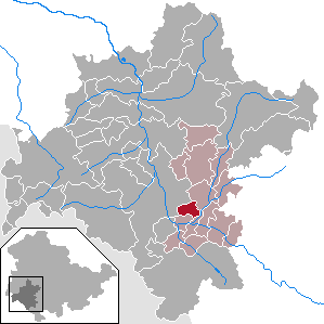
| Location of the community Ellingshausen in the district of Schmalkalden-Meiningen | ||
  |
||

Ellingshausen is a municipality in the district of Schmalkalden-Meiningen in the Franconian south of Thuringia .
geography

Ellingshausen is located in the lower Hasel valley on the right side of the Hasel , a right tributary of the Werra , around five kilometers east of the district town of Meiningen . The Hohe Maas, a mountain range up to 499 m high, rises between the two places . The municipality belongs to the administrative community Dolmar-Salzbrücke , which has its administrative seat in Schwarza .
history
The place was first mentioned in 923 as Eigilgereshusen in a document from the Fulda monastery . In the Middle Ages the place was a fiefdom of the Counts of Henneberg . The place originally belonged to the Vogtei Henneberg (later Amt Maßfeld ) of the county of Henneberg -Schleusingen. It was awarded to the Lords of Herda in 1350 and has since been alienated from the Maßfeld office after the jurisdiction of the bailiff had passed to the noble village lords. In the years that followed, the castle was often pledged and sold. There were several owners: The Lords of Schaumberg , von Wechmar , von Meusa, von Herda and from 1573 to 1820 those of Bose . The latter converted the castle into a renaissance castle in 1604. Another renovation was completed in 1804. From 1902 to 1945 the castle belonged again to Count Bose. Today the facility is used privately and is being renovated.
Ellingshausen was affected by the persecution of witches from 1597 to 1623 : five people were accused in witch trials , four were executed, the outcome of one trial is unknown. The first victim in 1597 was Catharina Ritz.
Ellingshausen belonged to the Duchy of Saxony-Meiningen from 1680 and to the state of Thuringia from 1920 .
politics
Municipal council
Since the municipal council election on May 25, 2014, four seats have been allocated to the CDU and two to members of the Greens . Since then, a member of the Greens had given up her post, so that the incumbent municipal council consists of five CDU and one Green member. (Status: 2017)
mayor
The honorary mayor Reiner Baumann was re-elected on June 27, 2004.
traffic
The federal motorway 71 and the Neudietendorf – Ritschenhausen railway pass by. The closest motorway junction is the Meiningen-Süd junction, four kilometers away. The Eisenach – Meiningen – Sonneberg ( Werrabahn ) and Erfurt – Schweinfurt railway lines meet at the Grimmenthal station, two kilometers to the south .
Monuments
The renaissance castle with stair tower and bower, first mentioned in 923, is located in the town center.
The Bakuninhütte , which was built in 1926, is located on the northern edge of the municipality's territory, approx. 2.5 km from the locality, on the Kühndorfer Berg in the immediate vicinity of the Hohe Maas .
Individual evidence
- ^ Population of the municipalities from the Thuringian State Office for Statistics ( help on this ).
- ^ Entry on Ellingshausen Castle in the private database "Alle Burgen". Retrieved June 26, 2016.
- ↑ Kai Lehmann : Innocent. Witch hunt south of the Thuringian Forest. Over 500 researched cases from the 16th and 17th centuries. Wehry-Verlag, Untermaßfeld 2012, ISBN 978-3-9813902-8-5 , pp. 97 f .; Kai Lehmann: Exhibition "Luther and the Witches". Ellingshausen area, Library Museum Schloss Wilhelmsburg Schmalkalden, 2012; Ronald Füssel: The persecution of witches in the Thuringian area (= publications of the working group for historical witchcraft and crime research in Northern Germany. Vol. 2). DOBU-Verlag, Hamburg 2003, ISBN 3-934632-03-3 , pp. 240–244, (at the same time: Marburg, University, dissertation, 2000).
Web links

Belrieth | Birx | Breitungen / Werra | Brotterode-Trusetal | Christes | Dillstädt | Einhausen (Thuringia) | Ellingshausen | Erbenhausen | Fambach | Flea Seligenthal | Frankenheim / Rhön | Friedelshausen | Grabfeld | Kaltennordheim | Kühndorf | Leutersdorf (Thuringia) | Mehmels | Meiningen | Neubrunn (Thuringia) | Oberhof | Ober Maßfeld-Grimmenthal | Oberweid | Rhönblick | Rippershausen | Ritschenhausen | Pipe | Pink | Roßdorf (Thuringia) | Schmalkalden | Surge | Schwarza (Thuringian Forest) | Steinbach-Hallenberg | Sülzfeld | Undersize field | Utendorf | Vachdorf | Wasungen | Zella Mehlis