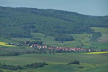
Kaltenwestheim
|
Kaltenwestheim
City of Kaltennordheim
Coordinates: 50 ° 36 ′ 34 ″ N , 10 ° 7 ′ 4 ″ E
|
|
|---|---|
| Height : | 500 m above sea level NHN |
| Area : | 19.43 km² |
| Residents : | 661 (December 31, 2017) |
| Population density : | 34 inhabitants / km² |
| Incorporation : | 1st January 2019 |
| Postal code : | 36452 |
| Area code : | 036946 |
|
Districts of the city of Kaltennordheim
|
|
Kaltenwestheim ( Rhöner Platt : Wääsde) is a district of the town of Kaltennordheim in the Schmalkalden-Meiningen district in Thuringia .
geography
Kaltenwestheim is located in the southwest of Thuringia, directly on the state border with Hesse .
history
It was first mentioned in 795 as Westheim . The place belonged for centuries to the office of Kaltennordheim , which was temporarily owned by the lords of Neidhartshausen , the county of Henneberg -Schleusingen (1274–1583), various Ernestine duchies and most recently from 1815 to the Grand Duchy of Saxony-Weimar-Eisenach ( Eisenacher Oberland ) . From 1920 the community was in the Eisenach district in the Free State of Thuringia , from 1952 it belonged to the Meiningen district in the GDR district of Suhl . In 1974 Mitteldorf was incorporated into Kaltenwestheim. In 1992 the community was incorporated into the Hohe Rhön administrative community . As part of the Thuringia regional reform in 2018 and 2019 , Kaltenwestheim and Mitteldorf were incorporated into the city of Kaltennordheim on January 1, 2019 . Kaltenwestheim and Mitteldorf became two independent districts of Kaltennordheim.
Kaltenwestheim was persecuted by witches from 1652 to 1696 : Twelve women were tried in witch trials , six were burned, one died under torture, and two managed to escape. The last victim was Elsa Strauss.
The churchyard and the place itself were fortified in the Middle Ages. The church, built between 1600 and 1606, fell victim to a major fire in 1796. In 1799, the church of St. Laurentius , which still exists today, was built on the foundations of its predecessor. In this the gate tower and parts of the curtain wall of the former fortified church are preserved.
politics
Former councilor
The council of Kaltenwestheim last consisted of eight council members.
Former mayor
The mayor Harald Heim was re-elected on June 5, 2016.
Economy and Infrastructure
Infrastructure
The L1124, the Kaltenwestheim with Tann / Rhön (approx. 9 km west) and the B 278 ( Bischofsheim a. D. Rhön - Buttlar ) and with Kaltensundheim (approx. 3 km east) and the B 285 ( Bad Salzungen - Mellrichstadt ) run through the village ) connects.
Individual evidence
- ↑ Federal Statistical Office (Ed.): Municipalities 1994 and their changes since 01.01.1948 in the new federal states . Metzler-Poeschel, Stuttgart 1995, ISBN 3-8246-0321-7 .
- ↑ Südthüringer Zeitung: Mitteldorf is a separate district available online at insuedthueringen.de , accessed on December 20, 2018
- ↑ Thuringian Law and Ordinance Gazette No. 14/2018 p. 795 ff. , Accessed on January 3, 2019
- ↑ Kai Lehmann : Innocent. Witch hunt south of the Thuringian Forest. Over 500 researched cases from the 16th and 17th centuries. Wehry-Verlag, Untermaßfeld 2012, ISBN 978-3-9813902-8-5 , p. 184; Kai Lehmann: Exhibition "Luther and the Witches". Kaltenwestheim area, Library Museum Schloss Wilhelmsburg Schmalkalden, 2012; The persecution of witches in the Thuringian region (= publications of the working group for historical research on witches and crime in Northern Germany. Vol. 2). DOBU-Verlag, Hamburg 2003, ISBN 3-934632-03-3 , pp. 239 f., (At the same time: Marburg, Universität, Dissertation, 2000).
- ↑ http://www.rhoen.info/lexikon/staetten/Laurentius-Kirche_in_Kaltenwestheim_6281544.html Retrieved on November 1, 2014
- ↑ Michael Köhler: Thuringian castles and fortified prehistoric and early historical living spaces. Jenzig-Verlag Köhler, Jena 2001, ISBN 3-910141-43-9 , p. 151.
- ↑ 2014 municipal council elections, Kaltenwestheim , The State Returning Officer, accessed on December 20, 2018


