
Berka in front of the Hainich
| coat of arms | Germany map | |
|---|---|---|

|
Coordinates: 51 ° 3 ' N , 10 ° 23' E |
|
| Basic data | ||
| State : | Thuringia | |
| County : | Wartburg district | |
| Management Community : | Hainich-Werra Valley | |
| Height : | 266 m above sea level NHN | |
| Area : | 14.96 km 2 | |
| Residents: | 735 (Dec. 31, 2019) | |
| Population density : | 49 inhabitants per km 2 | |
| Postal code : | 99826 | |
| Area code : | 036924 | |
| License plate : | WAK, SLZ | |
| Community key : | 16 0 63 006 | |
| Address of the municipal administration: |
Am Schloss 6 99826 Berka in front of the Hainich |
|
| Website : | ||
| Mayor : | Siegfried Lämmerhirt (FDP / Sport / FFw) | |
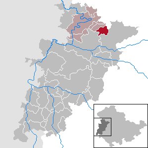
| Location of the community Berka in front of the Hainich in the Wartburg district | ||
  |
||

Berka vor dem Hainich (officially: Berka vdH or Berka v. D. Hainich ) is a municipality in the Wartburg district in Thuringia . It belongs to the administrative community Hainich-Werratal .
geography
The municipality of Berka is located on the southwestern edge of the Hainich National Park , a large beech forest area. The location is 265 m above sea level. The Löhberg ( 468.2 m above sea level ), the Dermeröder Berg ( 430.2 m above sea level ), the Lohberg ( 424.2 m above sea level ) and the Lange Berg ( 376.2 m above sea level ) are the local mountains of Berka.
The Lauterbach rises in the district with further tributaries, but only the Kernbach flows through the locality. This place is still dominated by agriculture, but has only a small proportion of forest areas. Since the middle of the 19th century, agriculture has been focused entirely on sheep farming, poor farmland east of the village was abandoned and converted into pasture areas. In the area of the former military training area, a new forest has only been created since 1990 through natural regeneration.

history
Early to 1800


The remains of the settlement discovered around 1936 during road construction work near the Lange Grund Vorwerk are probably the oldest traces of settlement in the community. On the castle hill , about three kilometers northeast of the local situation, there are remains of ramparts of a prehistoric fortress , it should have been a refuge for the local population here.
The place Berka was first mentioned in a document in 1035, this happened on the occasion of a donation to the Fulda monastery . Today's Berka Castle is one of the oldest buildings in the village . It goes back to a medieval moated castle and is now the seat of the local government. The former castle was built by the Lords of Creuzburg . Berka has belonged to the Wettin office of Creuzburg since the 13th century .
The Berka farmers also took up arms in 1525 , after which the village had to pay a fine of 150 guilders for participating in the Peasants' War . With the Reformation the place became Lutheran. The oldest church book in the community dates back to around 1600, when it is estimated that the town had around 400 inhabitants. The plague and the Thirty Years' War brought heavy losses and destruction to the place, over half of the population at that time was killed.
After the war, Berka went to Zacharias Prueschenck von Lindenhofen , son-in-law of the knight Friedrich Albrecht von Creuzburg and one of the richest administrative officials in the Duchy of Saxony-Eisenach . He had a modern manor built on the site of the destroyed outer bailey.
Instead of a predecessor made of timber or timber, the rococo church was consecrated in 1752 after four years of construction.
1800 until today
As a result of the dynastic division of the Wettin principalities, Berka belonged to the Duchy of Saxony-Eisenach , but the neighboring towns of Neukirchen , Behringen , Hütscheroda and Craula belonged to the Duchy of Saxony-Gotha . A tri-man's stone and other boundary markings in the hallway are a reminder of this time. After 1800 bought Eisenacher textile manufacturing family Eichel the Berkaer castle. She was interested in cheap wool with her textile production and encouraged the farmers to give up their arable land for sheep farming.
Around 1815, the consequences of the Napoleonic occupation led to a time of need that also triggered a famine in Berka . In 1838 the place still had about 650 inhabitants, but there was still great hardship. Almost 120 Berka residents sought their fortune abroad, they emigrated to the USA .
In 1850 there were 67 small farmers , 58 day laborers , 5 servants, 2 shepherds , 4 carpenters, 2 wagons, 3 blacksmiths , 1 teacher, 1 forester , 5 shoemakers, 3 linen weavers , 2 carpenters , 4 whitewashers and 4 bricklayers in Berka .
The place has been supplied with electricity since 1911 . The Fallen Memorial at the cemetery on the outskirts commemorates the victims of the First World War - 31 dead and 3 missing. In 1919, the Bruns cigar factory set up a production facility as a branch of its Eisenach branch, which enabled 40 women to find employment.
With the sale of a meadow area on the Kindel , a stationary shooting range was opened there for gun technology manufactured in Eisenach . This place had been used as a maneuvering area since the 19th century.
During the Second World War , 53 Berka residents were killed at the front, 20 are still missing today. In early April 1945 Berka was occupied by US troops , which were replaced by the Red Army in early July . The former military installations on the Kindel became a threat to the population, because Berka was now in the target area of the tank firing range.
The Berka estate including the castle was expropriated without compensation in the course of the land reform in 1945, the last owner family of Eichel-Streiber moved to the western zones . Since the end of the war, resettlers and war refugees have been arriving in the town every week, and the population quickly increased to around 1200 people. In 1985, the town's 950th anniversary was celebrated by the then almost 1,000 residents. The 1,000-inhabitant mark was never reached again so closely.
After 1990, after an application by the previous owner had been rejected, the castle was property of the municipality, extensively renovated and served as the main administrative seat of the Mihla administrative community until October 2014. Since then, the castle has been a branch of the administration of VG Mihla, which was renamed the Hainich-Werratal administrative association . The Protestant St. George's Church , built in 1752, was also completely renovated, including its interior furnishings from the Rococo period, with the support of a support association and the German Foundation for Monument Protection . At the end of the GDR era, it offered "the image of a decaying church" in a "wretched condition".
politics
Municipal council
The local council of Berka in front of the Hainich consists of eight councilors.
(As of: local election on May 26, 2019 )
mayor
The honorary mayor Siegfried Lämmerhirt (FDP / Sport / FFw) was elected on June 6, 2010. In the mayoral election in 2016 he was able to defend his position in the runoff election.
Culture and sights
Buildings
- The manor house , built around 1820 in its current classical form. In front of it is a pond, the remainder of an earlier moat of the former moated castle. There are ruinous farm buildings near the castle.
- The Protestant St. George's Church was built in 1752 in the Rococo style.
- There are numerous half-timbered houses and farms that have been renovated in accordance with historic monuments.
- The war memorial for the fallen and missing soldiers of the place in both world wars is located in the cemetery. The original memorial was donated by Amtmann Schüttler in 1919/1920 and erected on the Anger.
- The view of the mountain west of Berka is determined by 22 wind turbines.
Natural monuments

Berka is located on the southwest edge of the Hainich National Park , one of the largest and most beautiful beech forest areas in Germany, and is therefore an important starting point for hikes in the National Park. To the northeast above the village are the ancient Mallinde and the Malstein , which represent the heraldic symbol of the municipality of Berka. Court has been held here by the Thuringian landgraves since the 12th century. A nature trail from the Hainich National Park to the Silberborn source with the Silberborn linden tree begins at the Mallinde with its hikers' car park . Following the rising brook you come to the Sulzrieden desert , which was abandoned in the 14th century. During the construction of a tank firing range in October 1936 (concrete runways preserved), a row graveyard was found and 13 almost complete skeletons were exposed. The dredging work destroyed 20 to 25 skeletons in advance.
literature
- Berka in front of the Hainich - a historical overview . Brochure, published by Gemeindeverwaltung Berka, 2002, pp. 4–9
Individual evidence
- ^ Population of the municipalities from the Thuringian State Office for Statistics ( help on this ).
- ^ Main statutes of Berka in front of the Hainich
- ^ Thuringian State Office for Statistics: Municipality: Berka vd Hainich
- ↑ Municipal directory of the federal and state statistical offices ( memento of the original from 23 September 2016 in the Internet Archive ) Info: The archive link has been inserted automatically and has not yet been checked. Please check the original and archive link according to the instructions and then remove this notice.
- ↑ a b c d e Berka in front of the Hainich - a historical overview . Brochure, published by Gemeindeverwaltung Berka, 2002, pp. 4–9
- ↑ a b H. Helmboldt Berka in front of the Hainich In: Lehfeldt, Paul / Voss, Georg (Hrsg.): Bau- und Kunst-Denkmäler Thüringens. Booklet XL. Jena 1915, p. 386f
- ^ Herbert Koch: Zacharias Prueschenck von Lindenhofen. Family history supplements. In: Thüringer Fähnlein, monthly journals for the Central German homeland, 4th year. Issue 4, April 1935, pp. 253-254
- ^ Gerhard Kühn: Churches in Eisenacher Land . Evangelische Verlagsanstalt, Berlin 1989.
- ↑ Claus Peter Müller: Resurrection of a Church. In Berka in front of the Hainich, private involvement saved the "Dom". Frankfurter Allgemeine Zeitung, November 3, 2012
- ↑ Local elections in Thuringia on May 26, 2019. Elections of the community and city council members. Preliminary results. The regional returning officer, accessed on May 29, 2019 .
- ↑ Local elections in Thuringia on June 6, 2010. Elections for community and city council members. Preliminary results. The regional returning officer, accessed on June 6, 2010 .
- ↑ Mayoral election 2016 , wahlen.thueringen.de, accessed on June 2, 2019
- ^ Parish Berka in front of the Hainich
- ↑ Roland Geißler: "Great Hainich Hiking Guide". Rockstuhl Verlag, Bad Langensalza 2004. pp. 117-120
- ↑ Overview of the excavations
Web links
- Internet presentation of the community Berka in front of the Hainich
- Official website of the Association for the Restoration of the Rococo Church Berka vdH
Office of Creuzburg | Bad Liebenstein | Bad Salzungen | Barchfeld-Immelborn | Berka vd Hainich | Bischofroda | Buttlar | Dermbach | Empfertshausen | Frankenroda | Geisa | Barley ground | Barley | Hallings | Hörselberg-Hainich | Krauthausen | Krayenberg Community | Lauterbach | Leimbach | Moorgrund | Nazza | Oxen | Ruhla | Schleid | Seebach | Treffurt | Unterbreizbach | Vacha | Weilar | Werra-Suhl Valley | Wiesenthal | Wutha Farnroda