
Seebach (Wartburg district)
| coat of arms | Germany map | |
|---|---|---|
.png)
|
Coordinates: 50 ° 55 ' N , 10 ° 25' E |
|
| Basic data | ||
| State : | Thuringia | |
| County : | Wartburg district | |
| Fulfilling municipality : | Ruhla | |
| Height : | 350 m above sea level NHN | |
| Area : | 3.62 km 2 | |
| Residents: | 1797 (Dec. 31, 2019) | |
| Population density : | 496 inhabitants per km 2 | |
| Postal code : | 99846 | |
| Area code : | 036929 | |
| License plate : | WAK, SLZ | |
| Community key : | 16 0 63 071 | |
| Association administration address: | Carl-Gareis-Strasse 16 99842 Ruhla |
|
| Mayor : | Gerrit Häcker (independent) | |
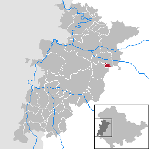
| Location of the Seebach community in the Wartburg district | ||
  |
||

Seebach is a municipality in the Wartburg district in Thuringia . The fulfilling municipality of Seebach is the city of Ruhla .
geography
Geographical location
In terms of nature, the municipality of Seebach is located on the north-western edge of the Thuringian Forest .
The next largest towns are the city of Ruhla , Wutha-Farnroda , Waltershausen and the city of Eisenach . The municipality of Seebach borders in the north on the districts Farnroda and Deubach of the municipality Wutha-Farnroda, in the east on the district Schmerbach of the city of Waltershausen and in the south and west on the city of Ruhla and its district of Thal.
Geology and mineral resources

The community is located in the Krebsbachtal, a side valley of the Ruhlabaches / Erbstrom. An originally existing lake gave the place its name, it silted up in the late Middle Ages.
From a geological point of view, the place lies in a leaching zone - this is indicated by several sinkholes in the northern part of the district. Minor copper ore deposits are found underground, especially on the border with Ruhla and Winterstein, which in the 16th century was intended to be used for mining. The Klingelloch shaft on the Great Wartberg is a reminder of these attempts . Over the course of the day, gypsum was mined on the Goldberg at the Schmerbach border and refined into quicklime in the kilns located there . Also noteworthy is the existing cave near the summit of the Great Wartberg, the legendary oven hole .
mountains

The local situation is ( 325 m above sea level ) to ( 350 m above sea level ). The landscape around the village is characterized by meadows and mostly wooded mountains, including: as the highest point in the districts of the Rögis ( 478.5 m above sea level ) and the Dilmen ( 470.1 m above sea level ), already in the Ruhlaer The local area is the Großer Wartberg ( 567.7 m above sea level ) and Kleiner Wartberg ( 520 m above sea level ).
Waters
The Krebsbach is the current name for the Seebach, which has been handed down in the place name, its source area is in the eastern part of the district. Several ponds were created for agricultural purposes, and there are sinks created by sinkholes, some of which are filled with water. The watershed between the Erbstrom and Emse rivers runs over the Goldberg.
history

In 860 the Franconian nobleman Erphold is named as the first count in Tonna. He is also considered the founder and namesake of Erfurt . King Ludwig the German had given him the town of Tonna. However, the sex with Erphold died out in the same year. Shortly before his death, he is said to have given his possessions in the grave field and in the upper Eichsfeld to the abbey of Fulda and the Würzburg monastery. Seebach is also mentioned in this document.
Seebach, or the Seewich , as the place was popularly called, used to belong to the Farnroda rule and was probably founded as a clearing settlement by forest farmers and shepherds at the instigation of the Thuringian landgraves .
Middle Ages and Early Modern Times
The settlement was territorially isolated for centuries and only connected to the main town of Farnroda via a narrow corner of land - the Hucheroda suburb . The place Seebach belonged to the Kirchberg court in the Duchy of Saxony-Eisenach . All other neighboring places, however, belonged to the Uetterodtschen court , justice office Thal in the Duchy of Saxe-Gotha .
The original place was, according to the settlement, a forest hoof village with its houses scattered along the stream or in groups. Until agriculture required more land, the lower area of the valley was used for fish farming, for which a large water basin was dammed up by earth walls. During the Thirty Years War , heavy fighting broke out in the vicinity of Seebach when two enemy regiments met in the woods near Sondra and Schmerbach.
17th century
In the 17th century, the place became known through the Seewich miracle doctor Johannis Dicel . Dicel was born in Seebach in 1676 as the seventh son of a poor man and was interested in the effects of herbs, medicinal and medicinal plants. As an autodidact he was notorious among the trained pharmacists and doctors, but that did not prevent the Eisenach Duke Johann Wilhelm from giving him the title of High Princely Medicus in 1724 , which allowed him to continue his practice. As a benefactor of his home community, he donated the building of the Seebach church in 1735, raised the funds for the salary of the pastor and the school teacher and also donated most of the money for the new building of the school in Seebach. Dicel died on November 9th, 1758. Posterity appreciated his services better than his contemporaries and had a plaque walled in at the church in 1836 next to the church door in his memory.
19th century

In the 19th century Drechsler crafts spread in Seebach, in the resort worked about 40 Drechsler for Ruhlaer meerschaum -Pfeifen- manufacturers as a supplier and produced wooden bowls and tubes. The tobacco pipes depicted in the local coat of arms can be traced back to this activity.
Around 1875 there were 67 houses and 424 inhabitants. The Seebach district had an area of 362.36 hectares, of which 11.7 hectares were accounted for by courtyards and gardens, 40.05 hectares of meadows and 151.06 hectares of arable land. Forest ownership was 147.23 hectares, ponds and streams 0.51 ha, roads, drifts and orchards 11.70 ha. The livestock was given as 10 horses, 130 cattle, 240 sheep, 75 goats and 85 pigs.
Industrialization in the 20th century

In 1892, construction work began in Seebach for a supplier factory for the Ruhla company, Gebr. Thiel . In 1913 the production of pillar drilling machines began . In 1932 Gebr. Thiel GmbH built a clock factory in Seebach, where clockwork - time fuses were manufactured during the Second World War using forced labor from the Soviet Union . The Seebach clubhouse was built in 1938. Until the mid-1930s, however, Seebach remained a place dominated by handicrafts and agriculture.
The watch factory, nationalized in 1952 , was renamed VEB Uhrenwerk Klement Gottwald in 1954 . Seebacher LPG was founded in 1957 as a cooperative and farmed the valley slopes as a pasture. Because of the poor transport conditions in winter, the winding and narrow local connecting road between Thal and Seebach was abandoned in the 1960s and replaced by a new building - part of today's federal highway 88 . From 1970 to 1972 another machine factory was built in Seebach, as well as 650 residential units, a school and a first department store. When microelectronics was promoted in the GDR economy around 1980 , Seebach was one of the development and competence centers of this branch of industry and was simultaneously linked to the construction of four prefabricated residential areas ( Am Stein , Friedrich-Engels-Ring , Wirtsgasse and Neue Straße ), a thermal power station and the corresponding industrial infrastructure.
The development after the reunification

After the political change in 1989–1990, the large company VEB Uhrenwerke Ruhla collapsed under trust management . Private, highly specialized small and medium-sized companies emerged, such as Eurochron GmbH, Gardé Uhren und Feinmechanik Ruhla GmbH. As a result of the spin-off, companies in tool and special machine construction, electronics production and plastics processing were also created.

Numerous small and medium-sized companies benefited from the successes of the automotive industry in the Eisenach economic area as suppliers or service providers.
coat of arms
The green color stands for the state of Thuringia as the “green heart of Germany”. The two crossed tobacco pipes stand for the woodturning trade that was part of the village in the past. The origin of this trade can be seen in connection with the production of tobacco pipes, which began around 1740 in neighboring Ruhla. The Seebach church book mentions a Röhrsgens maker for the first time in 1756 . Around 1900, Seebach was home to exactly 55 woodturners. This craft has not been practiced in the village since around the 1990s. The gear symbolizes the industry based in Seebach. The coat of arms was introduced in 1946.
Population development
Development of the population:
|
|
|
|
|
Data source: from 1994 Thuringian State Office for Statistics - values from December 31st
politics
The municipality of Seebach has been administered by the city of Ruhla as a fulfilling municipality since July 1, 2006.
Municipal council
The Seebach municipal council consists of 12 council members.
- CDU : 7 seats
- Die Linke / For Seebach: 3 seats
- Free voters Seebach: 2 seats
(As of: local election on May 26, 2019 )
mayor
Gerrit Häcker was elected mayor in the local elections on April 15, 2018 with a turnout of 72.5% and 776 votes (66.4%). He has been running the official business on a voluntary basis since July 1, 2018, replacing Maritta Nagel, who held the office from July 1, 2012 to June 30, 2018. From 1990 to 2012 Kurt Kästner was mayor in Seebach.
Culture and sights
Townscape
The location of Seebach arose along today's main road and shows the basic structure of a forest hoof village as a settlement area. However, the numerous industrial companies, the four prefabricated housing estates and the single-family houses built by private individuals on the western and north-eastern outskirts are now characteristic of the place. Historical buildings can still be found in the center of the village around the church.
_Kirche_01.jpg)
church

The Seebach church was commissioned in 1735 to replace a late medieval chapel that was probably destroyed in the 17th century. On June 26, 1736, the church was solemnly consecrated; the interior was splendidly decorated in rococo style and the building finally cost 2,160 thalers . The Seebach population previously used the Laurentius Church in Farnroda. Friedrich Kummer from Schwarzhausen took up his duties as the first pastor in Seebach . A commemorative plaque donated as early as 1836 honors the services of Seebach's honorary citizen and benefactor Dicel, on the 250th anniversary of his death in November 2008 this plaque was restored.
societies
In Eisenach and Seebach the music association Franz Schubert Chor e. V. resident. The association is active in the field of classical choral singing.
The mixed choir Seebach e. V., who is musically active under the direction of Katrin Ortmann. Citizens from Seebach and the surrounding area are active in the choir.
The SCC (Seebacher Carnevals Club) was founded in 1972 as an association. The club's domicile is the Seebach clubhouse on Waldstrasse. An annually changing program is offered under the motto Siewich Helau .
There is a technical aid base in Seebach

Fire protection is provided by the Seebach volunteer fire brigade association. V. organized.
The Seebacher Heimatverein has set up a small museum on local history in the parish hall.
Founded in 1995 carnival club aligns the annual in a tent fair from. The festival formerly known as Seewicher Pfarrkirmeß was launched in 1736 on the occasion of the church consecration and celebrated its 275th anniversary in 2011.
Economy and Infrastructure

Numerous industrial companies in the tool and special machine construction, plastics processing and electronics industries are located in the Seebach commercial and industrial area.
- DECKEL MAHO Seebach GmbH
- Eurochron GmbH
- Fischer Metallbau GmbH
- Frank Liebetrau Manufacturing Technology
- Hench Kunststofftechnik GmbH
- HKW Electronics GmbH
- Multicon GmbH
- PWB Ruhlatec Industrieprodukte GmbH,
- Toolmaking Ruhla GmbH
Road traffic
The junction 40a ( Eisenach-Ost ) of the A4 can be reached via the federal highway 88 and federal highway 84 after about twelve kilometers. The junction 41a ( Waltershausen ) of the A 4 can be reached via the B 88 to Langenhain and the L 1027 Laucha after about 12 kilometers.
Rail transport
For rail travelers, the next long-distance train station is in Eisenach , regional transport stops are in Wutha and Sättelstädt.
education
- State primary school "Am Wartberg" Seebach
- State regular school "J. Dicel “Seebach
Sons and daughters of the church
- Christian Ernst von Reichenbach (1644–1699), statesman and university professor
- Johannes Dicel (1676–1758), miracle doctor , patron and honorary citizen
- Claudia von Alemann (* 1943), filmmaker
- Ulrich von Alemann (* 1944), political scientist
literature
- Johannes E. Harstick: Seebach - history and stories. Seebach 1991.
- Seebach - Wartburg district / Thuringia . Information brochure from the Seebach municipal administration, Seebach 2001
- Ludwig Storch : The Seewicher parish fair day . In: The Gazebo . Issue 9–11, 1853, pp. 87–90, 97–100, 109–112 ( full text [ Wikisource ]).
Web links
References and footnotes
- ^ Population of the municipalities from the Thuringian State Office for Statistics ( help on this ).
- ^ Thuringian Land Survey Office Wartburgkreis and District Free City Eisenach , Erfurt 2002, ISBN 3-86140-250-5
- ^ Geyer, Jahne, Storch: Geological sights of the Wartburg district and the independent city of Eisenach . In: District Office Wartburgkreis, Lower Nature Conservation Authority (Hrsg.): Nature conservation in the Wartburgkreis . Booklet 8. Printing and publishing house Frisch, Eisenach and Bad Salzungen 1999, ISBN 3-9806811-1-4 , p. 74-75 .
- ↑ a b Thuringian Land Surveying Office TK25 - sheet 5028 Eisenach O , Erfurt 1998, ISBN 3-86140-048-0
- ↑ Guido Reinhardt: History of the market Gräfentonna , Langensalza 1892.
- ^ A b C. Kronfeld: Regional Studies of the Grand Duchy of Saxony-Weimar-Eisenach . Second part. Weimar 1879. p. 55.
- ↑ Timeline and short chronicle. In: Seebach - Wartburgkreis / Thuringia , information brochure of the Seebach municipal administration, Seebach 2001
- ↑ Hartmut Ulle: Thuringian Wappenbuch . Working group Genealogy e. V.
- ↑ City council elections 2019 in Thuringia - final result. The regional returning officer, accessed on May 29, 2019 .
- ^ Result of the mayoral election 2012 in Seebach. (No longer available online.) Office of the Regional Returning Officer, April 22, 2010, formerly the original ; Retrieved on April 25, 2012 : “Entitled voters: 1820; Voters: 973; Turnout: 53.5%; Invalid votes 117; Valid votes 856. "
- ↑ The Church . In: Seebach - Wartburgkreis / Thuringia , information brochure of the Seebach municipal administration, Seebach 2001
- ↑ The choir - mixed choir Seebach e. V. Accessed January 24, 2017 .
- ↑ Ulrike Sauer: Seebach celebrates 275 years of parish fair in June. In: Thuringian General . March 21, 2011, accessed December 28, 2013 .
- ↑ data source
Office of Creuzburg | Bad Liebenstein | Bad Salzungen | Barchfeld-Immelborn | Berka vd Hainich | Bischofroda | Buttlar | Dermbach | Empfertshausen | Frankenroda | Geisa | Barley ground | Barley | Hallings | Hörselberg-Hainich | Krauthausen | Krayenberg Community | Lauterbach | Leimbach | Moorgrund | Nazza | Oxen | Ruhla | Schleid | Seebach | Treffurt | Unterbreizbach | Vacha | Weilar | Werra-Suhl Valley | Wiesenthal | Wutha Farnroda