Barley ground
| coat of arms | Germany map | |
|---|---|---|
 Help on coat of arms |
Coordinates: 50 ° 42 ' N , 10 ° 3' E |
|
| Basic data | ||
| State : | Thuringia | |
| County : | Wartburg district | |
| Fulfilling municipality : | Geisa | |
| Height : | 500 m above sea level NHN | |
| Area : | 4.61 km 2 | |
| Residents: | 67 (Dec. 31, 2019) | |
| Population density : | 15 inhabitants per km 2 | |
| Postal code : | 36419 | |
| Area code : | 036967 | |
| License plate : | WAK, SLZ | |
| Community key : | 16 0 63 033 | |
| Association administration address: | Marktplatz 27 36419 Geisa |
|
| Mayor : | Antonius Schütz ( CDU ) | |
| Location of the Gerstengrund community in the Wartburg district | ||
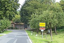
Gerstengrund is a municipality in the Wartburg district in Thuringia . According to the number of inhabitants, it is currently the smallest independent municipality in the Wartburg district and the third smallest in Thuringia. The city of Geisa is the fulfilling municipality for Gerstengrund .
geography
The Gerstengrund community is located in a narrow side valley of the Ulster in the Auersberger Kuppenrhön in the Rhön Biosphere Reserve . The geographic height of the place is 500 m above sea level. NHN .
Neighboring places
The municipality of Gerstengrund borders the municipality of Oechsen in the north, the district of Brunnhartshausen follows the municipality of Dermbach in the east, the municipality of Schleid with the district of Zitters follows in the south and southwest, and the town of Geisa with the districts of Bremen and Geblar in the northwest . The Hesse-Thuringia border runs three kilometers south of Gerstengrund.
mountains
Immediately south of the Gerstengrund locality is the partially wooded Kuhberg ( 642.6 m above sea level ), it is considered the highest elevation in the district. The Mannsberg ( 698.7 m above sea level ) and the Rossberg ( 693.6 m above sea level ), only 3 km away, determine the landscape west of Gerstengrund and leave only a narrow access to the upper Kohlbachtal. Geological explorations of shell limestone , red sandstone and the volcanism of the Rhön can be studied on the mountains mentioned.
Rivers
The water system is formed by the Kohlbach (already mentioned in 1044 as Cholobach ) - a tributary of the Ulster , to which the Gabelsbach flows .
history
Prehistory and early history
The Rhön was already inhabited by people in prehistoric times. On the summit of the Sachsenburg - about 3 km northeast of the locality of Gerstengrund and the neighboring summit Altes Schloß there are two hill forts from the Celtic times and the early Middle Ages.
middle Ages
Little is known about the beginnings of the Gerstengrund settlement; at first there was only one farmstead before 1500 - in 1450 it is called Grund zu Gerstorfs . Because of the decreed change to the Protestant faith by Hartmann von der Tann, a close friend of Martin Luther , 25 families, residents of the village of Godermann, then located on the upper reaches of the Kohlbach, fled to the area dominated by Fulda, seven of these families settled near the existing farm in Gerstengrund - barely two kilometers from their old home but abroad - the place Godermanns became a desert. The place Gerstengrund belonged to the office Rockenstuhl, later Geisa in the dominion of the Fulda monastery ; In church, Gerstengrund originally belonged to the Schleid parish. Because of the harsh climatic conditions, arable farming was only possible to a limited extent, the agricultural basis was the breeding of sheep and cattle on the high pastures above the village. The charcoal burner trade is said to have been of a certain importance for the place.
Thirty Years' War
During the Thirty Years' War the localities of the Geisa office were badly damaged. Troop movements in the Feldatal began as early as 1622, looting and famine took place, a first plague epidemic in the Schleid parish , named in 1626, was dramatic, claiming a total of 430 deaths, followed by a second wave of plagues with 429 deaths in 1635. The small settlements, mostly consisting of only a few farms, were already heavily depopulated when the enemy mercenaries began marching through in 1637. For this year, another 271 victims of the war were recorded in Schleid's death register . After the war, the population recovered quickly.
Witch madness and recatholization
In the middle of the 17th century, witch persecution also affected the places in the former offices of Fischbach and Rockenstuhl : in the neighboring towns of Ober- and Unteralba , Klings and Motzlar , several convicted witches and harmful wizards were killed at the stake. On the part of the authorities, attempts were made in various places, starting with the Zella provost's office , which was built in the neighboring village in 1718, and the newly created monastery in Dermbach, to recatholize the parishes that had become predominantly Protestant with the Reformation . This provoked the displeasure of the neighboring territories of Saxony-Weimar and Hessen-Kassel . The tensions led to the deployment of an army of 1,000 soldiers and 100 hussars , commanded by Duke Ernst August , on the border with Dermbach in 1741 . This battle at Dermbach Castle , known as the Dermbach War , escalated when the Prince Abbot requested imperial troops for support. In 1765 a peace and state treaty with the Duchess Anna Amalia led to the reorganization of the borders in the Feldatal. In the neighboring village of Kranlucken , a Catholic parish was founded in 1737, to which, in addition to Zitters, barley grounds and scattered courtyards were allocated.
19th and early 20th centuries
In 1802, in the wake of the Peace of Lunéville , the Reichsdeputationshauptschluss decided to dissolve the ecclesiastical and imperial knighthood territories in the Rhön, resulting in the Grand Duchy of Frankfurt . With the territorial changes as a result of the Vienna Congress , the area of the Feldatal and Ulstertal was combined to form the Eisenacher Oberland , which in 1815 came to the Grand Duchy of Saxony-Weimar-Eisenach , districts of Kaltennordheim, Lengsfeld and Geisa.
On May 30, 1911, on May 30, 1911, in Dermbach Castle, on behalf of Grand Duchess Feodora von Sachsen-Weimar-Eisenach , the school councilor Heiland presented Miss Klara Storch from Gerstengrund with a prize worth 30 Reichsmarks , who has been in Frankfurt / Main for 10 years was an impeccable maid and was proposed by their masters for this award.
Severe floods in 1913 caused considerable damage to the Kohlbachgrund.
Border in the GDR era
As early as the beginning of the 1950s, the GDR authorities began to deliberately depopulate the small settlements located directly on the inner-German border ; this also affected the Kohlbachshof south of Gerstengrund, which was demolished in 1972. Rumors about a planned deportation of unpopular people from the border region of Kaltennordheim in June 1952 caused great unrest among the population , where an unusually large number of freight wagons had arrived at the station, so numerous families left their homes in a panic and fled across the still open border to Hesse. From 1952, access to the border towns was made more difficult by the fact that one had to apply for an officially issued pass for visits to these places, residents of the border towns received a note on their identity card. Gerstengrund also fell into the 5-kilometer exclusion zone . Construction of the border troop barracks began in 1958 in Kaltennordheim. In November 1989, pressure from the population during the peaceful revolution led to the opening of the border barriers, and a provisional border crossing was established near Andenhausen .
21st century
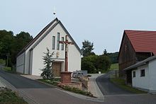
In 2011/2012 a church was built in the village, which was consecrated on May 18, 2012.
statistical data
In 1879, based on the census of 1875, statistical information on the place Gerstengrund was published for the first time. This year Gerstengrund had 12 houses with 67 inhabitants, 17 people lived in the two courtyards of Hochrain. The size of the field was 361.0 ha of which farms and gardens 2.2 ha, meadows 111.3 ha, arable land 165.0 ha, forest 45.5 ha, ponds, streams and rivers 0.4 ha, on paths, drifts , Wasteland and orchards accounted for 36.8 hectares. The livestock in the two districts: 18 horses, 128 cattle, 164 sheep and 16 goats.
Hochrain desert
About 500 m to the south there was a small settlement on the summit of the Kuhberg - the Hochrain-Höfe . This settlement was first mentioned in a document around 1515 and consisted of two sheep farms that used the cleared meadows for alpine farming; In 1912 a voluntary resettlement took place in connection with an animal disease and the mining operation.
Lignite mining
As early as the 18th century, mineralogists discovered lignite seams not far from Kaltennordheim and near the farms on the Hochrain, from which mining operations developed from 1704. The coal mined was initially delivered to the salt works in Bad Salzungen as fuel , which enabled additional income from wages. In the second heyday after the First World War , up to 50 construction workers and miners worked in the facility at times. In the first half of 1920 the miners had extracted 634 tons. Most recently, mining was operated by the Rhönkohle Zweckverband from 1947 to 1949 .
Population development
Development of the population:
|
|
|
|
|
- Data source: from 1994 Thuringian State Office for Statistics - values from December 31st
Culture and sights
Attractions:
- Wall castles - from Gerstengrund you can quickly get to the neighboring Sachsenburg and Altes Schloß fortifications .
- Settlement and mining relics - the Hochrain desert is on the Kuhberg .
- Crucifix - there is a wooden crucifix in the Gerstengrund community.
- Church “Maria Hilf” - the local church was consecrated in May 2012.
- Nature reserve Rossberg-Kohlbach-Hochrain - at 693.6 m above sea level , the Rossberg is one of the highest peaks in the southern district. The area of the nature reserve belonging to the southern part of the Gerstengrund district shows a geological feature - a block flow consisting of basalt .
- At Rossberg and Kohlenbach that runs Green Belt - a trail along the former border fortifications.
politics
Municipal council
After the municipal council elections in 2019, the municipal council in Gerstengrund consists of six council members.
- CDU : 6 seats
With a turnout of 98% (50 of 51 eligible voters went to the polls), the CDU received 265 of 267 votes.
mayor
The honorary mayor Antonius Schütz (CDU) was last re-elected on June 5, 2016. He received 100% of the valid votes cast.
State elections
The municipality of Gerstengrund set several records for the state elections in Thuringia in 2009 : On the one hand, the highest voter turnout of all Thuringian municipalities (91.8%) was measured - 45 of the 49 residents eligible to vote went to the polls. The 45 voters cast 44 valid votes, of which 42 (95.5%) came from the CDU and two (4.5%) from the FDP ; all other parties received no votes. With this, the CDU in Gerstengrund achieved (in terms of percentage) its best result nationwide, but did not come close to the result of 100% of all valid votes in the community from 1999 . Gerstengrund was also the only municipality in Thuringia in which none of the voters opted for the SPD or Die Linke .
The state elections in Thuringia in 2014 showed similar results. This time all 45 votes were valid, again the CDU achieved its national record result (91.1%, 41 votes). Gerstengrund was the only municipality in Thuringia without a vote for the left and one of two municipalities without an SPD vote. The four non-CDU votes were split between the FDP (2), Greens (1) and AfD (1). The turnout of 83.3% was the second highest of all Thuringian municipalities (behind Meusebach with 88.5%).
Also in the state elections in Thuringia in 2019 , the municipality had a high voter turnout of 87.8% but two invalid votes. The CDU won a clear election (82.9%, 34 votes), followed by Die Linke und Greens (7.3%, 3 votes each) and the FDP (2.4%, 1 vote). The constituency is the only one without a vote for the SPD and AfD in Thuringia.
traffic
Road traffic
Gerstengrund is connected to the road network via Kreisstraße 99 . To the south, a road branches off west of the town via the Mückenhof and Andenhausen to Tann (Rhön) and Kaltennordheim . The B 278 runs through the neighboring village of Schleid , 7 km away .
Rail transport
After the Ulstertalbahn was shut down in 1952 and the Feldabahn in 2003, the closest connection to rail traffic in the district town of Bad Salzungen is at the local train station in the route network of the South Thuringia Railway . There is a connection to the Intercity and ICE network of Deutsche Bahn in Fulda and Eisenach .
Public transport
The Wartburgmobil bus line 113 runs to Gerstengrund, which connects the town with Geisa, where there is a connection to national bus routes.
literature
- Adelbert Schröter: Country by the road. The history of the Catholic parishes in the Thuringian Rhön. 3. Edition. St. Benno Verlag, Leipzig 1989, ISBN 3-7462-0430-5 .
- Bruno Leister: On the history of the Kohlbachhof in the Geisa office. Resch-Druck, Meiningen 1998.
Individual evidence
- ^ Population of the municipalities from the Thuringian State Office for Statistics ( help on this ).
- ↑ a b c d Official topographic maps of Thuringia 1: 10,000. Wartburgkreis, district of Gotha, district-free city of Eisenach . In: Thuringian Land Survey Office (Hrsg.): CD-ROM series Top10 . CD 2. Erfurt 1999.
- ^ Geyer, Jahne, Storch: Geological sights of the Wartburg district and the independent city of Eisenach . In: District Office Wartburgkreis, Lower Nature Conservation Authority (Hrsg.): Nature conservation in the Wartburgkreis . Booklet 8. Printing and publishing house Frisch, Eisenach and Bad Salzungen 1999, ISBN 3-9806811-1-4 , p. 151-153 .
- ^ Adalbert Schröder: Schleid and the Kohlbachsgrund. In: Country by the road. Leipzig 1989, pp. 108-110.
- ^ Fritz Rollberg: From the witch madness in West Thuringia. In: The Thuringian Flag. No. 4, 1938, pp. 105-133.
- ↑ Gerd Bergmann: The Eisenacher Land and its changing dimensions in the course of time. In: EP Report 2 - Heimatblätter des Eisenacher Land. Marburg 1992, ISBN 3-924269-94-7 , pp. 60-64.
- ↑ Adalbert Schröder: A wrong game in the field ground. In: Country by the road. Leipzig 1989, pp. 119-121.
- ↑ NN: 100 years ago . In: Thüringer Allgemeine (local page Eisenach) . Erfurt May 30, 2011.
- ↑ Bruno Leister: On the history of the Kohlbachhof in the Geisa office. Meiningen 1998, p. 11f.
- ^ City administration Kaltennordheim (publisher): 1200 years of Kaltennordheim. Meiningen 1995, p. 91 f.
- ↑ a b An event of the century. In: Südthüringer Zeitung. from May 19, 2012, p. 15.
- ^ C. Kronfeld: Regional studies of the Grand Duchy of Saxony-Weimar-Eisenach. Second part. Weimar 1879.
- ^ Geyer, Jahne, Storch: Geological sights of the Wartburg district and the independent city of Eisenach. In: Nature conservation in the Wartburg district. Issue 8, Bad Salzungen 1999, p. 151 ff.
- ↑ Local elections in Thuringia on May 26, 2019. Elections of the community and city council members. Preliminary results. The regional returning officer, accessed on May 29, 2019 .
- ↑ Local elections in Thuringia on June 5, 2016. Preliminary results. The regional returning officer, accessed on June 3, 2019 .
- ↑ State election results for the Gerstengrund community at the regional returning officer
- ↑ Landtag election 1999 in Thuringia - final result, constituency 005 (Wartburgkreis I), community 63033 (Gerstengrund) Thuringian State Office for Statistics.
- ^ Elections in Thuringia. Retrieved October 29, 2019 .
- ↑ Verkehrsgesellschaft Wartburgmobil - regional transport offers and current timetables from June 1, 2019
Web links
- Entry on Gerstengrund in the Rhön Lexicon ( memento from August 10, 2007 in the web archive archive.today )


