
Hörselberg-Hainich
| coat of arms | Germany map | |
|---|---|---|

|
Coordinates: 50 ° 59 ' N , 10 ° 26' E |
|
| Basic data | ||
| State : | Thuringia | |
| County : | Wartburg district | |
| Height : | 285 m above sea level NHN | |
| Area : | 142.09 km 2 | |
| Residents: | 6101 (Dec. 31, 2019) | |
| Population density : | 43 inhabitants per km 2 | |
| Postal code : | 99820 | |
| Primaries : | 03622, 036254, 036920 | |
| License plate : | WAK, SLZ | |
| Community key : | 16 0 63 098 | |
| Community structure: | 17 districts | |
| Address of the municipal administration: |
Hauptstrasse 90A 99820 Hörselberg-Hainich |
|
| Website : | ||
| Mayor : | Christian Blum (independent) | |
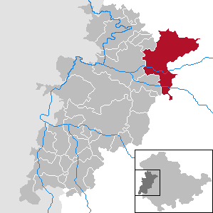
| Location of the municipality Hörselberg-Hainich in the Wartburg district | ||
  |
||

Hörselberg-Hainich is a municipality in the northeastern Wartburg district in the Free State of Thuringia , which was formed on December 1, 2007 through the voluntary merger of the municipalities of Behringen and Hörselberg .
geography
The community lies between Eisenach , Bad Langensalza and Gotha on the southern edge of the Hainich and surrounds the Hörselberge mountains, which give it its name . With 142 square kilometers, it was, after Erfurt , Sondershausen and Gera , until the merger of the new municipality of Gerstungen on July 6, 2018, Thuringia's fourth largest municipality and thus the largest municipality without municipal rights in Thuringia. With 6346 inhabitants, Hörselberg-Hainich ranks third among the most populous communities in the Wartburg district.
Neighboring communities are the independent city of Eisenach in the west, Berka vor dem Hainich (Wartburgkreis) in the northwest, Mülverstedt , Weberstedt , Schönstedt and Bad Langensalza (all Unstrut-Hainich district ) in the north, Nessetal , Hörsel and Waltershausen (all district Gotha ) in the east or south and Wutha-Farnroda in the southwest.
Waters
The municipal area is traversed by the first order waters Nesse and Hörsel from east to west. In Sättelstädt, the Emse flows into the Hörsel from the south . From the north the Böber flows into the Nesse in Großenlupnitz . A northern tributary of the Nesse, the Bieberbach , is the receiving water of the northern districts of Behringen, Wolfsbehringen and Hütscheroda. From Reichenbach to Tüngeda the Mittagswassergraben runs in an easterly direction , which still feeds the Wangenheim reservoir in the Tüngeda district .
In the Sondra district, groundwater is pumped from several wells , which is processed into drinking water in the Sondra waterworks . From here the city of Eisenach and some of its districts, the communities of Wutha-Farnroda and districts, Seebach (Wartburgkreis) , parts of the city of Ruhla and the southern villages of Hörselberg-Hainich are supplied via long-distance lines. Parts of the districts of Sondra, Sättelstädt and Bolleroda are designated as drinking water protection areas due to the extraction of water .
Community structure
The municipality of Hörselberg-Hainich includes 17 localities:


| District | Height above NN | Population (June 2018) |
|---|---|---|
| Behringen | 282 | 1492 |
| Beuernfeld | 254 | 114 |
| Bolleroda | 260 | 83 |
| Burla | 287 | 82 |
| Craula | 432 | 331 |
| Ettenhausen on the Nesse | 253 | 146 |
| Grossenlupnitz | 231 | 770 |
| Hastrungsfeld | 302 | 109 |
| Hütscheroda | 315 | 64 |
| Calf field | 260 | 217 |
| Melborn | 238 | 173 |
| Reichenbach | 322 | 354 |
| Sättelstädt | 264 | 566 |
| Sondra | 275 | 155 |
| Tüngeda | 284 | 495 |
| Wenigenlupnitz | 234 | 591 |
| Wolfsbehringen | 290 | 438 |
The place Behringen was created by the merger of Großenbehringen and Oesterbehringen in the 1950s. The small settlement Heßwinkel in the district of Großenbehringen was given up in 1976.
history


The district of Sättelstedt is named as Setinstete in a document dated December 30th (between 1015 and 1018), in which Emperor Heinrich II granted the monastery of Fulda the wild ban in the Thuringian Gau and the Mark Lupenzo (around Großenlupnitz ).
The municipality of Hörselberg was created on January 1, 1996 through the merger of five municipalities. The municipality of Behringen was initially created on July 1, 1950 through the merger of three municipalities, one of which (Wolfsbehringen) became independent again in 1957. These and three other communities were merged on July 1, 1999 to form the new Behringen community. In the period from 1957 to 1994, smaller communities were already dissolved.
Population development
Development of the population:
|
|
- Data source: from 1994 Thuringian State Office for Statistics - values from December 31st
politics
Municipal council
The local council in Hörselberg-Hainich consists of the mayor and 20 council members.
| Party / list | Share of votes in 2019 | Seats 2019 | Share of votes in 2014 | Seats 2014 | |
| CDU / citizen for Hörselberg-Hainich | 47.5% | 9 | 46.7% | 9 | |
| Citizens' initiatives of the unified community (BI) | not started | - | 19.0% | 4th | |
| Free voters Hörselberg-Hainich | 28.4% | 6th | 16.7% | 3 | |
| Future-Hörselberg-Hainich (ZHH) | 24.1% | 5 | 17.6% | 4th |
(As of: local election on May 26, 2019 )
mayor
Bernhard Bischof (independent, CDU since August 2013) was elected full-time mayor of the community on February 10, 2008 with 96.6 percent and no opponents. On December 1, 2013, he was confirmed in office for a further six years with 96.7 percent of the votes cast. In the mayoral elections on October 27, 2019, Christian Blum (Free Voter Hörselberg Hainich) was elected Bishop's successor with 55.4 percent of the votes cast. He took office on February 12, 2020. Currently (February 2020) an election challenge against the mayoral election is still pending and a final decision has not yet been made.
coat of arms
|
|
Blazon : “ Square of silver and green, fields 1 and 4: a black broken stake ; Field 2: a golden ammonite (Ammon's horn); Field 3: a serrated golden beech leaf. " |
|
Justification for the coat of arms: The heraldic figure of a black broken pole in a silver field creates the initial letter H. The two letters HH (Hörselberg-Hainich) represent the new community name. The ammonite is a symbol of the shell limestone landscape with dry grassy areas, notched valleys and periodic streams, where fossil fossils, including mussels or ammonites, can occasionally be found. The leaf stands pars pro toto for the species-rich deciduous forest of the Hainich .
In 2008, the local council held an ideas competition to find motives. The coat of arms was designed by heraldist Uwe Reipert after evaluating the suggestions and was approved by the Thuringian State Administration Office on March 12, 2010 . |
flag
The municipality's flag is green and yellow, with the municipality's coat of arms in the middle.
Culture and sights
Attractions


- Hainich National Park
- Manor house and wildcat village Hütscheroda
- Lookout tower on the Generalsberg near Hütscheroda
- Wacholderheide nature reserve near Craula
- Silbersee reservoir near Großenlupnitz
- Hörselberge
- Venus and Tannhauser cave
- Hörselberghaus
- Frau-Holle-Haus, Hastrungsfeld
- Neuscharfenberg Castle , Wenigenlupnitz
- Behringen Castle with castle park, lapidarium , inspector's house and village green
- Sculpture hiking trail Behringen - Hesswinkel - Hütscheroda
- Tüngeda Castle
- Tüngeda dam ( Wangenheimer See )
- Village church Oesterbehringen
- Peter and Paul Church in Großenlupnitz
- Luther Church Kälberfeld
- Church and vineyard Sättelstädt
- Post mill Tüngeda
- Wenigenlupnitz golf course
- Wolfsbehringen animal enclosure
- Watercress ponds in Ettenhausen
- about 15 stone crosses
- Waidmühlstein on the Craula village green
- Kindel airfield
Monuments
An archaeological site (ground monument) is located east of the town of Sättelstädt near the former motorway in the Hörseliederung. Late Bronze Age finds and palisades were found there. It is believed that these facilities had a cultic character. In the vicinity of the towns of Behringen, Wenigenlupnitz and Reichenbach there are around 10 medieval desertions, the location of which is known, as well as other prehistoric and early historical sites as ground monuments.
In all districts there are (mostly by the respective church) memorials to the fallen soldiers for the local victims of the wars, they were designed more or less elaborately. The majority of the soldiers who died in fighting in the districts of the community were reburied in the central war cemetery at Hötzelsroda at Dürrerhof near Eisenach. Eight German soldiers who fell during the occupation by US troops on April 3, 1945, and another fallen man were buried in the Sättelstädt cemetery.
Natural monuments
Several trees in the municipality are designated as natural monuments :
- Oak in Reichenbach
- Yew tree near Hütscheroda
- White Pine in the Behringen Castle Park
- Linden tree at Steinhöck in Großenlupnitz
societies
The community has a very rich club life that takes into account many of the interests and needs of the residents: the oldest clubs include choirs, rifle clubs and sports clubs, some of which are more than 100 years old.
Orchestras, choirs and singing groups
- Behringen Music Association
- Mixed choir Behringen
- Women's choir Nessetal Großenlupnitz / Wenigenlupnitz
- Wenigenlupnitz men's choir
Shooting clubs
- Schützengesellschaft 1853 eV
- Schützenverein Craula 1990 eV
- Schützenverein Emsetal eV
- Small caliber rifle club Kälberfeld 1927 eV
sports clubs
- Soccer club Behringen eV
- Golf Club Eisenach im Wartburgkreis eV
- Gymnastics group Wenigenlupnitz
- Grossenlupnitz Equestrian Club
- SG Nessetal Wenigenlupnitz
- SV Blau-Weiß Tüngeda 1990 eV
- SV Town & Country Behringen - Sonneborn eV
Cultural, homeland and history associations
- Hörselbergverein
- Support association for the churches Sättelstädt and Burla
- Behringen International Association.
- Sättelstädt partnership association
- Heimatverein Tüngeda
- Friends of home Behringen
- Rural women's associations have been formed in Craula and Reichenbach.
Carnival and fair clubs
- Behringer Carnival Association
- Fair societies in Behringen, Wolfsbehringen, Craula, Reichenbach, Großenlupnitz, Wenigenlupitz-Melborn, Sättelstädt and Tüngeda
There are garden and small animal breeding associations and fire brigade associations in almost all districts.
Regular events
Numerous events and festivals take place in the districts throughout the year, some of which are rooted in medieval customs.
- The May Festival in Großenlupnitz is traditionally organized by the local volunteer fire brigade. The program includes a parade through the village, music and dance events as well as a sporting competition with neighboring fire brigades.
- The festival of a thousand lights is celebrated every year in June in Wenigenlupnitz on the banks of the Nesse. It was first committed in 1965. The traditional event was initially organized by the village club and the local farm. In the meantime, the Nessetal e. V. taken over. Sports competitions, dance and music as well as various amusements for children and young people are part of the standard program. The highlight is always an ox on a spit, which earned the event the nickname "Lupser Ox Festival".
- The Erhard Schall football commemorative tournament takes place in Wenigenlupnitz in June and is organized by the Nessetal sports community. After the tournament, which also includes women's and youth teams, the athletes' ball traditionally follows.
- The Laubmannsfest takes place in the Hastrungsfeld-Burla district. Every June there is a parade of the leaf man and his entourage through the village. The parade originally served as a nature and harvest festival.
- Also in Hastrungsfeld-Burla, the Frau-Holle-Fest is held in the community center, the Frau-Holle-Haus, during the Christmas season.
- Every year on the Sondra fairground there is a local festival of the people of Sättelstädt and Sondra with their guests, including visitors from the Irish partner community.
religion
In the districts of Hörselberg-Hainich there are 15 Evangelical Lutheran churches. Some of the houses of worship were built in the late Middle Ages or replace an older building. Romanesque architectural features still show the churches in Hastrungsfeld and Craula. The two youngest churches are in Großenbehringen (built in 1846) and in Kälberfeld (consecrated in 1905). The structure that has grown over time is also evident in the five parish districts:
- Evangelical Parish Office Behringen - responsible for the parishes in Craula, Hütscheroda, Großenbehringen, Oesterbehringen and Wolfsbehringen
- Evangelical rectory in Großenlupnitz - responsible for the parishes of Beuernfeld and Großenlupnitz
- Evangelical rectory in Melborn - responsible for the parishes of Burla, Ettenhausen / Nesse, Hastrungsfeld, Melborn, Sättelstädt and Wenigenlupnitz
- Evangelical rectory in Schönau ad Hörsel - responsible for the Kälberfeld parish
- Evangelical rectory in Wangenheim - responsible for the parishes of Reichenbach and Tüngeda.
Economy and Infrastructure
Commercial and industrial
In addition to the traditional local businesses, three large business parks and one industrial area were opened up and partially settled after 1990. The companies located in the Kindel industrial estate, the Behringen industrial estate and the Großenlupnitz industrial estate are now the largest employers in the region. Another commercial area with predominantly small and medium-sized businesses as well as a craftsman's farm are located in the Sättelstädt district. Commercial areas were also developed in the vicinity of the Kindel airfield from 2006 onwards. Some small businesses typical of aviation have settled there.
Water and sewage
The water and wastewater association Mittleres Nessetal is responsible for water supply and wastewater disposal for the places of the former unified community of Behringen (Behringen, Craula, Hütscheroda, Oesterbehringen, Reichenbach, Tüngeda and Wolfsbehringen) .
The Eisenach-Erbstromtal drinking and wastewater association takes on this task for the locations of the former unified municipality Hörselberg (Beuernfeld, Bolleroda, Burla, Ettenhausen an der Nesse, Großenlupnitz, Hastrungsfeld, Kälberfeld, Melborn, Sättelstädt, Sondra and Wenigenlupnitz).
traffic
The municipal area is cut through by the federal highway 4 to a length of 14.4 km and accessed by the federal roads 7 and 84 , the state roads 1029, 2113, 2120, 2122 and 3007 and the district roads 1, 1a, 2a, 7, 503 and 515.

With the commissioning of the north relocation of the A 4 , which was realized as part of the German Unity Transport Project (VDE No. 15), the municipality received two connection points. At Großenlupnitz, the new Eisenach-Ost junction is connected to federal highway 84 via state road 2113. At the junction Sättelstädt, not far from the district of the same name, federal road 7 begins in an easterly direction. The southern districts and the Wutha-Farnroda traffic area are accessed via the 3007 state road, which also begins here (a section of the former federal road 7 to Eisenach). The relocated motorway leads to high levels of noise and air pollution in the districts of Beuernfeld, Bolleroda, Ettenhausen, Großenlupnitz and Hastrungsfeld. The construction contract for relocating the A 4 was awarded in September 2007 as part of a public-private partnership (PPP) . For the 22.5 km long, six-lane route, a three-year construction period was initially expected. The new line has been in operation since January 6, 2010, initially with restrictions.
In addition, the Halle (Saale) –Erfurt – Gerstungen line crosses the southern districts of the Hörseltal with a stop and a depot in Sättelstädt . The railway connection to Kindel station was disrupted with the shutdown of the Nessetalbahn Bufleben – Friedrichswerth on September 28, 1995 and dismantled in 2007.
The Eisenach-Kindel airfield in the suburb of Wenigenlupnitz serves regional air traffic .
Hörselberg-Hainich is connected to the neighboring towns of Eisenach and Bad Langensalza by several bus routes.
Voluntary fire brigades, emergency services

Fire and disaster control in the Hörselberg-Hainich community is organized by the Hörselberg-Hainich volunteer fire department with 10 local fire departments in Behringen, Craula, Ettenhausen, Großenlupnitz, Kälberfeld, Reichenbach, Sättelstädt / Sondra, Tüngeda, Wenigenlupnitz and Wolfsbehringen, under the direction of a local fire department. The district fire brigades have their own military leader and continue to be called volunteer fire brigade. Priority fire brigades art locations are the FF Behringen with Löschgruppenfahrzeug LF 10/6, Tanklöschfahrzeug TLF 16/24-Tr, advance Rüstwagen VRW, team transport vehicle MTF, the FF Großenlupnitz with Löschgruppenfahrzeug LF 16/12 and advance trolley VGW for the Western region and the FF Sättelstädt with a fire fighting group vehicle LF 10/6 and a special tank fire engine for the southern part of the community. All other fire brigades with basic equipment have small fire engines (KLF Thuringia) or portable fire pumps TSF-W. The alarms and operations are coordinated by the responsible control center of the Wartburg district (IlSt) in Eisenach .
The Sättelstädt Fire Brigade Association maintains a collection of various operational historical fire engines and syringes. In addition, a branch of the German Red Cross Eisenach was opened in Behringen in July 2016. The ambulance station with an ambulance is currently only manned during the day.

Medical and social care
- There are three general practitioners (Wenigenlupnitz, Behringen and Sättelstädt), three dental practices (Wenigenlupnitz and Behringen), a pharmacy (Behringen) and four physiotherapists (Behringen, Wenigenlupnitz, Sättelstädt and Sondra) working in the community.
- The clinics in Bad Langensalza and Eisenach are responsible for acute and emergency care as well as special treatments and therapies.
- Two dormitories were set up in Behringen and Wenigenlupnitz to look after the elderly and people with psychologically difficult living conditions as well as people with intellectual disabilities. There are other nursing homes for the elderly in the neighboring town of Eisenach and in Bad Langensalza.
- A youth social worker works at the Krokotreff Children's and Youth Center in Behringen.
education
The following educational opportunities and schools exist in the districts of the municipality:
- State primary school "Nessetal" Wenigenlupnitz
- State primary school "Am Hainich" Behringen
- State regular school "Am Rennstieg" Behringen
Kindergartens are located in
- Behringen ("Rainbow" day care center)
- Großenlupnitz (children's ark "Kastanienbaum")
- Reichenbach (day care center "Pusteblume", formerly "Zwergenland")
- Sättelstädt (Children's Ark "House of Happy Children")
- Wenigenlupnitz (Children's Ark)
- Wolfsbehringen ("Villa Kunterbunt" daycare center)
A driving school is located in the Großenlupnitz industrial park and a flight school and a traffic safety center are located at the Kindel airfield.
Daughters and sons of the church
- Ernst Wilhelm Wolf (born February 25, 1735 in Großenbehringen , † December 1, 1792 in Weimar ), court conductor, pianist and composer
- Therese Blase (born May 6, 1873 in Craula, † May 2, 1930 in Mannheim), social politician (SPD)
- Otto Schiek (born October 5, 1898 in Großenlupnitz; † March 4, 1980 in Weimar), politician (KPD)
- Dagmar Schipanski (born September 3, 1943 in Sättelstädt), scientist, politician (CDU)
Individual evidence
- ^ Population of the municipalities from the Thuringian State Office for Statistics ( help on this ).
- ^ Thuringian law on the voluntary reorganization of municipalities belonging to the district in 2007 of November 21, 2007
- ^ StBA: Changes in the municipalities in Germany, see 2007
- ↑ a b c d e municipal administration (ed.): Hörselberg-Hainich - legendary diversity . SonsDruck, Bad Langensalza 2012, p. 48 .
- ^ Topographic map 1: 25000, sheets 4928 and 5028, Thuringian Land Survey Office, 1997
- ↑ Population figures in the Hörselberg-Hainich community. Hörselberg-Hainich municipality, September 2015, accessed on December 28, 2015 .
- ↑ August Beck: The History of the Gothaischen Land , Volume I, History of the Regents, Gotha, 1868. P. 38
- ^ StBA: Changes in the municipalities in Germany, see 1996
- ↑ a b Municipalities 1994 and their changes since January 1st, 1948 in the new federal states , Metzler-Poeschel publishing house, Stuttgart, 1995, ISBN 3-8246-0321-7 , publisher: Federal Statistical Office
- ↑ StBA: Changes in the municipalities in Germany, see 1999
- ↑ City council election 2019 in Hörselberg-Hainich
- ↑ Local elections in Hörselberg-Hainich (Thuringia) on May 25, 2014. The regional returning officer, accessed on May 30, 2014 .
- ↑ Birgit Schellbach: Bernhard Bischof (CDU) is still mayor of Hörselberg-Hainich. Thüringer Allgemeine , December 1, 2013, accessed on December 2, 2013.
- ↑ Request for contesting the election in Hörselberg-Hainich Thüringer Allgemeine , January 31, 2020, accessed on February 26, 2020
- ↑ Main Statute Hörselberg-Hainich - Amendment 1
- ↑ Michael Köhler: Pagan sanctuaries. Jenzig-Verlag, 2007, ISBN 978-3-910141-85-8 , p. 231.
- ^ Biedermann: Natural monuments in the Wartburg district; District Office Wartburgkreis, 2014, page 35 ff.
- ↑ Rolf Herm: The associations of the community Hörselberg . In: Hörselbergverein e. V. (Ed.): Hörselbergbote . Issue 33.Wutha-Farnroda 1998, p. 35-39 .
- ↑ Press release from Eurovia, December 18, 2009 ( Memento of the original from September 27, 2009 in the Internet Archive ) Info: The archive link has been inserted automatically and has not yet been checked. Please check the original and archive link according to the instructions and then remove this notice.
- ↑ Verkehrsgesellschaft Wartburgmobil - regional transport offers and current timetables from June 1, 2019
Web links
- Official website of the municipality of Hörselberg-Hainich
- Local council of the Hörselberg-Hainich community
Office of Creuzburg | Bad Liebenstein | Bad Salzungen | Barchfeld-Immelborn | Berka vd Hainich | Bischofroda | Buttlar | Dermbach | Empfertshausen | Frankenroda | Geisa | Barley ground | Barley | Hallings | Hörselberg-Hainich | Krauthausen | Krayenberg Community | Lauterbach | Leimbach | Moorgrund | Nazza | Oxen | Ruhla | Schleid | Seebach | Treffurt | Unterbreizbach | Vacha | Weilar | Werra-Suhl Valley | Wiesenthal | Wutha Farnroda