
Lauterbach (Wartburg district)
| coat of arms | Germany map | |
|---|---|---|
.png)
|
Coordinates: 51 ° 4 ′ N , 10 ° 21 ′ E |
|
| Basic data | ||
| State : | Thuringia | |
| County : | Wartburg district | |
| Management Community : | Hainich-Werra Valley | |
| Height : | 207 m above sea level NHN | |
| Area : | 6.62 km 2 | |
| Residents: | 663 (Dec. 31, 2019) | |
| Population density : | 100 inhabitants per km 2 | |
| Postal code : | 99826 | |
| Area code : | 036924 | |
| License plate : | WAK, SLZ | |
| Community key : | 16 0 63 049 | |
| Association administration address: | Michael-Praetorius-Platz 2 99831 Creuzburg |
|
| Website : | ||
| Mayor : | Bernd Hasert | |
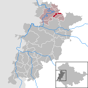
| Location of the community Lauterbach in the Wartburg district | ||
  |
||


Lauterbach is a municipality in the Wartburg district in Thuringia . It is administered by the Hainich-Werratal administrative association.
geography
Lauterbach is located on the edge of the Hainich National Park in the so-called "Berka-Mihlaer Mulde", about 13 km north of Eisenach and 16 km from Mühlhausen . The Lauterbach flows through the village and flows into the Werra in the neighboring village of Mihla .
The area, which is only seven square kilometers in size, stretches as a narrow strip from Hainich to the Reitberg. The highest point is on the western slope of the Schnepfenhardt mountain near the Dreiherrenstein 395 m above sea level. NN . The farmland extends up to a height of 329 m above sea level on the riding mountain . NN . The soil is considered fertile; it is interspersed with weathered debris from the shell limestone and Keuper formation that emerges here.
history
The main features of the place originated in Germanic times before the 9th century , when 15 farms were counted. The first documented mention as "Luterenbach" comes from the year 1155. Around 1700 today's church was built. A carved altar in the church from around 1500 bears witness to the former prosperity of Lauterbach, which was triggered by the abundance of forests around the place. 75 people fell victim to the plague around 1600, which is a quarter of the population at that time. In 1638 a school was set up in a residential building, which remained there until 1905 when a new building was completed. The von Hopffgarten family was the aristocratic landlord and court lord in the village, which is why Lauterbach belonged to their " Hopffgarten Court " and thus until 1920 as an exclave to Saxony-Gotha .
A RAD camp existed in the Riedesel manor and surrounding barracks from 1933 .
In March 1944, a four-engine American Avro-Lancaster bomber was shot down by a German night fighter, exploded in mid-air and fell in the Kalkgrund between Lauterbach and Bischofroda. The eight-man crew of the Flying Fortress perished.
In the years after reunification , two new development areas were developed, the residential park "Im Rieth" and "Am Sportplatz".
Culture and sights
In Lauterbach's St. Nicolaikirche, built around 1700, there is an altar of Mary, which is described as one of the most outstanding works of art of the Middle Ages in Thuringia. Another landmark is the “Sunday fountain” built around 1635 during the plague. The villagers met there every Sunday in order to be able to determine the number of citizens not yet affected by the disease. The fountain was also included in the local coat of arms in a symbolic form. There are some renovated half-timbered houses in the town center .

With the Primeval Forest Life Camp, which opened on Harsberg in 2008, the community has a new attraction, especially for school classes and young people. The glider pilot school, built in the 1930s, initially served to train pilots and was used as a military facility in the GDR era. After the establishment of the national park, the idea of an adventure and experience camp was developed.
The 250 to 300 year old linden tree at the cemetery was designated as a natural monument in 1966 .
Regular events
A fair has been held in Lauterbach since 1868 .
Since 1991 the local clubs have also organized the “Spring Festival”.
politics
Municipal council
The municipality council in Lauterbach consists of eight members.
| List name | Share of votes | Seats |
|---|---|---|
| Voting Association for the Voluntary Fire Brigade Lauterbach eV | 60.9% | 5 |
| UWG culture and tradition | 21.1% | 2 |
| UWG Sport Lauterbach | 17.9% | 1 |
(As of: local election on May 26, 2019 )
mayor
Bernd Hasert was re-elected honorary mayor on June 5, 2016.
Individual evidence
- ^ Population of the municipalities from the Thuringian State Office for Statistics ( help on this ).
- ^ Biedermann: Natural monuments in the Wartburg district; District Office Wartburgkreis, 2014, page 34
- ↑ Local elections in Thuringia on May 26, 2019. Elections of the community and city council members. Preliminary results. The regional returning officer, accessed on May 29, 2019 .
- ↑ Local elections in Thuringia on June 5, 2016. The regional returning officer, accessed on October 25, 2016 .
Web links
Office of Creuzburg | Bad Liebenstein | Bad Salzungen | Barchfeld-Immelborn | Berka vd Hainich | Bischofroda | Buttlar | Dermbach | Empfertshausen | Frankenroda | Geisa | Barley ground | Barley | Hallings | Hörselberg-Hainich | Krauthausen | Krayenberg Community | Lauterbach | Leimbach | Moorgrund | Nazza | Oxen | Ruhla | Schleid | Seebach | Treffurt | Unterbreizbach | Vacha | Weilar | Werra-Suhl Valley | Wiesenthal | Wutha Farnroda